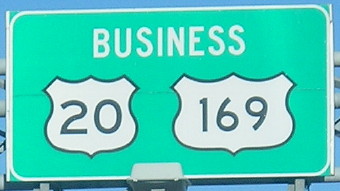
 BUSINESS
and
BUSINESS
and 
(926: 1990-2014)
The evolution of highways in the immediate Fort Dodge area can be seen in this set of maps.
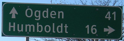
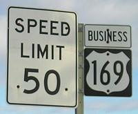
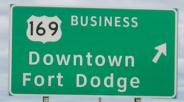
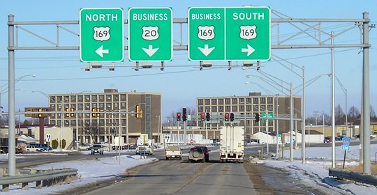
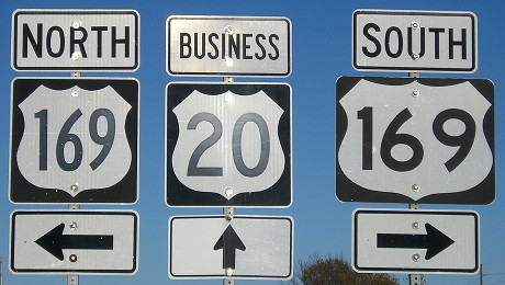
NORTH End: Interchange, US 169, Fort Dodge, Webster County
Facing west, but heading north, on 926 (10/20/18)
Facing west, but heading north, on 926 (9/16/07)
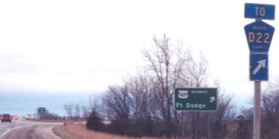
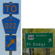
There is no "END" signage at either end. The blurs in the background are "To D22" and "To South 169" assemblies with upward-pointing arrows.
Facing west, but heading north, on 926 (9/16/07)
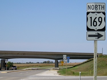
Facing south on 169 (10/20/18)
Facing south on 169 (11/10/02)
Photo by Jason Hancock
Jason says, "IA 926 ends at a trumpet interchange, but it's not your ordinary trumpet; the intersection with D22 is right in the middle of the ramp." The D22 assembly was replaced between November 2002 and May 2003:
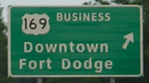
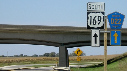
Facing south on 169 (left and center, 3/20/03; right, 6/5/14)
Prior to 1990 the BGSs at this interchange would have been for IA 7 eastbound.
Facing south on off-ramp (11/10/02)
Photo by Jason Hancock
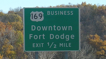
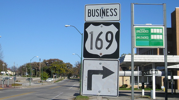
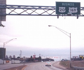
Facing east, but heading south, on Business 169 after interchange (12/12/05)
Facing south on 169 after interchange (11/10/02)
Photo by Jason Hancock
Facing north on 169 (3/20/03)
Facing north on 169 (5/7/03)
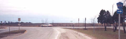
The northbound "To D22" assembly is at left.
Facing north on 169 (9/11/14)
Facing south from same spot (3/20/03)
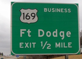
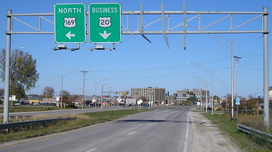
At the first BGS for Business 169's north end, 1/2 mile away, you can turn around and easily see its south end.
Surrounding area information: On 169
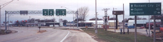
Facing north on 169 (11/10/02)
Photo by Jason Hancock
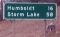
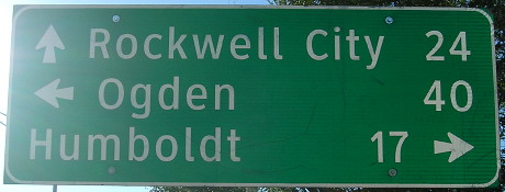
This is between Business 169's north end and the junction with IA 7. The LGS includes Storm Lake because 7 shared this portion with 169 before it was truncated and its standalone piece east of 169 became the northern half of 926.
Facing east (3/20/03)
There are some intersections on 169 between 926's ends to a frontage road. Just south of the apparently-now-former KWMT radio station building is this "Keep Left"(!) sign for traffic turning onto northbound 169.
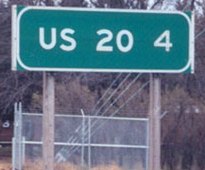
Between 926's south end and the interchange with US 20, 169 deviates from its previous route. A standard junction with P51 was lost because of this - it's about at the halfway point on this bypassed piece - so one direction's signs say "To P51" and the other says "Jct P51". At this intersection P51 leaves Old 169. (3/20/03)<
As for 926/Business 169, it leaves 169 following an east-northeasterly direction along old IA 7, turns south-southeast, and then goes southwest with Business US 20 along 20's old route. Its approximate halfway point, the junction with Business 20, can be seen on the IA 7 page.
Surrounding area information: Downtown roundabout
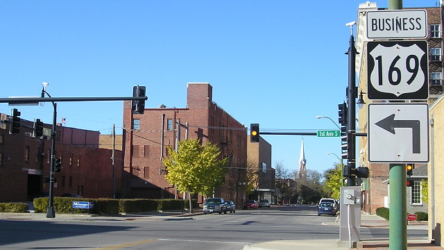
Facing west on 2nd Avenue South (10/20/18)
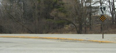
After taking control of IA 926, the city of Fort Dodge built a roundabout at South 6th Street and 1st Avenue South, shunting traffic away from two blocks of former/Business 169. To the left is a large building that was a Fareway but now isn't.
Facing east on 2nd Avenue South (10/20/18)
While doing my customary pre-trip walkthrough on Apple Maps, I noticed a funny curve in the road. That's how I found out about the roundabout. Turning around from the blocked-off road above, this sign remains, directing no one. This sign needs to be moved a block north, because there was no east-to-south turn signed in fall 2018.
Facing (mostly) north on South 7th Street (10/20/18)
The sign for the north-to-west turn has been moved to the necessary position.
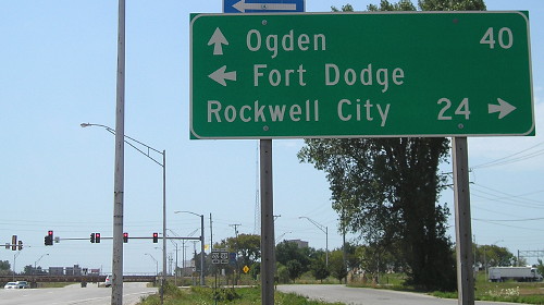
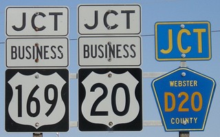
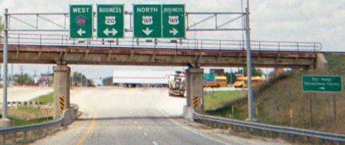
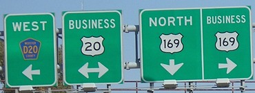
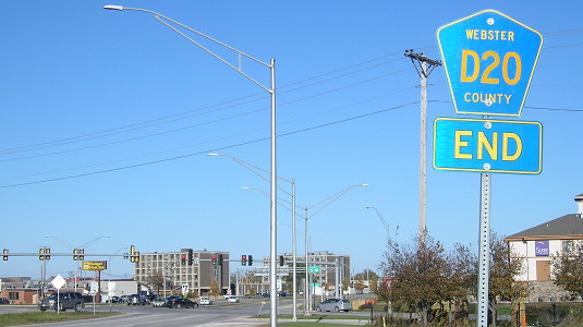
EAST End: Stoplight, US 169 and D20, Fort Dodge, Webster County
Facing southwest, but heading south, on 926 (11/10/02)
Photo by Jason Hancock
Facing southwest, but heading south, on 926 (10/20/18)
Signs in left gantry (11/10/02)
Photo by Jason Hancock
Facing south on 169 (11/10/02 and 7/25/12)
Left photo by Jason Hancock
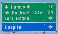
It should be noted that the entire business route is inside the Fort Dodge city limits - a fact that was partially rectified with a replacement sign, as seen on the right. (I have cropped out a hospital sign above the LGS.) Between 1959 and 1990, this was the intersection of 20 and 169. Prior to that, 169 went northeast with 20 into downtown and left via 15th Street.
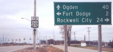
Facing north on 169 (9/16/07)
In the 1990s, this was the only place in Iowa that two business routes touched each other. Now, counting the common endpoint for Business 18 and Business Loop I-35 in Clear Lake, there are four.
Facing north on 169 (3/20/03)
At right is a sign for the Fort Dodge Correctional Facility - or, according to the 2000 map, the Fort Dodge Recreational Facility. Some vacation.
Closeup of top signs / LGS behind railroad bridge (9/16/07)
Facing northeast, but heading north, on D20 - note "D20 End" (12/12/05)
Facing northeast, but heading north, on D20 (10/20/18)
Lost a sign there, and since this isn't a state road we won't get it back.
The replacement for the lost BGS (10/20/18)
Facing northeast, but heading north, on D20 (10/20/18)
First signs on 926 (11/10/02) / Closeup (10/20/18)
Left photo by Jason Hancock
The fine print
The recap of the November 2014 meeting of the Iowa Highway Commission includes this statement: "The Commission approved the transfer of jurisdiction of Iowa 926 roadway and right of way from the Iowa DOT to the city of Fort Dodge that includes all of Iowa 926, excluding bridges, and lies entirely within the corporate limits of the city of Fort Dodge with a total length of approximately 3.17 miles." I do not know if "excluding bridges" means the DOT will still do maintenance on the two major viaducts, if those will still be classified as 926, or what; the official city map has already deleted 926.
Page created 7/14/03; last updated 3/22/19