
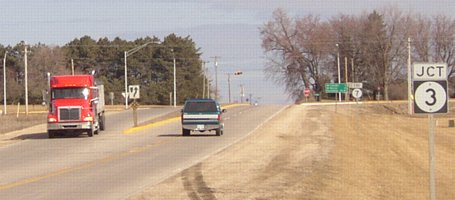
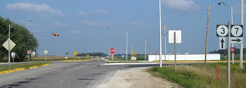
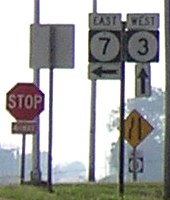
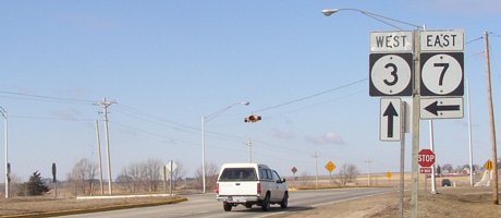
WEST End: 4-way stop, IA 3, Cherokee County
Facing north, but heading west, on 7 (3/21/03)
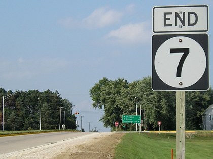
Facing north, but heading west, on 7 (8/31/08)
LGS in above pictures (8/31/08)
The (official) 45 miles between Pocahontas and Cherokee on IA 3 is the third-longest distance between towns on a state or US highway. The next is Tama to Cedar Rapids on US 30, 48 (official) miles. The winner is Rock Rapids to Spirit Lake on IA 9, 54 (official) miles. Given current practices, the real distance (between city limits, or at least development) on IA 3 may be longer than on US 30.
Oddly enough, it wasn't until the mid-'30s that anyone considered connecting Cherokee and Pocahontas with any numbered road, despite the fact that it is now one of the longest straight stretches of road in the state and part of it is part of the longest. Before the creation of IA 3 in 1945, the two main east-west routes in the area had a northwest tendency. IA 10 used its current route, IA 17 (now 4) to Pocahontas (a redundancy that lasted until 1969), and now-3 to Luxemburg (after 1931). IA 5 used now-3 from Akron to here, and then now-7 to Fort Dodge. The remaining piece of 3 was undistinguished IA 221, still unpaved in 1941.
Facing east on 3 (8/31/08)
Facing east on 3 (8/31/08)
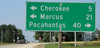
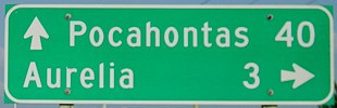
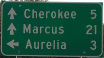
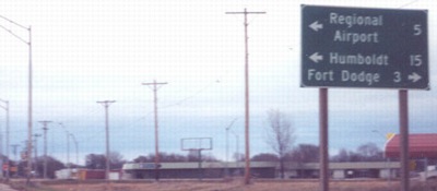
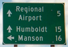
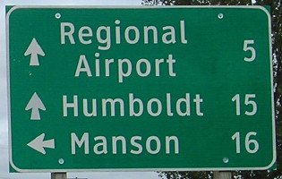
Sometimes it would be nice if more than just the next town was listed. In this case, Storm Lake would be a good candidate for inclusion under Aurelia.
Facing east on 3 (8/31/08)
Facing west on 3 (8/31/08)
Facing west on 3 (3/21/03)
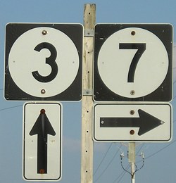
The reversed positions of the signs in the 2003 photo could feasibly be a long-standing remainder from the designations in 1945-62. In that period, IA 5 followed what is now all of 7 and 3 west of here to Akron, and so the right would have had a 5 with a left-and-ahead arrow pair. For 17 years a redundant 3/5 multiplex ran 60 miles(!) until someone got around to deleting it in 1962, the same year 3 was realigned around the northeast side of Cherokee. Conceivably, the portion of 5 (7) between 3 and Aurelia could also have been diagonalized to meet the new alignment; most of it would have followed railroad tracks.
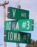
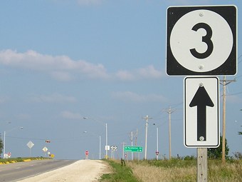
Rural signs at intersection (3/21/03)
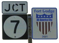
EAST End: 4-way stop, US 169, Fort Dodge, Webster County
The evolution of highways in the immediate Fort Dodge area can be seen in this series of maps.
Facing east on 7 (5/7/03)
Facing east on 7
Photo by Jason Hancock
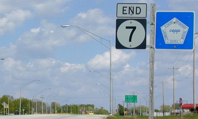
Although mileage for Fort Dodge is included, this is the northwest corner of the city limits.
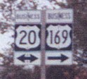
Facing south on 169 (5/7/03)
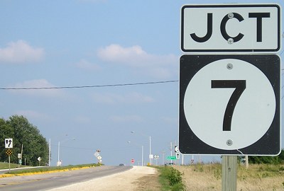
And as an intersection near the limits, special signs get put here.
Facing south on 169 (5/7/03)
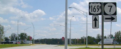
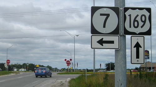
An early alignment of IA 5, which became 7 in 1969, went through this intersection to meet US 20 in downtown Fort Dodge near or at the same place 7 did until 1990. It probably changed in 1960, at the same time US 169 was put onto this alignment, creating a duplex and leaving 169 at an interchange whose ramps also intersect a county road. (See the north end of IA 926.)
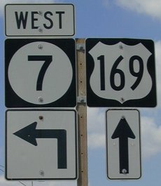
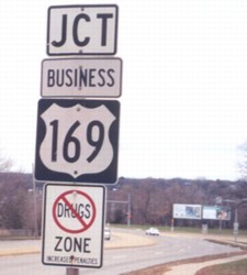
Facing north on 169 (5/7/03 and 5/7/03 and 9/11/14)
The absence of a northbound "Jct 7", with the assembly at left instead, is a throwback to 7's pre-1990 duplex with 169. The LGS and its Clearview replacement are shown.
Facing north on 169 (9/11/14)
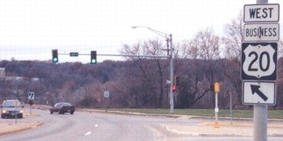
Old EAST End: Stoplight, US 20 (now Business US 20)/Kenyon Road, Fort Dodge, Webster County
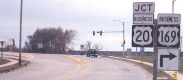
Facing southeast, but heading east, on 7 (11/10/02)
Photos by Jason Hancock
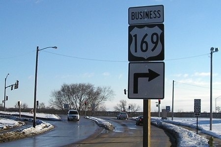
The standalone segment of 7 east of 169 was not turned over to the city; instead, it became part of Business US 169 and secret IA 926. I suspect that 926 will remain under state jurisdiction because of two lengthy bridges/viaducts along the route. Signs at this location changed slightly in the next three years:
Facing southeast, but heading east, on 7 (12/13/05)
Given the position of the fire hydrant in the lower right corner, I believe this is the pole in the 2002 picture with the "Jct Business 20 <->" on a new one.
Facing southwest, but heading west, on Business 20 (11/10/02)
Photo by Jason Hancock
This is probably where "Jct 7" was posted.
Facing southwest, but heading west, on Business 20 (11/10/02)
Photo by Jason Hancock
A "Business 169" with ahead-and-right arrows would be appropriate on the pole, since only the above picture indicates an intersection with Business 169.
Page created 7/14/03; last updated 12/29/08 4/60/20