
NORTH End of MN 26: Stop sign/T intersection, MN 16/Old US 16, Houston County MN
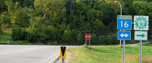
Facing north on 26 (9/7/06)
Downtown La Crosse is only 5.5 miles away from here. There is no "End" sign.
Facing west on 16 (9/7/06)
Also in this direction was a sign you'd expect to see in Texas - pointing to Houston and Brownsville.

Facing south on 26 (9/7/06)
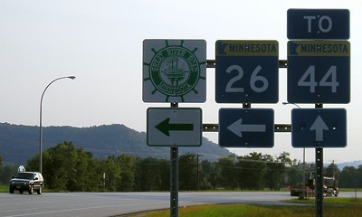
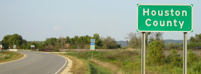
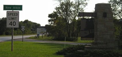
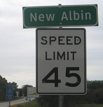
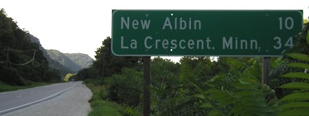
NORTH End: Minnesota state line, New Albin, Allamakee County IA/Houston County MN
Facing north on 26 (9/28/15)
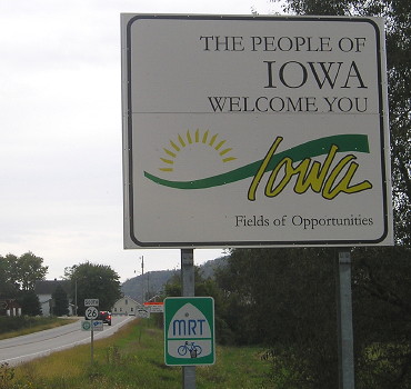
Allamakee County has its own "Welcome/Goodbye" sign set up.
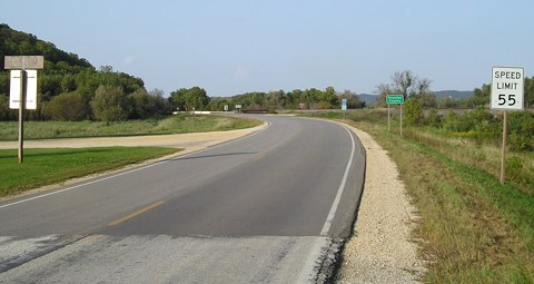
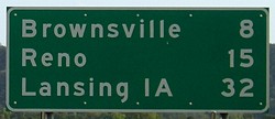
Facing north on 26 (9/7/06)
The Minnesota paving project looks like it carried just a bit farther south, since the foreground signs are Iowa's.
Facing north on 26 (9/7/06)
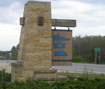
Facing north on 26 / Closeup (7/14/02 and 9/7/06)
Left photo by Jason Hancock
The "Historical Marker" sign points back to the state line (see below).
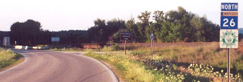
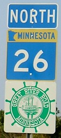
Facing north on 26 (9/7/06)
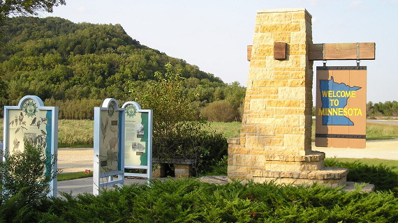
This "Welcome to Minnesota" marker also has information about the Great River Road, of which 26 is a part.
Another view of Minnesota welcome marker (9/28/15)
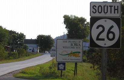
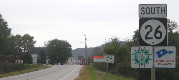
Facing south on 26 (9/7/06)
The 26 designation has never been applied to a long highway in Iowa. In 1969, 26 moved from far northwest Iowa to here; in return, IA 182 switched corners the other way around.
Facing south on 26 (9/7/06)
Facing south on 26 (9/28/15)
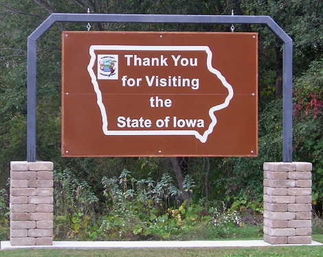
Signs were rearranged in order in my second visit to New Albin, nine years after the first, and the speed limit coming into town was increased. The "Welcome to Iowa" is the same in both, but you can see the faded yellow.
Facing south on 26 (9/28/15)
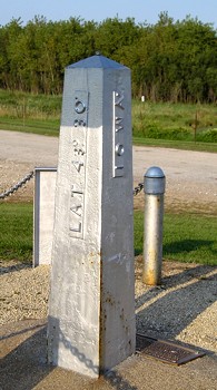
Surrounding area information: Boundary marker
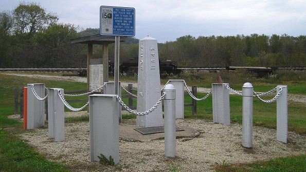
Facing northwest (9/28/15)
This marker is between 26 and the railroad tracks, possibly along the original routing for IA 182 through New Albin. Compare its condition to the one at the triple point with South Dakota on the IA 9 West page.
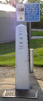
Sign at top: This 'Iron Post" was placed here in 1849 to mark the disputed boundary between Iowa and the Minnesota Territory. Listed on the National Register. Placed by the Allamakee County Sesquicentennial Commission, 1996.(9/7/06)
Plaque at bottom: HISTORY OF CAPTAIN LEE'S IRON MONUMENT. Government records show that in 1849, Capt. Thos. J. Lee of the U.S. Topographic Engineer Corps, erected an iron monument on the boundary line between Iowa and Minnesota, on the parallel of 43°30' North Latitude, the legal boundary between the two states, at a distance of a little over three miles west from the west bank of the Mississippi River as it then flowed; the monument was described by Capt. Lee as a hollow pyramid of cast iron, six feet long and weighing 600 pounds, with suitable inscriptions on its side to identify its purpose.
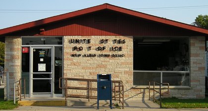
The northeasternmost post office in Iowa, minus a few letters (9/7/06)
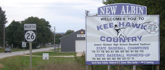
Lansing has the high school, but New Albin has Eastern Allamakee's baseball diamond.
Facing north on 26 (9/28/15)
This is on the south side of New Albin. The entire route of 26 is within the Eastern Allamakee School District. Kee High's first championship was the year the IHSAA split baseball into two classes, and its fifth was the year the IHSAA split baseball into four classes. All but two of Kee High's championships were won when the state tournament was in Marshalltown; the first was in Carroll (a one-off) and the most recent in Des Moines (2005 was the first year at Sec Taylor Stadium). It's nearly 300 miles one way to Carroll, and the Kee Hawks and their fans did it repeatedly in the Carroll years (1995-2004) when there were far fewer four-lane roads across Iowa. Longtime Kee High coach Gene Schultz retired in 2014 after more than 1700 wins and a lifetime .815 coaching win percentage.
Surrounding area information: The northeasternmost point in Iowa

If you head east from New Albin along a gravel road, you will eventually come to this landing. It's about half a mile south of the Minnesota line, and 1.5 miles west of the main channel of the Mississippi (the official Wisconsin line), but this is the northeasternmost point in Iowa accessible by car. (WI 35 actually comes closer to the triple point itself, but that's on the Wisconsin side.) (9/7/06)
When I visited this site on September 7, 2006, it completed my journey to Iowa's "five corners" in the span of eleven months: the northeasternmost point (here); the northwesternmost point (Gitchie Manitou State Preserve, June 25, 2006); the southwesternmost point (west of IA 333, June 12, 2006); the southeasternmost point (US 61/136, Keokuk, October 21, 2005); and the easternmost point (US 52/IA 64, April 18, 2006). (The westernmost point by highway, which is slightly west of the northwest corner, wasn't included, though I was close in 2004.)
SOUTH End: IA 9, Lansing, Allamakee County
Facing north on 26, leaving Lansing, 1 mile north of the end (9/7/06)
This end is close enough to the east end of IA 9 that they share a page.
Page created 2/2/03; last updated 1/13/17