 BUSINESS
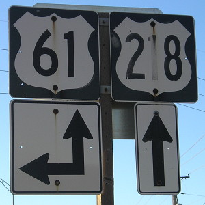
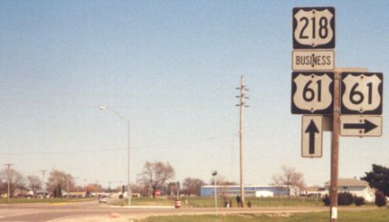
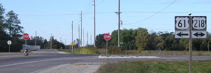
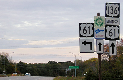
NORTH End: Intersection, US 61, Lee County
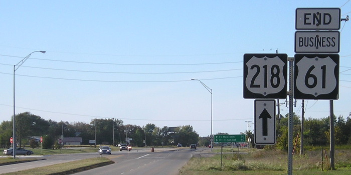
Facing north on Business 61 (which is also 218) (10/3/15)
Business 61 is co-signed with US highways for its entire route, half with US 218 (which ends in downtown Keokuk) and half with US 136.
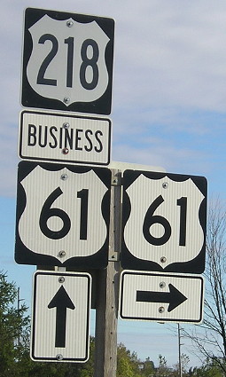
LGS in background of above picture (4/4/04)
Photo by Jason Hancock
This is another incident of the LGS having all ahead arrows, the other being US 69 northbound at old IA 349.
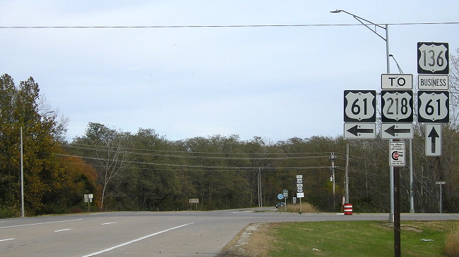
Facing northwest, but heading north, on 218/Business 61 (12/18/06 and 10/3/15)
Instead of a regular "little green sign," there is now this, and then that, probably because 218 is a four-lane road here and north of here becomes an expressway. Should this be called a "medium green sign"?
Facing northwest, but heading north, on 218/Business 61 (10/3/15)
Facing south on 61/218 (disclosure: foreground has been lightened) (10/21/05)
Facing south on 61/218 (10/21/05)
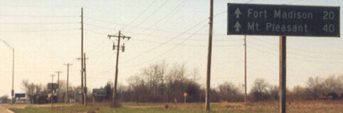
We're running out of real estate in Iowa fast. This is 61's mile marker, since it joins 218 here like the semi is doing, though I think 218 has about the same distance.
Facing south on 61/218 (10/3/15)
Facing south on 61/218 (4/4/04 and 10/3/15)
Left photo by Jason Hancock
Facing north on 61 (4/4/04)
Photo by Jason Hancock
Facing north on 61 (10/3/15)
Facing north on 61 (10/3/15)
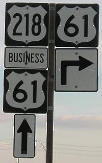
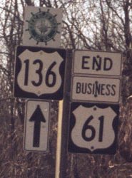
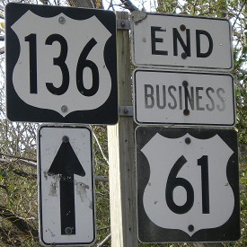
Business 61 is to the right here, following US 218 into Keokuk and US 136 out of Keokuk. The straight north-south line you see on maps on the west side of Keokuk is 61 proper. Pictures of Business 61 signage at 218's south end are on the US 218 page.
SOUTH End: Intersection, US 61, Lee County
Facing west, but heading south, on Business 61 (which is also 136) (4/4/04 and 11/4/19)
Left photo by Jason Hancock
Because Business 61/US 218 goes diagonally southeast into Keokuk, the business route is co-signed with US 136 for more than half of the latter's entire route in Iowa. US 136 only stays in Iowa long enough to go through Keokuk, down in the tip of the state. Keokuk is so far south that only two of three stations in the Quad Cities television market cover it, and the city probably pays more attention to the network affiliates in Kirksville MO (KTVO/ABC) and Quincy IL (KHQA/CBS and WGEM/NBC).
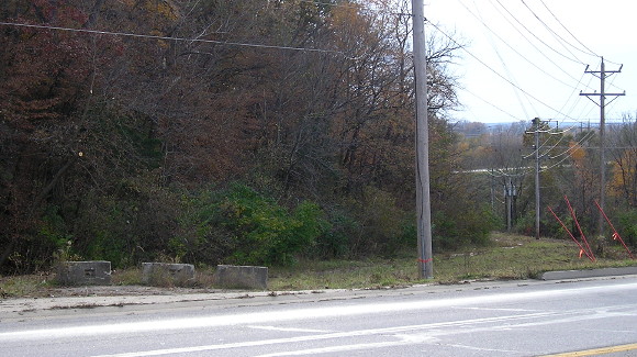
Facing south
The concrete blocks block off the east part of the old road in this area. Twin Rivers Drive, running south of the present intersection, cuts through it. The west part of the old route has been taken over by an expanding car salvage yard.
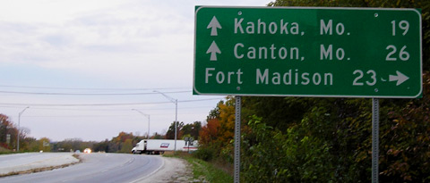
Facing west on 136, but heading south on Business 61 (10/21/05)
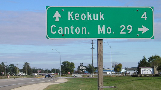
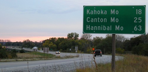
This is the second-southernmost sign in Iowa with an Iowa town on it. (The southernmost is the one on eastbound 136 at this intersection!) Kahoka is on 136 at MO 81 and Canton is south on US 61.
Facing west on 136, but heading south on Business 61 (10/21/05)
Facing south on 61 (10/21/05)
A road going south from this intersection becomes the southernmost road in Iowa (see bottom).
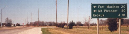
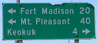
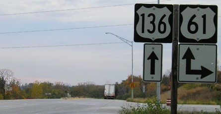
Facing east on 136, but heading north on 61 (10/21/05)
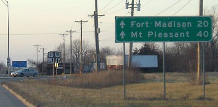
The LGS in the background reads "^ Keokuk; <- Fort Madison 20". There is no mileage for Keokuk because this is inside the city limits. That is the southernmost LGS in Iowa, but because it was near sunset a zoom on this picture would be too blurry.
Facing east on 136, but heading north on 61 (11/4/19)
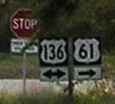
In an interesting twist, neither end on Business 61 has a stop sign as it follows the main routes. Going north from here will get you to US 218, but then you'll miss the south end (if you're looking to clinch the route).
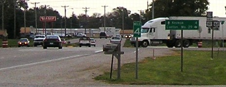
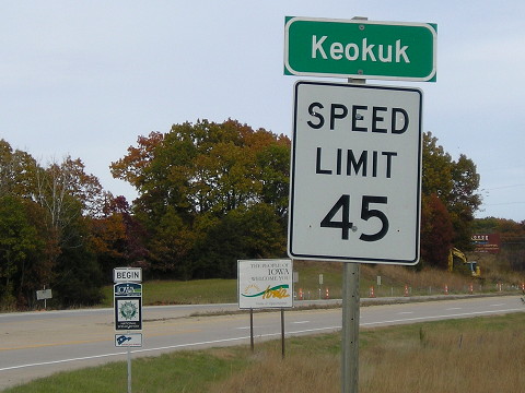
This intersection, about a half-mile in from Missouri, is the first of two signed-route intersections along the 3.6 miles of US 136 in Iowa. (It is the tenth-shortest signed route in Iowa.) The other is the south end of US 218.
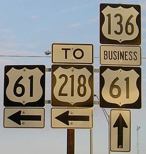
Closeup of signs at right / First signs after intersection (12/18/06)
This is the southernmost US 218 shield currently in existence. Highway Commission archives indicate that before US 136 was extended into Iowa, 218 signage actually began/ended at the Des Moines River, slightly southwest of this point (see below).
Surrounding area information: The southernmost road in Iowa
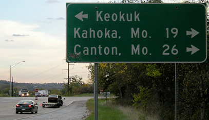
Facing mostly west on 136, but heading south on 61 (10/21/05)
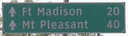
Two notes on this mileage sign: First, notice the lack of punctuation, even though the sign on southbound 61 - and every other normal lowercase sign in Iowa like it - is punctuated. (Semi-exception: "Hannibal Mo" on southbound IA 27, but it's a larger sign.) Second, the numbers for Kahoka and Canton are one less than on the sign on southbound 61 at the intersection, though the two aren't that far away from each other.
When you are in about the middle of the bridge, perhaps a little closer to the south bank of the river, you are at the southernmost easily-accessible point in Iowa, on the southernmost road. There is a small piece of technically-Iowa on the south bank, but there are no roads to it. The three southernmost roads in Iowa can be seen in the below aerial photo. The second-southernmost point is on a gravel road by railroad tracks and a car graveyard. The southernmost point that's not on the bridge is on a road that gradually creeps back northeast through an industrial area.
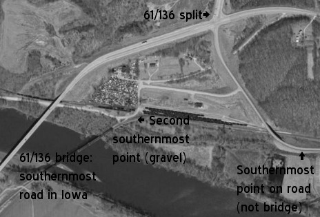
In the above picture, the pre-1960 alignment of 61/136 can be seen. At far left, in the small clearing, is the site of the old bridge, and the road angled northeast from there. The curved segment that is bisected by the north-south road is the old pavement, which could be partially driveable.
Facing northeast, but heading north on 61 and east on 136 (11/4/19)
Coming across the river means immediately entering Keokuk, with the junction with Business 61 just ahead.
Page created 12/18/03; last updated 5/8/20