
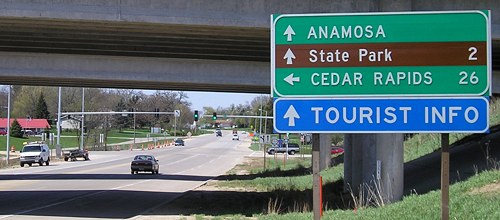
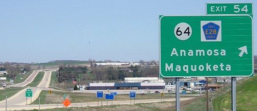
WEST End: Interchange (was intersection), US 151, Anamosa, Jones County
Facing west on 64 (4/18/06)
This assembly makes for an interesting mileage-sign case study. (Bad pun! Bad, bad pun!)
Facing west on 64 (4/18/06)
The stoplight is a later addition, not present after the interchange's opening, as seen below:
Facing west on 64 (12/2/01)
Photo by Jason Hancock
Facing east on E28 (3rd Street) (March 2002)
Photo by Jason Hancock
The road into Anamosa used to be part of 64 until US 151 was realigned around town in 1965. The piece between old and new 151 then became IA 428, the highest-numbered signed spur route ever created (after skipping over odd 420s).
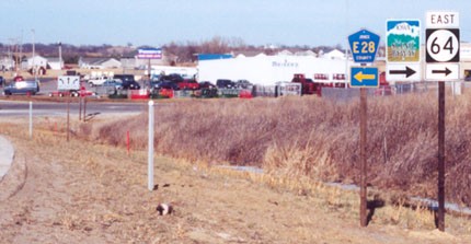
Facing east on E28 (4/18/06)
Facing east on 64 (4/18/06)
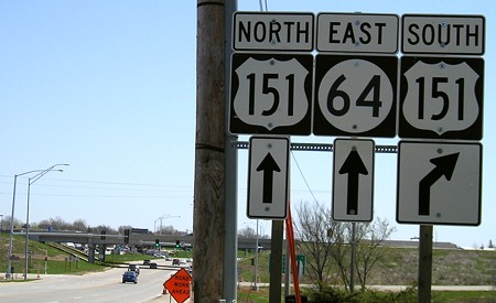
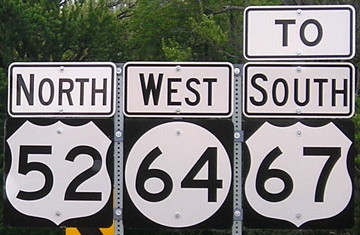
Two Q's, a K, a W, and a Y - this sign might have the highest Scrabble value in Iowa.
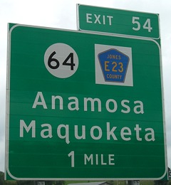
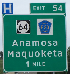
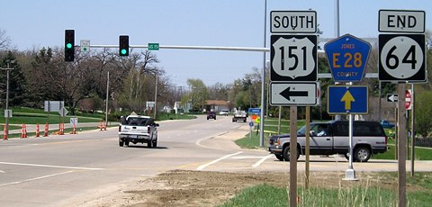
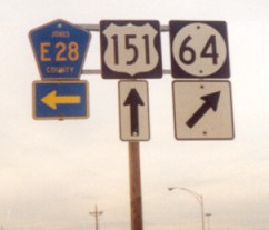
Facing north on 151 (8/9/07 and 9/1/12)
Right photo by Jason Hancock
Northbound, the advance BGS was replaced with Clearview, but the other stayed. Southbound, the reverse happened.
Jason writes: "For some reason, someone decided to place a non-cutout IA 64 shield on this BGS along northbound US 151 near Anamosa. Also, the county road number on this sign is incorrect -- County Road E28 runs westward from US 151, not E23." As of 2018, the sign has not been changed.
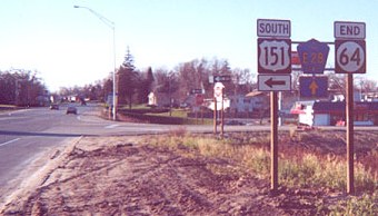
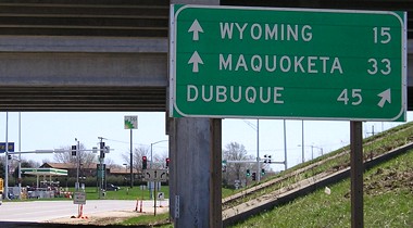
Facing north on 151 (4/18/06)
There is still no preliminary BGS (1 mile) on 151 nearly five years after the upgrade. Between March 2002 and April 2006, the Wal-Mart in the background closed for a supercenter across the road. (And the little blue signs have remained blank.)
Facing north on 151 offramp (February 2002)
Photo by Jason Hancock
Facing north on 151
Photo by Jason Hancock
Old photo: Signage before interchange was built
EAST End: Illinois state line near Sabula, Jackson County IA/Carroll County IL
The last five or so miles of IA 64 are very interesting, meeting a US highway on its way to ending, crossing causeways, and visiting an island city before a long, classic bridge that was replaced in 2017.
Surrounding area information: Junction US 67
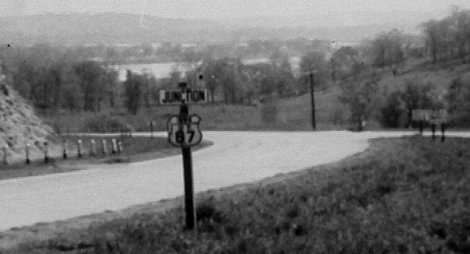
Facing east on 64
This photo was found in a collection from my grandparents. The only meaningful information on the back is "1946". In the background at right, the signs appear to be a mileage sign, a cutout US shield, and a cutout round Iowa shield. The only place in Iowa that could have a rural junction with 67 like this is where 64 meets 67 near the latter's end. The cutout US shield in the foreground has "Iowa" at the top and "U S" right above the block numbers. I finally had the chance to visit this intersection about 40 years later, and positions of equivalent signs had changed to allow more distance before the intersection.
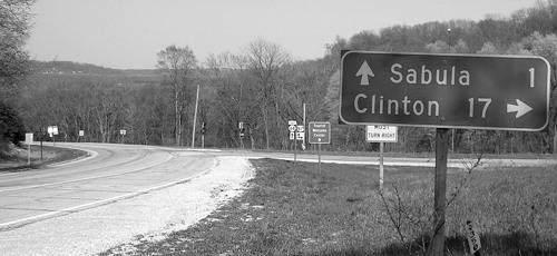
Facing east on 64 (b&w for atmosphere) (4/18/06)
This was the sign closest to the location in the first picture. The "Jct 67" is now a distance behind the camera.
Facing east on 64 (4/18/06)
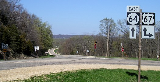
The north end of US 67 is in the background, just barely visible in the clearing. Pictures of that intersection can be found here. Just after the intersection, 52 and 64 follow a causeway - but they're not out of the state yet.
Facing north on 67 (11/16/18)
Sabula - Iowa's island city
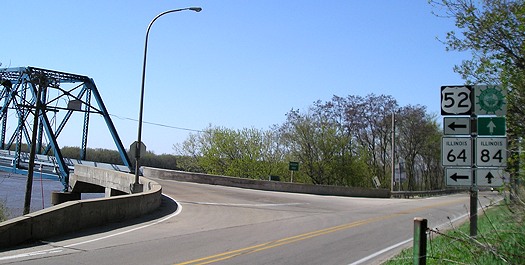
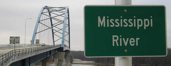
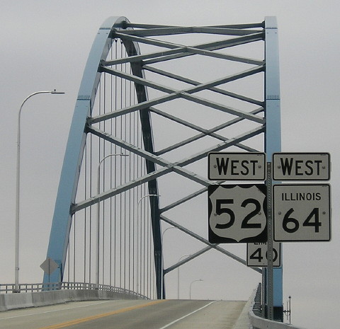
Facing south on 52, but heading west on 64 (4/18/06)
This is the first/last turn for 52 and 64 in Iowa. North of this point, "southbound" 52 heads north - actually, north-northwest, and then north-northeast, before heading due east across the main channel of the Mississippi River.
Northeast corner, same intersection (4/18/06)
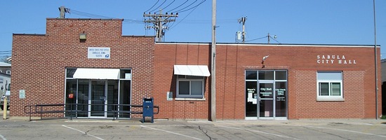
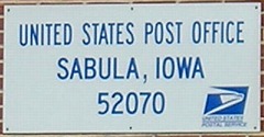
This is the farthest east post office and city hall in Iowa.
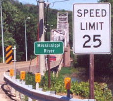
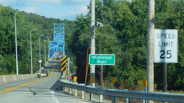
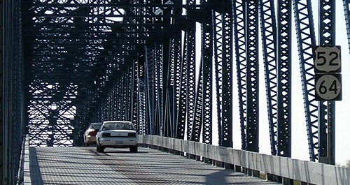
Facing north, but heading south on 52 and east on 64 (4/18/06)
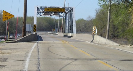
Notice how the pavement lines narrow significantly for this first bridge.
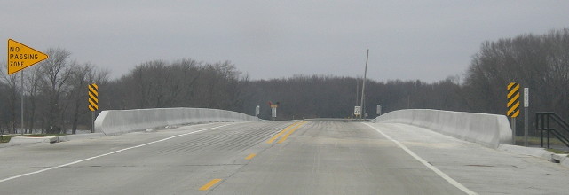
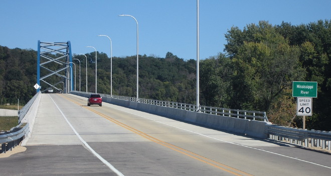
Facing north, but heading south on 52 and east on 64 (11/16/18)
Construction of this bridge took longer than expected, which meant the main bridge was idle for months shortly after opening.
Facing east (June 2002 and 9/27/15)
Left photo by Jason Hancock
The key difference in these pictures is the painted bridge.
Facing east (9/23/18)
Photo by Jason Hancock
The new bridge is just downstream of the old one. To the left is a pullover area with a sign surprise.
Facing west (4/18/06 and 6/27/20)
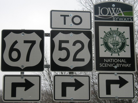
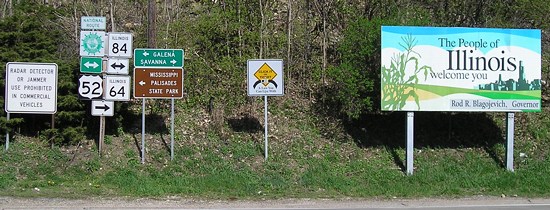
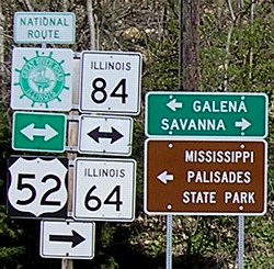
These signs are about across from the pictures above from the old bridge. This is the first 67 sighting on 52. The sign grouping on the right might be from the Illinois DOT because...
Facing west (11/16/18)
Does this Clearview look off to you? Well, the state of Illinois made it, and also the new first-52 and first-64 signs in Iowa.
Looking north
Photo by Jason Hancock (7/31/05)
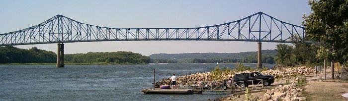
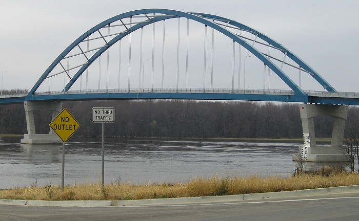
It's a really nice bridge, just with a really narrow deck. They don't make 'em like this anymore. This bridge crosses the main channel of the Mississippi, and as such, the state line is in the middle, about three miles away from Sabula. The US 52/IA 64 crossing is, by the slimmest of margins, the farthest east river crossing in Iowa, narrowly beating out the IA/IL 136 bridge at Clinton. The easternmost land in Iowa is about parallel to this bridge, but unless you're riding the Iowa, Chicago and Eastern Railroad, it's hard to get to. (The tracks themselves were originally Milwaukee Road [Chicago, Milwaukee, St. Paul and Pacific] tracks, going through Canadian Pacific and I&M Rail Link before the IC&E took over the IMRL in 2002.)
You look familiar...
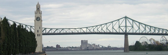
The Jacques Cartier Bridge over the St. Lawrence River in Montreal bears a striking resemblance to the Savanna-Sabula Bridge, possibly because they opened within three years of each other. (6/28/07)
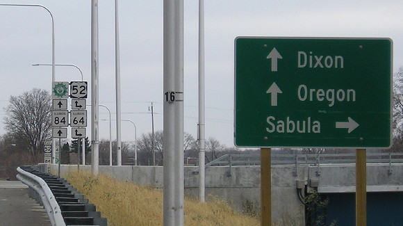
Facing northwest (11/16/18)
This is what we see now across the Mississippi, as seen from the Illinois side.
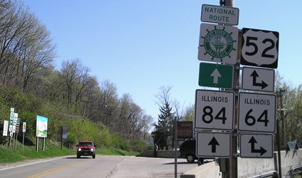
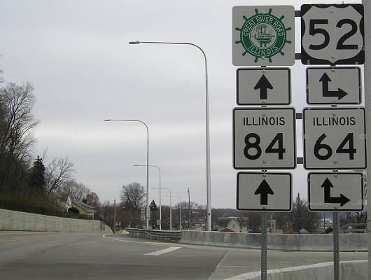
Facing east on 52/64 (4/18/06)
Immediately - and I mean immediately - as cars get off the bridge, drivers see these signs. The intersection's position didn't really change much.
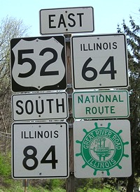
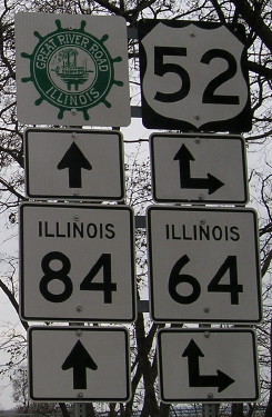
Closeup of signs at left / Southbound sign assembly (4/18/06)
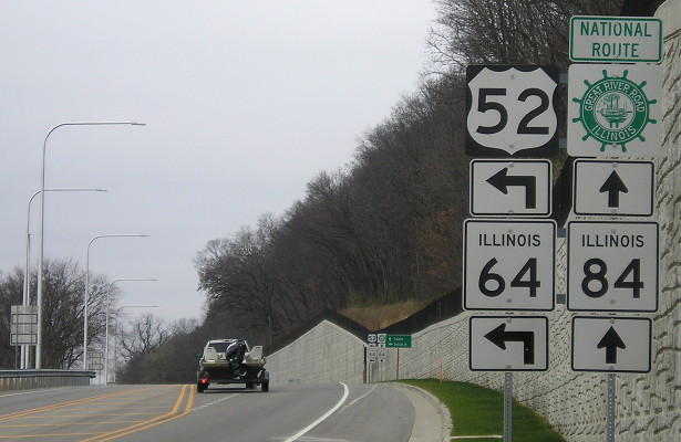
The Illinois Great River Road is the "National Route," while Iowa's side has an "American Byways" designation. Notice that US 52 is signed as east-west in Illinois. The 52/64/84 route becomes Chicago Avenue in Savanna, a street that really does go to Chicago.
Facing south on 84 (4/18/06)
The concrete barriers are the end of the bridge, and there's a plaque for the bridge visible at far right. The plaque is dated Dec. 1, 1932. The bridge was a toll bridge until the mid-'80s.
Facing south on 84, new bridge (11/16/18)
Facing south on 84, before and after the LGS (11/16/18)
Facing north on 84, but heading west on 52 and 64 (5/26/02)
Photo by Jason Hancock
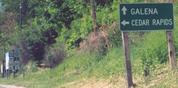
Today, IA 64 does not go to Cedar Rapids, but it is the most direct route from Chicago. The route was originally created to do just that. Iowa and Illinois both agreed to use the number 64 to connect the two cities in December 1936. About two and a half years later, IA 64 was extended westward through the rest of Iowa to Council Bluffs, theoretically connecting to NE 64 in Omaha, but I don't know if 64 was actually signed with US 6/75 across the bridge into Nebraska.
Facing northwest-ish (4/18/06)
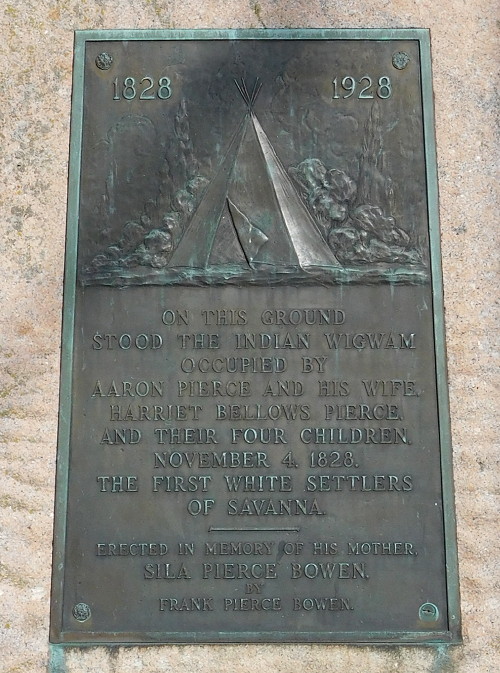
This angle really shows how close the bridge is to the intersection. In the middle of this picture, just down and to the left of the sign in the middle, is a plaque about the bridge. There's also one on the superstructure (two below).
Facing north on 84 (11/16/18)
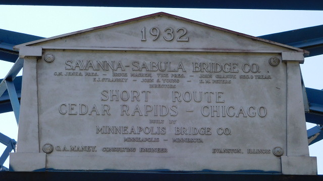
Overhead plaque at bridge (9/27/15)
Facing west (4/18/06)
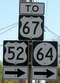
Right after you turn on the bridge from the Illinois side, you see these two signs. The US 52 shield is in Series D, the default for Illinois but very uncommon for Iowa, and the other is obviously an IA 64 shield - an interesting mix, given that the state line is a bit ahead yet.
Marker near intersection (9/27/15)
Facing west on 52/64 (11/16/18)
Facing west on 52/64 (11/16/18)
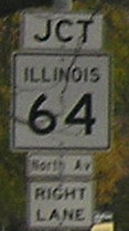
End Illinois 64
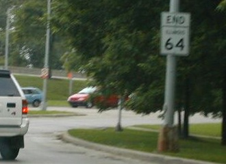
Facing east on 64 (6/17/02)
Photo by Neil Bratney
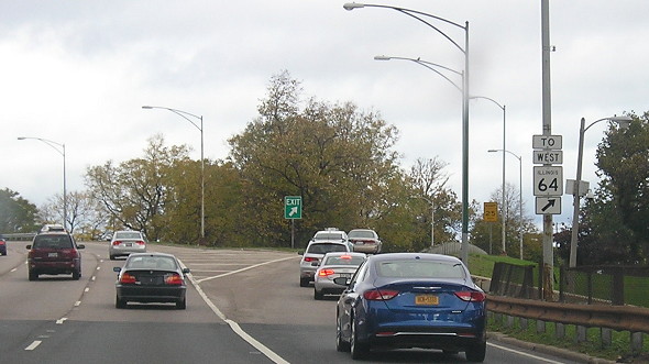
Illinois 64 comes to an end at an interchange with US 41 (Lake Shore Drive) on the south side of Lincoln Park north of downtown Chicago. Straight ahead is Lake Michigan. The Sears Tower is two miles south-southwest; I-90/94 is two miles behind the camera.
Facing north on 41 (11/3/16)
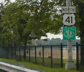
Facing north on 41 (6/17/02)
Photo by Neil Bratney
In this somewhat gratuitous excuse to post a photo for US 41, which goes nowhere near Iowa, this photo is north of 64's end. It comes as 41 approaches the east end of old US 32, which did go through the state, and the current east end of US 14.
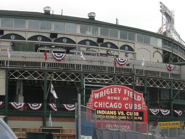
You leave 64, take a little LSD, go tripping for eight minutes, and next thing you know, you think the Cubs are in the World Series. Crazy, right? (11/3/16)
Page created 5/14/06; last updated 9/7/20