 NORTH
NORTH
Old NORTH End (January 1, 1934-August 31, 1943): Locust St. at US 20/4th St., Dubuque, Dubuque County
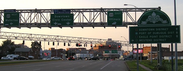
The first Iowa-related north end of US 67 depends on US 20's historic route through Dubuque. Through 1930s aerial photos and a fortuitous article in the Cascade Pioneer, I learned that 20 through Dubuque did not use Dodge Street until the late 1930s, mainly because it didn't exist yet. For that matter, neither did the Julien Dubuque Bridge; 20 used 4th Street to reach an old bridge across the Mississippi. (Part of this street east of present US 52/61/151 was removed in the early 2000s.) I had thought that 20 might have used 7th instead of 4th in this area, which would have put 67's north end at the Dubuque County Courthouse, but I was wrong. (I found this out days after I had been to Dubuque and taken a slew of pictures. Talk about bad timing.)
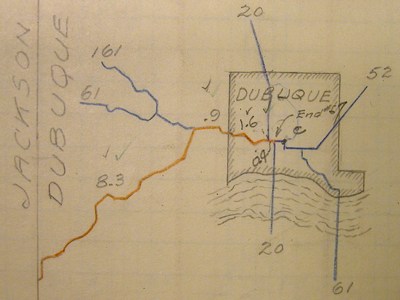
This map from the DOT archives (right is north) mixes information from the late 1930s and early 1940s. It still shows US 161 (though 151 is elsewhere in the book), and the old alignment of US 20 noted above is erased out (the blue arc through the "C", the "E" in "End 67," and and the second "U" in "Dubuque"). The red line, US 67, stops at what looks like the "north" junction of US 20 on 67. Between 1938 and 1943, 20 was realigned on a new Dodge Street west of Locust, then north on Locust to 4th to use the bridge, and then the Julien Dubuque Bridge opened. US 67, then, would have come up from the north on Locust and ended at 20. Since 20 is using a north-south road in the map above, it is probably still the original bridge; one problem with trying to match such maps to the present is that downtown Dubuque's streets are not straight north-south and east-west. (The distance between Dodge and 4th is four-tenths of a mile, which is what's marked on the map above.)
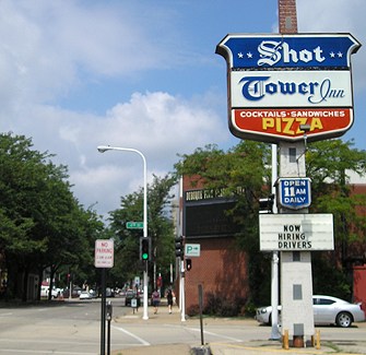
Facing north on 67 (Locust)
Nowadays, Locust is one-way northbound here. This would have been 67's end as 20 went ahead (west) and right (east) here. Notice how the pole for the Shot Tower Restaurant has been painted to look like the Shot Tower itself. Behind the restaurant is the Five Flags Center, so named for the five nations' flags that have flown over the location of Dubuque, although two of them lasted for a matter of months (Great Britain in 1780, during the Revolutionary War, and Napoleonic France in 1803-04, just long enough to turn it over to the United States).
Facing west on 20 (4th)
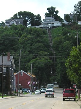
The Fenelon Place Elevator is described as "the world's shortest, steepest scenic railway."
Old NORTH End (August 31, 1943-1967): Locust St. at US 20/Dodge St., Dubuque, Dubuque County
Facing north on 67
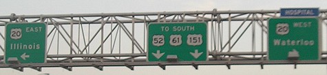
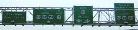
A small portion of Locust Street, now designated IA 946, serves to connect the US 52/61/151 expressway with US 20 since they don't directly intersect.
Facing north on 67
This is where 67 would have ended when the new Julien Dubuque Bridge opened. This would have been the intersection of five US highways - 20, 52, 61, 67, and 151.
Facing south on 52/61/151 (now 946)
Facing west on 20
Since Locust was original 61, somehow they crammed toll booths in between the position this photo was taken (still on the bridge approach) and the stoplight.
Facing east on 20
Jason Hancock has more pictures of this intersection in his Dubuque Photo Gallery (see "US 20"). I have been unable to find the specific day or month that US 67 was taken out of Dubuque; I only know that it is not on the 1968 state map, and construction in that time period did not help matters any.
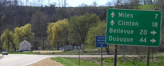
NORTH End (since 1967): T intersection, US 52, Jackson County
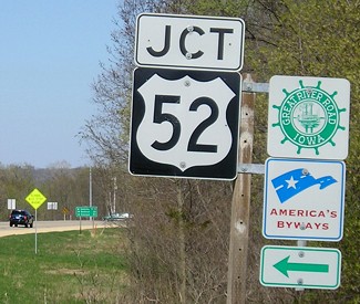
Facing east, but heading north, on 67
Illinois' Great River Road signs are normal-sized. Why aren't Iowa's?
Facing east, but heading north, on 67
Facing east, but heading north, on 67
A long diagonal journey that starts at the Rio Grande in Presidio, Texas, west of Big Bend National Park and due south of Carlsbad Caverns, ends in a tree-lined intersection about a mile from the Mississippi River. It ends east of US 61 at another diagonal highway that is often signed as north-south despite its even number.
Facing south on 52
Facing south on 52
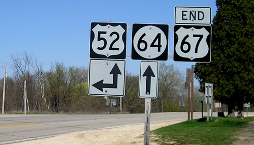
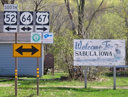
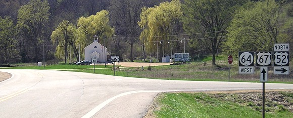
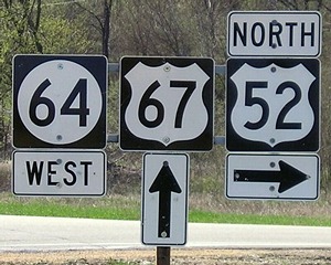
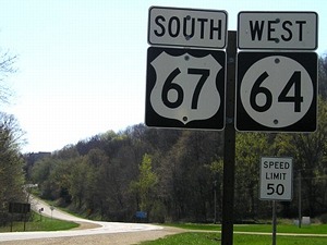
Half a mile west of here, US 67 and IA 64 split.
Facing west on 64, but heading north on 52
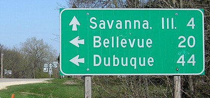
This is the farthest east all-Iowa mileage sign. The Jackson County Welcome Center is in the background.
Facing west on 64, but heading north on 52
Facing west on 64, but heading north on 52
This assembly could be improved by putting the "West" on top of the 64 shield and adding an ahead arrow underneath, and adding a "South" on top of the 67. More in line with general practice would be to remove the direction tags and put the 64 shield under the 67.
Facing west on 64, but heading south on 67
In the far left background you can see the split of 64 and 67.
Old SOUTH Iowa line (December 1, 1934-July 12, 1940): Mississippi River (Government Bridge), Davenport IA/Rock Island IL, Scott County IA/Rock Island County IL
Highways on the Government/Arsenal Bridge
| October 1926-December 1931 |   |
| December 1931-December 1934 |  |
| December 1934-November 1935 |   |
| November 1935-July 1940 | |
Facing southeast, but heading east, on 6
Library of Congress photo
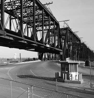
In December 1896, a two-level bridge opened connecting Iowa and Illinois via Rock Island (the island). This would be the only connection between Davenport and Rock Island (the city) until 1940, and is the only bridge on either side of Iowa built in the 19th century that lasted into the 21st. (This bridge was the replacement for the first one to ever cross the Mississippi River!) It's interesting that a bridge originally built for carrying railroad traffic and horse-drawn wagons was "replaced" by a bridge that today carries an interstate highway, below.
For a map showing just the history of these two bridge crossings, click here. For detailed Davenport highway history, see Jason Hancock's page.
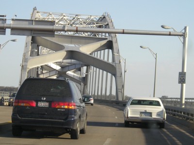
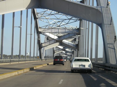
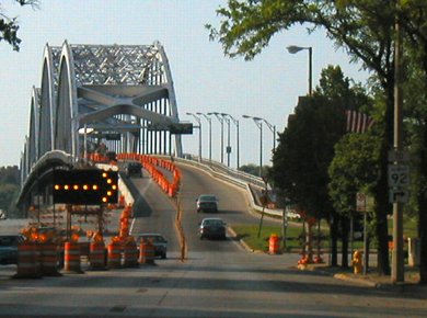
SOUTH Iowa line: Mississippi River (Centennial Bridge), Davenport IA/Rock Island IL, Scott County IA/Rock Island County IL
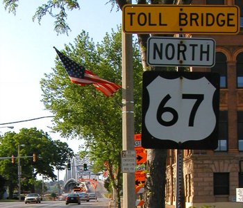
Facing south on 67
Facing south on 67
Facing north on 67
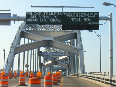
This second-to-last sign in Illinois in May 2003 still had the toll warning for the Centennial Bridge a couple of weeks after the tolls were lifted. On Memorial Day weekend, the toll booths were removed, hence the construction. This sign is also near the closest point US 150 officially got to Iowa.
Facing north on 67
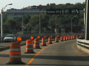
The 67/92 junction is so close to the bridge that the bridge goes over 92 - and on the other side of the river, goes over US 61.
Facing north on 67
Facing north on 67
In addition to removal of the toll booths, the approach and exits on the Iowa side of the bridge have changed since these pictures were taken. Now northbound 67 doesn't make as sharp a turn to reach US 61.
Pictures by me: First-third and fifth, 8/9/07; fourth and sixth, 8/10/07; seventh, 1/31/03; eighth-16th, 18th, and 19th, 4/18/06; 18th-21st, 5/25/03
Seventeenth picture by Library of Congress: February 1985
Page created 5/8/06; last updated 11/27/07