
WEST Iowa line: Des Moines River (with US 61), near Keokuk, Lee County IA/Clark County MO
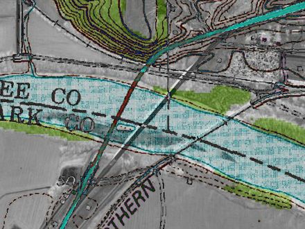
2002 aerial photo and 20-plus-year-old topographic map
This overlay marks the positions of the previous and current locations of the bridges into Missouri relative to each other. The one on the left (reddish) is the old bridge, which can only be made out now by a small treeless scar by the river on the Iowa side. The gray line is the present bridge.
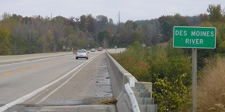
Facing southwest on 61/136 (10/21/05)
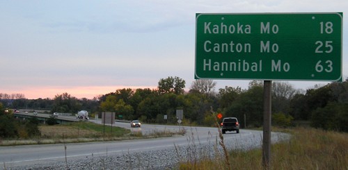
It's a close contest, but I believe that this bridge at the state line on the river is the southernmost point of Iowa that is easily accessible by car. For more on this state extreme, see the bottom of the Business US 61 page. There is a road that is south of 136 in Keokuk, but it goes through an industrial area and crosses railroad tracks a couple of times. The back of this sign is visible in the center two photos down.
Facing northeast, but heading north on 61 and east on 136 (10/25/08)
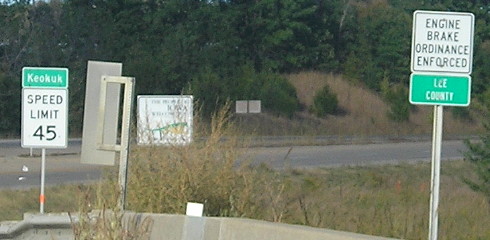
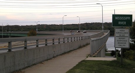
Facing northeast on 61/136 (10/3/15)
US 136 doesn't do much in Iowa, and is overshadowed by IA 136 in the eastern part of the state. Because of the number duplication, US 136's Mile 0 is "Mile 100", and its MM 3 is MM 103. That mile marker is just west of 136's only other intersection of significance in Iowa - the south end of US 218, seven blocks from the river (and 136's northernmost point in the state).
Facing southwest, but heading west on 136, and south on 61 (10/25/08)
For US 61's current and historic crossings in the Dubuque area, see this page.
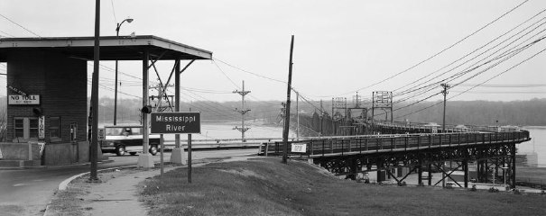
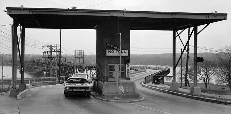
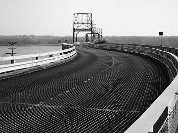
Old EAST Iowa line: Mississippi River (Keokuk swing bridge), Lee County IA/Hancock County IL
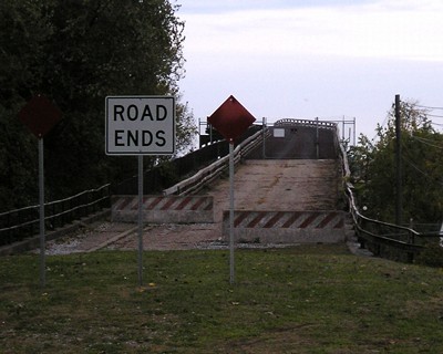
This bridge is just north of the present bridge; in fact, you can easily see the old one's west end as you get on the new one.
Facing southeast (March 1982)
Library of Congress photo
Facing southeast (March 1982)
Library of Congress photo
Facing southeast (March 1982)
Library of Congress photo
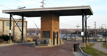
Present-day view of Iowa exit (12/18/06)
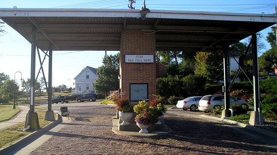
Present-day view of Iowa entrance (10/3/15)
Facing east (10/3/15)
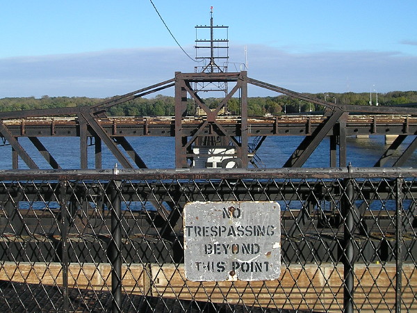
This is the end of the fixed bridge. The swing span is open.
Facing northwest on Illinois side (10/21/05)
Access this close to the bridge is no longer possible.
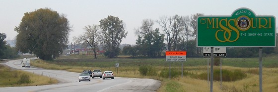
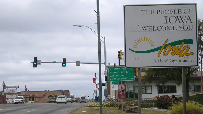
EAST Iowa line: Mississippi River, Keokuk, Lee County IA/Hancock County IL
Facing southeast on 136 (10/21/05)
There's no fancy name for the utilitarian 1985 bridge that was built just south of the railroad bridge that had served as the main Iowa-Illinois connection since 1916 and is still used for trains. This is arguably the southeasternmost accessible point in Iowa, depending on how you judge "southeasternmost".
Facing west on 136 (12/18/06)
This is, as far as I know, the only "Iowa State Line" sign of its kind.
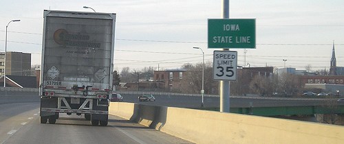
Facing west on 136 (10/4/15)
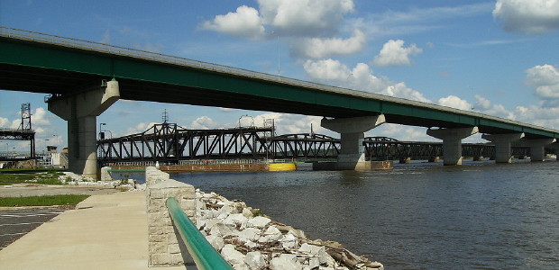
View of the new and old bridges (7/25/10)
Photo by Jason Hancock
Surrounding area information: West junction IL 96
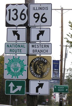
This intersection is about a mile and a half east of the Iowa/Illinois line in the middle of the Mississippi. (10/21/05)
Page created 7/15/06; last updated 2/24/19