


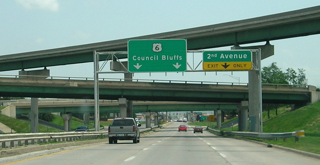
WEST Iowa line: Missouri River (with US 6), Council Bluffs IA/Omaha NE, Pottawattamie County IA/Douglas County NE
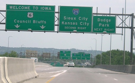
Facing east on 480/6 (6/12/06)
This sign gantry is actually on the Nebraska side of the river. The center lane in this picture is one of the two lanes coming from US 6/Douglas Street; mainline I-480 is coming in on the left. The east end is coming up fast; the "480 Ends" gantry is in the background above. For more history of the river crossing here see the US 6 page.
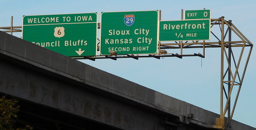
Facing east, from the Nebraska side (10/1/16) / Facing east, on the Iowa side (10/21/14)
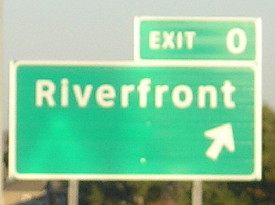
The appearance of Exit Zero is a recent development. "Dodge Park" has changed to "Riverfront".
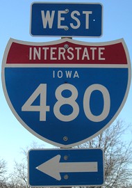
An ultra-rare "Iowa 480 shield" at Dodge Park. There is an eastbound exit (see above) and a westbound entrance between I-29 and the river. (4/6/08)
Construction pictures
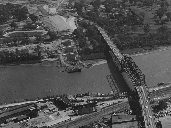
Facing east; Iowa at top (10/4/64)
Copyright © Iowa Department of Transportation. All rights reserved.
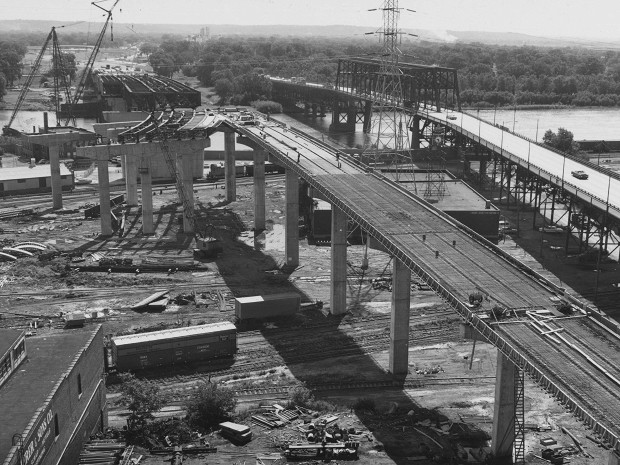
Facing east, view from Nebraska side (7/6/66)
Copyright © Iowa Department of Transportation. All rights reserved.
The state has 140 photos of construction of the I-480 bridge, but the website does not allow direct linking. You have to go to this site and click "Accept," but then the I-480 gallery is one of the root galleries.
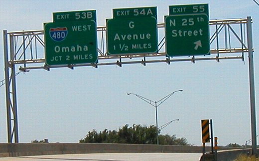
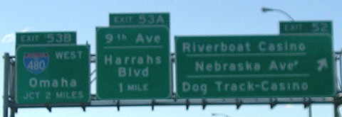
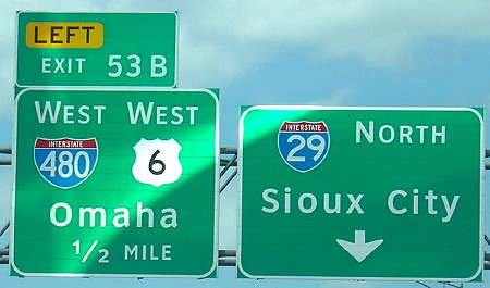
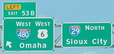
EAST End: I-29 exit 53B, Council Bluffs, Pottawattamie County
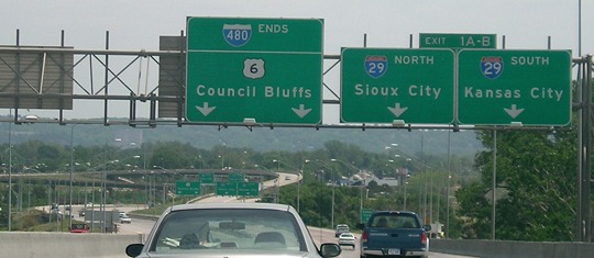
Facing east on 480/6 (6/12/06)
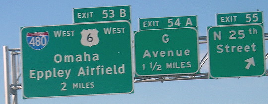
Facing east on 480/6 (10/1/15)
The signs have been replaced from the 2006 photo, and the exit numbers have been removed. I really think the "O" in "South" and "O" in "Sioux City" were set in each other's place incorrectly (notice their respective thicknesses).
Facing east on 480/6 (6/12/06)
The above pictures encompass the entirety of mainline I-480 in Iowa.
Gantry at split as seen from Dodge Park (4/6/08)
Facing east on the offramp before the fork (10/21/14)
Facing east on 480/6
Copyright © Iowa Department of Transportation. All rights reserved.
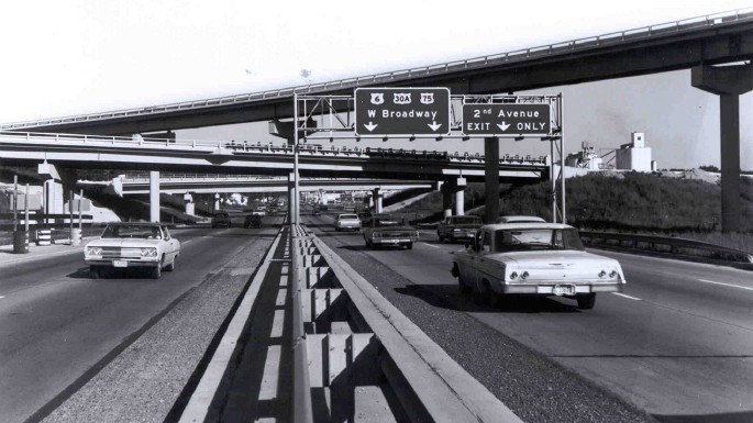
This picture is from between October 21, 1966, when I-480 opened into Nebraska, and 1969, when US 30A was dropped.
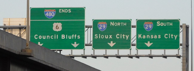
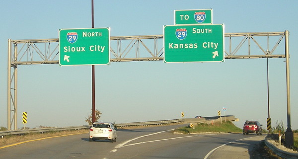
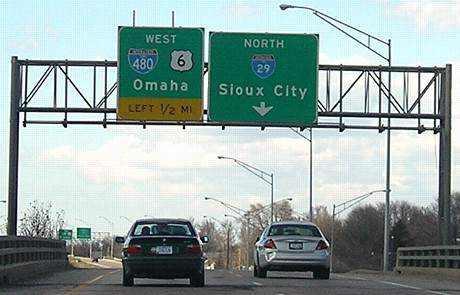
Facing east on 480/6 (6/22/13)
Same gantry and same bridges, 45 years later! (The middle one still retains its railing.)
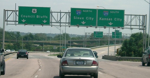
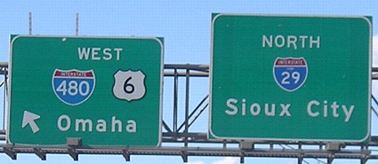
Facing south on 29 (6/9/03)
There is no access to eastbound 6 from I-29, but the sign here also omits westbound 6 with westbound I-480.
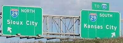
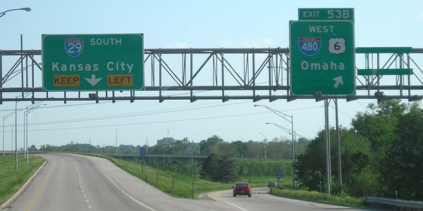
Facing south on 29 (10/2/15)
The left sign was replaced with a Clearview version that includes 6. The curve makes it hard to get a straight-on in-focus picture. Construction of a completely new I-29/I-480 interchange, which will include access to eastbound Broadway, won't start until 2020 at the earliest. The G Avenue exit and 35th Street half-exit will be removed.
Facing south on 29 (5/13/07)
Facing north on 29 (4/6/08)
Facing north on 29 (4/6/08)
Facing north on 29 (4/6/08)
Facing north on 29 (8/2/16)
Facing north on 29 (8/2/16)
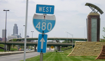
Facing west on 480 (6/12/06)
A picture of this easternmost "Iowa 480" shield was taken by turning off a street just north of Broadway. The merge sign ahead is for that street. Downtown Omaha is prominent in the background. At least one more 480 shield is up on the mainline before entering Nebraska, but it doesn't have the state name; some on the 29 offramps do.
Facing west on 480/6 (6/12/06)
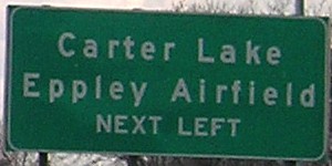
This is the other side of the "480 ends" or middle gantry. This bridge is the nearest access to/from Carter Lake.
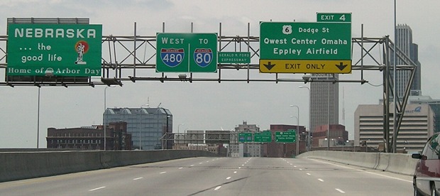
There is now an uncentered, pasted-over line on the Exit 4 gantry that says "Event Ctr-Ballpark" instead of "Qwest Center Omaha."
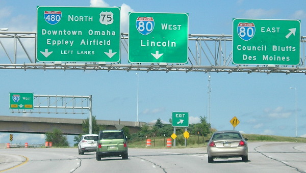
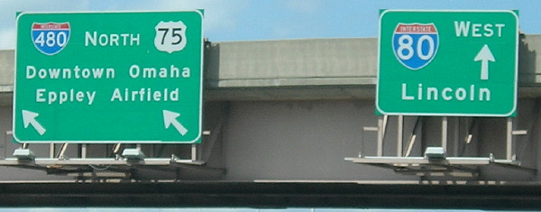
SOUTH End (Nebraska): Complex interchange, I-80 exit 452 and US 75, Omaha NE, Douglas County NE
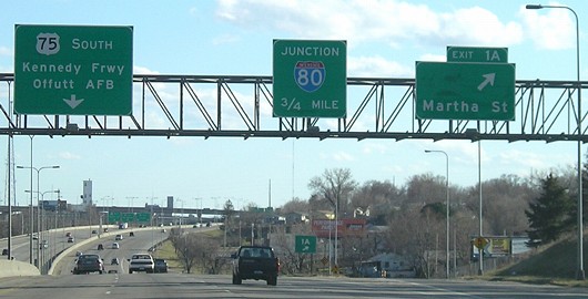
Facing south on 480 (4/6/08)
Signage of I-480 changes from east-west to north-south as it meets US 75. The blank space at Exit 1A was for NE 38.
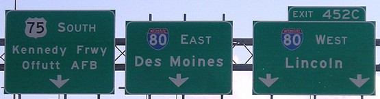
Facing south on 480 (4/6/08)
This is the westernmost mention of Des Moines on signs.
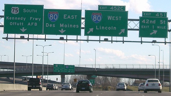
Facing south on 480 (4/6/08)
Watch what lane you get in here: The rightmost one becomes the I-80 exit for 42nd Street. The left two lanes shift a bit left as they cross I-80 and then there's the eastbound exit.
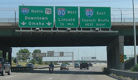
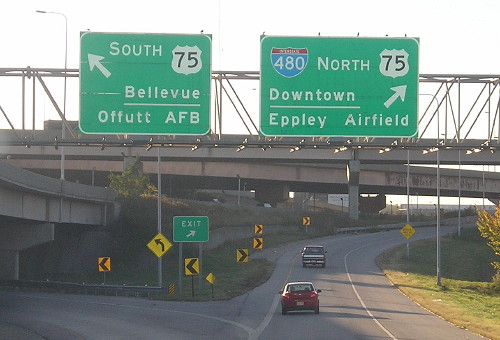
Facing north on 75 (6/12/06)
After I-480 comes across the north side of downtown Omaha, it turns southward, and so does the signage. Overall, the east-west and north-south segments are about equal. I think that I-429 would have been a more interesting option for this interstate designation, and it would have been just as valid. As a bonus, it would have given Omaha a more explicit connection to I-29 and given Nebraska a second branch of an interstate that doesn't enter the state. As it is, all the 3-digit interstates in Omaha and Kansas City that could have conceivably received an x29 designation are instead branches of other interstates in the area (I-80 and I-35).
Facing north on 75 (8/2/16)
Northbound 75 and southbound 480 don't actually meet 80 at the same spot; one direction must curve to meet the other.
Facing north on 75 (8/2/16)
Based on Iowa mileage signs, this interchange is a few miles east of the halfway point between Cheyenne and Chicago. By the time a traveler reaches I-680 a short distance to the west, the halfway point is passed.
Facing west on 80 (10/21/14)
Page created 9/17/06; last updated 12/18/16