
(January 1, 1969-July 16, 1997)
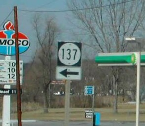
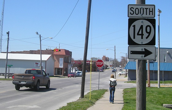
NORTH End: Stop sign, IA 137, Eddyville, Wapello County
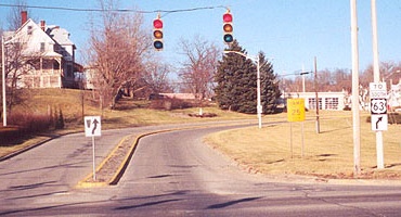
Facing northwest, but heading north, on 23, now US 63 (1/20/02)
Photo by Neil Bratney
In 1997, 23's route between Eddyville and Ottumwa was divided up, part promoted and part demoted. North of Chillicothe, the route became part of the new four-lane stretch of US 63, while south of Chillicothe and into Ottumwa it became a county road. (Kyle Johnson says it is now "Eddyville Road", without an alphanumeric designation.) Before then, this sign would have been a 137 shield with a left-and-ahead arrow with an "End 23" nearby. For more pictures of the intersection and what happened to it see the IA 137 page.
Facing northeast, but heading north, on 137 (1/20/02)
Photo by Neil Bratney
If you turned right at the stop sign, you would have been at the beginning of 23. This piece of road has now been abandoned, closed off for a new intersection to the south for a straighter line for IA 137 to the interchange at new 63.
SOUTH End: Interchange, US 63, Ottumwa, Wapello County
Jason Hancock visited downtown Ottumwa after this 23 was decommissioned, so he does not know where the "End" sign was. This is harder than usual, since there is no intersection; instead, 63 is on a raised viaduct in the area, sort of like IA 14 is in central Marshalltown crossing the railroad tracks. A two-dimensional map of what the area would have been before 1997, with circles and arrows corresponding to Jason's pictures:
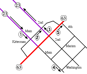
Because the intersecting road was US 63 both when 23 ended here and when these pictures were taken, this page will refer to the road as 63 despite it now being Business 63/IA 149.
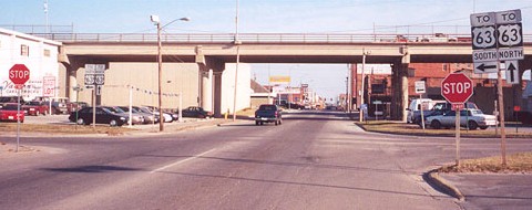
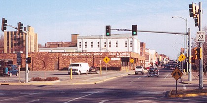
Facing southeast, but heading south, on 23 (Main St.) (3/16/02)
Photo by Jason Hancock
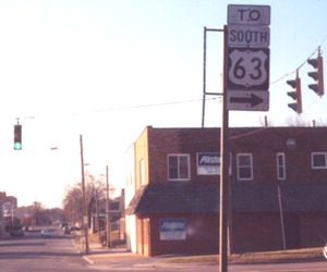
1) About a half-mile northwest of this point, 23 split into SE-bound Main St. and NW-bound 2nd St. This is the 3-way stop at Main and Kitterman. The bridge is 63. Kyle Johnson of Ottumwa said in a 2002 e-mail that he was 95% sure the "End 23" signs, one on each side of the road, were slightly after this intersection (which would make sense, being almost directly under 63).
Facing northeast on Kitterman (3/16/02)
Photo by Jason Hancock
2) Jason writes, "At this point [Kitterman] turns into an on-ramp to southbound US 63; it also serves as an off-ramp from southbound 63 to old 23." It's sort of non-standard to have a "To" with the sign, although since it's at a viaduct and not a freeway that might be why.
Facing northeast on Kitterman (4/13/16)
The stoplight has been removed from the intersection - and the ramp advisory speed has been knocked down 5 mph.
Facing northeast on Kitterman, other side of the street from the above picture (4/13/16)
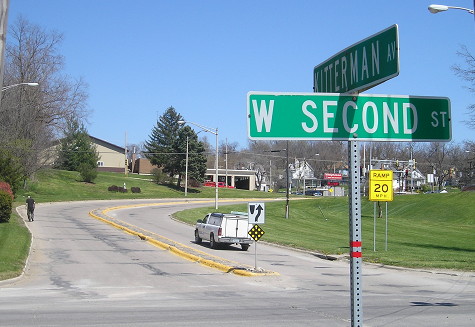
Facing northwest, but heading north, on 23 (2nd St.) (3/16/02)
Photo by Jason Hancock
3) According to Kyle Johnson, there was a "North 23" on the left side. "This was the first sign mentioning 23 on Second St., and the first actual 'North 23' sign (actually one on each side of the road, if I remember correctly) without a directional arrow appeared after this intersection."
Facing northwest, but heading north, on 23 (2nd St.) (4/13/16)
Facing southeast on Main (3/16/02)
Photo by Jason Hancock
4) Contrary to what Mapquest says (as is often the case), Washington Street, a block past Marion, is used to get 23's traffic to 63, even though Marion is a block closer.
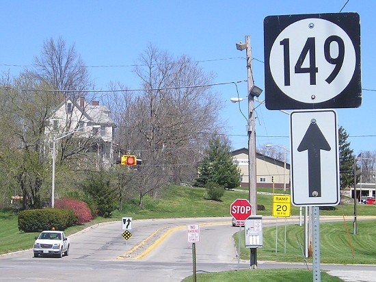
Facing northeast, but heading north, on 63 (3/16/02)
Photo by Jason Hancock
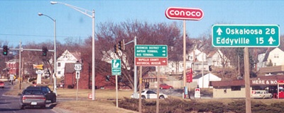
Jason writes, "Looking northward on US 63 approaching the stoplight at 4th Street. Note the up arrow next to the mileage for Eddyville [previously a right arrow]. Southbound, the distance to Eddyville on the LGS was covered with plywood." It certainly does look strange for the up arrow to be on the right side, especially when a normal one is right above it.
IA 23's polarity problem
Although the diagonal has about a 9-mile north-south distance and a 10-mile east-west distance, the road was signed as north-south, probably because it functioned more like a north-south route.
Last seen: 1997
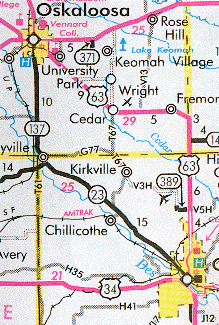
On this map you can see old 23, old 389, 137 to Oskaloosa, and 163 when it ended at 92. In 1998, this map area was much different.
Page created 5/27/02; last updated 1/5/17