
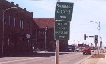
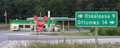
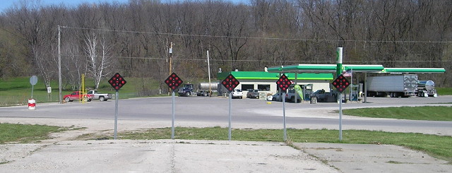
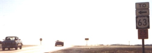
Old NORTH End (December 4, 1934-July 16, 1997): Stoplight, IA 92/A Ave. and US 63/Market St., Oskaloosa, Mahaska County

Facing north on 137, now 63 (3/10/02)
Photo by Jason Hancock
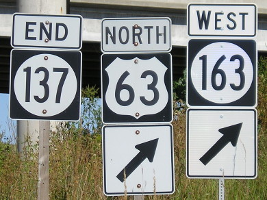
When 63 was rerouted in 1997, its duplex with 92 was removed (it came to 92 at what is now the north end of 23) and took over 137's route north of Eddyville. Previously, 63 would be ahead and to the right. This intersection was, once upon a time, the east end of US 163, going to the left while 63 was ahead and to the right.
Facing west on 92 (3/10/02)
Photo by Jason Hancock
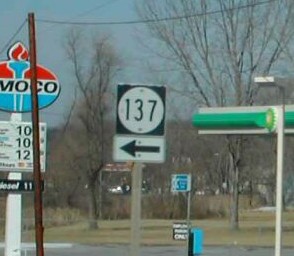
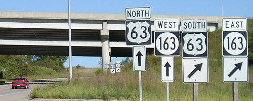
Closeups of above signage (3/10/02 and 11/19/07)
Left photo by Jason Hancock
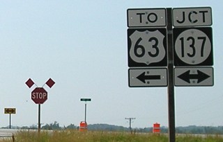
Signage directing travelers to 163 is abundant at this intersection.
Facing south on 63 (10/29/04)
Old NORTH End (July 16, 1997-July 12, 2004): Stop sign, US 63, Eddyville, Wapello County
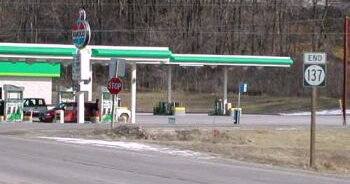
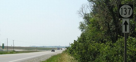
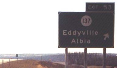
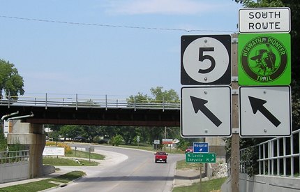
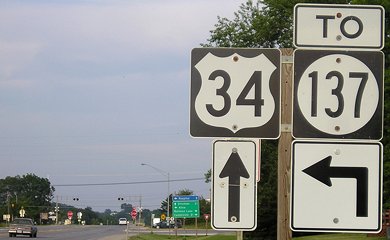
Facing northeast, but heading north, on 137 (1/20/02)
Photo by Neil Bratney
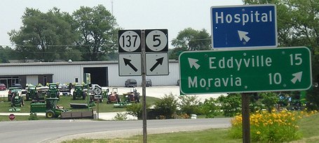
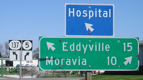
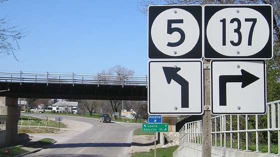
Until US 63 was rerouted in 1997, 137 was almost twice as long as it is now. Its 24-mile length lost the 10 miles between Eddyville and Oskaloosa. Incidentally, 137's Oskaloosa-Albia route was the only stretch of IA 59 not replaced by US 63 in 1935. What makes the routing somewhat strange is that the flow of the road leans toward 63's alignment, as 137 had to take a left and head northwest from here as 23 went south. (Aerial photos from the 1930s indicate that there was an earlier Des Moines River bridge that came into downtown Eddyville on Walnut Street, but 137 still would have had to turn at a T intersection.)
Facing north on 63 (1/20/02)
Photo by Neil Bratney
Before 1997, this would have been the north end of 23, with 137 to the left and straight ahead.
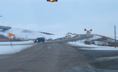
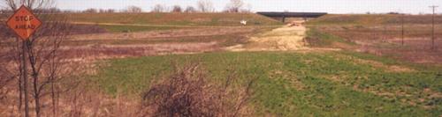
Facing northeast, but heading north, on 137 (7/11/05)
At the original intersection in 2005, a temporary arrow was placed by the Oskaloosa line to make traffic turn right (to new 63). Turning left will take you on old 63 through Eddyville, then curve north on a new road to a new interchange. Part of old 63 right where the four-lane deviates for the bypass is completely blocked off now. At the time this picture was taken the road was still 137, but a new Des Moines River bridge just to the south was being built to make a smooth transition from old 137 to the new road that runs into 63 at the interchange.
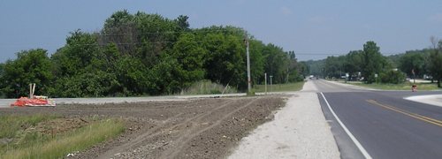
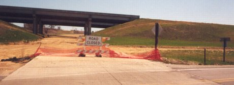
Facing south on 63 (1/25/03)
See below for a better shot of the bypass construction right a few yards ahead. On the north side of Eddyville, bridges for the bypass practically abutted the alignment. The bypass route was graded and appeared ready for paving in 2003, and 137 will be straightened a bit to meet 63 (see below). The Amoco sign was replaced by a completely new BP set during 2003.
Facing south on 63 (1/31/04)
Right at the intersection (1/31/04)
The above "137 <-" is right beside the No Passing Zone sign. The original pavement went straight ahead but has been shifted for grading. Bridges for the bypass are at left.
Facing south (6/16/06)
Deep in the background is the new 137.
Facing north (6/16/06)
This photo is between the old 137 (visible) and the new 137 (behind the camera). The BP is at right. The old road has been abandoned.
Facing northeast (4/13/16)
The road is so abandoned it's not on the Eddyville map anymore. For a time it was IA 437.
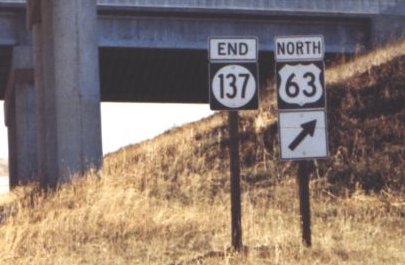
NORTH END: Interchange, US 63 (and now IA 163), Eddyville, Wapello County
The end of 137 at two-lane 63 faced northeast. Now, it ends facing due east, south and east of the intersection. The April 2004 photos show a road being built to meet 63; the December 2004 ones show the finished interchange, first going north on 137 and then coming back as if taking the exit ramp from southbound 63.
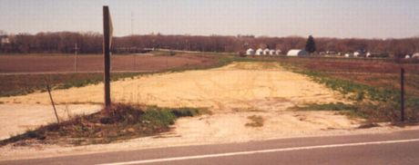
Facing east, southwest of 137's at-grade end (4/4/04)
Photo by Jason Hancock
Jason writes, "View from the existing IA 137 showing grading for the realigned 137. The 'Stop Ahead' sign is for the current road." This road was not finished when the bypass opened.
Facing east (63 is cross road) (4/4/04)
Photo by Jason Hancock
This road is now open, and the End sign has been put up:
Facing east, but heading north, on 137 (12/24/04)
Photo by Jason Hancock
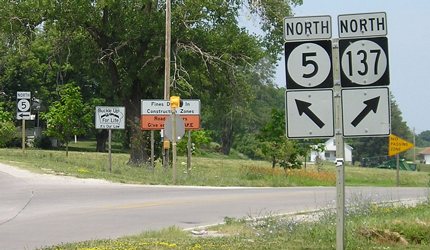
At its heart, the north end of 137 is a trumpet interchange, making the diagonal arrow somewhat superflous. Crossing under the bridges, going north on 63 is the only option. There is one other interchange for Eddyville, but it is NOT County Road G77; it is a new road constructed on the north end of town.

Facing east, but heading north on 137 (9/8/10)
IA 163 was extended to Burlington in late 2009.
Facing east, but heading north, on 137 (9/8/10)
Notice the difference between the older signs and the "prismatic" shielding with IA 163.
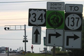
Facing north on 63 (9/8/10)
Facing south on 63 (12/24/04)
Photo by Jason Hancock
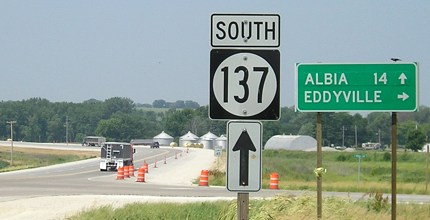
The exit tab's area is larger than the previous standard, allegedly to make it more readable. No "South" added...sigh.
Facing south on offramp (12/24/04)
Photo by Jason Hancock
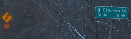
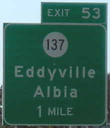
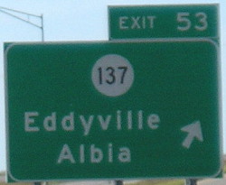
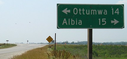
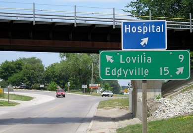
Wait a second. From the old intersection, Albia was 15 miles away (see above). The net change in distance between the two spots can't be more than a fraction of a mile. Curious indeed.
Facing west (63 is cross road) (4/4/04)
Photo by Jason Hancock
This looks at the grading for new 137 from the opposite direction of the first April shot above.
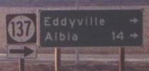
Facing west, but heading north, on 137 (12/24/04)
Photo by Jason Hancock
This is nearly the same vantage point as above; the cross road is now old 63. Jason writes, "It's tough to tell by this photo, but the "ALBIA 14 ->" is really a piece of cardboard tacked onto the LGS; it will be removed when the connecting road opens. And I don't know why they put the arrow above the IA 137 shield..."
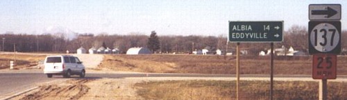
Facing south on old 63, but heading north on temporary 137 (12/24/04)
Photo by Jason Hancock
"...nor do I know why this US 63 assembly is all messed up." This position is a few hundred feet south of the T; 137 later changed to run across the middle of the photo, as seen below.
Facing south (6/16/06)
This LGS looks like the same one that was at the original intersection, behind the camera, in 2004.
Facing south (6/16/06)
The road (or vicinity of the road) in this perspective was IA 23, then US 63, then IA 137 in 2004-05, and now finally a local Eddyville road.
Facing west, but heading south, on 137 (6/16/06)
Compare the shot of this LGS to the one four pictures up. Also compare it to the other, older LGS two pictures up, which says Albia is 15 miles away.
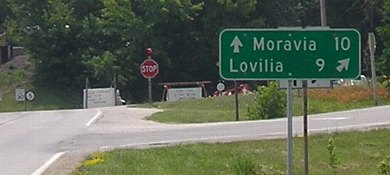
SOUTH End: Y intersection, IA 5, Albia, Monroe County
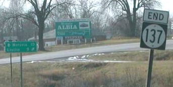
Facing south on 137 (March 2002)
Photo by Neil Bratney
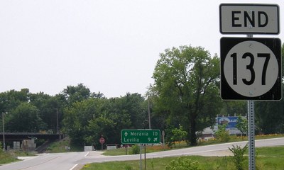
Facing south on 137 (7/11/05)
Facing south on 137 (4/13/16)
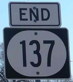
Here are closeups of the new wide IA 137 shield, which is now all over the place, and the last shields seen in below pictures.
Facing south on 137 (7/11/05)
When Neil Bratney took pictures here in 2002, these signs were on wooden poles. The metal creep continues.
Signs hidden behind LGS in above picture (March 2002)
Photo by Neil Bratney
Facing south on 137 (4/13/16)
Facing north on side street (4/13/16)
The skinny digits and wide shield look even worse when placed right next to a normal (or what used to be normal) Iowa shield.
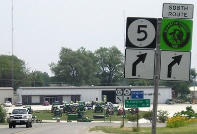
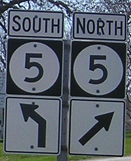
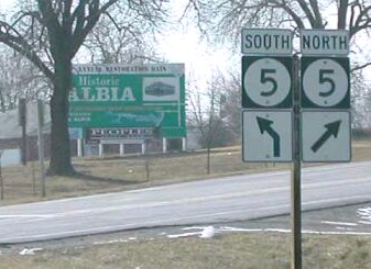
Facing southeast, but heading south, on 5 (7/11/05)
To get to 137, you take a short east-west connecting road and then turn left.
Facing southeast, but heading south, on 5 (7/11/05)
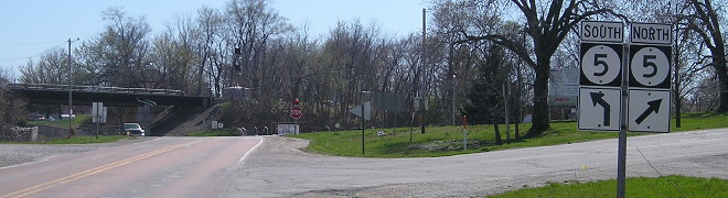
Facing southeast, but heading south, on 5 (4/13/16)
The part of this picture to notice is not the additional decade of wear on the LGS, but why the arrow for 137 changed from diagonal-left to ahead-and-diagonal left. A driver going onto 137 does go straight for a bit (as the road for 5 curves) before needing to turn.
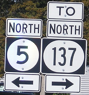
Facing north on 5 (4/13/16)
But then, this ahead-and-right sign makes zero sense compared to an angle arrow.
Facing north on 5 (7/11/05)
Facing north on 5 (7/11/05)
Facing north on 5 (7/11/05)
Surrounding area information: Jct. IA 5/US 34
Facing north on 5 (7/11/05)
From just looking at a map, one might think that 137 can be reached or seen from 34. In fact, that was the case prior to 34's realignment in the 1960s - 137 ended at US 34/Benton Avenue two blocks east of IA 60 (5) and the courthouse in downtown Albia. Since that is not the case today - 137 is on the north side of town, 34 the south - 137 shields have been put up at the intersection.
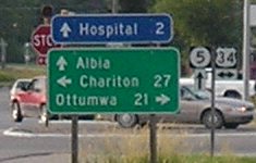
Facing north on 5 (7/11/05)
The mileage sign includes Albia because the bulk of the town is to the north, although some businesses have located here for the highway traffic. It's an eight-lane four-way stop here, just like US 63/US 30 used to be in Toledo, and I presume just as annoying to get through.
Facing east on 34 (7/11/05)

Facing east on 34 (7/11/05)
And if the stop wasn't enough, there's railroad tracks right here too. Notice the LGS doesn't give any distance for Rathbun Lake, which is definitely more than a mile away.
Facing west on 34 (7/11/05)
IA 137's polarity problem
Since 1997, when 137 left Oskaloosa, it has been connecting two north-south highways. Normally, such a task is done by an east-west highway. With the truncation to Eddyville, 137 actually became just that. Today, its total north-south distance is only about 8 miles, whereas its east-west distance is 9½ miles. Despite the creation of such an oddity, 137 will likely remain signed as a north-south route. (Maybe it's good there's no direction listed on 63's BGSs.)
Page created 3/28/02; last updated 1/6/17