
(October 7, 1991-July 1, 2003)
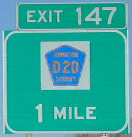
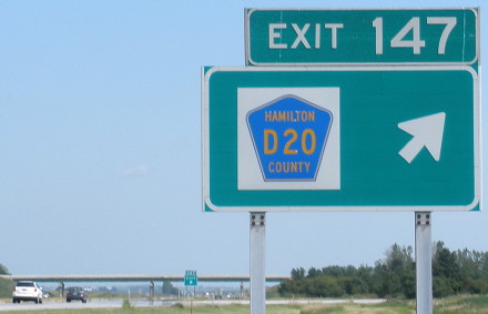
WEST End: I-35 exit 147, Hamilton County
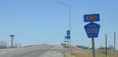
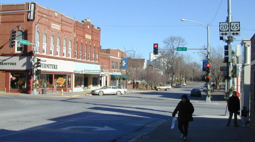
Facing east on D20 (12/8/02)
Since IA 941 was an unsigned highway, this was the only "End" around. Starting from this interchange, 941 went east from I-35. However, US 20 didn't reach this road until half a mile east of here...right?
Facing south (7/29/10)
In the southwest corner of the interchange is this custom sign. Smart travelers could use this route as a fast connection between where IA 928 (old 20) intersected I-35 and 20 a mile east. It makes you wonder why, when the freeway west of 35 was opened, the DOT didn't go ahead and bypass Williams and take this mile over...or did it?

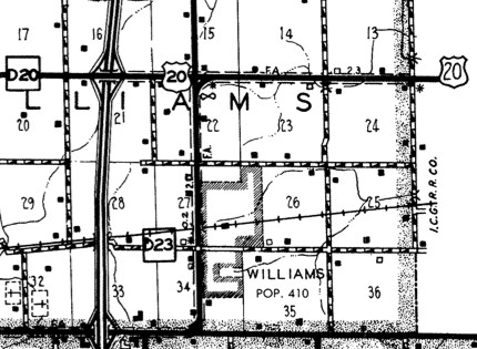
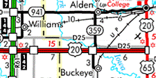
1986 state map / 1986 Hamilton County map
In the 1981 route log, and further corroborated in the national 1989 log of US highways, something surprising pops up. It seems that, despite what state maps indicated, the official routing of US 20 joined I-35 between exits 147 (D20) and 142 (the cloverleaf). The north-south road through Williams was officially IA 928, even though it's red like a part of US 20 in the 1986 state map at left. The 1986 county map, right, shows US 20 bypassing Williams and using I-35, while no secret routes are marked as was custom at the time.
The sign contract in early 1975, for I-35 running north of 20, shows US 20 running through the interchange and going through Williams. It was a year and a half after that that the 20 four-lane opened between US 69 and Webster City, and it's possible the signs changed then. But at the very beginning at least, 20 was not directed onto the freeway.
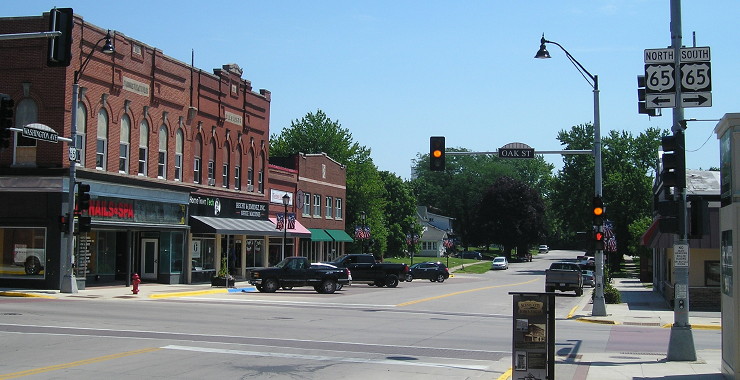
Facing north on 35 (12/8/02)
Facing north on 35 (7/29/10)
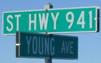
Facing east on 941 (12/8/02)
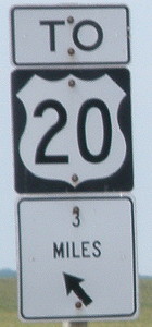
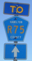
On the left is the only signage at the I-35 interchange past "End D20". R75 goes north from the east end of IA 928. On the right is the Mystery Mile Marker. It is a mile west of MM 159, which is at the end of 928 and on old 20 itself. But this one isn't. However, it makes perfect sense in light of an official routing of 20 here in the 1980s, and may well have been the only indicator of 20's presence on that road.
At 928's east end 941 assumed the true route of old 20 and headed east to Iowa Falls. It actually crosses the Iowa River three times - the South Fork west of Alden, and the river proper twice.
Facing east on 941 (12/8/02)
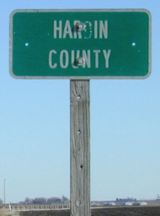
Unlike Hamilton County, which assimilated 941 and 928 into its standard signing scheme, Hardin County marks marked 941 as such.
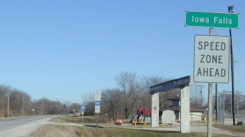
EAST End: City limits of Iowa Falls, Hardin County
Facing east on 941 (12/8/02)
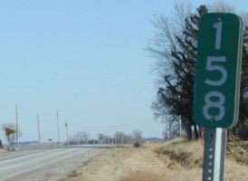
Over two miles of 941 in Iowa Falls were given to the city in November 1995, according to the Washington Avenue bridge site linked below. Mile markers 172 and 173 are still up between here and 20/65.
Facing west on 941 (7/2/14)
Facing east on 941 (7/2/14)
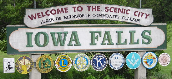
Nearly every fraternal/social organization you can think of is represented on this welcome sign. However, much like rural Iowa, fraternal organizations have been declining in numbers since the 1950s.
Surrounding area information: Washington Avenue bridge
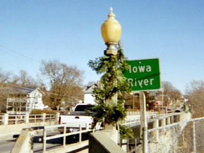
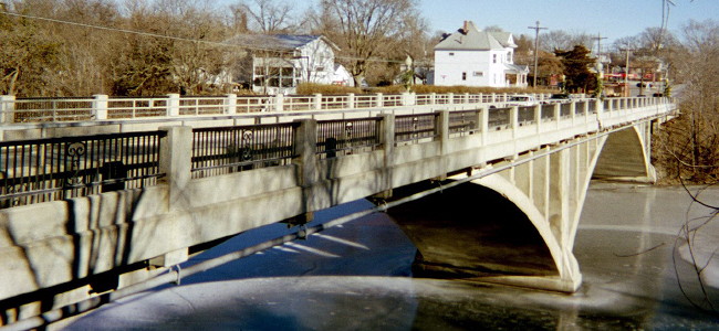
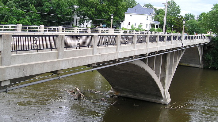
Old 20's second crossing of the Iowa River proper, in Iowa Falls, is the Washington Avenue bridge, a structure built in 1934 that now resides on the National Register of Historic Places. You can read about it here. (12/8/02)
After you cross the bridge you enter Iowa Falls' business district and approach the old east end below. (12/8/02)
Another view of the bridge (7/2/14)
Old EAST End: US 20/US 65/Oak St., Iowa Falls, Hardin County
Facing east on 941 (12/8/02)
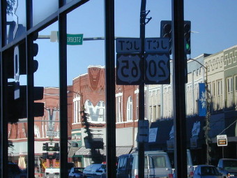
Here's an interesting picture: The signs are reflected in the wall of the Iowa Falls State Bank.
Facing east on 941 (12/8/02)
While behind us, Washington is a main street, ahead of us it dead-ends in a few blocks.
There are also a few ancient alignments of 20 and 65 in Hardin County. Before an early change, 20/65 went north a couple of blocks from here and then headed east on what is now D15. County Road S45 (the gray line descending from where 65 meets 20 on the Franklin/Hardin line) was 65 going north, while D15 continued east to Ackley. The pre-2003 alignment of 20 between Iowa Falls and Ackley was done in 1930.
Facing east on 941 (7/9/18)
Last seen: 2003
Page created 12/15/02; last updated 12/20/18