
(1980-July 1, 2003)
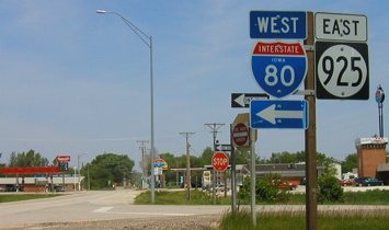
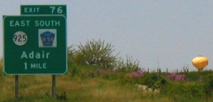
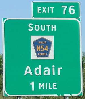
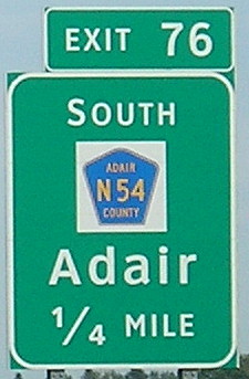
WEST End: I-80 exit 76 and N54, Adair, Adair County
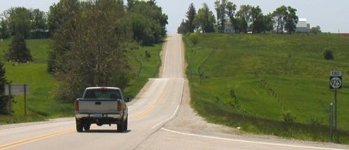
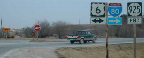
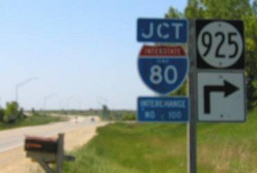
Facing south, but heading west, on 925 (5/27/03)
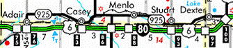
Highway 925 was another famous secret highway, the route for US 6 through Adair, Casey, Menlo, Stuart, and Dexter. For its last three-tenths of a mile, 925 didn't follow 6's old route - in Adair, 6 went west on Broad Street, now G30, and intersected I-80 at exit 75 before continuing to Anita.
Facing north, but heading east on 925 (5/27/03)
This was the only other sign for 925 at this interchange. Notice the complete lack of US 6 signage, par for the course in western and central Iowa - until late 2003 and early 2004, when signage was greatly improved.
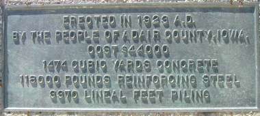
Right before 925 picks up 6's old route is this bridge, built before the formation of the US highway system. Ironically, the state picked up, rather than let go of, this bridge in 1980. (5/27/03)

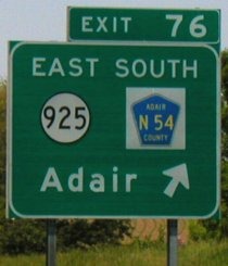
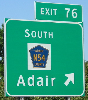
Facing north on N54 (7/20/12)
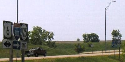
These relatively recently erected signs and already removed signs are part of what appears to be a very short-lived period in Iowa interchange signing that retained mileage signs but used Clearview, and then signing US 6 along with I-80 which hadn't been done until the mid-2000s.
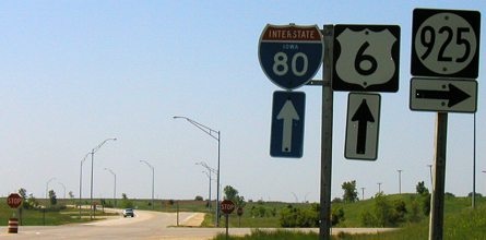
Facing west on 80 (5/27/03)
Peeking up over the horizon is Adair's famous smiley-face water tower. :-)
Facing west on 80 (5/27/03)
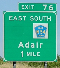
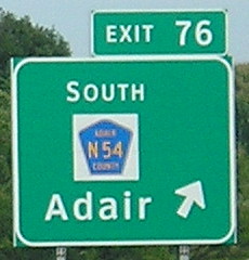
This interchange, unlike those involving US 6, has uniform signage and is entirely correct to boot. After 925 was turned over, N54 was marked on the north-south segment from here north to the north side of Adair, where 925 (now F65) split to the east. However, the BGSs merely got the 925 shields popped off (below).
Facing west on 80, post-decommissioning (6/12/06)
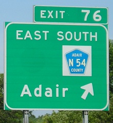
Facing west on 80, post-Clearview (7/20/12)
Adding "South" is both irrelevant and incorrect, since N54 now goes north as well. My bet is that the designer blindly took what was there earlier (see above) and merely deleted the IA 925 component.
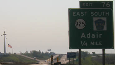
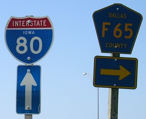
Facing east on 80 (5/25/03)
The 1/4-mile notice is because of the G30 interchange just to the west. Apologies for the pictures; they were taken into the sun early in the morning.
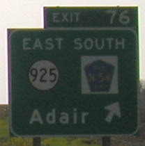
Facing east on 80 (8/16/16)
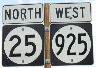
Duplex with IA 25
Facing west on 925 (5/21/03)
After July 1, 2003, the only part of 925 still under state control is its duplex with another state highway. The two routes have nothing in common with each other, just like US 425 is not a branch of US 25, except in that case there is a rule that was broken.
Transfer of jurisdiction of 925 was a tricky situation. Being the old route that it is, it follows the railroad without regard for section lines; thus, it goes back and forth between (or on) Guthrie and Adair counties. At least the entire route was re-asphalted in 2003, unlike say IA 183 north of Missouri Valley, which is narrow, crumbling on the sides, and has become a whole lot of no fun for Harrison County. (And that's an old piece of US highway too!)
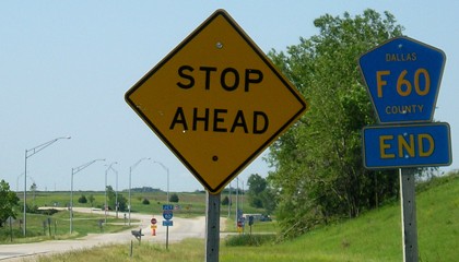
EAST End: Stop sign/T intersection, US 6 (near I-80 exit 100), Dallas County
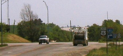
Facing east on 925, taken beside a "Jct I-80" sign (5/27/03)
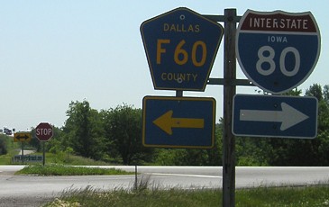
As of July 1, 2003, this is County Road F65 with County Road F60 being the crossroad.
Facing east on 925 (1/18/02)
Photo by Neil Bratney
Way back when (the 1950s and early '60s), this was the west end of IA 90 - from two different directions. During the construction for I-80, 6 and 90 swapped routes a couple of times so 6 could duplex with the new interstate. Between 1961 and 1966, 90 went north from here through Redfield and Adel, and 6 went straight ahead. Yes, straight ahead; I-80 was built right on top of the road. You can see headlights from I-80 traffic to the right of the yellow sign. Then the roads mostly switched back (90 then began 6 miles east of here), until 6 was put on 80.
Facing east on 925, post-decommissioning (6/4/07)
Facing southeast
The interchange is built such that the bridge over the interstate requires hanging left, as the main road becomes the onramp for westbound 80/6 (see second picture down). Notice that neither I-80 shield on 925 has "To" attached to it.
Facing south, post-decommissioning (6/4/07)
Compare to the signs at right in the above photo.
Facing south, but heading west, on 6, with unexplained blurriness (5/27/03)
Facing south, but heading west, on old 6 (6/4/07)
Facing south, but heading west, on 6 (5/27/03)
Notice there are stop signs for southbound (westbound) 6, which means that both directions of 6's original route stop today. This is probably the exact opposite of what it used to be, although it's entirely possible and indeed probable there was a four-way stop when IA 90 was here.
Same assembly, post-decommissioning (6/4/07)
Facing north, but heading east, on 6, with no 6 signs in sight (5/27/03)
Facing north, but heading east, on old 6 (6/4/07)
Between I-80 and here, I'm not sure which county road has the official designation. South of 80, the paved road is P53, which has never been marked at the interchange.

Facing north, but heading east, on old 6 (10/21/14)
This all-caps black-on-white sign mystifies me. It feels like a callback to the 1950s and early 1960s before mileage signs changed to white mixed-case on a green background.
This is the same stub end of IA 90 photographed by Neil as seen on the 90 page, taken about 10 yards east of the T-intersection. The top picture for this end shows how there was an island between lanes; the same was the case here. (5/27/03)
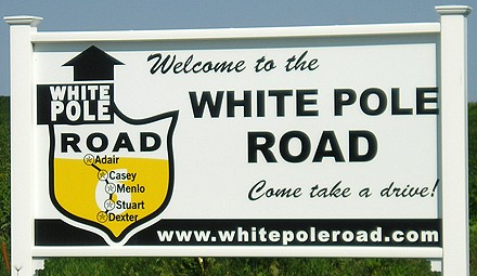
The route that eventually became IA 925 started out as the White Pole Road, also known as the Great White Way. The route was the first auto trail certified by the Iowa Highway Commission. When Bonnie and Clyde's gang went through Iowa in July 1933, they traveled on this part of 6. Once I-80 was finished between US 71 and Dexter in 1960, the Iowa Highway Commission was ready to drop the route that went through five towns and changed direction with the railroad. It would take more than 40 years before the White Pole Road in southern Guthrie and Dallas counties was taken off state rolls. (6/4/07)
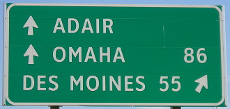
Surrounding area information: I-80 Exit 100 (as depicted until 7/1/03)
Facing west on 80 / Facing east on 80 (5/25 and 27/03)
These two signs show the two main styles of shields on BGSs in Iowa. At left is the newer-style sign. At right is an older one, with an outline. This one appears to be a 3-digit shield (?!) with a wide number. Neither sign has the direction attached (but the sign on the right may precede the need) nor mark P53 south. At original construction, gravel P53 turned east right south of the intersection; it has since been paved to go south and then meet its original alignment a mile away from this interchange.
Facing east on eastbound offramp (5/27/03)
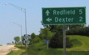
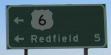
This sign could have been put up before 1980, although the style of the 6 means it probably was not (see above). Prior to 1980, it would have meant that US 6 was to the left, which it indeed was. From 1980 to 2003, it meant that 6 continued north from this point. US 6 skirted Redfield like IA 94 skirted Palo. The north-south part of 6 was designated F60 along with the rest.
Facing north, but heading west, on 6 (5/27/03)
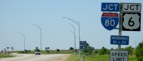
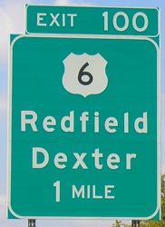
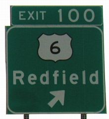
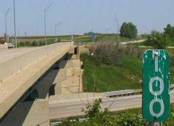
In a somewhat eerie coincidence(?), MM 100 for US 6 is right near MM 100 for I-80. Looking at old maps, I keep getting circa 103 for the mileage here, but it seems close enough to be plausible. (Those maps may have a lot of rounding among all those towns along 925.) This mile marker would have been to the west along 925 prior to 1980; after July 1, 6 lost unique mile markers 100 through 115, making it the second US highway to lose its own MM 100. (US 218 was the first, four miles north of I-80 on I-380; US 63 barely makes it with MM 100 being just south of its east junction with 6.)
Last seen: 2003
Page created 4/7/02; last updated 1/11/18