
| IA 183 south
endpoint history (north end always IA 141) |
||
| FROM | TO | SOUTH |
| 12/1/30 | 10/25/68 |
US 75 (IA 127) |
| 10/25/68 |
11/19/69 |
US 30 (L20/1st Street at US 30, Missouri Valley) |
| 11/19/69 |
10/20/81 |
US 6 (Broadway at Kanesville Blvd, Council Bluffs) |
| 10/20/81 |
7/1/03 |
NCL Council Bluffs |
| 7/1/03 |
Present |
IA 127, same as its pre-1968 end |
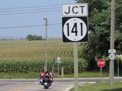
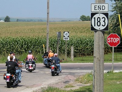
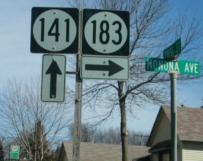
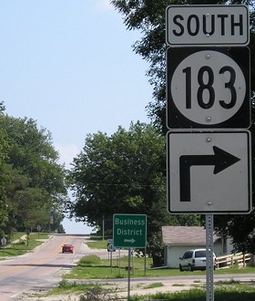
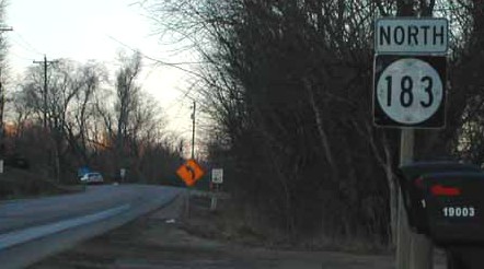
NORTH End: Stop sign, IA 141/1st St., Ute, Monona County
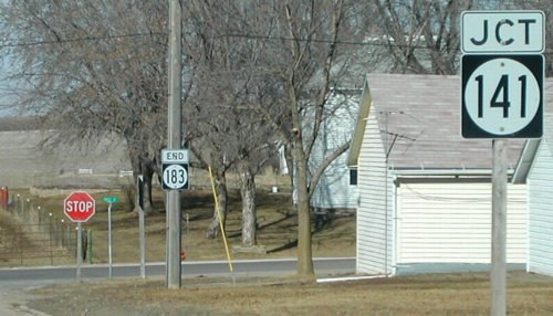
Facing north on 183 (2/23/02)
Photo by Neil Bratney
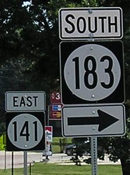
Additional perspectives (8/31/08)
Facing east on 141 (2/23/02)
Photo by Neil Bratney
A few blocks behind this picture, 141 switches from a north-south direction to an east-west direction. This is the sign directly perpendicular to the viewer in the top picture between the green street sign and the "End 183" sign. But that changed later in the decade:
Facing east on 141 (8/31/08)
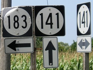
Facing west on 141 (8/31/08)
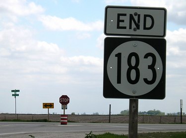
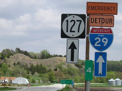
SOUTH End: Stop sign/T intersection, IA 127, Harrison County
Pictures were taken one month before 183 was truncated to IA 127, and then the site was revisited three years later.
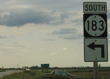
Facing south on 183 (6/1/03)
In the 1930s, 183 ended here while US 75 was the cross road, and ends here again in the 2000s. This pole was later removed.
Facing south on 183 (5/7/06)
Facing south on 183 (5/7/06)
Facing south on 183 (6/1/03)
Notice that 183 was picked up on the duplex in the rural street system. This had to be changed later.
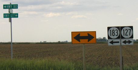
Facing east on 127 (5/7/06)
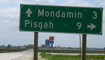
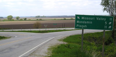
The mile marker is not accurate because there is a Mile 1A near Mondamin.
Facing east on 127 (5/7/06)
Facing east on 127 (5/7/06)
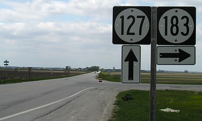
Facing west on 127 (5/7/06)
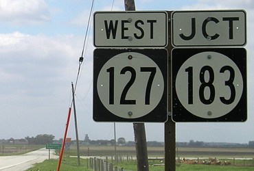
Prior to truncation, this sign could have been "West 127 ^; North 183 <ahead and right>".
Facing west on 127 (5/7/06)
Facing west on 127 (5/7/06)
Compare the plain ahead to the edge of the Loess Hills as seen in the eastbound picture and the one below.
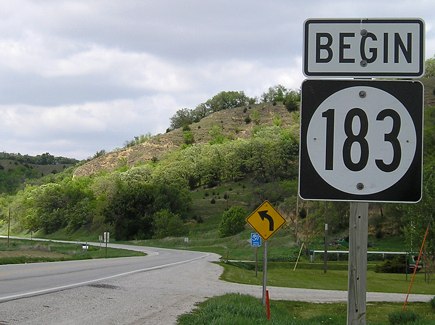
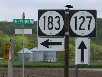
Facing north on 183 (5/7/06)
The only other place I've seen "Begin" signs are at the IA 117/330 junction and the south end of old 945. This picture gives another view of the hills; 183 will follow along their west side for a bit and then go through them.
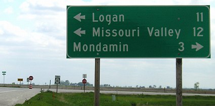
Surrounding area information: South junction IA 127
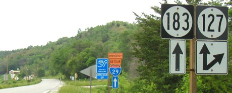
Facing north on 183 (6/1/03)
A mile and a half to the southeast, 127 turns away to begin its original route. At this point, the pavement for 183 narrows all the way down to Missouri Valley, which isn't the best situation for Harrison County with upkeep.
Facing west on 127 (5/7/06)
This triangle is a remainder of US 75's old routing, as it ran north-south in this view. Old 75/old 183/present-day L20 follows the west side of the Loess Hills down to about Honey Creek.
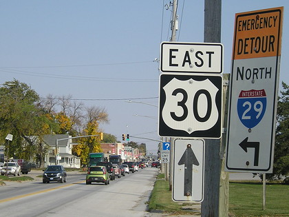
Old SOUTH End (October 25, 1968-November 19, 1969): Stoplight, US 30/Erie St., Missouri Valley, Harrison County
Facing south on 183 (10/8/20)
When US 75 was taken off its original route and moved entirely onto I-29 in late 1968, IA 183 was extended from the junction with 127 to Missouri Valley. A year later, US 30A was decommissioned and 183 extended to Council Bluffs along the Lincoln Highway.
Facing south on 183 (10/8/20)
Before 1968, US 75 would have turned east here.
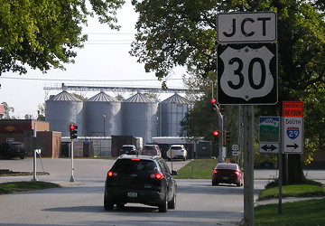
Facing west on 30 (10/2/20)
This gives you a little flavor as to why there are plans for 30 to bypass Missouri Valley.
Facing east on 30 (10/2/20)
This is the first stoplight on eastbound 30 in Iowa. Until US 75 was moved onto I-29, it ran left and ahead.
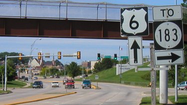
Surrounding area information: Former east junction US 30
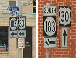
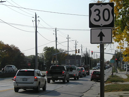
Northbound 183 signs / Westbound 30 signs (6/1/03)
On June 29, 2003, the Sunday before official truncation of 183, all the 183 shields were gone on the route itself but the shields on 30 were still up. This intersection was the east end of US 30A from 1931 (as US 30S) to 1969. This is five blocks east of the other intersection.
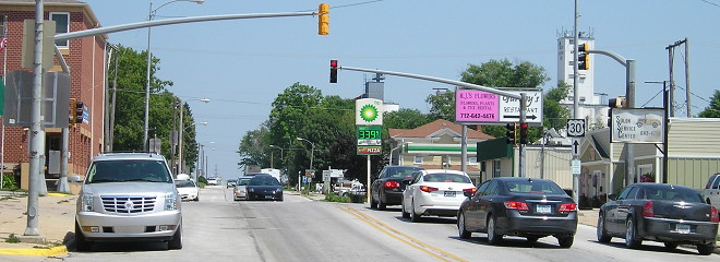
Facing east on 30 (7/12/13)
The Lincoln Highway, and then 30 until 1931, are ahead and to the right. After 30 was routed across the Blair bridge, 30A went right, following the original Lincoln Highway into Council Bluffs, Dodge Street in Omaha, and US 275 northwest to meet 30 again at Fremont. Later on, US 30A in Nebraska was taken off 275 and moved onto NE 92, going all the way to meet 30 northeast of Central City.
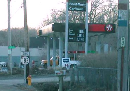
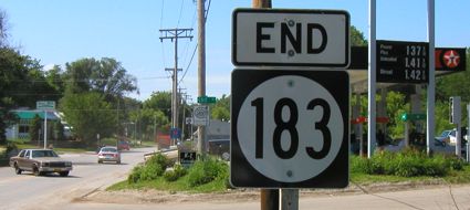
Old SOUTH End (October 20, 1981-July 1, 2003): City limits of Council Bluffs, Pottawattamie County
Facing south on 183 (1/15/02)
Photo by Neil Bratney
After 30 was rerouted straight west of Missouri Valley, this route became US 30S (1931-34) and then US 30A (1934-69). As of now it is County Road L20, a far fall for the first transcontinental highway. Highway 30A lived long enough to appear on BGSs; there is a picture on the back of the 1999(-2000) map showing it.
Facing south on 183 (6/1/03)
Compare the gas prices in the two pictures. Prices doubled in the four years since this one was taken...and then retreated to near that level in the next year and a half.
Facing north on 183 (1/15/02)
Photo by Neil Bratney
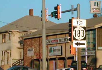
Old SOUTH End (November 19, 1969-October 20, 1981): Stoplight, US 6/Broadway/Kanesville Blvd., Council Bluffs, Pottawattamie County
Facing south on 183 (6/9/03)
The city of Council Bluffs converted this to a more conventional T intersection at the end of 2016.
Facing west on 6 (6/9/03)
Facing east on 6 (1/15/02)
Photo by Neil Bratney
At this intersection, US 6 changes from East Broadway to Kanesville Boulevard. Interestingly, 183 becomes North Broadway (a reminder of 30's route). The part of 183 inside the city limits was turned over to the city in 1981.
Page created 3/28/02; last updated 10/29/20