 and
and
 BUSINESS
(To see the old south end of US 151, scroll down to south end of Bus. 151/922)
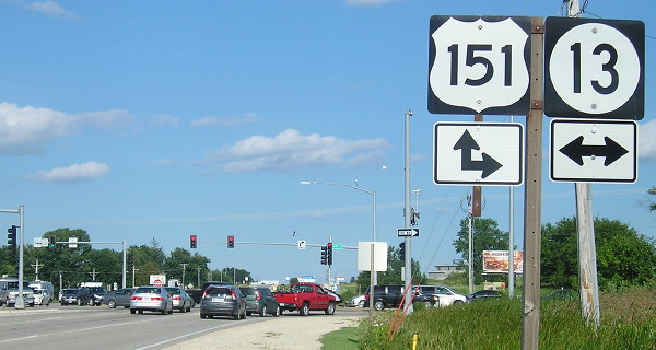
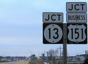
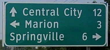
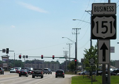
NORTH End of Business 151: Stoplight (was 4-way stop), US 151 and IA 13, Marion, Linn County
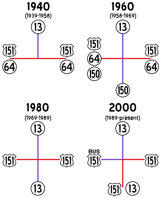
The history of this intersection can be seen in these four maps. Clockwise from 9 o'clock:
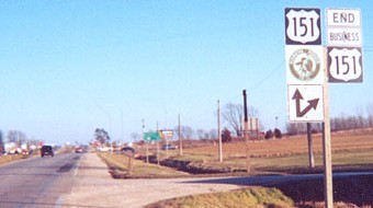
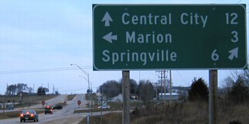
Facing east, but heading north, on Business 151 (pre-stoplight) (March 2002)
Photos by Jason Hancock
Before this intersection was furnished with a stoplight, it was one of the more devious four-way stops out there because of the eight lanes of traffic (plus a few mini-exits). The light really should have been put up ten years earlier, when 151 in the area was being upgraded to four lanes. Jason says all diagonal arrows, like those in the above pictures, are gone now. A Wal-Mart opened on the vacant lot seen in the left picture in January 2006.
Facing east, city-erected LGS (7/29/17)
While the LGS in the background of the first photo remained from DOT days, Marion put up a new one later. This one has been bent since at least 2005.
Facing east, but heading north, on Business 151 (10/21/05)
Photo by Jason Hancock
Facing east, but heading north, on Business 151 (7/29/17)
Facing south on 13 (7/29/17)
Facing south on 13, before/after stoplight (March 2002 and 7/29/17)
Left photo by Jason Hancock
Facing west, but heading south, on 151 (11/28/03)
Facing west, but heading south, on 151 (11/28/03)
Facing west, but heading south, on 151 (10/21/05)
Photo by Jason Hancock
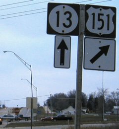
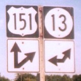
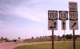
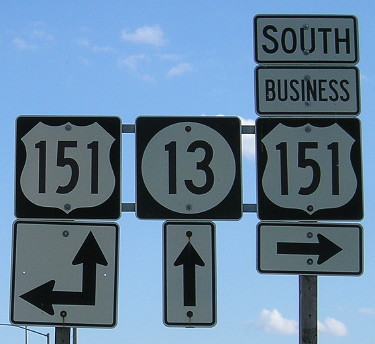
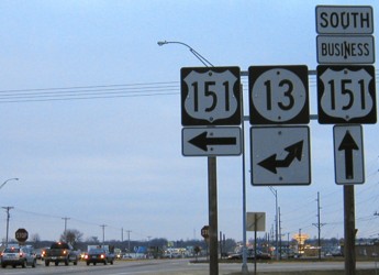
Facing north on 151/13 (11/28/03)
Facing north on 151/13 (7/2/05)
Photo by Jason Hancock
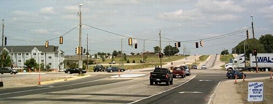
Lights were strung up while construction in the area progressed. There's more development in the northwest quadrant now - past the hotel, which is a Microtel, is a Culver's at the next intersection.
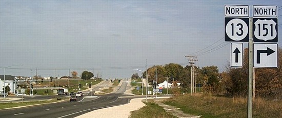
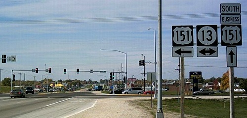
Facing north on 151/13 (10/21/05)
Photo by Jason Hancock
Conspicuous by its absence, the LGS seen three pictures up has disappeared - and, by September 2006, had been replaced with a mileage sign in the Clearview font.
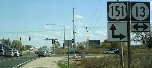
Facing north on 151/13 (6/17/07)
Photo by Jason Hancock
Closeup of the intersection (10/21/05)
Photo by Jason Hancock
This enlargement shows how the left-turn lanes angle away from the thru lanes.
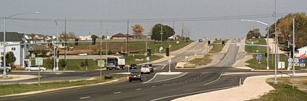
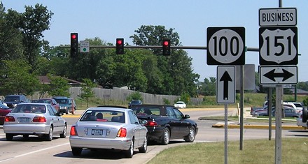
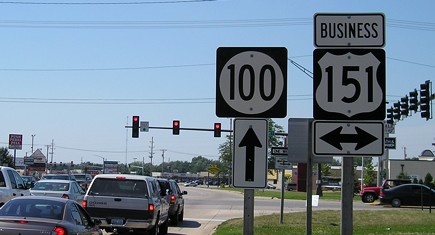
NORTH End of 922: Stoplight, IA 100/Collins Road, Cedar Rapids/Marion, Linn County
Facing north on Business 151 (January 2002)
Photo by Jason Hancock
The intersection of Collins Road and 1st Avenue is near the line dividing Cedar Rapids and Marion. Between 1969 and 1984 it was the end of IA 150 at US 151, between 1984 and 1989 it was the end of IA 100 at 151, between 1989 and 1996 the end of 100 at Business 151, and since 1996 it has been just the intersection of 100 and Business 151. However, it is still an end of something, as the segment of Business 151 through Cedar Rapids is secret 922, and the part north of here through Marion is not state-maintained.
Facing north on Business 151 (7/16/06)
Facing south on Business 151 (7/16/06)
A short distance behind this sign, a Cedar Rapids city-limit signed remained until 2020.
Facing east on 100 (7/16/06)
This was the eastern end of 100 between 1984 (when it was commissioned) and 1996. Before that, it was the south end of 150 before it was rerouted to Vinton. Highway 100 was commissioned August 14, 1984, the same day IA 101 was decommissioned and IA 150 rerouted.
Facing west on 100 (7/16/06)
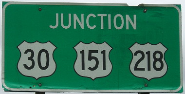
SOUTH End of both: Interchange, US 30/151/218, Cedar Rapids, Linn County
Facing southwest, but heading south, on Business 151 (11/28/03 and 5/18/17)
All three shields are correct at this intersection, unlike the old north end of IA 965. The second photo is the same sign with 14 more years on it. This sign got wiped out in the derecho.

Facing southwest, but heading south, on Business 151 (5/18/17)
East of this intersection is Iowa's most famous wrong-way multiplex: 151 and 218 are going two separate directions. While the direction is generally southeast east of here, you are going south on 218 and north on 151, a consequence of the rerouting of 151 around the east and south sides of Cedar Rapids. In the early 1980s, the leftmost 151 shield would be a 149 shield, the middle 151 set wouldn't exist, and the right one would be "End 151".
Facing southwest, but heading south, on Business 151 (11/28/03)
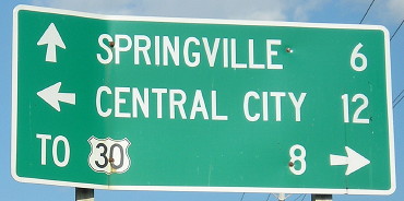
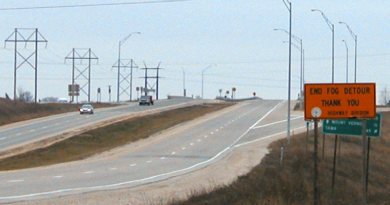
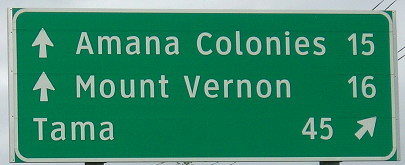
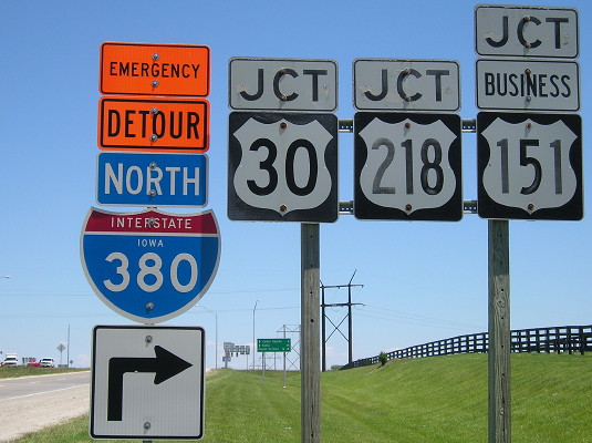
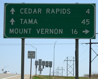
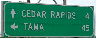
The bottom two towns under the "End Fog Detour" sign are Mount Vernon and Tama. The fog detour is for when unfavorable winds reduce visibility as the freeway goes through an industrial area. (And even when the winds are favorable, as you pass the General Mills plant on Edgewood Road you can encounter a smell vaguely like burnt Cheerios.) The "fog detour" has since been renamed to an "emergency detour". (Hawkeye fans fleeing Kinnick Stadium after a loss to Purdue may constitute an emergency.)
Facing southwest, but heading south, on Business 151 (5/18/17)
This is the updated version of the LGS hidden by the orange sign.
Facing southwest, but heading south, on Business 151 (5/18/17)
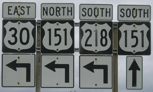
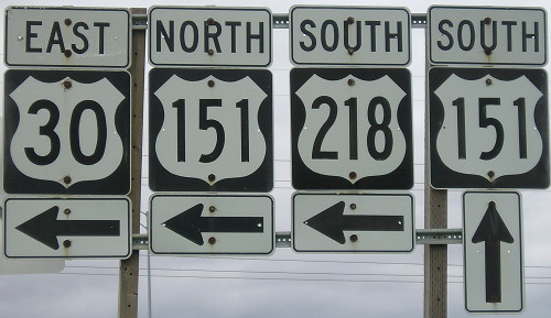
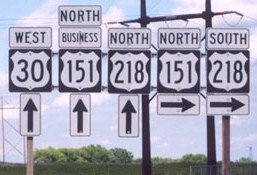
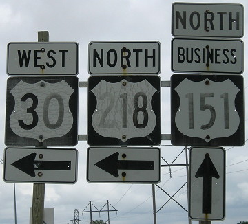
This sign and its companion below clearly illustrate the wrong-way multiplex on 30, and also show square three-digit shields WORKING PERFECTLY FINE WHY DID YOU CHANGE THEM. These were replaced within six months of the pictures.
Facing southwest, but heading south, on Business 151 (5/18/17)
Facing southwest, but heading south, on Business 151 (5/18/17)
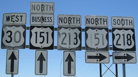
The south side of the bridge would be the very end of Business 151, since NB 151 goes east and SB is ahead. This set is also replaced.
Facing northeast, but heading north, on 151 (May 2002)
Photo by Jason Hancock
Facing northeast, but heading north, on 151 (5/31/17)
Facing northeast, but heading north, on 151 (4/18/06)
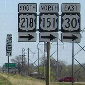
Facing northeast, but heading north, on 151 (May 2002)
Photo by Jason Hancock
This assembly omits eastbound 30, which is also a right turn.
Facing northeast, but heading north, on 151, same signs, now replaced (5/31/17)
Facing northeast, but heading north, on 151 (4/18/06)
The assembly after the previous one, which is actually on the north side of the ramp it's pointing to, doesn't omit eastbound 30.
Facing northeast, but heading north, on Business 151 (5/18/17)
Facing west on 30, but heading south on 151, but heading north on 218 (4/17/16)
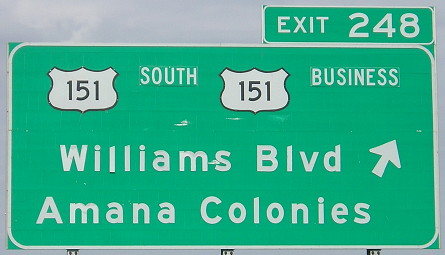
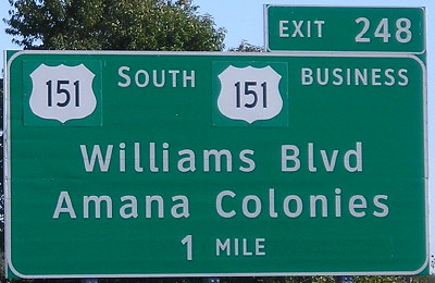
Smaller than normal type for the "South" and "Business" tags - these better photos show those labels are bolted on. Also, the squat US highway shield is on a lot of BGSs in the Cedar Rapids area, most notably at the I-380 interchange with these three highways.
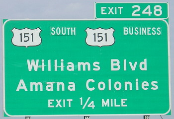
Facing east on 30 (10/14/19)
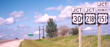
Look closely and you can see the 151 markers are pasted over the old ones; now why would they do that?
Page created 4/27/02; last updated 10/13/21