
(June 26, 1985-July 1, 2003 [sort of])
Ends and notes correspond to 2003 alignment unless noted.
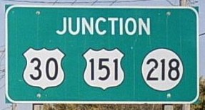
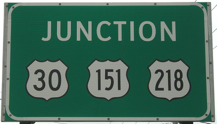
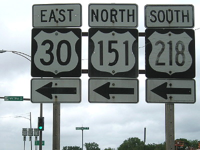
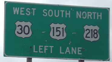
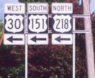
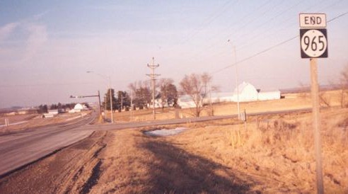
Old NORTH End: Interchange, US 30/151/218, Cedar Rapids, Linn County
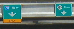
Facing north on 965 (10/21/05)
Photo by Jason Hancock
Well, two out of three ain't bad.
Facing north on 965 (5/18/17)
They fixed it.
Facing north on 965 (10/21/05)
Photo by Jason Hancock
When US 218 was rerouted onto I-380 on June 26, 1985, the segment of 6th Street south of the US 30 freeway was designated IA 965. North of here, 6th Street and 16th Avenue - old 30 and 218 - had been named IA 941 four years earlier when most of the current freeway opened. For five years, 965 went between here and US 6 in one piece. "End 965" was probably at the far right.
Facing north on 965 (5/18/17)
Facing north on 965 (5/18/17)
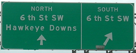
The turn is onto Waconia Avenue, which then has a short ramp onto eastbound 30.
Facing south on 965 (5/18/17)
Facing east (September 2002)
Photo by Jason Hancock
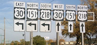
Jason writes, "This sign assembly is looking east on Waconia Avenue, which is where the off-ramp from eastbound US 30 ends, at 6th Street SW." Don't get confused by Iowa's most famous wrong-way multiplex.
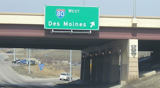
Facing east on 30/151/218 (September 2002)
Photo by Jason Hancock
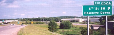
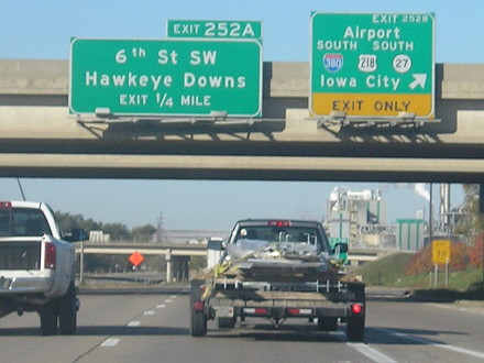
This BGS may have been put up after 965 was decommissioned in the city. The exit is less than a mile from I-380; Exits 252BC are for the interstate.
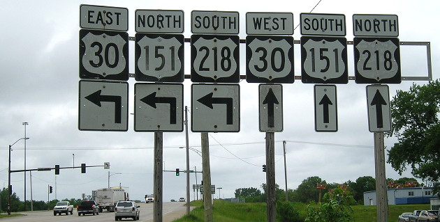
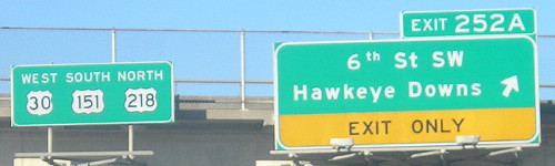
Facing west on 30/151 (10/21/14)
Signs on US 30 at the I-380 interchange were replaced in 2016.
Facing west on 30/151/218 (10/21/14)
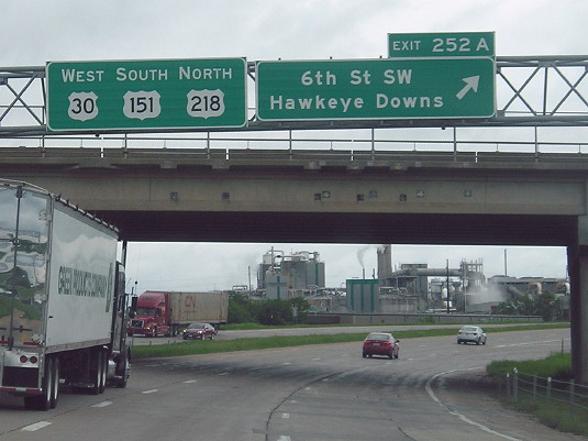
Facing west on 30/151/218 (5/18/17)
The right lane, which not too far back was the merging traffic from I-380, should have "Exit Only" like the previous version.
Facing east on offramp (5/18/17)
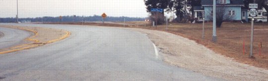
NORTH End [NORTH segment]: 76th Ave. SW, Linn County
Facing north on 965
Photo by Jason Hancock
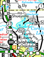
Highway 965 may have been the first 900-series highway to actually be signed, according to Jason Hancock. This intersection is a mile north of E70/Wright Brothers Blvd., which goes to the airport. With the current city limits this is about a mile and a half north of the Cedar Rapids city limits; however, the limits follow the center line of the highway down to include the rest area on I-380. Cedar Rapids ended up accepting jurisdiction of 965 clear into Johnson County.
As I'm updating this page on the 100th anniversary of the Wright Brothers' successful flight, I feel obligated to point out the brothers lived in Cedar Rapids for a while when they were very young. (The tale of a rubber-band plane they got while living here has been used as a Paul Harvey "Rest of the Story".)
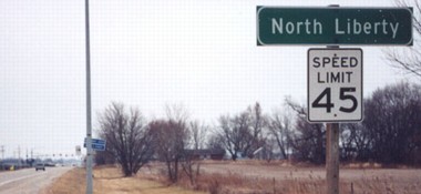
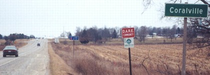
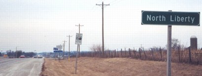
SOUTH End [NORTH segment]: City limits of North Liberty, Johnson County
Facing south on 965 (12/25/02)
Photo by Jason Hancock
Just like IA 928 is broken in Webster City, 965 is broken because North Liberty took control of the road.
Facing north on 965 (12/25/02)
Photo by Jason Hancock
As you leave North Liberty, you're back on a state highway that shows signs of its high-use past. Turn around and travel about 2.5 miles south to get to the beginning of the south segment.
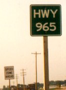
Photo by Jason Hancock
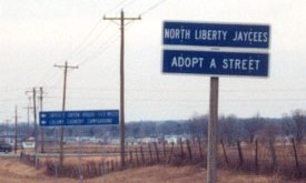
The signs in the city aren't made by the state, because it's not the state's responsibility. However, North Liberty retained the newest name of the road (as opposed to, say, "Old Highway 218"). Given that local media still call it 965, perhaps that's OK. Signs like this are gone now, but the name remains.
This was posted on I-380 when the bridge across the Iowa River was being worked on. (9/28/14)
NORTH End [SOUTH segment]: City limits of North Liberty, Johnson County
Facing south on 965 (12/25/02)
Photo by Jason Hancock
Although the city limits border each other, there is still a lot of farm acreage in between. Check back in five years, though.
Facing north on 965 (12/25/02)
Photo by Jason Hancock
South of this point, 965 rises from nonexistence and lives for about two more miles.
Facing north on 965 (12/25/02)
Photo by Jason Hancock
Since it's not owned by the state and not a highway anymore, those in North Liberty "adopt a street".
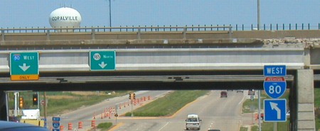
NORTH End [Post-2003 segment]: I-80 exit 240, Coralville, Johnson County
"He says he's not dead!" "Yes, he is." "I'm not!"
Facing west on 80 (7/15/06)
Is Highway 965 alive or dead? It kind of depends on where you look. In 2003, all the signs were removed, and despite some haggling over a segment south of Cedar Rapids, that should have been that - but it wasn't. Mark Odor found out that there's still a little piece remaining under state control - the segment between I-80 and US 6. It's a very small segment, but a vital connector between the two, which would explain its continued survival despite the removal of shields. On the official Johnson County and Coralville city maps, the style of the road indicates that it is state-maintained, but no 965 marker is present on either map even though much shorter segments in the past always got markers. In light of that, here are some pictures of the interchange from both 80 and 965; keep in mind that the ends are within sight of one another.
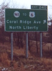
Facing east on 80, pre-decommissioning / Sign on eastbound 80 as seen from 6, post-decommissioning
Left photo by Jason Hancock (December 2001 and 7/15/06)
Interstate 80 was constructed
such that a direct interchange
with US 6 was not feasible. This exit was originally for US 218.
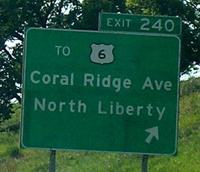
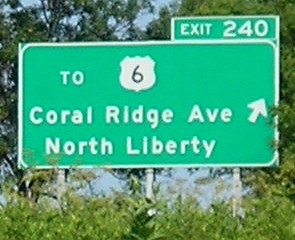
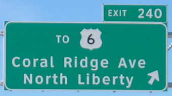
This sign has been replaced repeatedly since the mid-1990s:
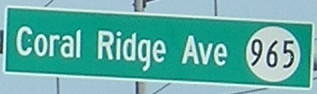
**Before the mall this exit was signed "Coralville"
as opposed to "Coral Ridge Avenue"
**A severe wind storm in 1998 blew the sign down, but this could
have been the pre-mall sign
**A new sign in March 1999 (to replace the fallen one) had black
borders around both shields and an older-style font and shape
for the 6 shield. It also condensed the letters in "Coral
Ridge Ave" and had a strange font for the "orth"
- the N was correct - in "North Liberty".
**The sign shown at left dates to spring 2001
**As of mid-2003, this sign and related ones have had the 965
shield popped off and now just say "To 6" (as seen at
right).
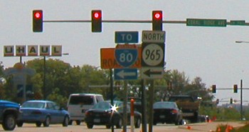
**After expanding I-80 to three lanes in each direction, Clearview BGSs
at this exit were moved to overhead gantries, as seen below.
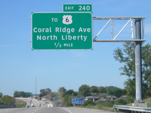
Facing west on 80 (10/7/13)
Facing west on 80 (10/7/13)
The layout is identical for eastbound 80.
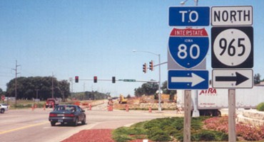
Facing east on the offramp (6/19/03)
Photo by Jason Hancock
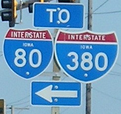
On each side of the ramp, signs for 965 and 6 go their respective ways (more or less). Now, though, it appears 965 mostly goes to the right and to 6, though its true end is on the north side of the interchange at the westbound offramp.
Facing east on the offramp (6/19/03)
Photo by Jason Hancock
Facing north on 965 (5/25/03)
This picture was taken during construction on the interchange. Multiple signs here were temporary, including those on the left - and what's that on those?
Closeup of above signage (5/25/03)
It's Butt-Ugly Kansas-Style Signage (and non-uniformly sized, at that)! Booo! The temporary 80 signs have been replaced (below).
Facing north on 965, finished bridge (3/12/07)
This interchange was a six-ramp configuration to begin with, which would have been rare in the original construction period.
Facing south on 965 (12/24/03)
Photo by Jason Hancock
And speaking of bad signage...
On November 24, 2003, a new BGS gantry for the I-380/US 218 interchange was put up on westbound I-80 (just west of this interchange) which not only had the aformentioned signage style, it had a misspelling. KCRG, the ABC affiliate in Cedar Rapids, picked up on the story of travelers trying to exit to Cedar Radids. Oops. The sign was spell-checked (read: fixed) within about 24 hours, but another one on the gantry still erroneously says an exit is 1 mile away instead of 1¼.
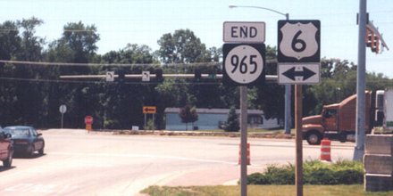
SOUTH End [SOUTH segment/Post-2003 segment]: Stoplight, US 6, Coralville, Johnson County
Facing south on 965 (6/19/03)
Photo by Jason Hancock
Facing south on 965 (6/19/03)
Photo by Jason Hancock
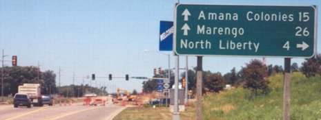
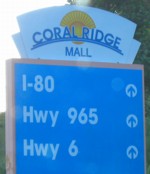
It's only a matter of about 2000 feet to US 6 from I-80's interchange with 965 (see below). This two thousand feet, though, is 6's only access to both I-80 and I-380 and serves that monument to urban sprawl, Coral Ridge Mall.
Facing west on 6 (6/19/03)
Photo by Jason Hancock
Facing west on 6 (6/19/03)
Photo by Jason Hancock
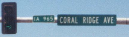
Enlargement of signs on stoplight pole (6/19/03 and 6/21/13)
Left photo by Jason Hancock
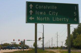
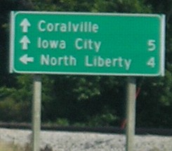
Facing east on 6 (5/25/03 and 7/15/06)
"One mile" to Coralville only by the DOT, which signs distances to city centers. Same for Iowa City's 5. On the right, you can see that three years later, the "1" is now gone. Hmm...
Facing east on 6 (5/25/03 and 7/15/06)
Sign on road around mall parking lot (5/25/03)
The indicators on the mall loop are still up.
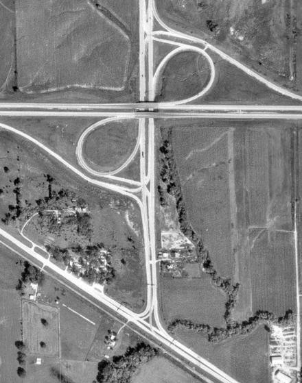
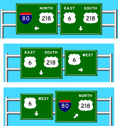
Photo via ortho.gis.iastate.edu / Kurumi SignMaker
Visible at the bottom of the 1970s aerial photo, left, are three sign gantries at the US 6/US 218 intersection, which is now IA 965's south end. At right is what those signs looked like, clockwise from left, except they were spread across all lanes and eastbound 6 also had a "STAY IN YOUR LANE" sign. The six-ramp configuration at I-80 has more entry/exit points than the modern version, but back then it would've been controlled with stop signs instead of lights. The entire area to the east of 965 and south of I-80 is now occupied by the mall and parking lots.
Last seen (signed): 2003
Page created 12/3/01; last updated 4/6/20