
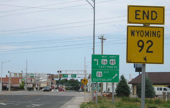
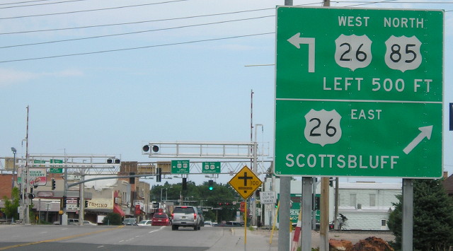
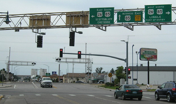
WEST End: Stoplight, US 26/85, Torrington WY, Goshen County WY
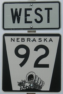
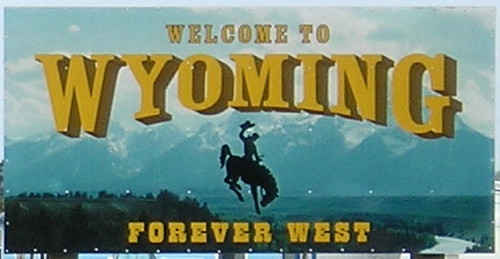
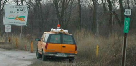
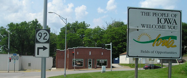
Facing west on 92 - last sign in Nebraska, Wyoming welcome sign
The quest to drive Highway 92 brought me back to Wyoming for the first time in 16 years. All these photos were taken 8/4/16.
Facing west on 92 - NOT at the end
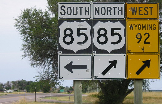
Way back in the BGM times (Before Google Maps), I wrote that the route marked as state highway 92 is so long Street Atlas* has to be at a magnification level of only 6 (of 16) to show it. The route runs for less than 17 miles in Wyoming (more north-south than east-west), completely crosses Nebraska and Iowa, and makes it about halfway across Illinois. Now, I know that after 92 gets into Wyoming (and passes an abandoned school) it meets US 85 and continues northward. But those 17 miles are enough to make it a very rare four-state number.
*Street Atlas was a computer program that, when used with a CD, gave you maps of the entire country down to street level. In the late '90s this was considered indescribable power. (And a CD is...oh, never mind.)
Facing north, but heading west, on 92
"Highway 92" runs for 886 miles - and I've driven all but nine of them. A detour in central Nebraska thwarted my clinching plans, but given the remote location, it'll have to be good enough for me.
Facing north, but heading west, on 92
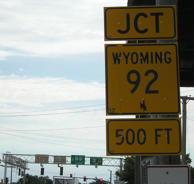
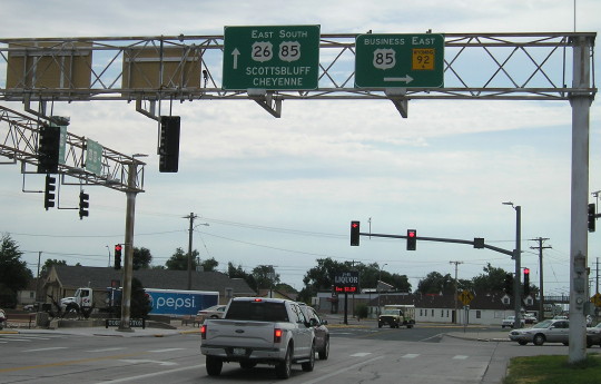
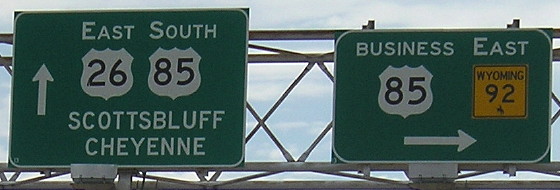
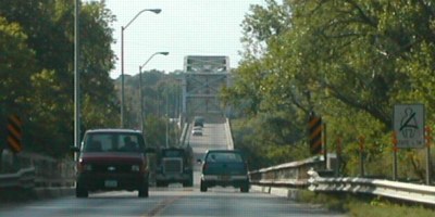
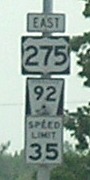
In 2013, US 85 was rerouted away from part of 92 to avoid this railroad crossing. Now 92 is signed with Business 85, which also ends here.
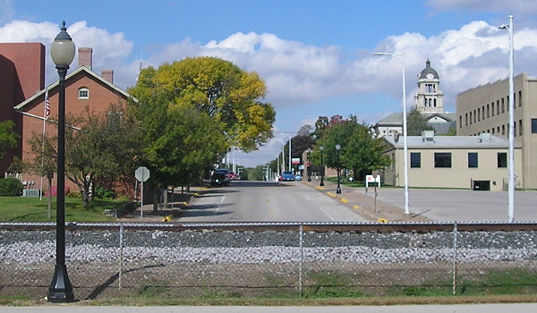
Torrington, with 6500 people, is the second-largest city on 92 west of Omaha, behind Scottsbluff. Rich Carlson, webmaster of the Illinois Highway Page (Jason Hancock's site's counterpart), wonders why 92 is the same in four states in the first place, while it "doesn't go anywhere important, and takes its time getting there." (Oh boy, does it take its time. - Ed.)
Facing southeast on 26, but heading south on 85
Facing southeast on 26/85
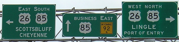
Closeup of signs in above picture
Facing south
The first river WY 92 crosses is the North Platte.
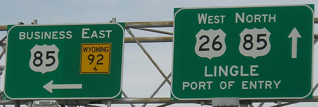
Closeup of signs in above picture
Facing northwest on 26/85
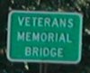
WEST Iowa line: Missouri River (new South Omaha Veterans Memorial Bridge), Council Bluffs IA/Omaha NE, Pottawattamie County IA/Douglas County NE
Old WEST Iowa line: Missouri River (old South Omaha/Veterans Memorial Bridge), Council Bluffs IA/Omaha NE, Pottawattamie County IA/Douglas County NE
Although 92's plenty long, making it a US highway would require two numbers to fit the rules, since it crosses US 30 in east-central Nebraska, and in addition only the eastern segment (east of US 281) is really major enough to be a US highway. Well, US 32 has been open since 1934...
Looking north from Nebraska (1/22/02)
Photo by Neil Bratney
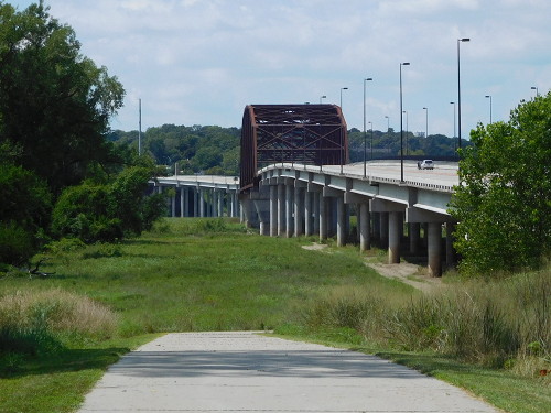
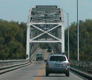
Although this bridge, the South Omaha Bridge, was built in 1935, the bridge did not carry US 275 until 1941 and IA 92 until 1960. Neil says, "On the west side of the bridge, NE 92/US 275 enter ethnic South Omaha on Missouri Ave. You can turn north immediately on 13th Street to get to I-80 (about 1.5 miles). NE 92 continues westward through Omaha and on to Wahoo."
The new South Omaha Veterans Memorial Bridge opened in 2010; a bypass of Wahoo opened August 26, 2015.
Iowa into Nebraska
Facing west on 92/275, with a Nebraska seat belt sign (summer 2002)
Photo by Neil Bratney
Facing west (8/2/16)
This is a picture of the new bridge from where the old bridge used to be.
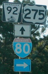
Photo by Neil Bratney (Summer 2002)
These are the first signs in Nebraska. It's missing a "To" tag for I-80, though. Nebraska likes to be bold in posting its US route numbers. (The font would best be described with a name like "Series D Bold" or "Series D Thick." The 92 is in standard Series D.)
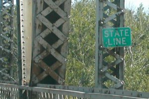
Nebraska into Iowa
Facing east on 92/275 (6/12/06)
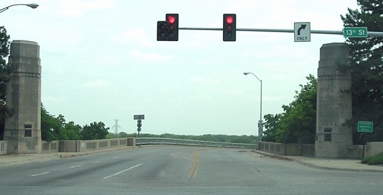
The road we're on is Missouri Avenue; the intersecting road is 13th Street, which carried US 73/75 prior to the mid-1980s. The South Omaha Bridge was named the Veterans Memorial Bridge in 1985, though the name is used less often on the Iowa side.
Closeup of bridge sign and last Nebraska shields (Summer 2002 and 6/12/06)
Left photo by Neil Bratney
Facing east (Summer 2002)
Photos by Neil Bratney
Facing east on the Nebraska side (4/6/08)
Facing east on 92/275 (Summer 2002 x2 and 4/6/08)
Left and center photos by Neil Bratney
Iowa's first sign set had neither a US 275 shield or a "Pottawattamie County" sign but by 2006 a 275 shield had been added (far right).
Facing west on 92(/275) (1/22/02)
Photo by Neil Bratney
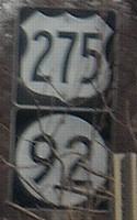
Neil says this mile marker is within 100 feet of the first sign. This corresponds to US 275's mileage; note the mini-shield. In the early 2000s, many US 275 shields along IA 92 were round Iowa 275 shields, though most of these had been removed by 2006.
Facing east (8/2/16)
There is just a sliver (a very silly sliver, really) of the old road here, but it's enough to make out where the old routing was and how it curved.
Facing east on 92, east of I-29 and the old 275 split (6/27/06)
This is either a non-conforming sign or a nice reminder of how long 92 is in Iowa.
Old EAST Iowa line: Mississippi River, Muscatine, Muscatine County IA/Rock Island County IL
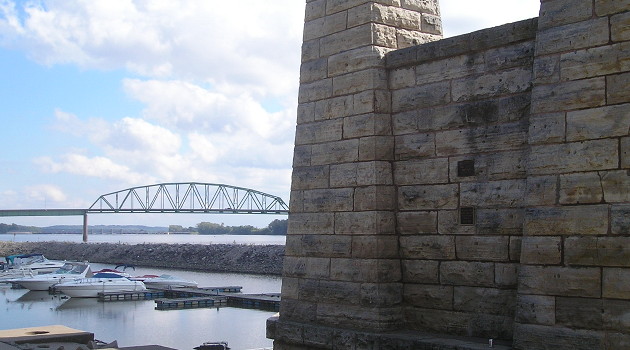
Facing mostly north (9/27/15)
In the foreground is the pier for the original Muscatine bridge. A small plaque shows the high-water mark from 1993.
Facing northwest (9/27/15)
This is looking the other direction from the bridge pier onto Walnut Street. I would be UNDER the old bridge; its footing was in the alley in the middle-ground. US 61 went underneath with bridge traffic taking Cedar or Mulberry to get to 2nd to go east on the bridge. The Muscatine County Courthouse is at right, two blocks away. For a map and history see my Muscatine Highway Chronology.
Facing north (9/27/15)
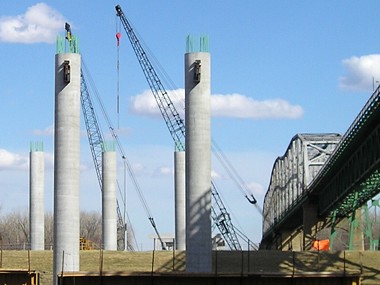
From the old bridge location we can see the new bridge.
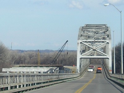
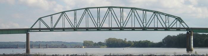
EAST Iowa line: Mississippi River (Norbert F. Beckey Bridge), Muscatine, Muscatine County IA/Rock Island County IL
Facing east (10/4/15)
The Mark Twain Overlook is a great place for taking pictures of the bridge and river, and seeing downtown Muscatine including the courthouse from the north. It was the beginning and endpoint for my circumnavigation of Iowa in fall 2015.
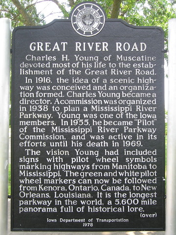
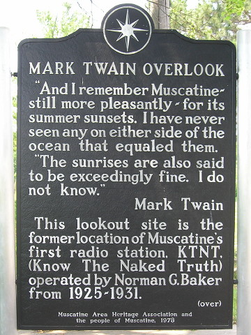
Markers at Mark Twain Overlook (6/8/15)
Northern approach (2014-present)
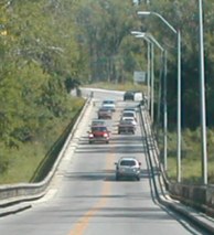
Facing southwest, but heading east, on 92 (6/8/15)
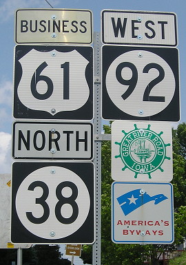
In 2014, IA 92 was removed from Grandview Avenue and Mississippi Drive and rerouted onto the US 61 bypass and IA 38; now 92 approaches the bridge from the north instead of the south.
Facing northwest, but heading west, on 92 (6/8/15)
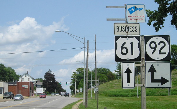
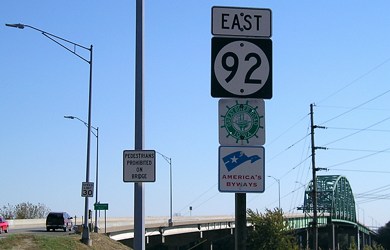
Facing northeast, but heading north, on Business 61 (6/8/15)
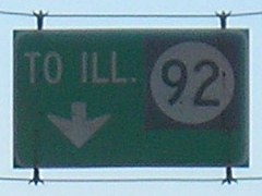
The sign pointing to Illinois (two pictures down), which seems like one that was just fine no matter what the highway was, is now gone.
Facing northeast, but heading north on 38 and west on 92 (6/8/15)
This sign set shows that IA 38 was not truncated to US 61 as part of IA 92's realignment. It is now a redundant multiplex that adds IA 22 a short distance to the north.
Southern approach (1972-2014)
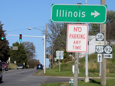
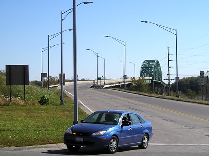
Facing northeast, but heading east, on 92 (10/13/06)
The first town on IL 92 is Illinois City, but it wouldn't be illogical to point to Rock Island instead since that's where 92 is going. It heads almost due east to the Quad Cities from here.
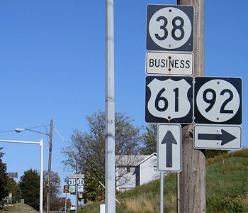
Facing northeast, but heading east, on 92 (10/13/06)
Facing southeast (10/13/06)
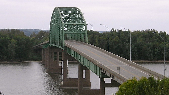
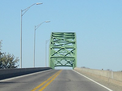
This is the Norbert Beckey Bridge into Illinois. Once it crosses the bridge, it becomes IL 92. The car is turning from IA 92 onto IA 38.
Facing southeast, but heading east on 92, shields at far right of above picture (10/13/06)
Facing southeast on 92 (10/13/06)
Facing northwest, but heading west, on 92 (10/13/06)
Facing northwest, but heading west, on 92 (10/13/06)
This is the second westbound 92 shield in Iowa; the first is in the background of the above photo.
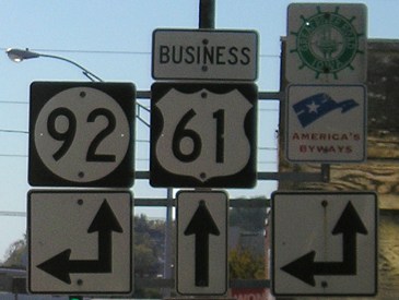
Facing southwest, but heading south, on 38 / Closeup (6/19/03 and 10/13/06)
Left photo by Jason Hancock
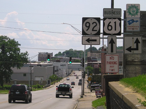
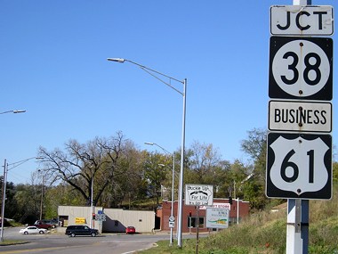
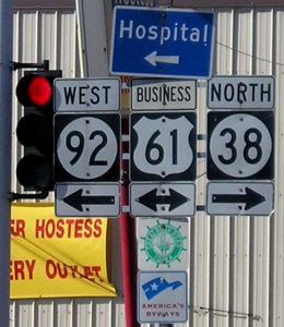
This is in downtown Muscatine as 92 crosses from Illinois and intersects Business US 61. This is also the south end of IA 38.
Facing southwest, but heading south, on 38 (10/13/06)
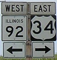
EAST End: Intersection, US 34, near La Moille IL, Bureau County IL
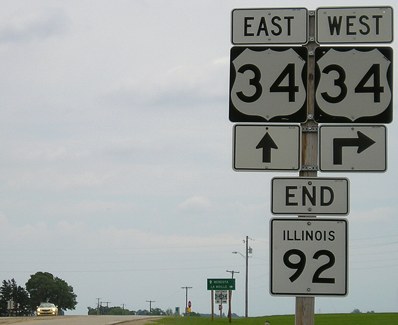
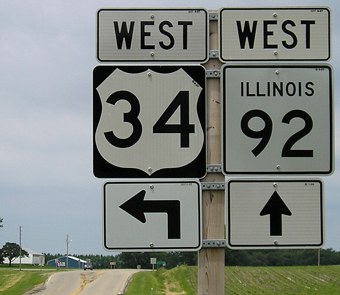
Facing east on 92 (6/15/08)
Highway 92 finally ends 12 miles west of I-39, but traffic eastbound on 92 can run right into 34's alignment and continue to Chicago.
Facing east on 92 (6/15/08)
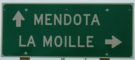
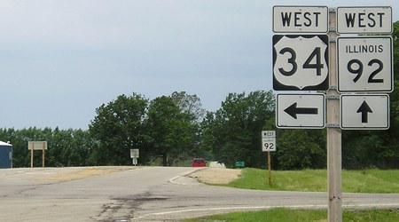
Facing east, but heading north, on 34 (6/15/08)
Facing east, but heading north, on 34 (6/15/08)
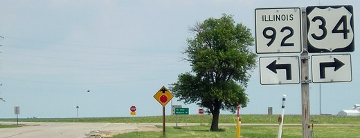
Facing west on 34 (6/15/08)
Facing west on 34 (6/15/08)
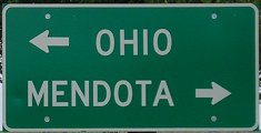
Facing west on 92 (6/15/08)
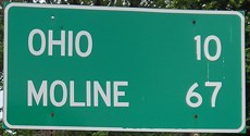
To get to Iowa from Illinois you have to go through...Ohio? Moline is due west of here.
Points of interest:
Highways 2, 60, 92 and 163 are the only state highways with business routes, all created from bypasses. The Clarinda bypass/business route for IA 2 was created in 1973, Knoxville's for 92 in 1978, and Pella's for 163 was created in 1994. A route for Business IA 60 through Sheldon was designated in 2006. Business 92 has its own page here.
Also, even though 92 is a sort of anomaly as a major road with 2 digits unlike 2, 3, and 9, it's the only one to continue as the same number on both sides of Iowa (see above). Before 92 was christened in 1939, the route did in fact have a single-digit number, 2. (That 2 was then given to what was 3, and a new 3 was later routed across northern Iowa.)
Page created 4/13/02; last updated 4/11/17