

- In 1920, they knew it as: Various roads, none with a name, from Anamosa to Muscatine (3 counties)
- We know it as: The southern half or so of present IA 38
- Let's get granular: 2nd Street and Park Avenue (including part with bridge over Mad Creek) in Muscatine, IA 38, Old Muscatine Road with break across I-80 to 306th Street, Old Muscatine Road, 1st Street, Ocean Avenue, Old Muscatine Road, 300th Street, IA 38, Logan Avenue, IA 38, Moscow Road, F36, IA 38, Main and Broadway streets in Stanwood, IA 38, Cleveland and Resident streets in Olin, Newport Road to vacated bridge across the Wapsipinicon River, 165th Avenue, 80th Street, 170th Avenue, IA 64, 115th Street, and 3rd-Scott-Main streets in Anamosa
- The 1914 county map implies a possibility of 120th Street, Story Avenue, and 5th Street to graze Wilton's west edge, but all other documents show a straight north-south road here.
- The abandoned 1st Street is just north of I-80, at an extinct map dot called Lime City that's been gone so long Huebinger's 1912 map called it a "former settlement".
- The severing of Old Muscatine Road occurred as part of 38 went from original gravel alignment to interstate in two construction seasons. The 1960 state map, and only that map, shows I-80 ending here, midway through its two present exits, so it's possible there were temporary ramps at the Pine Avenue overpass.
- A fragment of a curve north of Tipton, labeled "Escher Curve", may have 1928 concrete under a layer of gravel.
- The one shared mile of IA 38 and US 30 may look logical, but 38 went through Stanwood's business district until 1954!
- Point of interest: IA 38 is the only original primary numbered in the 30's to be located east of present US 71.
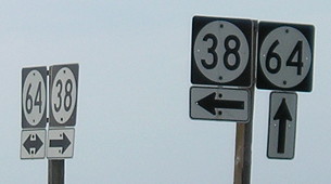
- Related route: IA 113 (I), which by the time 38 completely superseded it in 1938 covered all of 38's present route north of IA 64.
- IA 38 went through Center Junction until the route was paved in September 1957. (Monticello Express)
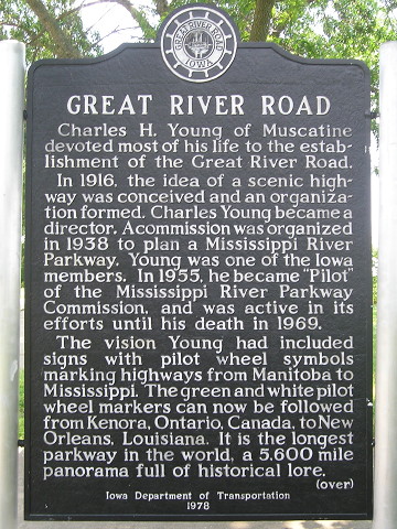
- See also: Muscatine Highway Chronology
| IA 38 endpoint history | |||
| FROM | TO | NORTH | SOUTH |
| 7/1/20 |
11/3/24 | Anamosa |
Muscatine (1891 High Bridge) |
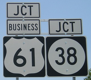
| 11/3/24 | 1/6/25 | IA 61, later IA 117 (west junction IA 38 at IA 64) |
|
| 1/6/25 | 7/8/31 | IA 20, later IA 22* | |
| 7/8/31 | 10/1/35 | Center Junction | Somewhere in here, 38 is re-extended down Park Avenue back to downtown Muscatine |
| 10/1/35 | 1/8/36 | IA 117 (same as above) | |
| 1/8/36 | 5/10/38 | US 151 (Oak St at Business 151/Main St, Monticello) | Muscatine (High Bridge, near 2nd and Mulberry streets) |
| 5/10/38 | 1/1/69 | IA 3 | |
| 1/1/69 | 6/3/86 | US 61* | |
| 6/3/86 | Present | IA 92 (Norbert Beckey Bridge) | |
| * Pretty much where IA 38 and US 61 meet today, just a hair to the south | |||
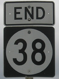
NORTH End: Stop sign/T intersection, IA 3, Delaware County
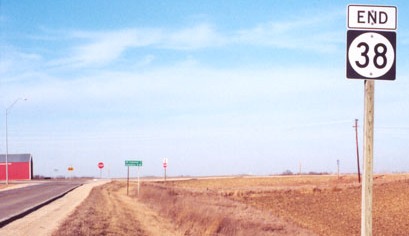
Facing north on 38 (1/26/02)
Photo by Jason Hancock
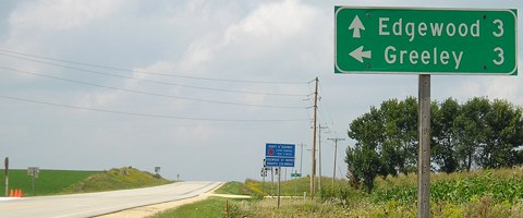
That "End" sign vanished in the next six and a half years:
Facing north on 38 (9/2/08)
However, it was back by 2011. (9/23/11)
Facing north on 38 (9/23/11)
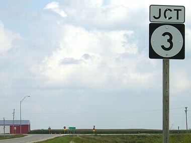
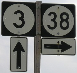
One way to save money - use the rural double arrow as the highway double arrow.
Facing east on 3 (9/23/11)
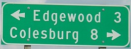
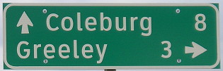
Oop. (This is the second time in a decade a mileage sign has omitted an S in a name.)
Facing east on 3 (9/2/08)
Facing west on 3 (9/2/08)
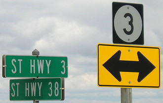
Lots of 3's at this intersection.
Facing west on 3 (9/2/08)
1920s NORTH End (1): IA 28, Anamosa, Jones County
Facing east on Main Street (6/18/15)
Scott Street at Main Street is where IA 38 (and IA 61 too) met IA 28 (future US 151), but the routes could've been signed westward through downtown to end at the courthouse. Since the Muscatine County Courthouse is very near where the 1891 bridge crossed the Mississippi River, 38 could have been a courthouse-to-courthouse route. Above is Main at Ford in the heart of downtown, three blocks east of the courthouse and five blocks west of Scott.
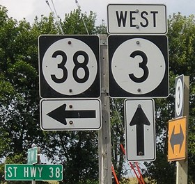
1920s NORTH End (2): IA 61, now IA 38 at IA 64, Jones County
Facing west on 64 (6/14/11)
The Anamosa Journal's printing of the August 3, 1920, supervisors minutes couldn't be clearer: "Application was made to the State Highway Commission for Primary road project; commencing on the west line of section 16-84-3, Jackson township, at the half section line where primary road number 38 leaves primary road number 61… ." It would have been relatively easy to estimate this location since Newport Road clearly used to have a bridge across the Wapsi, but I can't complain about getting an unambiguous confirmation. The bridge, built shortly after the Civil War, collapsed on August 29, 1944, according to the Journal.
But the intersection, now 170th Avenue at IA 64, did not serve as an end because it was redundantly multiplex to Anamosa until 1924. By that time, the road had been straightened north of Olin.
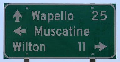
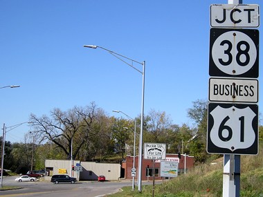
1920s SOUTH End (2): IA 20, now US 61, Muscatine County
Old SOUTH End (1969-85): Stoplight, US 61, Muscatine, Muscatine
County
Before the 61 bypass around Muscatine, 38 ended approximately where 61 meets the north end of Business 61 today. Back then, 61 came north out of downtown Muscatine and then turned east; continuing north would start on 38. In the downtown area in the late '70s and early '80s there was one duplex (61/IA 22) and one small triplex (61/IA 22/IA 92) - before 1969, IA 38 DID come south to its present end. With the completion of the bypass and establishment of the business route, 22 was rerouted and 38 extended. See this page for more on the history of highways in Muscatine. In the below pictures, the bypass road west of 38 did not exist when 38 ended at or near this intersection. Clockwise from top:
Facing south on 38 (8/31/07)
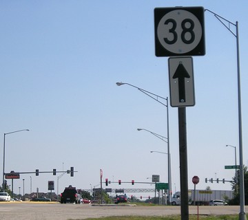
Facing south on 38 (8/31/07)
This pole could have been the "End 38".

Facing south on 38 (8/31/07)
Facing west, but heading south, on 61 (8/31/07, 8/31/07, and 6/8/15)
This probably provides the best comparison of what Iowa mileage signs used to look like before a decade of Clearview and what they look like now and in the future. The kerning (space between letters) is definitely different, and the "s" is skinnier.
Facing west, but heading south, on 61 (8/31/07)
Facing west, but heading south, on 61 (6/8/15)
The brackets and jumbo shields make this arrangement, which conforms to new standards, particularly ungainly.
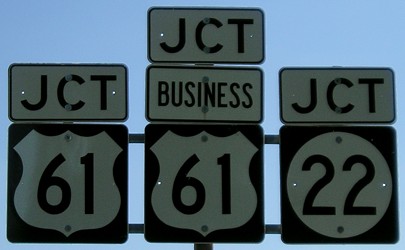
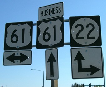
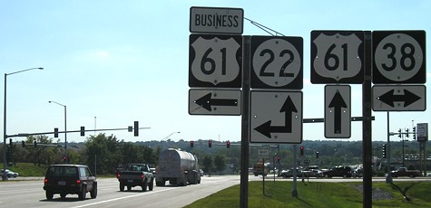
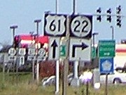
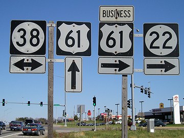
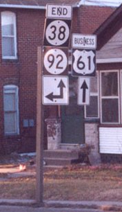
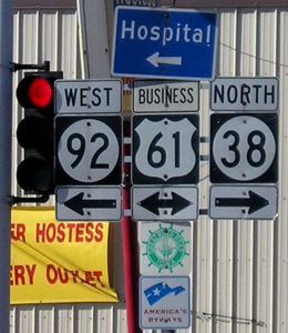
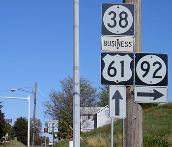
Facing north on 38/Business 61 (was 61), but heading west on 22 (8/31/07)
Take away the left sign and you have a setup from before 1986. After the stoplight would be the beginning of 38. The position of this gantry is approximately where a triangle intersection, and then a more advanced directionalized intersection, was located for the road going east to Davenport (IA 20, later IA 22, now US 61).
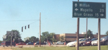
Facing north on 38/Business 61 (was 61), but heading west on 22 (6/19/03)
Photo by Jason Hancock
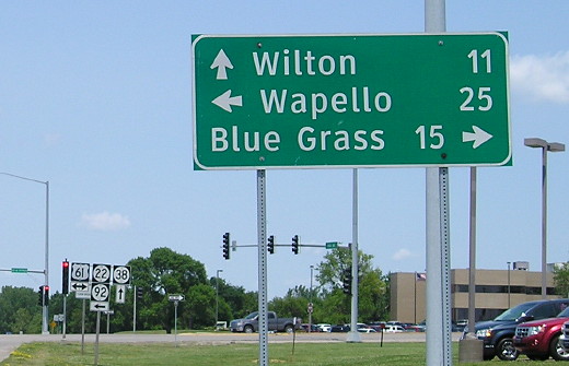
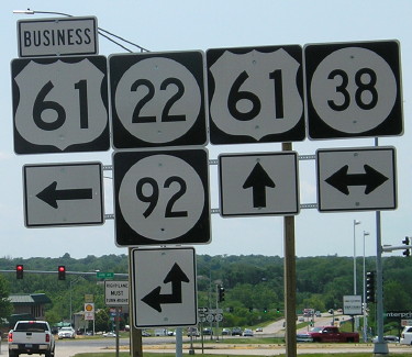
Facing north on Business 61/IA 38 (6/8/15)
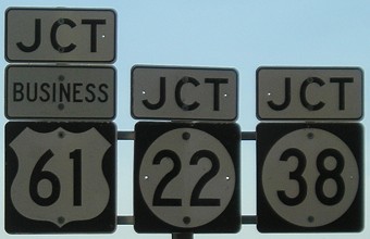
Facing north on 38, but heading west on 22 (10/13/06)
This is the previous version of the sign set in the lower left corner of the above picture.
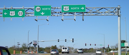
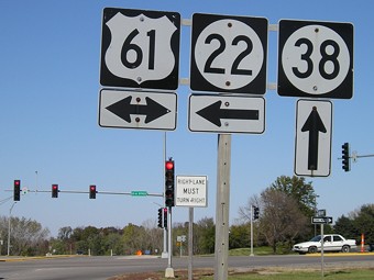
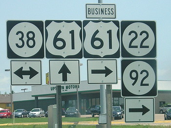
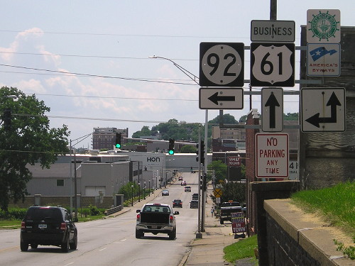
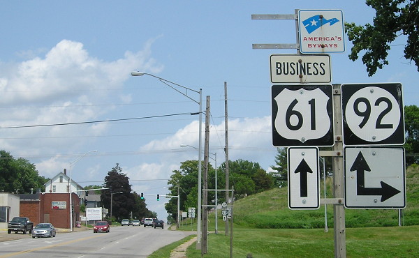
Facing east on 22, but heading north on 61 (10/13/06)
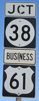
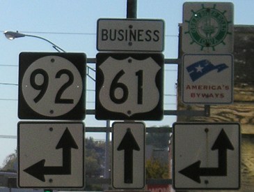
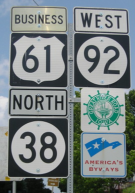
Facing east on 22/92, but heading north on 61 (6/8/15)
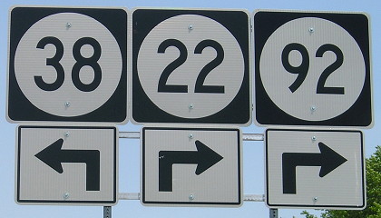
Facing east on 22/92, but heading north on 61 (6/8/15)
IA 38 was not truncated when IA 92 was rerouted, so the 38 arrow should be a double left-and-right.
Facing east on 22, but heading north on 61 (10/13/06)
Facing east on 22, but heading north on 61 (10/13/06)
Facing east on 22/92, but heading north on 61 (6/8/15)
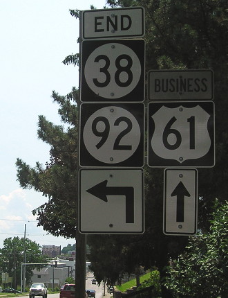
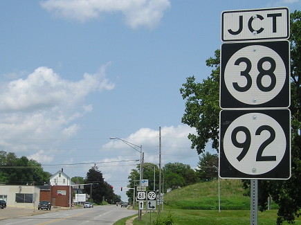
SOUTH End: Stoplight, IA 92, Muscatine, Muscatine County
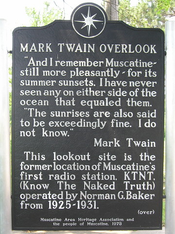
Signs at Mark Twain Overlook, accessible via a steep road just north of the 38/92 intersection (6/8/15)
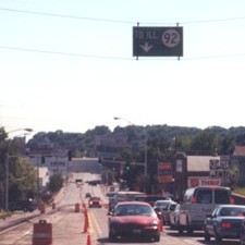
Facing southwest, but heading south, on 38 / Closeup (1/26/02 and 10/13/06)
Left photo by Jason Hancock
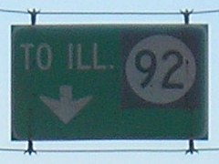
This is in downtown Muscatine as 92 crosses from Illinois and intersects Business US 61. This sign is gone now.
Facing south on 38 (1/26/02 and 10/13/06)
Left photo by Jason Hancock
New versions of those assemblies (6/8/15)
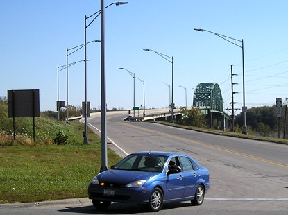
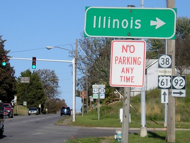
Facing southeast (10/13/06)
This is the Norbert Beckey Bridge into Illinois. Once it crosses the bridge, it becomes IL 92. The car is turning from IA 92 onto IA 38.
Facing northwest, but heading west, on 92 (10/13/06)
Facing northwest, but heading west, on 92 (10/13/06)
This is the second westbound 92 shield in Iowa; the first is in the background of the above photo.
Facing northeast, but heading north, on Business 61 (former IA 92) (6/8/15)
Facing northeast, but heading north, on Business 61 (former IA 92) (6/8/15)
Facing northeast, but heading east, on 92 (10/13/06)
The first town on IL 92 is Illinois City, but it wouldn't be illogical to point to Rock Island instead since that's where 92 is going. It heads almost due east to the Quad Cities from here. This sign is gone now.
Facing northeast, but heading east, on 92 (10/13/06)
After the intersection, facing northeast, but heading north on Business 61/38 and west on 92
Page created 4/27/02; last updated 1/11/21