

(July 1, 1920-April 1, 1986)
- In 1920, they knew it as: A fragment of the Clarion and Iowa Falls Road, whose legacy lives on in the winding county road running southeast of Dows through Popejoy
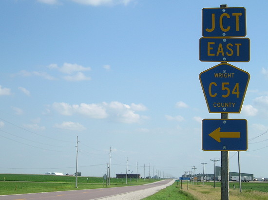
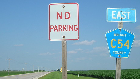
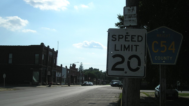
- We know it as: County Road C54
- Let's get granular (1920 route): C54, Washington Avenue, 270th St, and C54 again
| IA 72 endpoint history | |||
| FROM | TO | WEST | EAST |
| 7/1/20 | 1928 |
IA 15 (C54 at R59) | Dows |
| 1928 | 5/9/33 | IA 15 (R59 at US 69) | |
| 5/9/33 | 7/1/80 | US 69 (C54 at US 69) | |
| 7/1/80 | 4/1/86 | I-35 | |
WEST End (1933-86): Stop sign/T intersection, US 69, Wright County
Facing west on 72 (9/23/02)
The condition and style of the sign mean it's from the state highway days. The arrows imply a "split-T" intersection like the east end of IA 184, and Street Atlas shows it as such too. The ground around the intersection indicates the same as well. This sign had disappeared by the time I came back four years later.
Facing south on 69 (9/23/02 and 10/6/06)
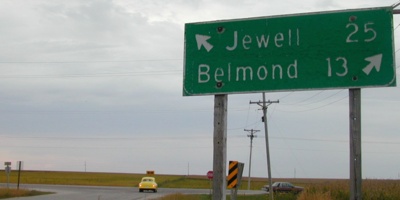
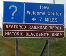
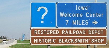
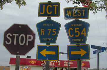
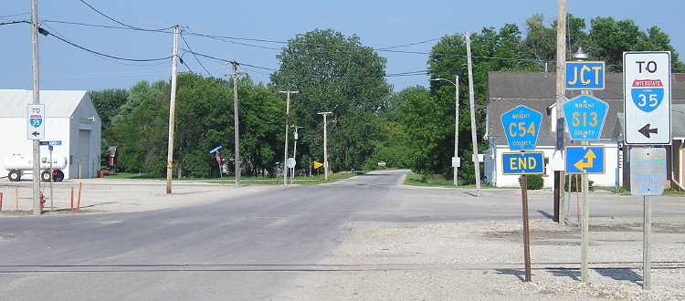
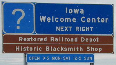
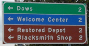
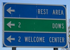
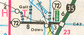
Wright County has excellent signage of the old county roads that make up old 72 (see below). C54 continues west half a mile south. Signs for the welcome center are also at the junction of IA 3 and S13, six miles north of Dows.
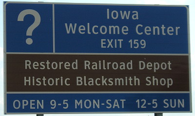
The Dows Depot lost its welcome center status in the mid-2010s.
Facing south on 69 (7/9/18)
Facing south on 69 (7/9/18)
Facing north on 69 (10/6/06)
Facing north on 69 (7/9/18)
Facing north on 69 (7/9/18)
Facing north on 69 (9/23/02)
Facing east on 72 (7/9/18)
A directional tag also shows up at the county road on the east end of 72 (see below).
1920 WEST End: IA 15, now C54 at R49, Wright County
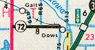
The precursor to US 69 wasn't quite as straight in Wright County. It moved east a couple miles at Big Wall Lake and then went north through Galt. Then from 1928-33 it went through Galt, and then moved to the intersection above.
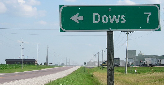
Entering/leaving Dows (west side)
Facing west on 72 (now C54) (9/23/02)
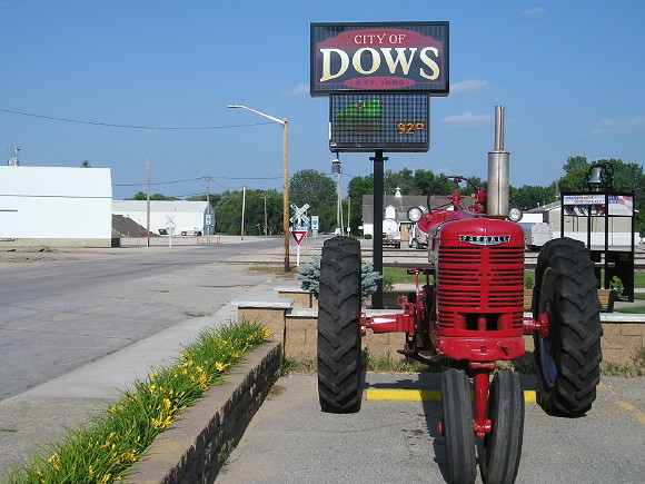
This is on the west end of Dows (1920 pop. 1145, 2010 pop. 538), and therefore, at or near the probable east end of 1920. Coming in on 72/C54 from the west, you curve south and then turn east again here. Nearly all the mile markers remained up between US 69 and Dows in 2002 (and most of them still around in 2018). Those two shields have different sizes for everything! By 1936 the official east end was the Wright/Franklin line.
We are really close to the R/S county road split line; one mile east is S13 (see below).
EAST End (July 1, 1920-July 1, 1980): Garfield St., Dows, Wright County/Franklin County line
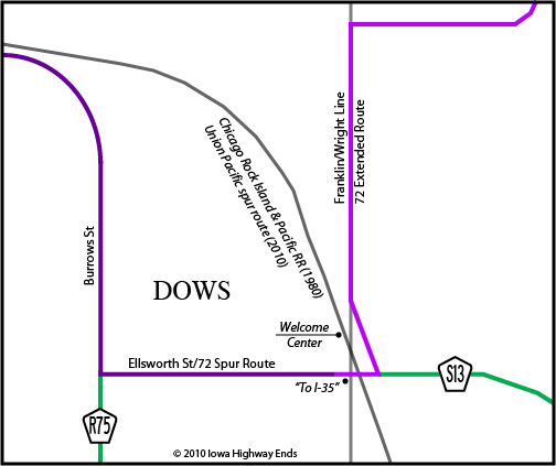
Now, although the 1986 map (see bottom of page) brings 72 back down to a spur, that was not technically the case at the time. This map shows the entirety of the route through Dows. The north-south portion is along the county line but within the city. So, when Dows accepted its portion of IA 72 effective November 1, 1985, it created a gap in the route large enough it would have appeared on the state map. (In the above map, it was from the corner in the lower left side of the map to the one in the upper right.)
Wright County agreed in mid-1985 to take over its portion of 72 west of Dows on April 1, 1986, with resurfacing of the road to follow that year. ("County agrees to take over Highway 72," Wright County Monitor, August 22, 1985) That may seem like a lengthy span in between, but I suspect that getting one more season of state snow removal was a factor. DOT documents show Franklin County took its portion at that time as well.
Facing west at spur beginning of 72 (7/9/18)
Facing east on 72 (7/9/18)
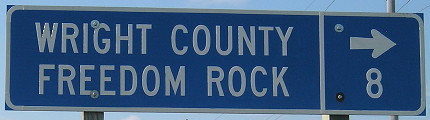
The Wright County Freedom Rock (background right) is practically on the county line. Think warm thoughts (it's 15 degrees as I'm updating this).
Facing east on 72 (7/9/18)
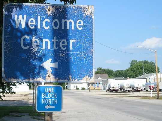
This sign didn't look nearly as bad in 2013 (Google Street View), but without an official welcome center there's no need for upkeep.
Facing east on Ellsworth, just past where 72 ended before 1980 (7/9/18)
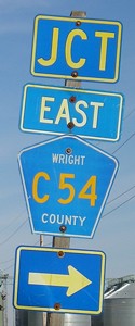
Look closely at the county road signs. Where are they from? They may be marked Wright, but technically we've gone across into Franklin County! The Union Pacific railroad tracks go at an angle through town (as they always do) and at this point the tracks have entered Franklin. From this intersection, S13 follows the railroad for about a mile and a half, and then straddles the county line. I'm not sure where the transfer occurs, because Wright signs S13 north of here. Notice the "To I-35" signs on the left and right sides of this picture.
*Original Number, Original End (probably)*
Surrounding area information: Dows
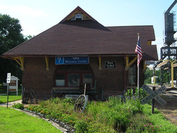
Facing north; depot is in Wright County (7/9/18)
Why did Dows have a Welcome Center? It didn't make much sense to me either.
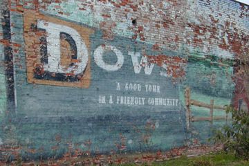
This was painted on the side of a building at the intersection to the west of the C54/S13 signs in Wright County. Today, this mural is pretty much hidden because three feet away from it is a community center built in 2003. (9/23/02)
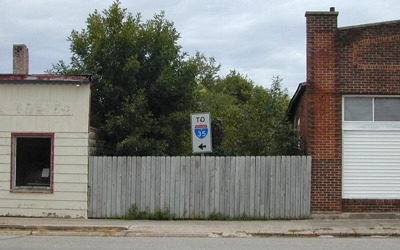
This "To I-35" picture just west of the railroad tracks looks in a very weird place without context. (It looks weird with context, too.) This is opposite the exit from an old one-room schoolhouse, which is near the welcome center. Since this picture was taken, both buildings were torn down but the sign remained until the Freedom Rock mini-park was built (see the tractor picture). (9/23/02)
Entering/leaving Dows (east side)
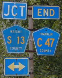
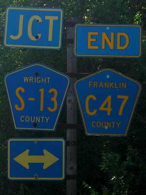
Facing west on 72 (now C47); S13 is on the county line (9/23/02 and 7/9/18)
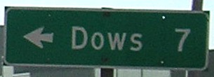
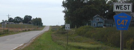
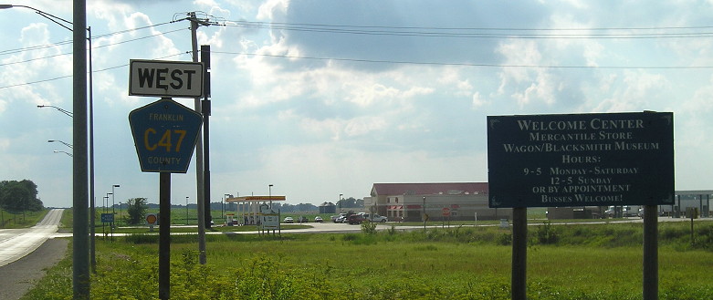
On the north side of Dows (DOT-style signage included), directly east of C54's main alignment before turning south to enter Dows, is C47. This is half a mile north of the S13/C54 intersection, and means that half a mile of 72 became S13.
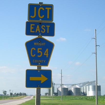
I wonder how many other assemblies in the state have TWO counties on them. Again, compare the size of the route numbers — even after both shields were replaced!
Facing west on 72/C47 (9/23/02)
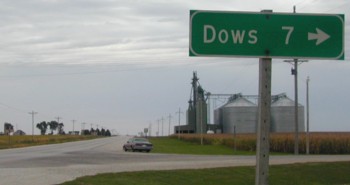
Someone at the DOT is not only a road culture historian, but one with a sense of humor. This fun sign came at the end of a modern "Burma-Shave" incarnation: "Daddy, Mommy / Hold That / Temper / Just One / More Mile / To the / Dows Depot / Welcome Center".
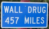
How do you get to Wall Drug? Follow old 72 to 69, north to 3, take 3 across the western half of the state to 12 and go north to old IA 403, take 403 which becomes SD 48 to I-29, north to I-90, second right at the cloverleaf, then west 286 miles and hang a right. You can't miss it! :-)
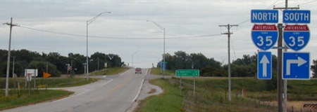
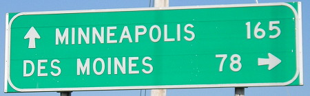
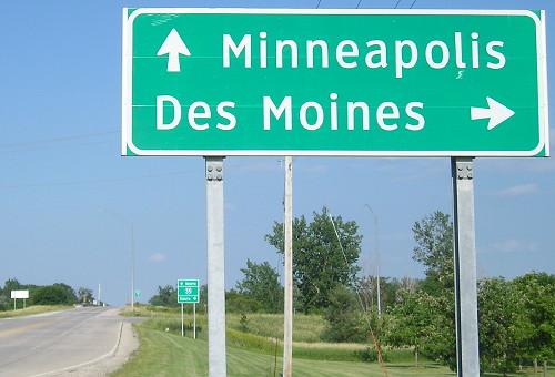
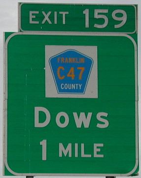
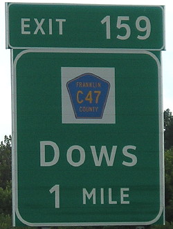
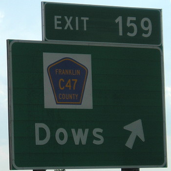
EAST End (July 1, 1980-April 1, 1986): I-35 exit 159, Franklin County
Facing east on 72 (9/23/02)
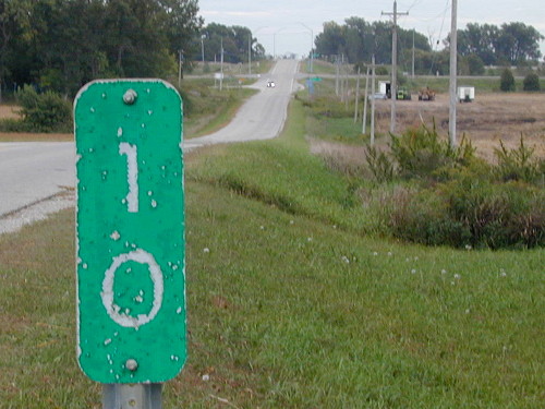
The interchange is in the background. This mile marker is a vestige of 72's extension, still there but even more faded in summer 2018. I recropped this picture when I realized how well it showed the land that had not yet become a rest area.
Facing east on 72 (9/23/02)
The pavement changes where the white side line begins, but I don't know where the end was actually signed. Across the bridge, the Northern Iowa River Greenbelt Scenic Drive turns right onto a gravel road. (See the C54/S13 intersection.)
Facing east on 72 (10/6/06)
A year after the first end picture were taken, a new rest area opened in the field to the right of the I-35 shields, closing the gap that existed between the rest areas near Ames and the Top of Iowa Welcome Center near the Minnesota border. While I'm sure that building new rest areas at existing interchanges is a money-saver, I still think there's something to be said for the original idea of pulling off into a rest area independent from interchanges.�
Facing east on 72 (7/9/18)
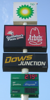
Across the street from the state rest area is Iowa's second Godfather's/Arby's in the Middle of Nowhere, the only food directly off the interstate between Clear Lake and Ellsworth besides the Subway at the Williams exit, and the only chance of food choice directly off the interstate between Clear Lake and, technically, Ankeny.
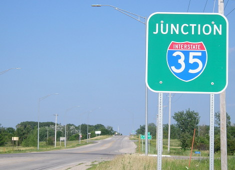
Facing east on 72 (7/7/11)
Facing east on 72 (7/9/18)
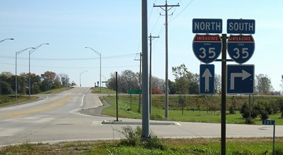
I detest the genericization of Iowa interchange signs.
Facing west on 72; backs of I-35 signs at far left (9/23/02)
The pavement change is perhaps a little more visible in the corner here. That "West" isn't standard by either county or state.
Facing west on 72 (7/7/11)
This view changed a bit.
Facing north on 35 (9/23/02)
Northbound offramp (9/23/02 and 10/6/06)
Facing south on 35 (7/7/11)
Facing south on 35 (7/7/11)
Last seen: 1986 (1981/86 maps)
As you can see, the 1986 map brings 72 back down to a spur (and even removed the mileage) though that wasn't quite true. Both the 1985 and 1986 route logs show 72 going to I-35, explained by the delayed turnover outside of Dows as discussed upward on this page.
Map by me: 2/11/10
Page created 11/28/02; last updated 2/11/10 2/14/21