
(November 9, 1937-November 14, 1986)
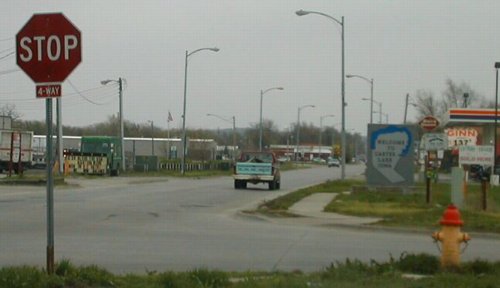
WEST End: 4-way stop, 11th St./Nebraska state line, Omaha NE/Carter Lake IA, Pottawattamie County IA/Douglas County NE
Facing west on Locust Street (4/20/02)
Photo by Neil Bratney
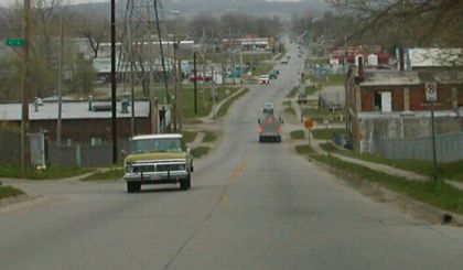
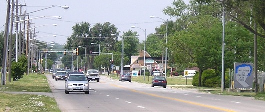
Neil says, "This is the view eastbound down Locust Street from about 14th Street in Omaha. The state line (and beginning of IA 347) is at 11th Street, where the second oncoming pickup is (with lights on). IA 347 stretches east from that point for about 0.8 miles."
Facing west (4/20/02)
Photo by Neil Bratney
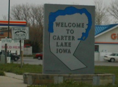
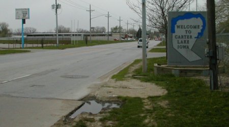
Neil says, "Here is the intersection of 11th Street and Locust Street in Omaha. The state line (and the beginning of IA 347) is right at the granite 'Welcome to Carter Lake, Iowa' sign." The signs are a remnant of when it was a state highway.
Closeup of signs (4/20/02)
Photo by Neil Bratney
This gas station changed to a Conoco sometime between 2002 and 2006.
EAST End: Nebraska state line, Omaha NE/Carter Lake IA, Pottawattamie County IA/Douglas County NE
Facing east on 347 (4/20/02)
Photo by Neil Bratney
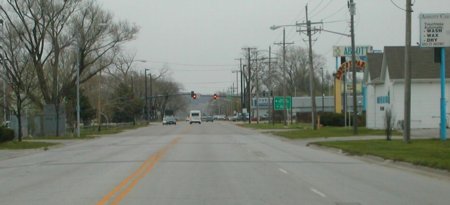
"The eastern boundary of Iowa / Carter Lake / IA 347 is just shy of Abbott Drive. You can see where the pavement changes on Locust Street at the state line. The green sign ahead says: '<- Airport Parking; ^ General Aviation.' On the left, you can see the backside of an identical granite sign at the state line. Abbott Drive is at the stop light ahead; if you turn right, you'll return to Carter Lake, Iowa, and find yourself on IA 165 southbound toward downtown Omaha." Given only the change of pavement, you would never have guessed a river ran here 125 years ago. Had the boundary gone a bit farther east here, 347 would have intersected the still-around 165.
Facing west on 347 (4/20/02)
Photo by Neil Bratney
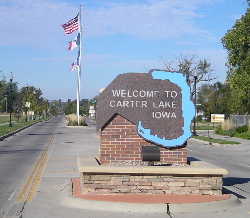
Facing west from near the Abbott Drive intersection (6/12/06)
The Super 8 sign to the left of the Carter Lake marker points to a motel that is about 150 feet on the Iowa side of the line.
Facing west (10/2/15)
Why did the city turn its geographical representation on the side?
Very proudly Iowan (10/2/15)
Last seen: 1986 (in most places)
 1986
Iowa
1986
Iowa 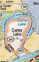 1992 AAA
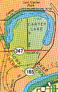
From the 1950s to 1967 Carter Lake had not one, not two, but three highways! Although 347 is the higher number on the map, it was the first highway in Carter Lake; this 165 is the second incarnation of that number. The other highway in Carter Lake was commissioned at the same time as 347, IA 348. It went north from 347 up 9th St., up the middle of Carter Lake (see the 1986 map). Although 347 was decommissioned in 1986, the 1992 AAA Nebraska/Iowa map still showed it, in addition to erroneously routing 165 through Nebraska.
Page created 5/23/02; last updated 12/18/16