
Iowa's shortest state highway
NORTH End: Nebraska state line, Carter Lake IA/Omaha NE, Pottawattamie County IA/Douglas County NE
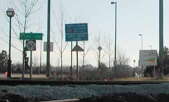
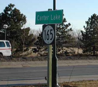
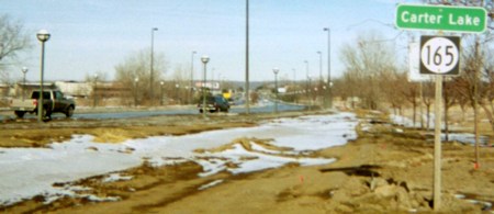
Two views facing southwest, but heading south, on 165 (1/15/02)
Photos by Neil Bratney
Highway 165 is the only Iowa highway west of the Missouri River. On March 16, 1877, the Mighty Mo decided the fastest way between two of its points was a straight line and cut across, leaving an oxbow lake (Carter Lake) and plenty of land access to Nebraska, but none to the displaced area's home state. Another case of populated land on the wrong side of the river is the St. Joseph MO airport, the land for which is now on the Kansas side.
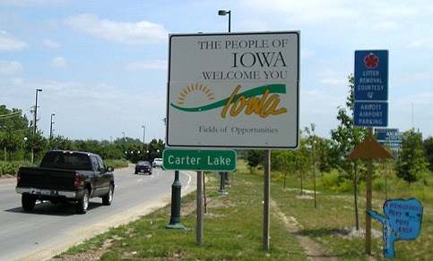
Facing southwest, but heading south, on 165 - after reconstruction of Abbott Drive (6/12/06)
Abbott Drive is continuous throughout the states and is an important road to Eppley Airfield, but the street is not a highway on either Nebraska side. Notice that the top picture has all the state-line trimmings: "Welcome to Iowa" and Adopt-a-Highway signs. Neil Bratney reports it's about 2700 feet (half a mile) long.
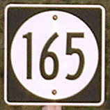
After the Second Great Decommissioning, 165 also holds the special significance of being the shortest signed state highway in Iowa - at least, it did (see below). This was the only shield left on the route in the mid-2000s after a construction project on Abbott Drive that started and ended outside of Carter Lake in Omaha. The route's existence may be mandated by Iowa Code:
313.24 SEPARATED CITIES. The department shall designate the street or streets which shall constitute the primary road extensions in any city of the state, which city is separated from the remainder of the state by a river more than five hundred feet in width from bank to bank. The laws of this state relating to the construction, reconstruction or maintenance of the extensions of primary roads in cities, and to the purchase or condemnation of right-of-way therefor, and to the expenditure of primary road funds thereon, shall apply to the roads or streets designated hereunder, the same as though said community were not so separated from the rest of the state.
While IA 347 and IA 348 also used to be in Carter Lake but were decommissioned, perhaps 165 was chosen to carry the "primary road extension" label.
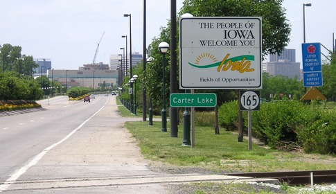
SOUTH End: Nebraska state line, Carter Lake IA/Omaha NE, Pottawattamie County IA/Douglas County NE
Facing northeast, but heading north, on 165 (1/15/02)
Photo by Neil Bratney
The entrance into Iowa on the south side was well-marked.
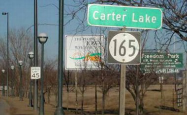
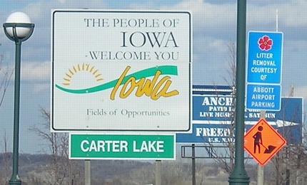
Facing northeast, but heading north, on/off 165 (1/19/03)
A project in 2003 shifted Abbott Drive and the beginning of 165 a few dozen feet to the northwest.
Facing northeast, but heading north, on 165 (6/12/06)
No counterpart 165 shield was put up on this sign, unlike the other end. That is, unlike the other end had for a time...
Captain! We've lost the shields!
Same sign, 22 months later (4/6/08 and 10/1/15)
Not only have both 165 shields vanished from Carter Lake, but now the city name is printed in Helvetica! Shields were posted some time later.
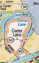
Until 1986 there was a second highway in Carter Lake, IA 347, which ran straight east and west on Locust Street. The two roads "intersected" in Nebraska. As seems to be usual, AAA is a little slow; this 1992 map shows not only 347, but 165 continuing into Nebraska (which it doesn't do and never has):
Page created 3/29/02; last updated 12/18/16