

(233: January 7, 1931-December 26, 1989)
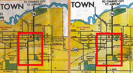
| IA 330 endpoint history | |||
| FROM | TO | NORTH | SOUTH |
| 1/20/48 | 7/11/51 |
IA 14 (Linn St at 3rd Ave, Marshalltown) |
US 30 (where today's WB 30 offramp meets 330) |
| 7/11/51 | 9/12/63 | IA 14 (Boone St at Center St, Marshalltown) | |
| 9/12/63 | 1/1/69 | US 30 interchange | |
| 1/1/69 | 10/12/85 |
US 65/IA 117 |
|
| 10/12/85 | 12/26/89 |
IA 14 (Linn St at 3rd Ave) |
|
| 12/26/89 |
Dec. 2012 |
IA 14 east of Albion | |
| Dec. 2012 | Present | I-80/US 6 at Altoona | |
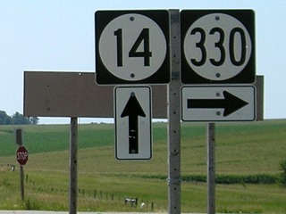
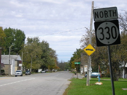
NORTH End of 330/EAST End of 233: Stop sign, IA 14, Marshall County
(Unnumbered paved county road continues east; I suggest naming it E23)
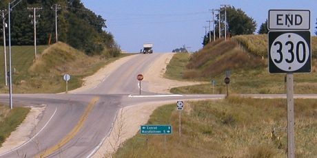
Facing east on 233, but heading north on 330 (9/7/04)
Facing east on 233, but heading north on 330 (7/15/07)
In the desire to have a fast route to Waterloo, I'd like to see 330 continue east on this paved road to T29, then go on a new diagonal near Gladbrook and Reinbeck to meet US 63 near Hudson. Once upon a time the Iowa Highway Commission had plans for such an alignment. However, with the state of road construction as it is today, and a traditional aversion to diagonals, this dream shall probably never see fruition. Travelers to Waterloo take 14 north to use either 96 and 63 or 20, all of which are straight roads. (And as someone from Traer, I encourage the former. :-)
Facing east, but heading north, on 330 (8/10/08)
Another bottom "End"... [shakes head]
Facing north on 14 (7/15/07)
Facing north on 14 (7/15/07)
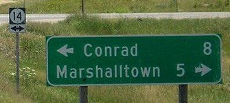
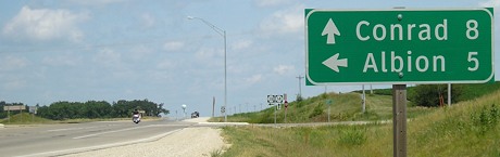
Conrad is used on LGSs between Grundy Center and Marshalltown, despite it not being on the route proper (it even had its own spur, IA 185).
Facing north on 14 (7/15/07 and 10/23/19)
Facing south on 14 (7/15/07)
I think Des Moines should be added as a third line on this LGS.
Facing south on 14 (7/15/07)
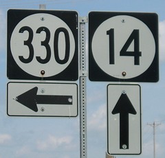
I have no idea what the closed sign behind this assembly is for; a similar one appears on westbound IA 96 at US 63.
*Inaugural Highway End*
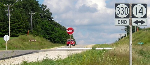
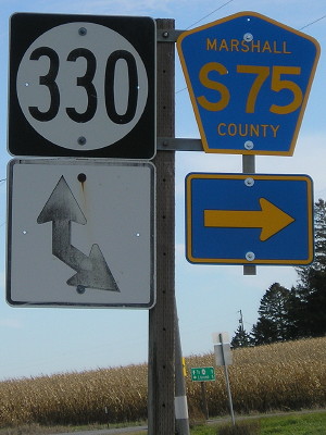
Temporary NORTH end of 330 (1995 only): Intersection, S75, Marshall County
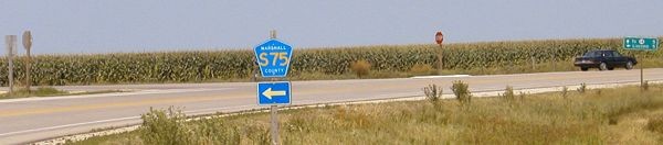
Facing northeast, but heading north, on 330 (7/29/04)
Facing northeast, but heading north, on 330 (10/23/19)
Facing west, but heading south, on 330 (5/21/03)
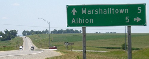
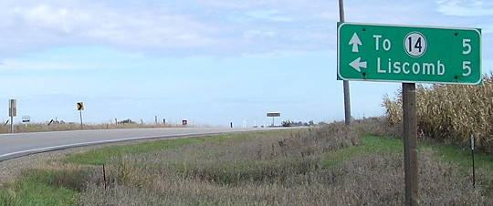
Just north of Albion, S75 leaves the secret multiplex with 330 (a road it had to itself before 1989). Heading west/south on 330, the state highway curves left while the county road goes straight ahead, complete with "^ Liscomb 5" LGS. Heading east/north, that mileage along with "^ To 14 5" (in top picture, far right) does double duty as the leaving-town LGS. A real leaving-town LGS on the south side of Albion ("Melbourne 14") disappeared when temporary parts of road were built for reconstruction of a route that intersects instead of crosses a railroad bridge. If it ever reappears I think Des Moines should be added. Without that sign, IA 330 joins IA 96 as a state highway that goes through a town but has no leaving-town LGSs on the entire route.
So what does that have to do with an intersection north of Albion being a temporary end? When IA 14 was closed for a complete resurfacing in 1995 it was closed between IA 96 and US 30, with a detour along 330, S75, and E18. (See the IA 311 page for additional info.) Since the road was closed and there wasn't anywhere for 330 to go after the detour, an "End 330" sign was placed along with the detour signage at the S75 junction. This situation was a bit like IA 32 during its extension in 2002.
Facing south on S75 (10/23/19)
Here we get to see an extremely rare arrow setup. The LGS seen a couple pictures up is in bottom center.
WEST End of 233: Johnson St., Albion, Marshall County
Facing south on 330, but heading west on 233 (5/21/03)
The first painted yellow stripe in the foreground would have been the beginning of the business district. The width of the road does change slightly past this intersection. I figured the end was here at George, but the 1980 route log proved me wrong. The end was set two-tenths of a mile south of George, at Johnson Street, a short distance ahead of the truck seen in this picture.
Facing north toward the same intersection (11/29/01)
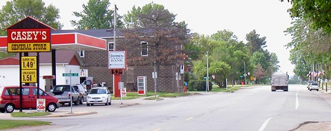
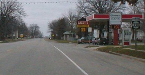
According to Jason Hancock's research: "The June 19[, 1989, Des Moines] Register ran a story on how Albion benefited being 'on the beaten path' between Des Moines and Waterloo. Rumor had it that the local Casey's was the second-best selling store in the chain, but a spokesman denied it, saying it was just a 'good average store.'" Since these pictures were taken a new Casey's (brick, with three sets of pumps) has opened a block to the south. (The move kinds of lends credence to the productivity comment.) Unfortunately, the bank whose sign is seen in these two pictures has also closed.
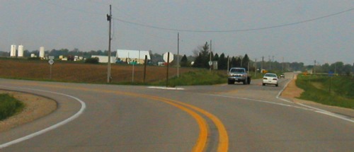
Between November 29 and December 8, 2001, a new bridge over the Iowa River opened and the old one blocked off and removed. Now there's a nice set of curves to get to the bridge and then back to the original blacktop, which immediately turned right to rise over the railroad tracks and go into Albion. Since early December 2002, though, a new road leaving Albion before the bridge has been built beside the old one. This one intersects the railroad tracks instead of crossing over them. By early January 2003 the bridge was gone and the land leveled out. The railroad crossing was removed after the line from Marshalltown to the ethanol plant near Steamboat Rock was abandoned in 2012.
When this 330 was born in 1947, taking over US 30's route through Marshalltown west of 14, its east end was on old 30 but NOT the Lincoln Highway; the Lincoln was two-three blocks north on Main and Church. The route of 330 out of Marshalltown became synonymous with the Lincoln nine blocks west, as it turned south on 9th Street. It continued on the Lincoln's route until just west of S75, where the Lincoln (now E41) went west and 330 went southwest to intersect 30 at an interchange that has been around since 1963 - an interchange that, with more four-laning in three directions, is now somewhat inadequate.
Facing south, but heading west, on 233 (10/23/19)
This is looking toward Johnson Street from the newer and much larger Casey's. This is closer to 233's 1980s end.
Facing north, but heading east, on 233 (10/23/19)
This shield at the city park, half a block north of Johnson, is a good indicator 233 began here.

Albion City Council meeting (10/23/19)
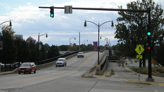
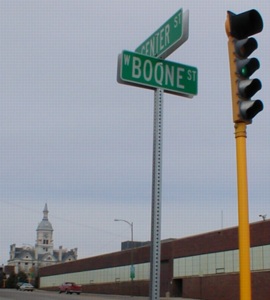
Old NORTH End (January 20, 1948-October 1985): Stoplight, IA 14/Center St., Marshalltown, Marshall County
Left: 1981 / Right: 1986
I am pretty certain that 330's route did not change west of Center Street since its inception; it is 14 that went through changes. Before 1975, the east-west portion of 14 was split on Linn (east/northbound) and Church (west/southbound) but both were on Linn by 1977. In 1985 (officially open to traffic October 12 or 18, typo in the official route description notwithstanding), 14's route was changed to using Anson Street for the east-west segment and going north on 3rd Avenue south of the railroad tracks. Because of this, 330 was extended one block north and three blocks east to still end at 14. This is likely the same end it had in 1948-51, before the Center viaduct opened.
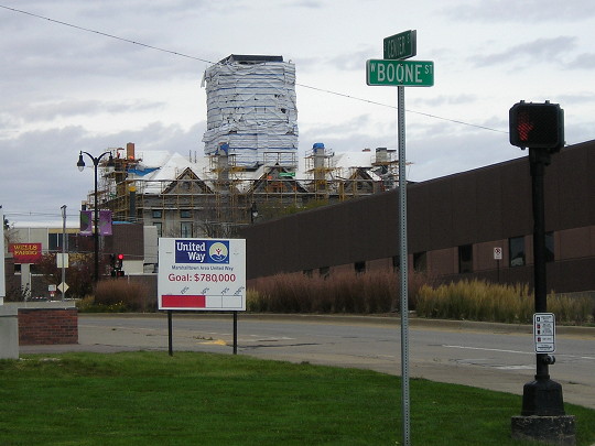
Facing east on Boone, but heading north on 330 (3/23/02)
If the car turned right, it would start on 330. The viaduct begins south of this intersection.
Facing east on Boone, but heading north on 330 (10/23/19)
Facing south on 14 (10/23/19)
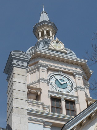
Facing mainly north; street sign with view of courthouse (3/23/02 and 10/23/19, post-tornado)
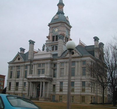
Left photo by Neil Bratney (3/23/02 and 3/26/10)
The Marshall County Courthouse was in danger of demolition in the 1970s before a restoration project. A tornado blew through on July 19, 2018, ripping off the cupola, seen closer at top right.
Old NORTH End (October 1985-December 26, 1989): Stoplight, IA 14/3rd Ave., Marshalltown, Marshall County
Facing east on Linn, but heading north on 330 (3/23/02)
Facing east on Linn, but heading north on 330 (10/23/19)
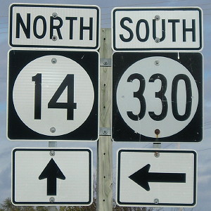
In the early 2000s the 14 with double arrow plus "North 14" and "South 14" signs were on the road at the intersection, gone now. (Oddly enough, all three "north" ends of 330 face east.) However, Linn has been a one-way street for years.
Facing south on 14 (10/23/19)
At left is the oldest part of the hospital that became Marshalltown Medical and Surgical Center. The hospital went bankrupt at the end of 2016, after a complex south of US 30 opened, and got bought by UnityPoint Health. At the end of 2019, UnityPoint Health announced that all services would move to that south building, which will be doubled in size from the initial complex.
Three blocks west (right) is Main and Center, where the courthouse is. The Lincoln Highway is marked west on Main, and east across the Third Street Viaduct and then to Anson Street.

At the corner of 3rd and Church, midway between Main and Linn, is Taylor's Maid-Rite, a Marshalltown icon since 1928. (10/23/19)
Facing south on 14 (10/23/19)
Linn is two blocks south of Main.
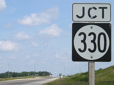
To the 2002-12 IA 330 South end (with IA 117 North)
To the previous IA 330 South end (just south of current end)
To the new IA 330 south end (Altoona)
Page created 11/24/01; last updated 4/29/10 5/10/20