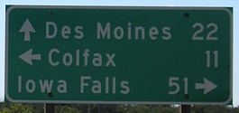
 NORTH
and
NORTH
and  SOUTH
at
SOUTH
at 
(2002-present)

The story of the "Marshalltown diagonal" cannot be told without the story of Iowa politics through most of the 20th century. That story, at its root, is Des Moines vs. everyone else. One of my professors said that for a politician running for statewide office, being from Des Moines was a "kiss of death". (The only thing worse? Being a lawyer from Des Moines.)
This anti-diagonal feeling was so strong that the ban passed the House 101-3 - but that's not all. A proposal to stop construction of the Marshalltown diagonal in its tracks as "a monument to farm-to-market roads in Iowa" was defeated 68-33. Keep in mind that at the time, it was practially complete south of Rhodes, and would reach Marshalltown by the end of the year.
By the time the law was repealed in 1963, its rationale had shifted from protecting businesses to protecting farmland. Diagonal portions of I-35 in north-central Iowa and I-380 northwest of Center Point only went ahead after years of litigation, in the case of the latter all the way to the 8th Circuit Court of Appeals in St. Louis. If the road to Marshalltown had not been built when it was, as IA 88 in 1934-35, it might never have existed at all. For the same reasons, the once-proposed diagonal extension from Marshalltown to Waterloo (and even West Union) will never exist. The rule in effect since the late 1970s is this:
"When the volume of traffic for which the road is designed or other conditions, including designation as part of the network of commercial and industrial highways, require relocation, diagonal routes shall be avoided if feasible ... ." --Iowa Code, Section 306.9
But Des Moines may have the last laugh. In the past 15 years, the roads getting the upgrade to four lanes are those with a general angled direction: IA 163, IA 5/92, IA 141, US 151, IA 60, and US 65/IA 330. With the exceptions of 151 and 60, all of those bring traffic to and from the capital.
Now, without further delay, what this page is actually for:
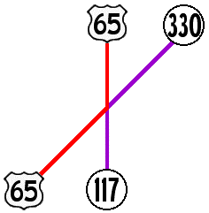
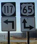
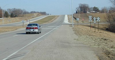
NORTH End of 117/SOUTH End of 330: Intersection, US 65, Jasper County
The new intersection, completely reconstructed after nearly 70 years of existence, has shifted north and become perpendicular. Now there aren't any I-80 signs and all the arrows are straight. In other words, it's been made nice and boring; the only good thing is that now all the shield numbers are the same font and size. In tribute to what was one of Iowa's coolest-signed intersections, the old intersection will retain its old page here.
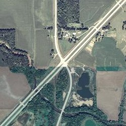
Left: Intersection at beginning of 2002; Right: New roads constructed in 2002 (2006 USDA NRCS/MIT image)
On the expressway, northbound lanes are old, southbound lanes are new. In the photos, brown grass is December 2002, shortly after the expressway was finished but before many signs were put up; green grass is September 2006. Clockwise from 2 o'clock:
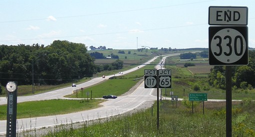
End 330
Facing southwest, but heading south, on 330
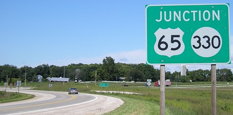
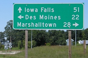
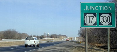
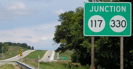
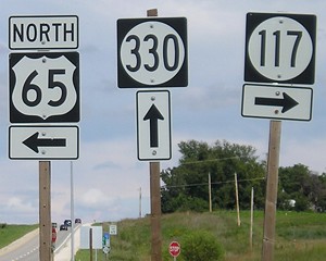
The green "Junction" signs and mileage signs in every direction were added a while after the four-lane was finished.
Facing southwest, but heading south, on 330
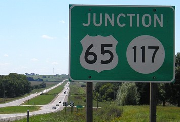
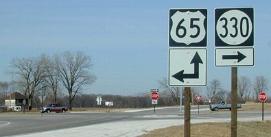
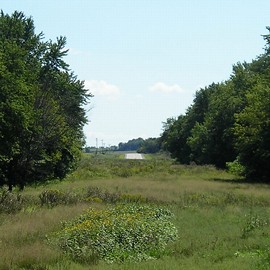
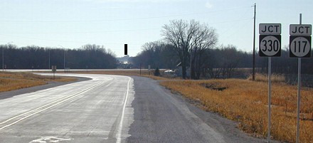
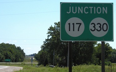
Despite the erection of a "Junction 65/117" sign before the "End 330", the older junction sign stayed, courtesy of the Department of Redundancy Department. In the far background you can see the Marsh Kink, a substantial bend in the otherwise-perfectly-diagonal road constructed to send traffic out of the way because environmentalists didn't want two more lanes built through part of the Engeldinger Marsh. The "Jct 117/Jct 65" assembly is the only one at the intersection where two sets of signs share a pole on a bracket; compare it to the one right after it (below).
Since the above picture was taken, yellow "Intersection" signs with flashing lights have been placed on both sides of the northbound and southbound lanes.
Facing southwest, but heading south, on 330
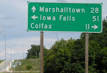
The 117 arrow indicating an ahead-and-left should just be a left. This is one of the places that used to have diagonal arrows.
Facing south-southwest-ish
The old straight portion of 117 is visible at far left; the road coming toward us is new, including both bridges.
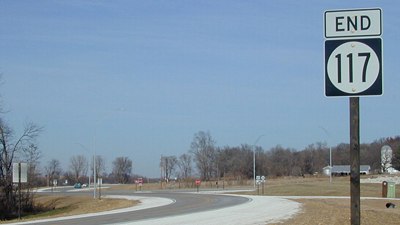
End 117
Facing north on 117
Facing north on 117
To conform to the expressway, the straight north-south piece was reconstructed to meet the diagonal perpendicuarly. The previous end of 117 was just to the south.
Facing north on 117
Final signage on 117
Yes, that right arrow is smaller than normal; those seem to crop up at new intersections. The house at left used to be by the road.
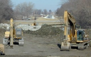
Facing north (2002) / Facing south (2006)
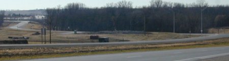
The backhoes are at work removing the old bridge for 117; the current road turns to the right here. The old intersection is right in the middle of this picture; you can see the straight 65 in the background. Now, only a long grassy scar remains.
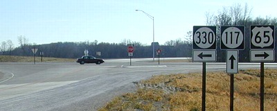
65 North
Facing northeast, but heading north, on 65
In late 2002, this was the only green-backed sign left in any direction, left over from before construction.
Facing northeast, but heading north, on 65
Facing northeast, but heading north, on 65
Facing northeast, but heading north, on 65
The old intersection was right where that straw is on the shoulder, spread over the old roadbed. There must be a surplus of wood and/or a shortage of brackets, given all the standalones here.
Closeup of signage in above picture
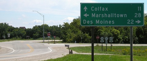
The rural street sign, visible just to the left of the sign with its back to us, has been split up into four different ones, with arrows. This set of signs was later consolidated onto one pole with a bracket, but for years inexplicably read "EAST 117" at right.
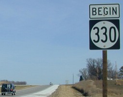
I don't know if it's because of the way the intersection is laid out or what, but this was the first "Begin" sign I saw that was not on a road that spontaneously started (see 107) or a 900 series (see 945). Now, there's also a "North" at top, so it reads "North Begin 330" (although "Begin North" would sound better).
65 South
Facing south on 65
The thick black line marks where 117 picks up the original direct north-south alignment. The intersection used to be directly under that line. These metal poles were replaced with the sign below.
Facing south on 65
Facing south on 65
Facing south on 65
Facing southeast-ish
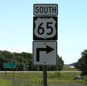
Unlike the northbound counterpart, there's no direction above the 65. Like the northbound counterpart, all three are on separate poles and have smaller arrows. Travel past the stop and yield signs to see...
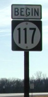
Begin 117! The road curves to the right, behind the sign, to get back to the original alignment.
Pictures by me: First-third, sixth, eighth, eleventh, 13th, 14th, 16th, and 19th-21st, 9/3/06; fourth, fifth, seventh, ninth, tenth, twelfth, 15th, 17th, 18th, 22nd, and 23rd, 12/14/02
Page created 1/10/03; last updated 4/15/07