
| IA 16 (II) endpoint history | |||
| FROM | TO | WEST | EAST |
| 12/1/30 | 2/28/33 | IA 1 | US 61 (Smith St at Central Ave, Burlington) |
| 2/28/33 | 1941 | Douds | |
| 1941 | 1942 | US 34, probably (Central Ave at Washington St, Burlington) | |
| 1942 | 1945 | US 34 (IA 16 at old 34) | |
| 1945 | Oct. 2006 | US 61 at Wever (before approx. 1963, closer to Beebe Cemetery) | |
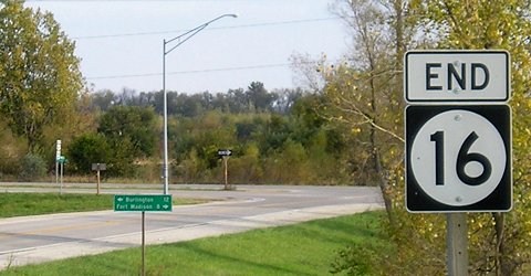
| Oct. 2006 | Present | US 34 | |
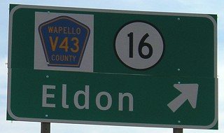
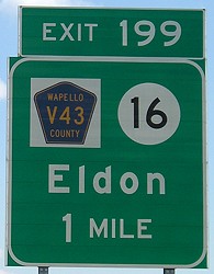
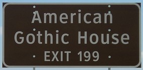
WEST End: Interchange, US 34/IA 163 and V43, Wapello County
Old WEST End: Stop sign, US 34 and V43, Wapello County
The at-grade pictures of IA 16's intersection with 34 are mostly from May 2005, with newer pictures interspersed.
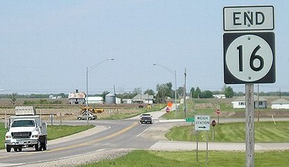
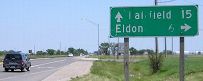
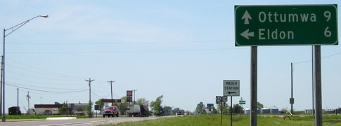
Facing north on 16 (5/10/05)
In the background, between the intersection and the farm, is construction work for US 34. Below, 18 months later, new 34 is finished and the weigh station is closed.
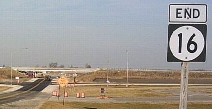
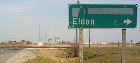
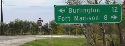
Facing north, but heading west, on 16 (11/22/06)
Photo by Jason Hancock
Though the end has moved slightly north, the sign remained unchanged until later.
Facing north, but heading west, on 16 (11/22/06)
Photo by Jason Hancock
Like some other new interchange openings in the 2000s, LGSs take a while to appear. The old one, or what remains of it, is still up.
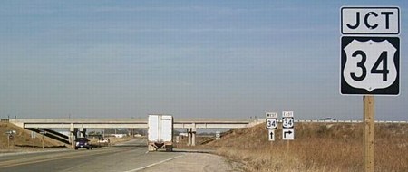
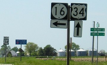
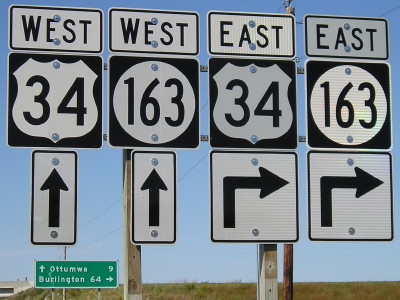
Facing east on 34 (3/16/02)
Photo by Jason Hancock
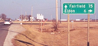
Three years later, this mileage sign appeared to have taken a beating:
Facing east on 34 (5/10/05)
Facing east on old 34, now secret IA 334 (11/22/06)
Photo by Jason Hancock
At this point, just taking the sign down would seem the best option.
Facing east on 34 (5/10/05)
Facing east on old 34, now secret IA 334 (11/22/06)
Photo by Jason Hancock
Because new 34 comes back to run just south of the old roadbed east of this intersection, old 34 will dead-end (and, like old 30 on the east side of the Marshalltown bypass, may or may not technically be abandoned).
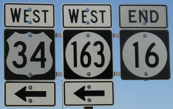
Facing west on 34 (5/10/05)
Facing west on 34 (5/10/05)
In late 2003 the four-lane plan was changed to make 16 at new 34 an at-grade intersection. This prompted the Cardinal Community School District of Eldon - which is actually not in Eldon, but 2.5 miles south of this intersection - to hold a special meeting to discuss the change. The school district worried about buses having to cross four lanes of traffic. The interchange was put back in the plans. In fact, the day I took the May 2005 pictures, I heard a radio report that the bypass of Batavia was opening the next day. (It was already marked on the 2005 map.)
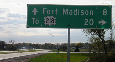
Facing east on new 34 (12/18/06)
This small exit sign was on 34 after opening. The main replacement signs, below, are back in the regular font instead of Clearview.
Facing east on new 34 (6/11/07)
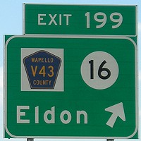
Facing south on V43 (6/11/07)
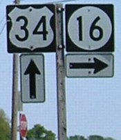
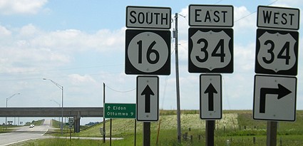
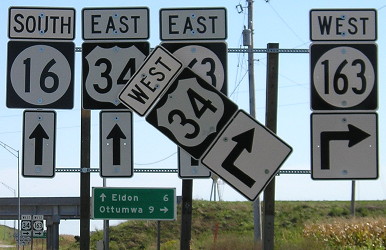
For some reason, the IA 16 shields at the new interchange have "South" instead of "East".
Facing south, but heading east (!) on 16 between new and old 34 (11/22/06)
Photo by Jason Hancock
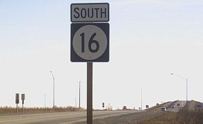
South of the intersection with old 34, the old first sign has the correct "East".
September 2010
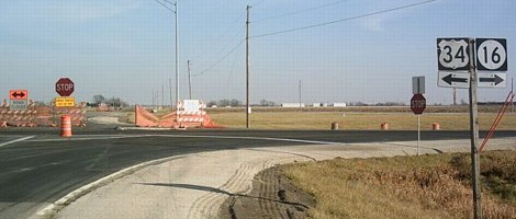
Facing north, but heading west, on 16 (9/23/10)
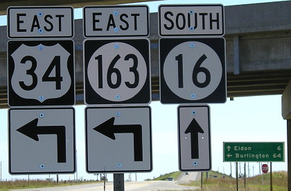
Facing south, but heading EAST, on 16 (9/23/10)
One wrong direction tag at a new interchange is bad. Multiple tabs after new shields have been set up three years later is worse.
EAST End: Stop sign/T intersection, US 61, Lee County
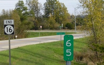
Facing east on 16 (10/21/05)
Facing east on 16 (10/21/05)
Facing east on 16 (10/21/05)
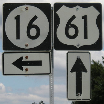
Facing south on 61 (10/21/05)
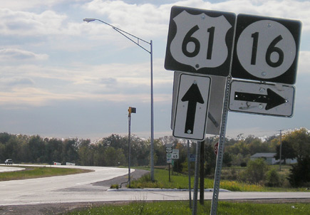
Facing south on 61 (10/21/05)
Facing north on 61 (8/31/09)
This palindrome would have disappeared in 2003 except for the condition of the road. Lee County said 16 needed many repairs between US 218 and US 61 and, instead of being forced to take those 20 miles in the Second Great Decommissioning, worked out a deal to take control of all of IA 103 (17 miles).
Page created 6/15/02; last updated 3/25/11 9/30/23