
In 2006, I took a two-day trip that hit three states and racked up 1000 miles. The travel time - slightly over 24 hours - inspired me to create a trip log with times, kind of like on the TV show "24". (Unlike Jack Bauer, though, I stop every once in a while and have to sleep. The stops and meals are part of the "24 hours of driving".)
Click on each thumbnail to see a larger 600x450 image.
|
The
following takes place between 8:33 AM and 8:50 PM Central Daylight
Time, September 7, 2006.
|
||
 |
 |
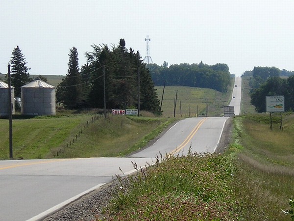
100
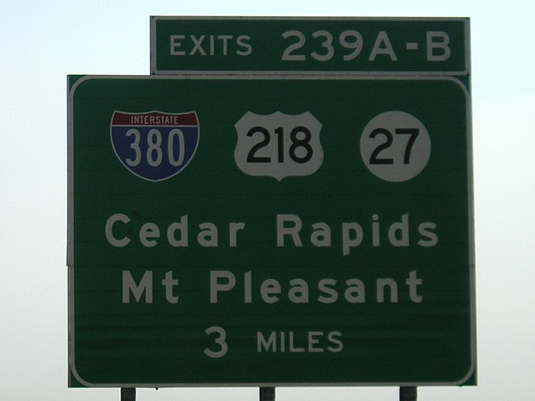
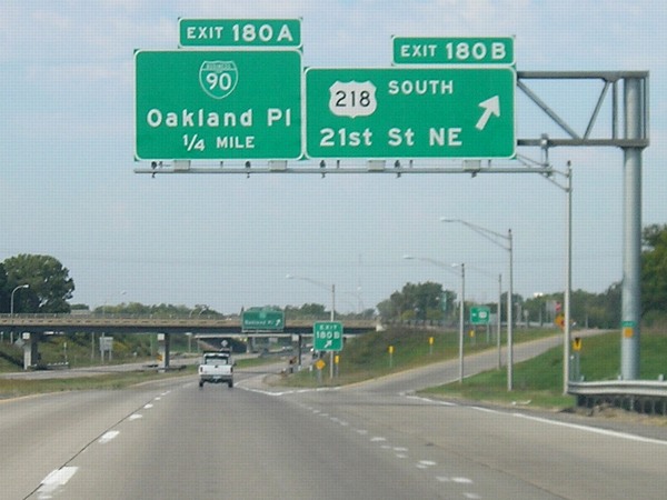
miles: I-80, Iowa/Johnson county line New 3-mile advance BGS for I-380/US 218/IA 27 on eastbound I-80. |
 |
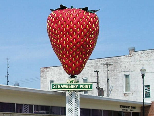 |
The World's Largest Strawberry is in Strawberry Point,
of course. This is near the north junction of IA 3 and IA 13. 200 miles: IA 13, 6 miles northeast of Strawberry Point |
 |
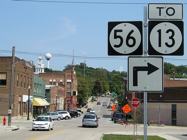 |
Picturesque view of downtown Elkader. This used to be the end of IA 56, until a bypass for 13 was built around town. Clayton County is one of a handful in Iowa without any stoplights, as this four-way stop in the county seat shows. The white tower of the Clayton County Courthouse is visible by the water tower. |
 |
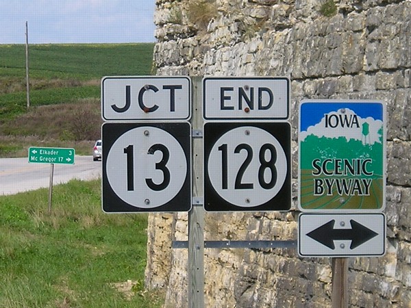 |
This intersection has been the end of IA 128 at IA 13 for more than 80 years. The route in northeast Iowa has been the same since its creation in late 1924. |
 |
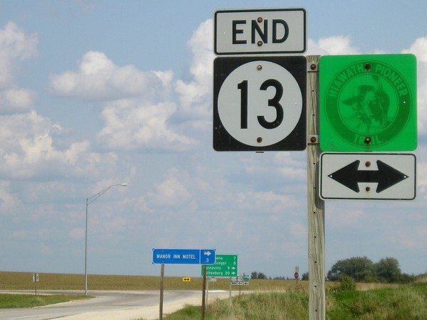 |
It took about three hours to go from IA 13's south end to its north end, counting the time it took to get through three stoplights at Marion, eating in Manchester, taking pictures in Elkader, and traveling back and forth on IA 128. |
 |
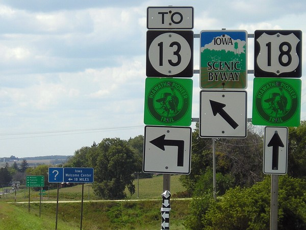 |
Prior to 1969, IA 13 went east with US 18 to McGregor and then north on what is now IA 76. There used to be a triangle formed with IA 13, US 18, and US 52, with 13 intersecting 18 to the east of here, but the southeastern leg of that triangle is gone. |
 |
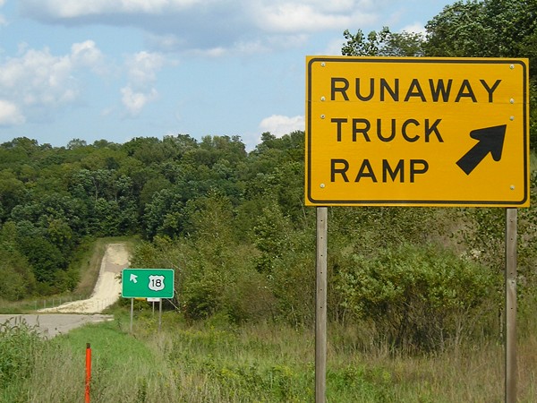 |
Here's something that may be one-of-a-kind in Iowa: A runaway truck ramp! This is on US 18 coming down a steep hill west of Marquette. |
 |
 |
The McGregor bypass was decades in the making. When the new bridge opened, everyone thought it was just a matter of time, but it would take 15 years. |
 |
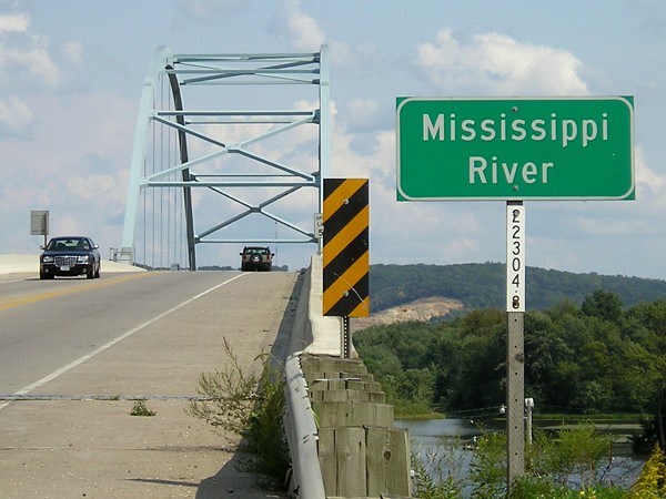 |
US 18 crosses the Mississippi River into its last state, Wisconsin. For more pictures of this area, see the Iowa termini of US 18 page. |
 |
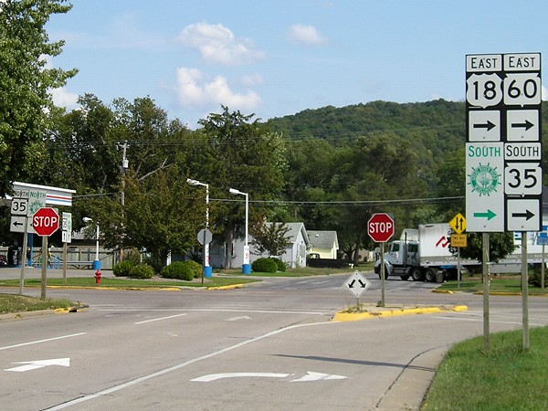 |
Inside Prairie du Chien, US 18 breaks into one-ways and then meets WI 35 but not WI 27. |
 |
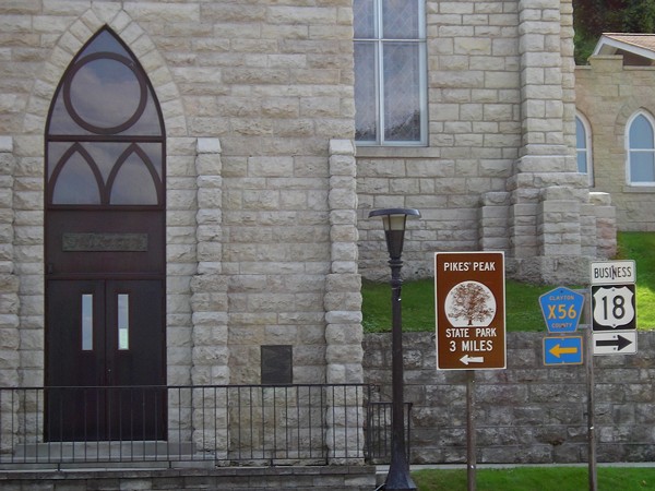 |
Going straight ahead isn't an option traveling west on Business 18 approaching what used to be IA 340. One can only imagine the headaches here when this was mainline 18. |
 |
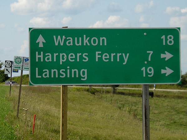 |
Even in the northeast corner of Iowa, I came across the newest scourge of the highways - the Clearview font! This is on IA 76 at the south end of what was IA 364, which goes on the east side of Yellow River State Forest on the way to Harpers Ferry. Here, 76 turns northwest to go to Waukon. |
 |
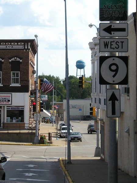 |
In downtown Waukon, IA 9 has a funny jog in it at the north junction with IA 76. Notice the arrows indicating both ahead and right for the right lane. Before 1968, westbound 9 would have been a right turn. |
 |
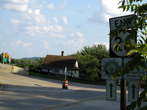 |
300 miles: IA 9, entering Lansing The south end of IA 26 is right by the east end of IA 9, which is right at the foot of the Black Hawk Bridge. You can see both end signs in this view, and the "End 9" shows up in the photo below as well. |
 |
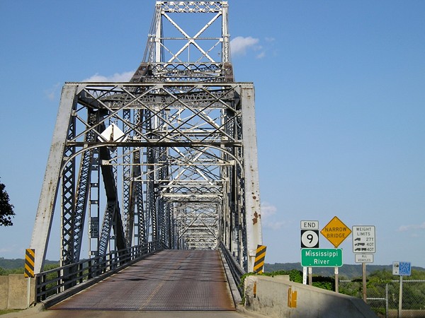 |
The afternoon sun was perfect for this picture of the Iowa end of the Black Hawk Bridge, the oldest active Iowa bridge on the Mississippi River. (It beats the US 52 bridge by 18 months, although it was closed for 12 years.) |
 |
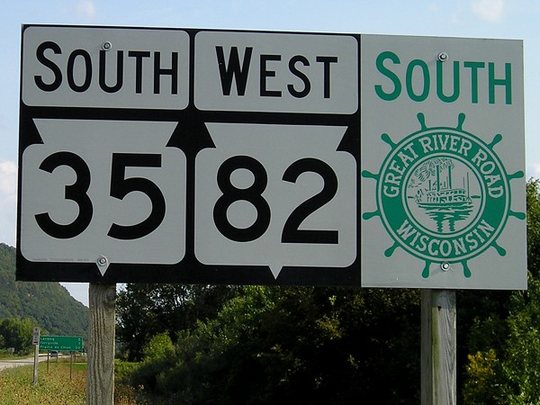 |
A 30-second jaunt into Vernon County, Wisconsin, just north of the north WI 35/82 intersection, gave me every county that borders Iowa. WI 82 goes south with 35 and then serves as the Wisconsin road that connects to the Black Hawk Bridge, with about a mile or so of lowlands between 35 and the bridge. (The Iowa/Wisconsin line follows the main channel and takes a swing southwest just north of the bridge.) |
 |
 |
This is the northeasternmost location in Iowa accessible by car, in the Upper Mississippi Wildlife Refuge, reached by a gravel road east of New Albin. This completed my tour of Iowa's four corners (and the eastern edge) in an 11-month span, and I dipped my hand in the Mississippi to top it off. |
 |
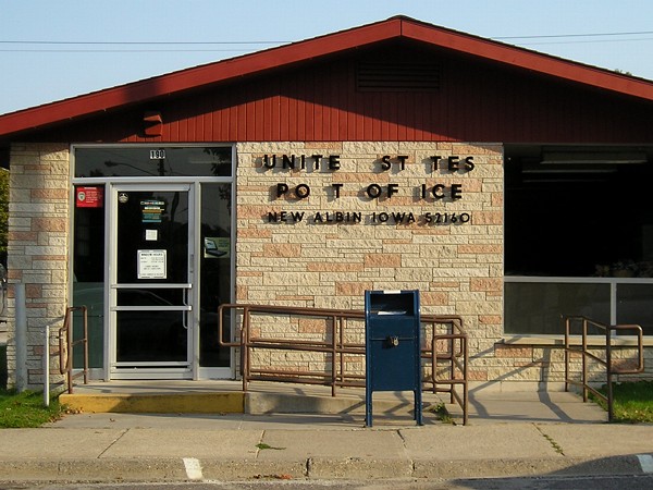 |
New Albin is the northeasternmost town in Iowa. About half a mile straight south from the Minnesota border (probably about ¾ mile on IA 26) is the Kee High baseball diamond. Kee High, as of this writing, has 16 state summer baseball tournament appearances and 9 summer baseball championships, most recently in 2005. |
 |
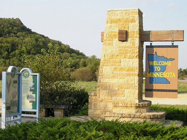 |
Minnesota welcome monument with information about the Great River Road. More pictures of this area can be see on the IA 26 page. The road becomes MN 26 and ends at MN 16 a couple of miles south of La Crescent. |
 |
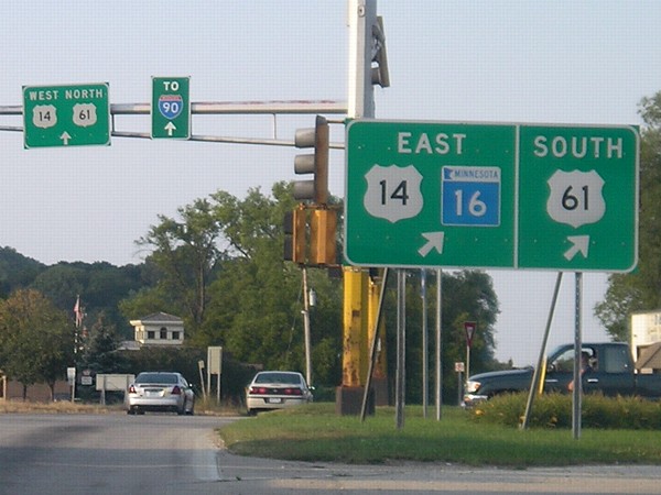 |
MN 16, former US 16, joins US 14 and US 61 right before all three cross the Mississippi into Wisconsin. |
 |
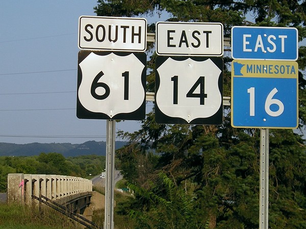 |
Although it's only a state highway now, Minnesota and Wisconsin kept the 16 designation multiplexed across the river. Usually, the lowest-numbered highway goes first, so the sign set should read US 14/US 61/MN 16. |
 |
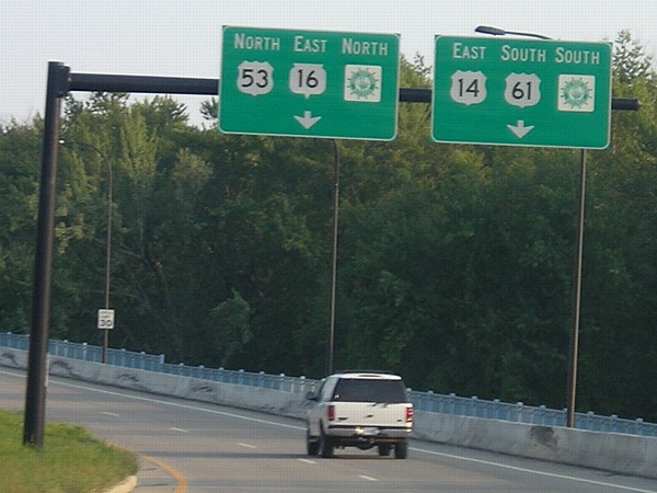 |
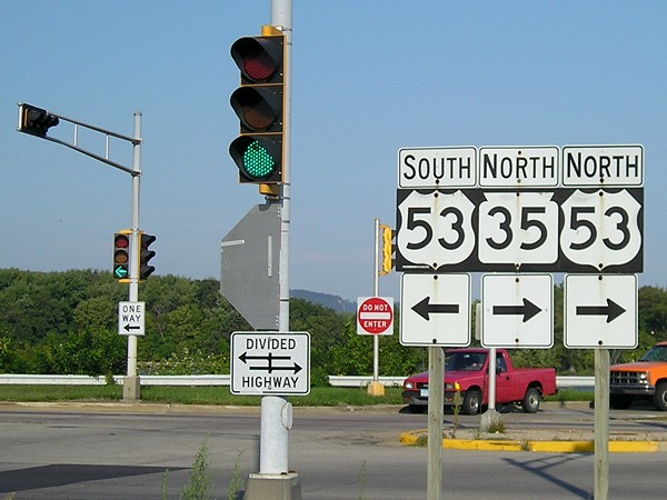
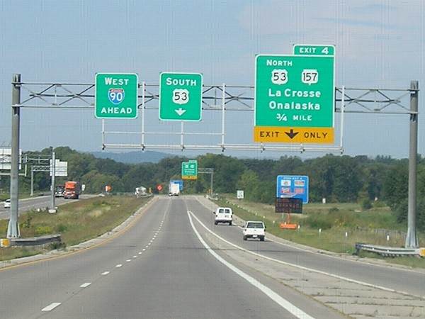
With the opening of the Cameron Avenue Bridge in 2004, 14/16/61 enter and leave La Crosse as one-ways. Upon reaching street level, they meet a one-way pair of 3rd/4th Streets, which carry US 53. While 14 and 61 go south, 16 goes east on Cass Street (the westbound counterpart to Cameron west of 4th). |
 |
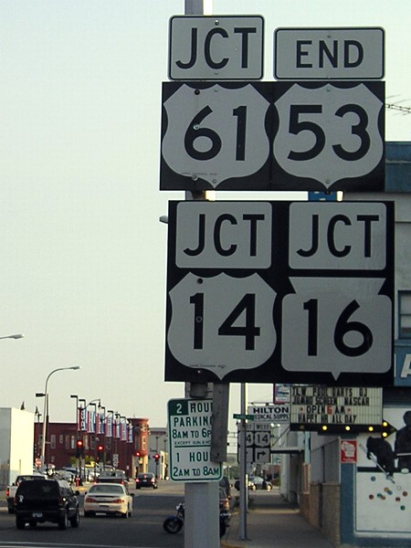 |
US 53 is only in Minnesota and Wisconsin, but originally was planned to
go into Iowa. However, US 55
was created instead. Had 53 followed the original plan, the river
crossing from Wisconsin into Minnesota would have carried westbound
14/16, southbound 53, and northbound 61. For more pictures of 53's south end, see this page. |
 |
 |
400 miles: I-90, 1 mile west of I-94 junction This is the best low-light photo I could get of the junction of interstates 90 and 94, 45 miles west of the state line. I turned around at exit 48 to spend the night in La Crosse. End: 454.7 miles |
|
The
following takes place between 8:42 AM and 8:45 PM Central Daylight
Time, September 8, 2006.
|
||
 |
 |
Double arrows are not used very often in Wisconsin; instead, the intersecting road is split up with shields and directions. Here, just south of I-90, WI 35 continues its trip along the western edge of the state by joining US 53. (35 avoids downtown La Crosse and joins US 14/61 south of it.) |
 |
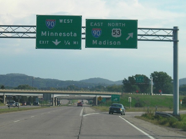 |
US 53 joins I-90 for about a mile and a half on the north side of La Crosse. This is the last mainland interchange in Wisconsin, which is likely why "Minnesota" is the control city; there's an exit for the airport on an island. |
 |
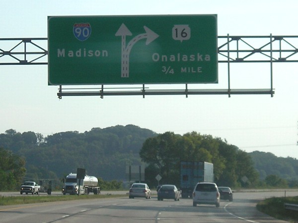 |
Graphical BGS for I-90 as it crosses WI 16, former US 16 (exit 5). It will take 20 minutes to follow 16 south (west) and then a winding road to the scenic view below. |
 |
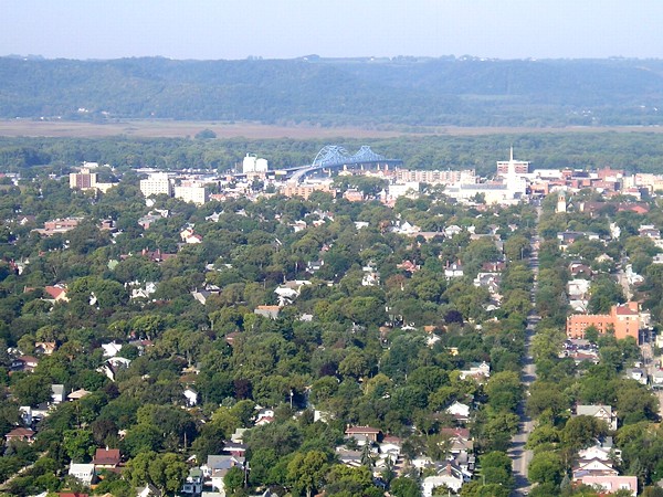 |
View of downtown La Crosse from Grandad Bluff. (Yes, that's how it's spelled.) You can see the blue bridges for US 14/61/WI 16 crossing the Mississippi. |
 |
 |
When a state or US highway joins an interstate in Wisconsin, there is often a secondary sign noting the multiplex going onto the interstate. Iowa would not have the "South 53" sign, on the idea that "North" on the right sign would imply that southbound 53 is not at this exit. (This applies in Iowa about everywhere except for signs relating to US 6.) |
 |
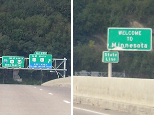 |
Split frame from the same picture of the entry into Minnesota. In the background is the exit for 14/61 to La Crescent. |
 |
 |
North end of MN 76, the only route with a number
beginning in Iowa to end at I-90. Austin is sometimes used as a control city in this area instead of Albert Lea. 500 miles: I-90, 1.3 miles west of MN 76 exit |
 |
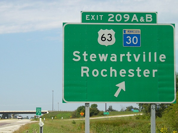 |
I-90 crosses US 63 south of Rochester. |
 |
 |
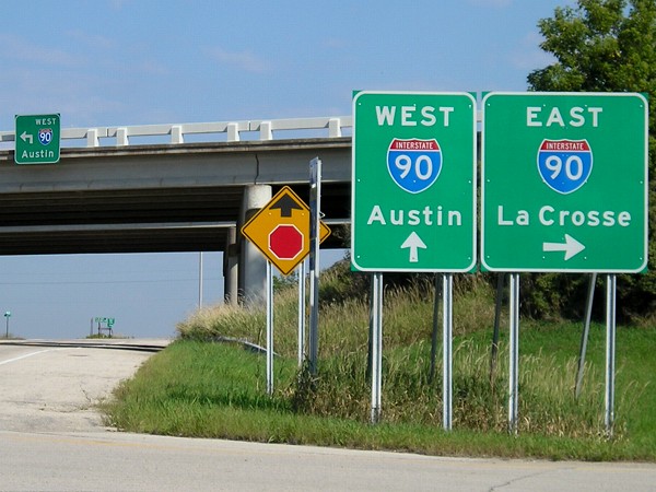
Exits for Business Loop 90 and southbound 218 in Austin practically overlap. It's not entirely clear on the Iowa map, but 218 and 90 do duplex. A local street is used instead of the last city in Minnesota (Lyle) or the first in Iowa (St. Ansgar). |
 |
 |
Advance sign for the Albert Lea exits. US 69 does not get all the way up to 90 - although Minnesota should ask to make it do so - but there is a "TO 69" sign at the exit. |
 |
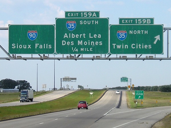 |
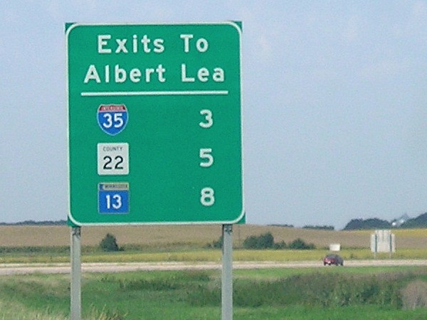
Somewhat older BGSs at I-35. On 35, the control cities on 90 are Sioux Falls and La Crosse, skipping Minnesota cities altogether, since Albert Lea is the main Minnesota control city. 600 miles: I-90, exit 154 (MN 13/To US 69) |
 |
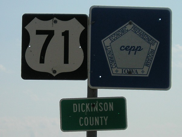 |
More than 400 miles south of Canada, US 71 enters Iowa northwest of Spirit Lake. 700 miles: US 71, 1 mile south of Iowa/Minnesota line |
 |
 |
Half an hour after entering Iowa, I leave it again, this time on IA 86. This view is typical of the area, and of a state route that was a county road before 1981 (no shoulders). |
 |
 |
It took another half-hour to travel the entire route of MN 86 (it seemed longer). |
 |
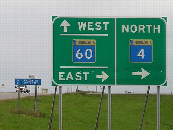 |
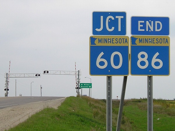
In Minnesota, 60 is an east-west highway, and crosses every route that comes up from Iowa east of IA 60, except those that end to its south. This is just southwest of St. James, where 60 becomes a four-lane road to Mankato. |
 |
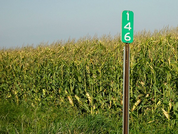 |
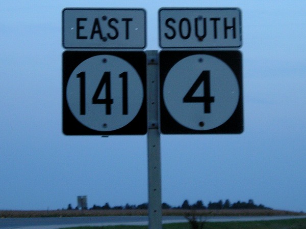
800 miles: MN 4, just south of split with old US 16 Back into Iowa again, 146 miles north of IA 4's south end in Panora. The end of MN 4 at I-94 makes it state highway from Iowa to get the farthest north. |
 |
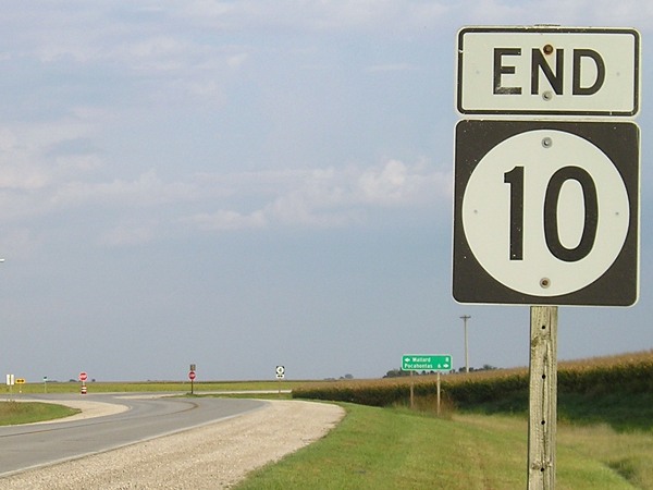 |
East end of IA 10 north of Pocahontas. 900 miles: IA 4, MM 56, 2 miles north of west junction IA 175 |
 |
 |
This picture marks both the end of daylight and my clinching of IA 4, my fourth single-digit state route. 1000 miles: IA 5, Fleur Drive exit |
Page created 11/5/07; links updated 1/21/18