Council Bluffs/Omaha Highway Chronology
The history of highways in Council Bluffs is intertwined with the history of highways in downtown Omaha. These maps include highways in Omaha west to about 50th Street. Special thanks to Jesse Whidden and Neil Bratney for their help with early highways on the Omaha side.
|
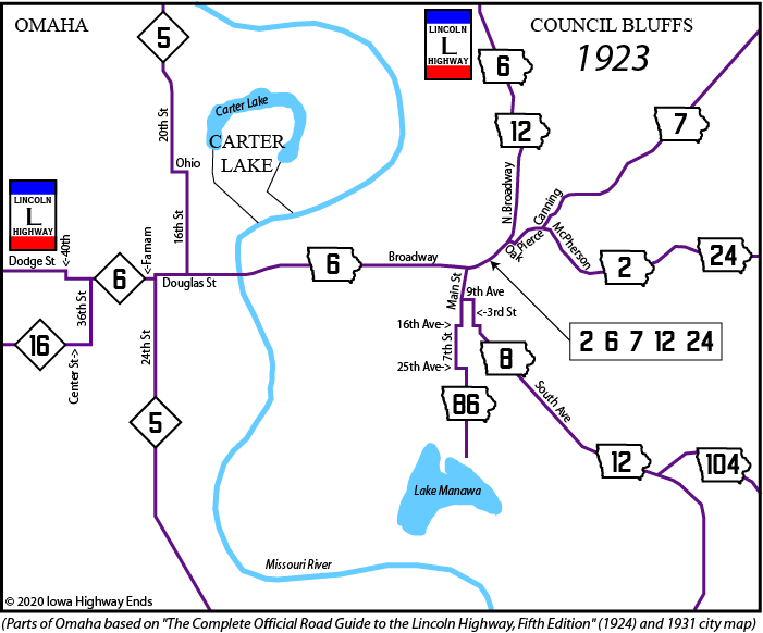
NOTE: IA 2, 7, and 8 may have continued
along Broadway into Nebraska along with IA 6 November 3, 1924: IA 12 truncated at Missouri Valley; IA
104 truncated to IA 8 |
|
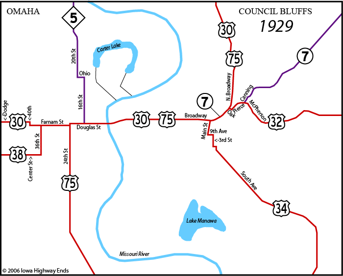
NOTE: The above map shows the ends of US 32, US 34, and US 38. May 27, 1931: IA 241 designated along former IA 86
route, then east to US 34 |
|
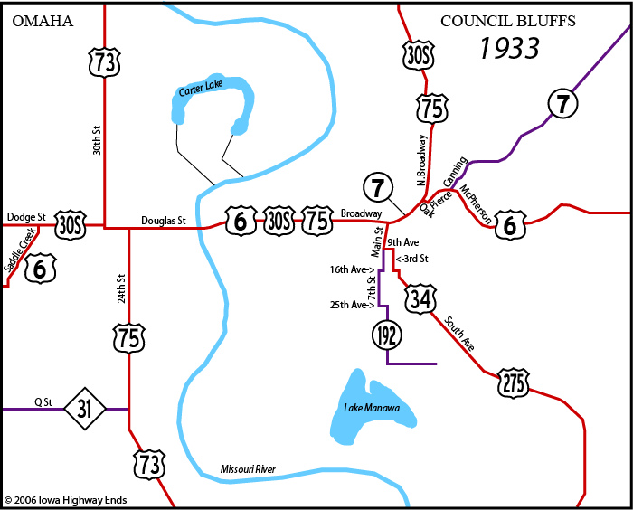
NOTE: Route descriptions in Highway
Commission minutes on February 5, 1936, show routes using
Pearl instead
of Main, half a block west. It is unknown when this began and
maps are
unclear on how long it lasted. December 1, 1934: US 30S becomes US 30A |
|
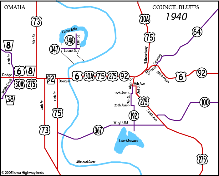
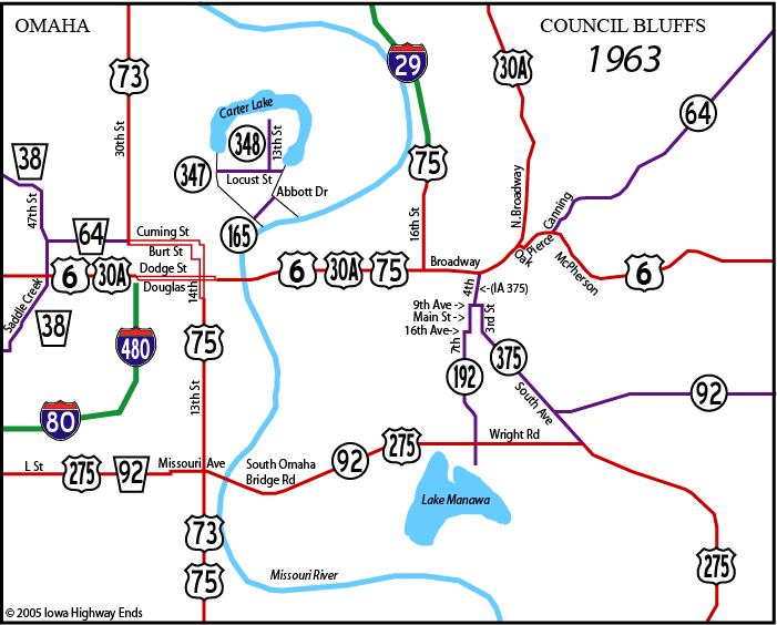
Iowa into Nebraska: Westbound 6, 30A,
and 92; southbound 75; northbound 275 US 6, W-E: Dodge St, 30th St, Douglas
St, Ak-Sar-Ben bridge, Broadway, Oak St, Pierce St, McPherson
Ave July 1, 1941: US 275 replaces IA 367, uses South Omaha
Bridge/L
St; IA 375 assigned to old route |
|
US 6, W-E: Dodge St, Dodge St
(WB)/Douglas St (EB), Ak-Sar-Ben bridge, Broadway, Oak St,
Pierce St,
McPherson Ave Mid-1960s: One-way alignment of 73 north of Dodge
changes slightly; I-680 built between US 6 and NE 133 (not
shown) |
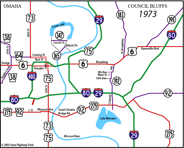
| US 73 NB: 13th
St, Capitol Ave, 16th St, Cuming St, 30th St US 73 SB: 30th St, Burt St, 17th St, Capitol Ave, 14th St, Leavenworth St, 13th St December 16, 1975: IA 192 eliminated |
|
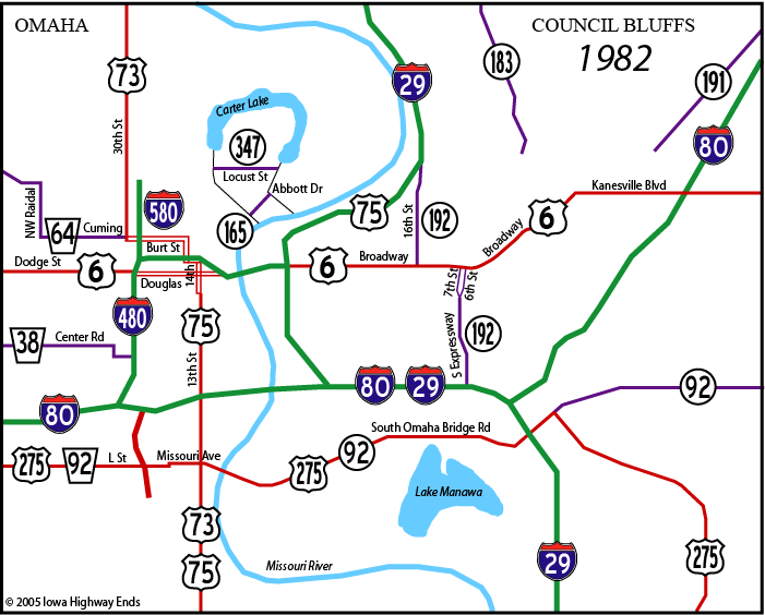
December 5, 1984: US 6 realigned between 7th St and
North Broadway, slightly north of old road in downtown |
|
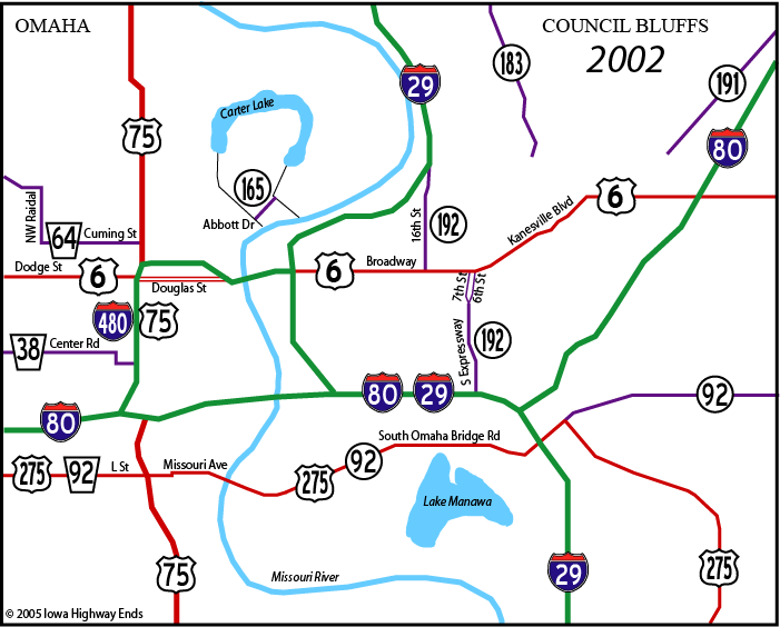
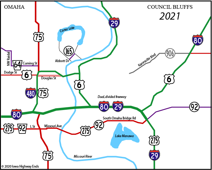
Late 2002: Southwest end of IA 165 shifted slightly for
Abbott Drive reconstruction project |
Page created 9/23/05; last updated 8/26/07 10/19/20