 BUSINESS
The evolution of highways in the Ottumwa area can be seen in this set of maps.
Old WEST End: Stop sign/T intersection, US 34, Wapello County
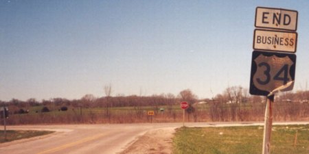
Facing west on Business 34 (4/4/04)
Photo by Jason Hancock
In the 1960s, 34 was rerouted through Ottumwa. In conjunction with the new four-lane 34, the Des Moines River was also rerouted, creating an oxbow lake in downtown. The old route on the west side of town is still Albia Road (the first town west). In 2007, the DOT took the official Business 34 designation off part of the old alignment, in favor of meeting 34 on Quincy Avenue, which has some businesses.
Facing east on 34 (6/11/07)
As with other business routes, rightly or wrongly, there is no signage in the direction leaving town. This signage was still up along 34 in June 2007 and replaced by August 2019, but the signage along the business route (see below) had been removed.
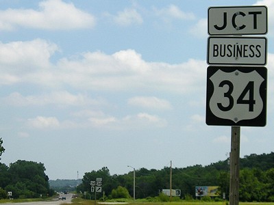
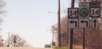
First sign on Business 34 (4/4/04)
Photo by Jason Hancock
This sign assembly looks very old, perhaps even original. The pavement isn't much newer, and that plus the old bridge probably figured into the change of alignment.
Official WEST End: Quincy Ave. at US 34, Ottumwa, Wapello County
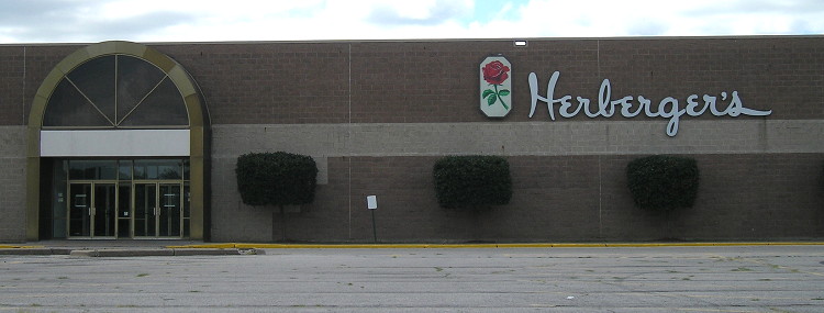
The 34/Quincy intersection is the gateway to Ottumwa's west retail district, including its big-box stores (although Wal-Mart is a bit more west). There were no signs at the intersection in 2019. What was nearby was the only Herberger's store in Iowa, part of the Bon-Ton chain that included Younkers and went out of business a year earlier. (7/15/19)
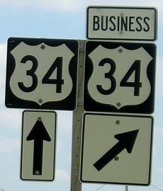
Along the route: Junction US 34/63
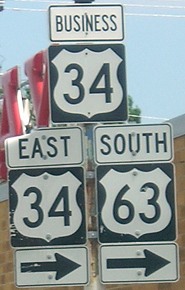
The old and new alignments of 34 cross in the "freeway" part of 34 built with two interchanges but a 45 mph speed limit and sharp, short ramps. Myrtle Street, which before the construction was part of 34, now serves as the road connecting eastbound ramps at the Church/Jefferson interchange. (Cook is the westbound counterpart.) This interchange will now be where Business 34 crosses Business 63 instead of mainline 63.
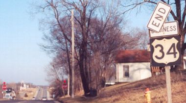
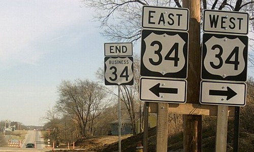
Old EAST End: Three-way stop, US 34, Ottumwa, Wapello County
Although the position of the end has not changed, the circumstances have.
Facing east on Business 34 (3/16/02)
Photo by Jason Hancock
Facing west on 34 (4/4/04)
Photo by Jason Hancock
On 34 is still the old, time-worn signage. Notice that all of the older signs have wider numbers. These signs have all been removed; 34 here is now a three-lane road (two with center lane) that dead-ends a short distance to the east after passing an Iowa State Patrol office and a couple of old motels.
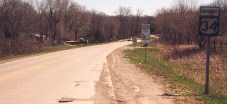
Facing west on 34 (4/4/04)
Photo by Jason Hancock
From this intersection, present 34 took a left onto a newer expressway alignment while the business route continues straight ahead (something that, worth noting, is what business routes often do).
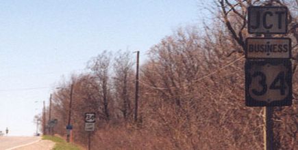
Facing north, but heading east, on 34 (6/16/06)
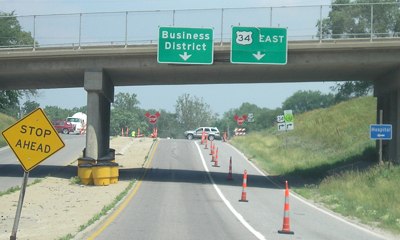
No mention of Business 34 eastbound, just a sign for the business district. This bridge is Main Street, which departs Business 34 just to the west of here. Up ahead is Roemer Avenue, part of a segment originally built in 1954. This was very shortly before the left sign was taken down and US 34 was rerouted to go straight ahead; see three pictures down. The road to the right now dead-ends.
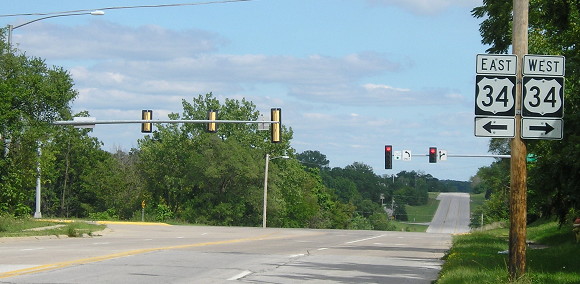
EAST End: Stoplight, US 34/63, Ottumwa, Wapello County
Facing east on Business 34 (11/22/06)
Photo by Jason Hancock
Jason took these pictures about a year before the Ottumwa bypass opened, so 63 was not signed here at the time.
Facing east on Business 34 (11/22/06)
Photo by Jason Hancock
The "End Business 34" was put up a few years ago; writes Jason, "It's something out of the 'didn't see that one coming' department."
Facing east on Business 34 (8/24/19)
But, according to Google Street View, that "End Business 34" sign was gone by mid-2009.
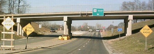
Facing north, but heading east, on 34 (11/22/06)
Photo by Jason Hancock
Between November 2006 and June 2007, the intersection ahead became a stoplight, with straight ahead as an option.
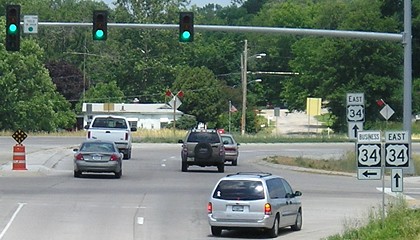
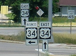
Facing north, but heading east, on 34 / Closeup (6/11/07)
The standalone "East 34" in the background is much larger than a normal shield, something only seen otherwise in Burlington.
Since these photos were taken, US 63 has been rerouted to go through the intersection.
Surrounding area information: Ottumwa bypass
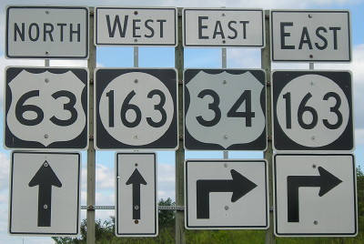
Facing northeast, but heading east on 34, but heading north on 63 (8/24/19)
This somewhat horrifying mishmash of sign styles is somewhat farther from the interchange than would typically be expected. At the freeway, 63 goes north while 34 goes east, but since 2009 the mainline has also carried IA 163 markers.

Facing northeast, but heading east on 34, but heading north on 63 (8/24/19)
This sign set is much better in uniformity. However, single-panel medium green signs like those at the north end of Business US 218 in Mount Pleasant will take their place soon if not already.
Page created 9/2/04; last updated 5/8/20