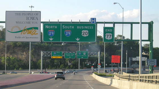
 NORTH
NORTH
(Since 1982)
Photos of US 77's historic Iowa termini are on a separate page.
Facing north on 77
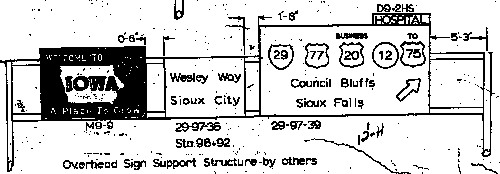
This is a clip from a state signage letting in February 1981 for the permanent signs after completion of the volleyball interchange. Those are five, count 'em FIVE, shields on one BGS, which would be a record for Iowa — assuming these signs ever got erected. That's a question because federal approval for peeling US 77 all the way out of South Dakota was granted in October 1981, mere months after the Missouri River bridge opened to four lanes. Then, for much of 1982, the bridge was closed after "a major component of the bridge failed to meet minimum strength requirements" (Sioux City Journal). Another signage letting in summer 1983 included BGSs with US 77 on them at the IA 12 interchange, a full year and a half after its end was supposedly truncated. If the 1981 signs were put up and replaced soon after erection, I have yet to find that file.
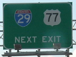
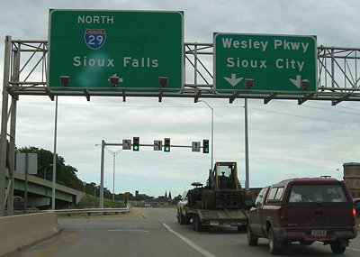
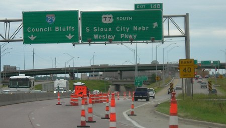
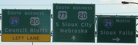
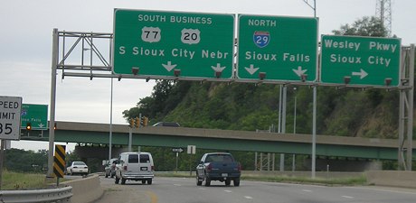
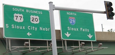
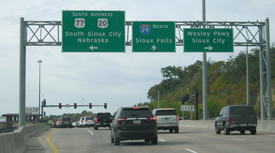
NORTH End: Volleyball interchange, now diamond interchange, I-29 exit 148 (NB)/149 (SB), Sioux City, Woodbury County
All of Eric Peterson's pictures are from November 1999, before IA 12 was decommissioned made an un-highway inside Sioux City.
Because of all the signs involved in this interchange, the pictures will go "around" it clockwise from 6 o'clock. This guide superimposes the 2005 signs nearest the interchange on top of their gantries as seen in an aerial photo, facing in the direction you would encounter them:
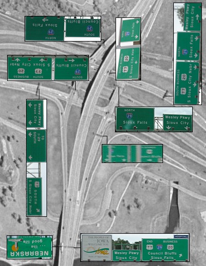
Someone wanting to take a "right turn" would only pass under one BGS (the first one on the ramp) while someone taking a "left turn" goes under three (the first one, one in the "inner" portion of the ramp inside the square, and another "inner" sign on the turn). This is the only major interchange in Iowa to mention Sioux Falls; the east end of I-129 still directs to downtown Sioux City.
This interchange was once described in a Sioux City Chamber of Commerce pamphlet as "Iowa's Most Stupid Intersection." It got replaced in 2012-13 on the early end of a decade-long project to rebuild and expand I-29 in Sioux City, one of Iowa's oldest interstate segments.
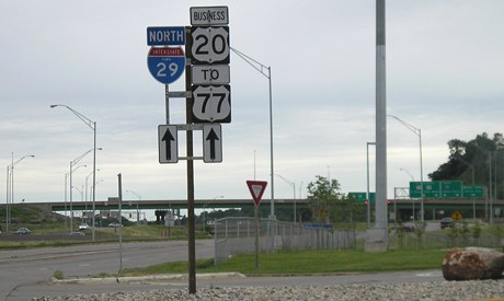
End US 77 (facing north)
Facing north on 77 in Nebraska (6/12/05 and 5/13/07 and 6/4/14)
Center photo by David Morrison
This sign is about halfway between the final intersection on the Nebraska side and the bridge. There used to be an IA 12 shield on the right, with no indication of Business 20. The fact that 77 is mentioned as being on the "exit" dates back to when 77 continued north with I-29 to Sioux Falls - but then the replacement sign kept 77 on there. It should say something like "Jct 29 End 77 Next Exit".
Facing north on 77 (6/4/14)
Facing north on 77 (6/4/14)
Why do signs on this gantry (the same green one from earlier, BTW) have down arrows but the Wesley Parkway pointer is up?
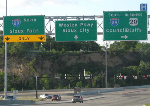
Sign in background (6/4/14)
<gollum> THE KERNING, IT BURNS US. </gollum>
Facing north on 77 (5/13/07)
Photo by David Morrison
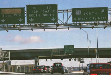
This is the first and last sign on mainline 77 pre-reconstruction. Exiting traffic comes into the volleyball, where the first stoplight leads to southbound I-29 and the second leads to northbound I-29. It's likely that IA 12 was on the right side of the right BGS. Below is a picture (courtesy Kurumi's SignMaker) of what the first sign on the offramp would have looked like with IA 12 on it. Blank spaces with I-29 on all these signs were occupied with IA 12 and the appropriate cardinal direction.
Facing north on ramp
Facing north on ramp (5/13/07)
Photo by David Morrison
Facing north on ramp, at second stoplight (6/12/05)
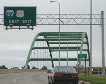
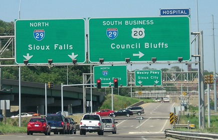
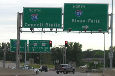
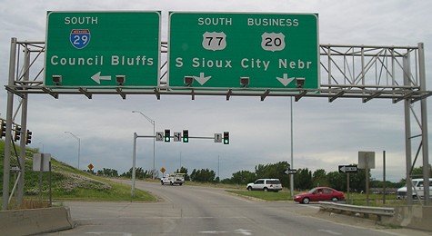
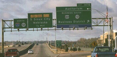
I-29 southbound (facing east)
Facing east, but heading south, on 29 (6/12/05)
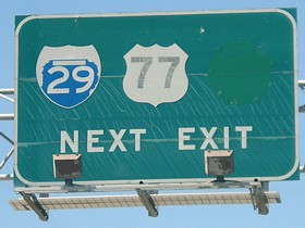
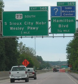
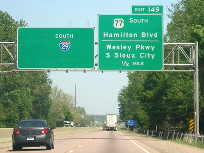
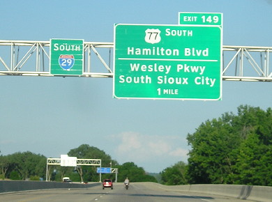
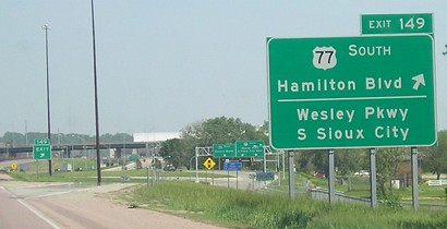
In late 2005, the separate ramps for Hamilton and US 77 were combined, leaving one sign up with almost nothing on it:
Facing east, but heading south, on 29 (5/13/07 and 6/4/14)
Left photo by David Morrison
Notice how everything was peeled off the left sign except "South", which got a 29 shield added to it, and then its equivalent BGS location was moved. The exit number was adjusted to stay with Hamilton Boulevard, so 77 is Exit 148 northbound and Exit 149 southbound (traffic exits to Hamilton and follows side ramp to 77). Hamilton Boulevard before the early 1970s was Isabella Street.
Facing east, but heading south, on 29 (5/13/07)
Photo by David Morrison
To reach 77 now, southbound 29 traffic must exit here and then continue through the interchange.
Facing east at Hamilton Boulevard interchange (5/13/07)
Photo by David Morrison
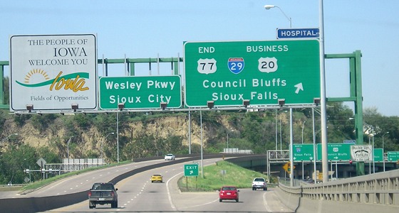
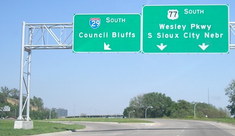
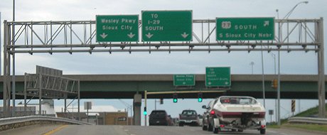
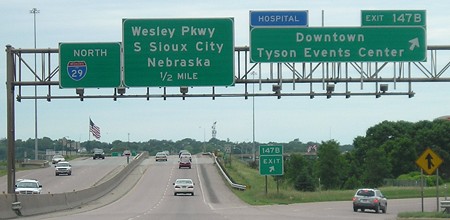
This is now the farthest-north mention of Council Bluffs, which previously didn't appear until the original exit ramp at the volleyball as shown below. If you look very closely you can see "Pkwy" is a greenout panel over "Way".
Facing east at Wesley Parkway (6/4/14)
Facing east, but heading south, on 29 (6/12/05)
Facing east on ramp (November 1999)
Photo by Eric Peterson
This picture shows the exit ramp sign when IA 12 was still on it. This is the only direction that uses text for 29 and 12. The text is covered up because at the time, Sioux City was rebuilding Wesley Way, which would be renamed Wesley Parkway.
Facing east on ramp (6/12/05)
After crossing under 77 and getting back on 29, there is an exit soon after for Business 20 to leave 29 (though Business 20 is no longer signed). However, that very-1950s pair of entrance/exit ramps meshing with Gordon Drive are getting wiped out in the reconstruction.
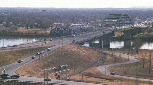
Photo by Eric Peterson (November 1999)
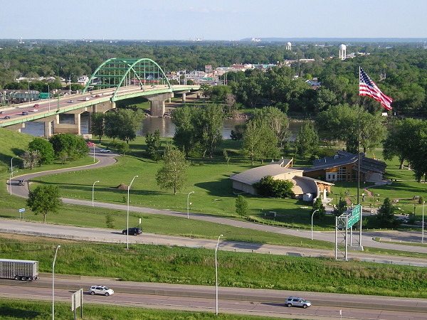
This picture from Prospect Point shows nearly the entirety of US 77 in Iowa, with the on-ramps to southbound 77 at bottom.
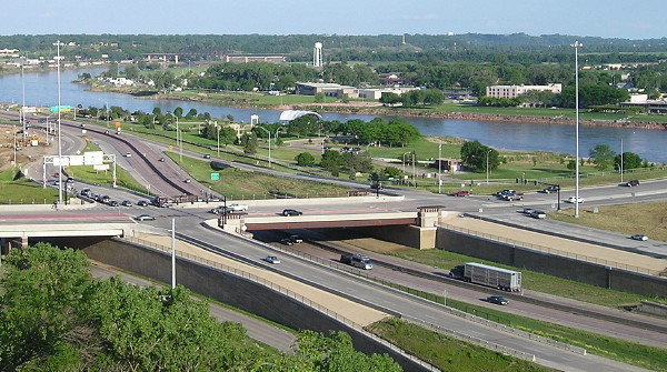
View of reconstructed interchange, with room for a six-lane I-29 (6/4/14)
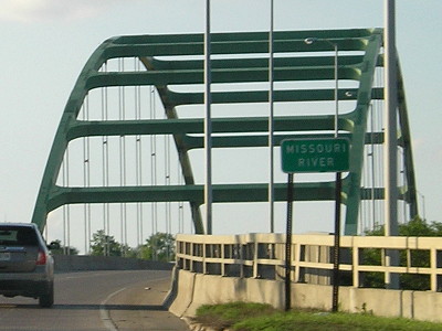
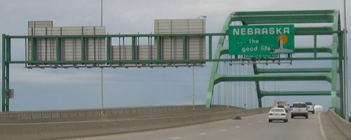
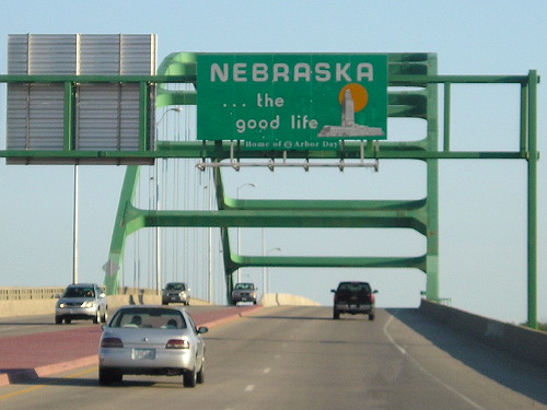
The original bridge over I-29, which would be just to the east of this one, was built in the exact location of the Combination Bridge's Iowa swing span, meaning that everything to the right/south is filled riverbed.
Facing south (6/4/14)
Easily visible in this photo is the Lewis & Clark Interpretive Center.
Be vewwy vewwy quiet. (6/4/14)
Wesley Parkway (facing south)
Facing south (6/12/05)
By official DOT maps, it looks like the road becomes 77 just north of the northernmost end of the ramps.
Facing south on ramp (6/12/05)
Facing south on Wesley Parkway (6/4/14)
Facing south on ramp, at second stoplight (6/12/05)
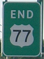
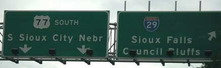
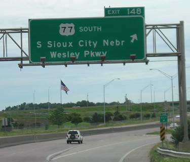
This is the last Iowa BGS facing south. It firmly commits Business 20 to entering South Sioux City.
Facing south on 77 (6/12/05)
This Nebraska sign is on the Iowa side of the river. The "End 77" BGS is the one with its back to us.
Facing south on 77 (6/4/14)
Business 20 westbound (facing west)
Facing west on Gordon Drive (6/12/05)
This was the last sign on Business 20 before joining I-29's exit ramp to the interchange - and, as far as we could tell in 2005, the only standalone 77 shield in Iowa. (IA 12 had been underneath the 29 shield.) This intersection is where a traveler wanting to get on southbound 29 from westbound Business 20 turned left. West of this point, 29 was built on top of 77's Gordon Drive alignment to Riverside Boulevard, where IA 12 goes north today. It had to be done because of space concerns; there's no median on 29 throughout the area. (Before the 1940s, 77 used West 4th Street.)
I-29 northbound (facing west)
Facing west, but heading north, on 29 (November 1999)
Photo by Eric Peterson
When the center and right signs were replaced, neither Business 20 nor IA 12 was signed at this interchange, nor had a 77 shield appeared on its exit sign (below).
Facing west, but heading north, on 29 (6/12/05)
Facing west, but heading north, on 29 (6/12/05)
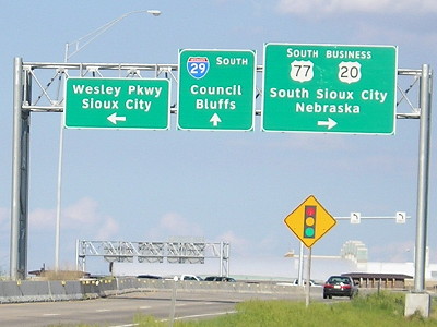
The destinations on this BGS are in the wrong order. Generally, the local road is put on top, followed by a city, OR the first turn is listed, followed by the second. Either way, Wesley Parkway (which is attached to this sign by a panel) should be above South Sioux City.
Facing west on ramp (6/12/05)
Facing west on ramp, at second stoplight (6/12/05)
Traffic wanting to go south on 77 goes under the bridge, takes a left, then waits at one more light before getting on the ramp to the mainline (which it barely joins before hitting the bridge into Nebraska).
Facing west (10/2/20)
This is the present equivalent to the two above photos. You get to this location either by having continued west on Gordon Drive from downtown or by exiting I-29.
Page created 6/27/05; last updated 10/29/20