
NORTH End: Old US 16/MN 13/Main St., Albert Lea MN, Freeborn County MN
Twelve miles north of the state line, US 69 comes to an abrupt end on the west side of Albert Lea. For pictures of that intersection, see this page.
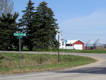
NORTH Iowa line: Emmons MN (7 miles N of Lake Mills), Worth County IA/Freeborn County MN
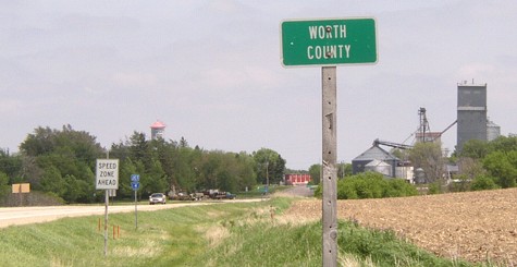
Facing north on 69 (5/19/04)
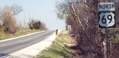
US 69 just kisses the northwest corner of Worth County before leaving the state. The counterpart Winnebago County sign was one of the first large ones spotted in the state (May 2004), but as of October 2006 the Worth sign is still small.
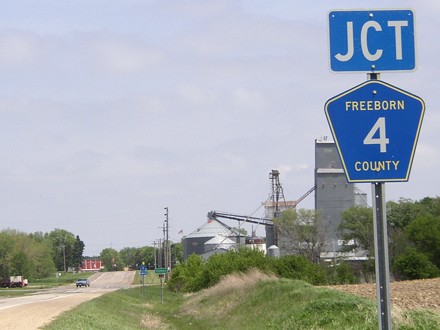
Facing north on 69 (5/19/04)
This sign for a Minnesota road is in Iowa...
Facing north on 69 (5/19/04)
...and this Iowa DOT sign is for a Minnesota town.
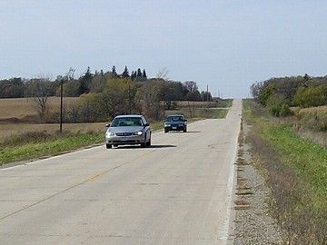
Facing north on 69 (5/19/04)
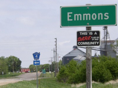
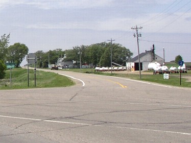
Facing north on 69, in and out of Emmons (7/7/11)
Facing west (5/19/04)
While County 4 goes west along the state line in a straightforward manner, the same cannot be said for the state-line road heading east from town. (This unfortunate fact cost me at least 10 minutes of driving.)
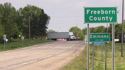
Facing south (10/6/06)
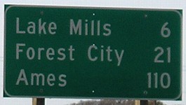
This is the "leaving town" mileage sign for Emmons, but it does double duty as the first sign in Iowa. Between here and the north side of Ames, there are precisely three stoplights - two in Forest City and one in Belmond.
Old NORTH Iowa line (1935-39): 3.25 miles east of present entrance, Worth County IA/Freeborn County MO
Facing northeast (10/6/06)
This is the route US 69, and IA 15 before it, followed in the early 1930s. This is about halfway between 69's current crossing and I-35.
Facing west (10/6/06)
The cars are traveling east, or north on old 69, in Iowa. This picture was taken in Minnesota. Because counties trade off sections of road jurisdiction, there is no Iowa county road signage here.
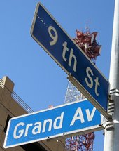
Old NORTH End (December 1934-May 1935): US 6/Grand Ave., Des Moines, Polk County
This map shows what the highways were like immediately before US 69 came to town:
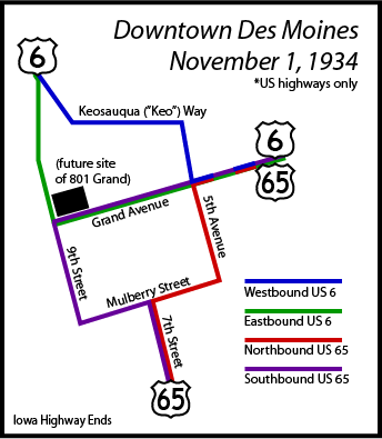
The highway routings followed different streets, but the streets themselves were NOT one-ways. Between 9th and 5th, traffic heading east on Grand was on eastbound 6, but traffic heading west on Grand was on southbound 65. (The configuration is related to left turns being banned at the intersection of 7th and Grand at one point.) When 69 was extended northward in late 1934, Highway Commission minutes and the January 1935 state map indicate it came north with 65 to Des Moines, where its end and beginning would have been at different intersections:
Facing north on 5th/65/69 (9/29/06)
Look in the upper left corner. Today, a car could not face the end of 69 because it's one way southbound. The building is the Polk County Convention Complex (at least, for now).
Facing west on Grand/6/65 (9/29/06)
The blue markers are relatively recent additions to downtown Des Moines. Of all the buildings in this picture, only the one in the right foreground with the green awning would/might have been around at the time 69 was here. Southbound 65/69 traffic would have continued ahead four blocks.
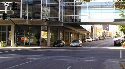
Facing south on 9th/eastbound 6 (9/29/06)
The car is following southbound 65 and starting on 69. A vehicle in the camera's position would turn left to continue on 6. Off to the camera's left, and visible in the photo above, is 801 Grand, the tallest building in Iowa.
The modern street signs at this intersection are color-coded blue as "truck routes". (9/29/06)
Old NORTH End (October 16, 1926-December 1934): 4-way stop, US 65 N/Church St. and US 65 S/1st St., Leon, Decatur County
Facing east, but heading north, on 69 (4/16/07)
From Leon to Ames, the route currently occupied by US 69 was originally signed as US 65. The eastward shifts of 65 between Colo and Des Moines and between Indianola and Leon didn't come until 1940 and 1934, respectively.
Facing east, but heading north, on 69 (4/16/07)
This intersection would have been the end of 69. To the left and straight ahead would have been US 65.
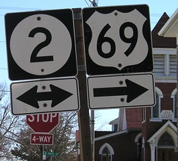
Facing west on 2 (heading north on 65) (4/16/07)
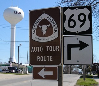
The Mormons, led by Brigham Young, originally traveled across southern Iowa in 1846. For a historical perspective, the beginning of the US highway system is closer to the era of the Mormon Trail (1926-80=1846) than to today (1926+80=2006).
Facing south on 69 (65) (4/16/07)
This is one of two water towers in Leon; the other, in the classic four-leg design, is behind the camera to the left. The church was built in 1888.
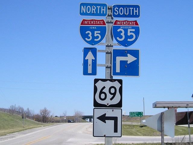
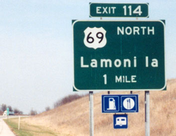
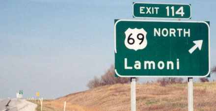
SOUTH Iowa line: Near I-35 exit 114 (IA exit 0), 4 miles south of Lamoni, Decatur County IA/Harrison County MO
Highway 69 meets the Iowa/Missouri border right next to I-35, but then straddles the state line before fully entering the Show Me State. Order of the photos below: South on 69 to the curve into Missouri, then turning around and heading east, the east side of the interchange, and then the views on I-35. Click on the thumbnails below for larger images.
|
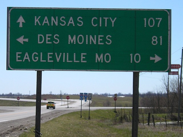
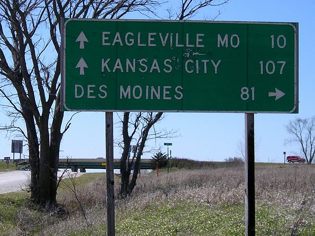
Facing south on 69 (4/16/07) The last mileage sign on 69, leaving Lamoni, gives almost the same distance to Kansas City as a sign on I-35 would. However, 69 has a lot of curves along the way, not to mention the lower speed limit. FYI: 69's turn in Lamoni, Decatur County's largest city, does not have a stoplight. What's more, a few blocks in the business district are still brick! |
| Facing south on 69 (10/2/15) Here's the Clearview replacement version. |
|
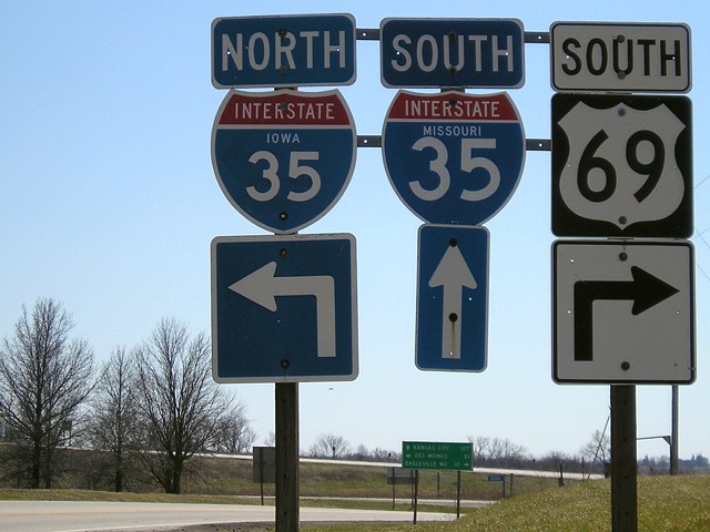 |
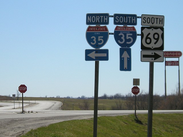
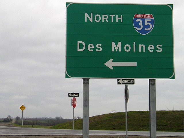
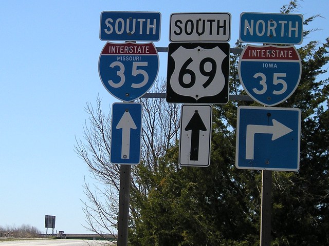
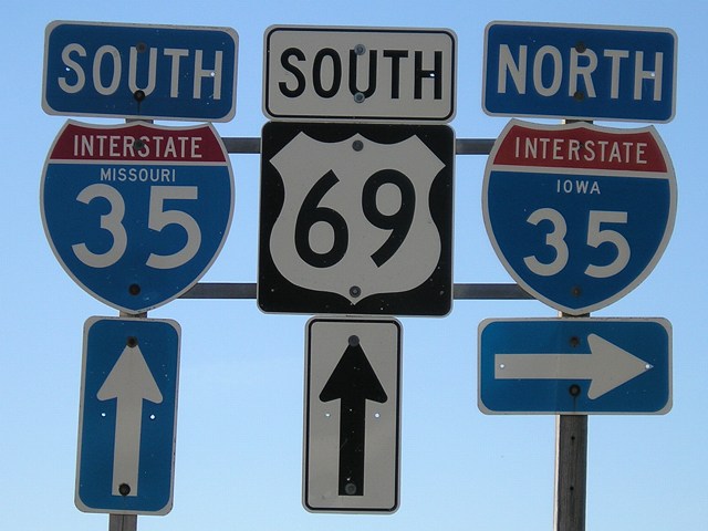
Facing south on 69 (4/16/07) This is the first bi-state sign assembly a southbound driver sees. All the "South 35" shields have larger numbers and the word "Missouri", while the "North 35" shields are Iowa standard (until 2008, anyway). There are other interchanges in the country at state lines, but I'm sure that this one has the most shields. |
 |
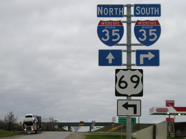
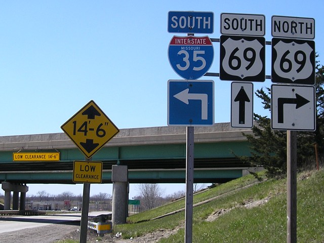
Facing south on 69 (10/2/15) Here's another view of that sign closing in on a decade later. |
|
Facing south on 69 (4/16/07) Straight ahead is the onramp for SB 35 in Missouri. Eagleville can be reached either on 69 or 35. As of October 2015 this sign had not been replaced. |
|
Facing south on 69 (4/16/07) While 35 north of this point opened in late 1970, it would take another two years before the Missouri section would open. Until then, all traffic would have had to exit 35 and go right/south on 69 along the state line. |
 |
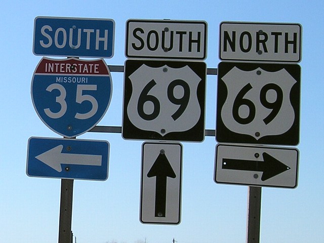
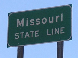
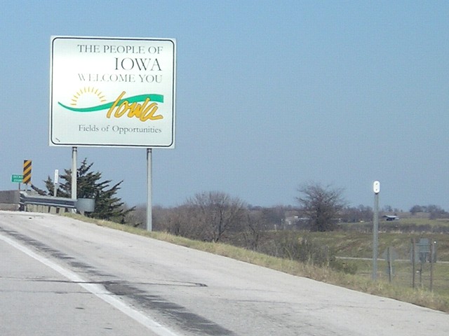
Facing north on 69 (10/2/15) The "Welcome to Iowa" sign is directly across from the assembly above. Now, lets keep going south on 69 by turning right. |
|
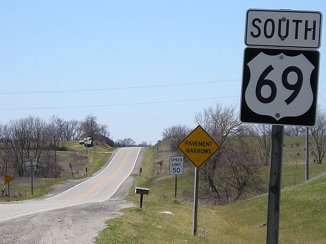
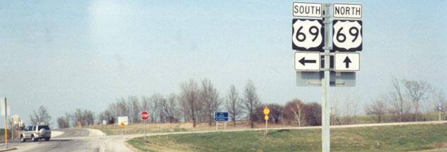
Facing west, but heading south, on 69 (4/16/07) Last southbound Iowa-standard US 69 shield. The 50-mph speed limit extends north of here all the way to Leon. |

|
Facing west, but heading south, on 69 (4/16/07) Halfway along the east-west segment, Iowa and Missouri trade off jurisdiction of the road, following the deal that was made on June 18, 1928. |
 |
Facing west, but heading south, on 69 (10/2/15) |
|
Facing west, but heading south, on 69 (4/16/07) This Decatur County sign marks the gravel road/state line as 69 fully enters Missouri. |
|
Facing east, but heading north, on 69 (4/16/07) From the point 69 starts to straddle the state line, you can clearly see the pavement change and the interchange. |
|
Facing east, but heading north, on 69 (4/16/07) This old Iowa-standard sign appears just before the pavement changes. Since this picture was taken, I have been told a Decatur County sign has been put up in the area. |
|
Facing east, but heading north, on 69 (3/24/03) Photo by Jason Hancock The first northbound Iowa shield is technically in Missouri, as are all of these pictures facing this direction. |
 |
Facing east, but heading north, on 69 (1/10/12) |
|
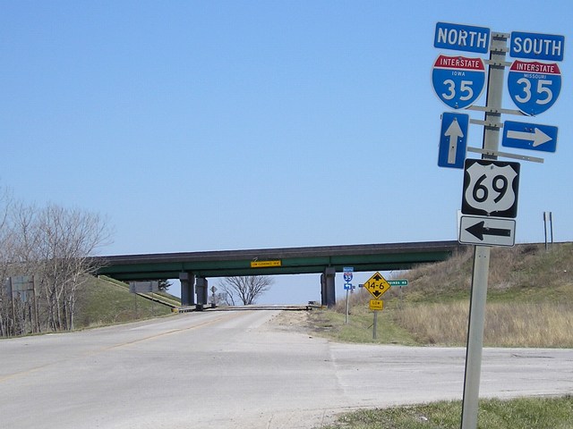
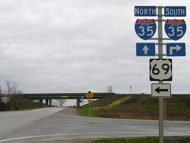
Facing east, but heading north, on 69 (4/16/07) The metal pole these shields are on is typical of those used in Missouri, but the 69 shield and arrow are definitely Iowa standard (Missouri almost always uses the wider Series D for numbers). It's possible the only Missouri parts of this assembly are the pole and the "Missouri 35" shield. |
|
Facing east, but heading north, on 69 (4/18/08) About a year after I extensively photographed this interchange, MoDOT went through and replaced everything on the south side. This means that all the Iowa stuff is gone eastbound, including the "Iowa 35" shield that used to be here. |
|
Facing east, but heading north, on 69 (4/16/07) This mileage sign is in button copy, which Missouri used longer than Iowa did, and could be original from 1972. It would be up to MoDOT to replace it. Around a year after this picture was taken, they did. |
|
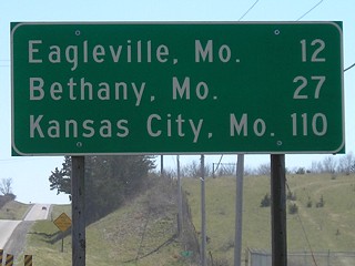
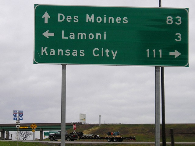
Facing east, but heading north, on 69 (4/18/08) Wait a second, how did Kansas City get 4 miles farther away? Now Missouri and Iowa disagree on the distance to both Kansas City and Des Moines. |
|
Facing east, but heading north, on 69 (4/16/07) Last signs before 69 turns north. The road ahead is paved to the east-side (NB 35) ramps. |
|
Facing east, but heading north, on 69 (4/18/08) As with the previous assembly, all these shields on the Missouri side of the interchange are now Missouri standard. |
|
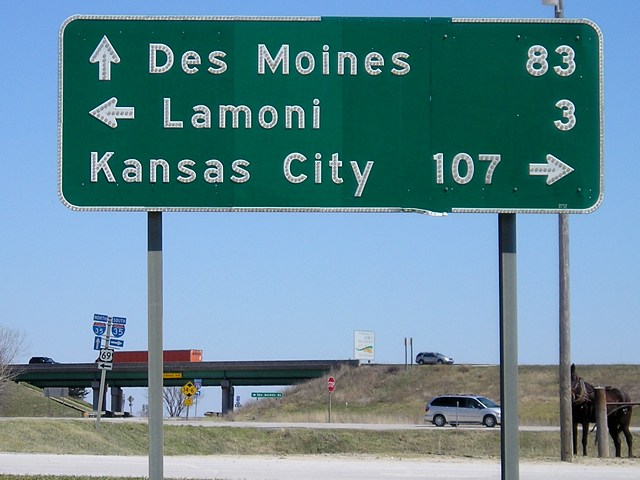
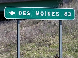
Facing east, but heading north, on 69 (4/16/07 and
1/10/12) Notice that the two Missouri signs give the distance to Des Moines as 83 miles, but the Iowa signs (see three pictures down) give the distance as 81 miles. But even that distance doesn't match Missouri's numbers. Near mile marker 100, a sign gives the distance as 85 miles, which adds up to about mile 71 in Iowa, barely into West Des Moines. That's the last distance given on 35 until 1 mile north of this exit, which gives the distance as a more accurate 80 miles. (So in a distance of 15 miles, you lose 5.) |
|
Facing east (4/18/08) Missouri added this sign at the far eastern side of the interchange, following the state's new standard for signing the "far side" of the interchange in either direction. (In Missouri, its counterpart would be facing west at the southbound ramp.) Surprisingly, Des Moines is used sparingly on these signs; Bethany and Cameron often appear instead for the northbound destination. |
|
Facing west (4/16/07) No signs on the Iowa side had changed as of April 2008, and they appeared to be the same (if replacemtn versions) in October 2015. |
|
Facing west (4/16/07) Someone has been using this Iowa-standard mileage sign for target practice. |
|
Facing west (4/16/07) |
|
Facing west (4/16/07) Whether by design or circumstance, these signs escaped the interchange genericization of the early 2010s, perhaps because the setup is a little more complicated with 69 intersecting the ramps. |
|
Facing west (4/16/07) |
 |
Facing west (1/10/12) Same shields, better light. |
|
Facing south on 35 (4/16/07 and 7/13/03) Right photo by Jason Hancock Look at how faded the (possibly original) right sign got in five years, below. |
|
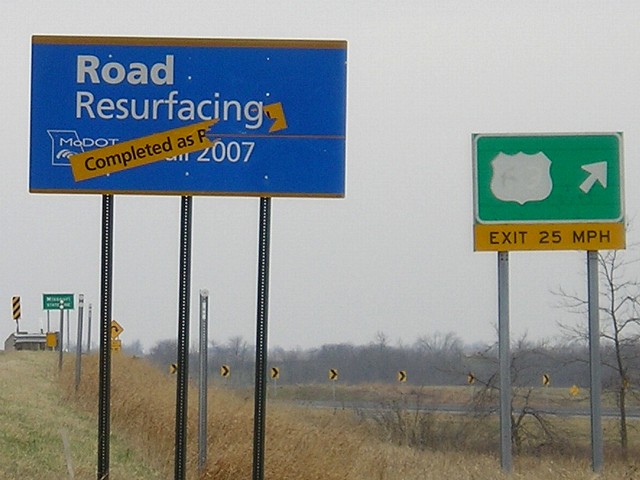
Facing south on 35 (4/6/08) MoDOT invades Iowa by putting this construction sign north of the border. Every project in Missouri has such a sign, and when completed has a strip placed across at a diagonal. Missouri resurfaced I-35 from Bethany north to the state line and built an actual welcome center on I-35 just to the south of here. It's a very nice one. Within two weeks of taking this picture, the US 69 exit BGS was replaced. |
 |
 Facing
south on 35 (5/5/09) Facing
south on 35 (5/5/09) |
|
Facing south (4/16/07) This is the I-35 sign for Missouri, just on the south side of the bridge, as seen from US 69. Another state-line sign in a highway font is on I-29 entering Missouri, although these have largely been dropped and replaced with special "Welcome To" state-line signs (see Iowa's at the bottom of this page). |
|
Facing north on the SB 35 offramp / Photo by Jason
Hancock (7/13/03) The exit from Iowa crosses into Missouri and loops back around to 69. The SUV is turning from Missouri onto the Iowa side of the road, but if it continues west it will turn back into Missouri. Straight ahead goes entirely into Iowa, with the welcome sign in the background. To the right would be getting back to northbound 35. |
|
Facing north on 35 (7/13/03) Photo by Jason Hancock This sign was replaced between April and October 2007. Southbound 69 is an option, but it is unlikely to be taken. |
|
Facing north on 35 (7/13/03) Photo by Jason Hancock |

|
Facing north on 35 (4/16/07) The new sign at this interchange has a larger exit tab, the addition of "IA" (compare to "Ia" above), and is right by a tenth-mile marker like those placed on all interstates in Missouri. This sign was replaced by that October, without "IA". |
 |
Facing north on 35 (5/23/10) The most recent 1-mile sign also omits "IA". |
|
Facing north on 35 (4/16/07) This is on the south side of the bridge, possibly technically in Missouri. You can see a large "Decatur County" sign to the left and one of the westbound shield assemblies on the right. |
Map created 10/21/06
Page created 11/14/06; last updated 1/13/17