
NORTH Iowa line: 9 miles S of
Worthington
MN (6 miles N of Allendorf), Osceola County
IA/Nobles County MN
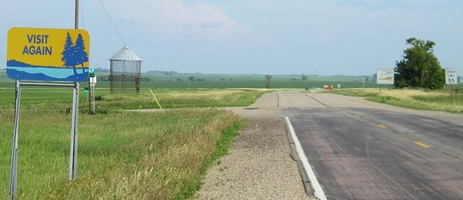
Facing (mostly) south on 59
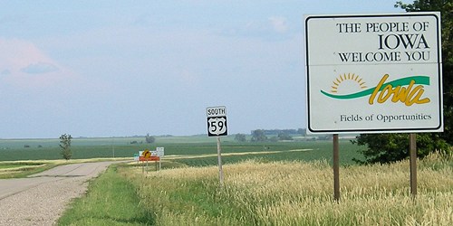
Facing south on 59
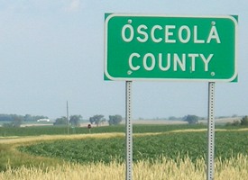
Facing south on 59
In northwestern Iowa, the new county road signs are being placed at the end of the standard state-line-signs lineup.
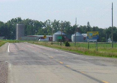
Facing north on 59
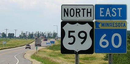
Facing north on 59, 5 miles north of the state line
Just ahead is a shared welcome center for 59 and 60. I-90 is about 7 miles ahead, Sanborn (the first incorporated town in Iowa on 59) 26 miles behind.
A little bit of this, a little bit of that...
US 59's route, with its sparse contingent of towns and only five county seats, was created from an assortment of state highways or state-maintained roads:
| State line to Ida Grove | IA 21 (designated 1920) |
| Ida Grove to Denison | An extension of IA 21, pre-empting the designation of an IA 150 from Denison northward to Schleswig in 1930 |
| Denison to US 34 east of Hastings | Part of IA 4 (designated 1920) |
| US 34 to Shenandoah | A new primary segment added to the primary system in spring 1931 and then made part of IA 4 in October 1931 |
| Shenandoah to state line | The southernmost segment of IA 48 (designated 1926), which became the southermost part of IA 4 in November 1931 |
In 1934, the "Highway 21 Association" lobbied the Highway Commission to label the entire road as IA 21, and then they got a better idea - call it US 73. (After all, it's between 71 and 75, isn't it?) Unfortunately, 73 was already assigned to a good chunk of western Nebraska, which put a damper on the idea. The wish to get a federal highway was granted - it was just a number that had no business being where it got put. But after putting US 51 and 61 so close to each other, I suppose there wasn't really a way to put it "in order".
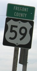
SOUTH Iowa line: 11 miles N of Tarkio MO (13 miles S of Shenandoah), Fremont County IA/Atchison County MO
Facing south on 59, a mile south of US 34
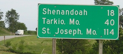
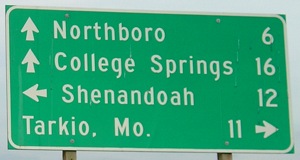
Because of the way 59 skirts the west edge of Shenandoah, this is the last southbound mileage sign in Iowa, and the first to mention St. Joseph.
Facing south on 59
This photo is taken from the last intersection in Iowa; the state line here is a fraction of a mile south of the section line.

Facing south on 59
Facing north on 59
Facing east on J64/old IA 333
This sign, a mile north of the state line, shows that the nearest city to 59's south state line is in Missouri. The absence of a city near either end of 59 helps explain why it was one of the later US highways in Iowa and why parts were not paved until the 1950s.
Pictures by me: Top five, 6/25/06; sixth-eleventh, 6/12/06 (yes, both ends in two weeks)
Page created 8/20/06; last updated 9/17/06