
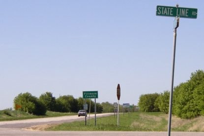
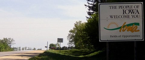
NORTH Iowa line: 16 mi. N of Decorah, Winneshiek County IA/Fillmore County MN
Facing north on 52 (all north end pictures 5/19/04)
Near the northeast corner of Iowa of Iowa on a cloudless May day, I crossed into Minnesota with my radio clearly picking up an FM station out of Marshalltown.
Facing north on 52
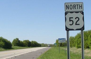
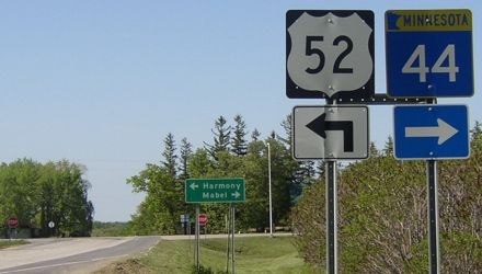
The standard Minnesota welcome signage is not on 52 until a mile north of the border, at its intersection with MN 44 (see below).
Facing south on 52
Facing south on 52
Facing south on 52
Surrounding area information: Jct. MN 44
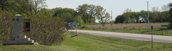
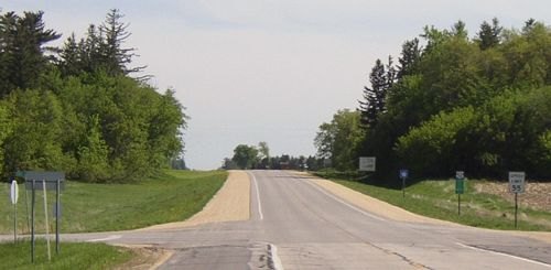
Facing south, one mile north of the border
"Decorah Ia 17" is the sign on the far right.
Facing north on 52
MN 44 used to continue to the left as well, then south a bit with MN 139, and then west three miles north of the border over to US 63.
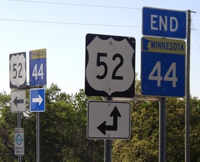
Signage on north side of intersection
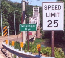
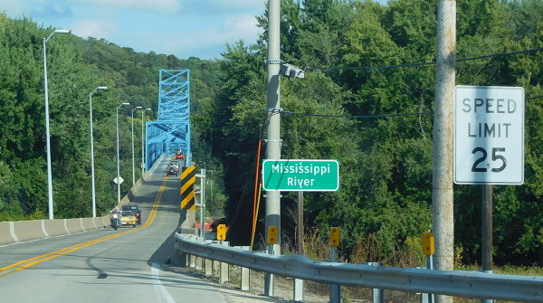
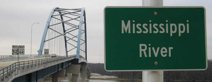
SOUTH state line: Mississippi River (Savanna-Sabula bridge), near Sabula, Jackson County IA/Carroll County IL
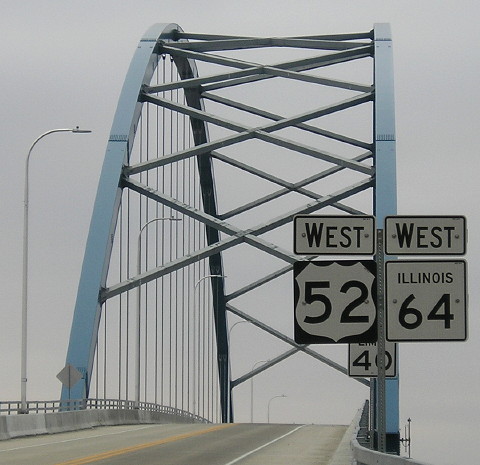
Facing south on 52, but heading west on 64 (4/18/06)
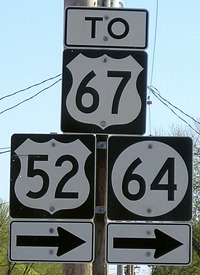
This is the first/last turn for 52 and 64 in Iowa, in downtown Sabula on the island, about a mile east of US 67's north end. North of this point, "southbound" 52 heads north - actually, north-northwest, and then north-northeast, before heading due east across the main channel of the Mississippi River.
Facing north, but heading south on 52 and east on 64 (4/18/06)
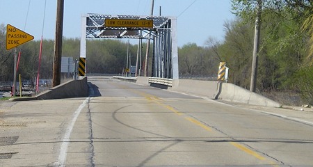
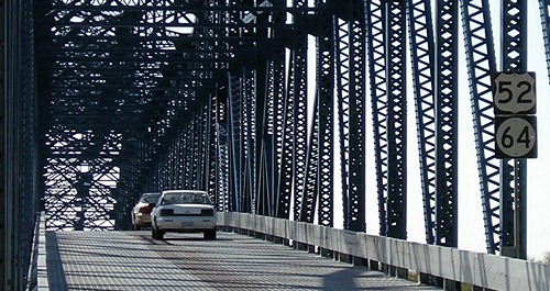
Notice how the pavement lines narrow significantly for this first bridge.
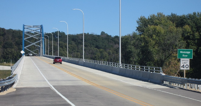
Facing north, but heading south on 52 and east on 64 (11/16/18)
Construction of this bridge took longer than expected, which meant the main bridge was idle for months shortly after opening.
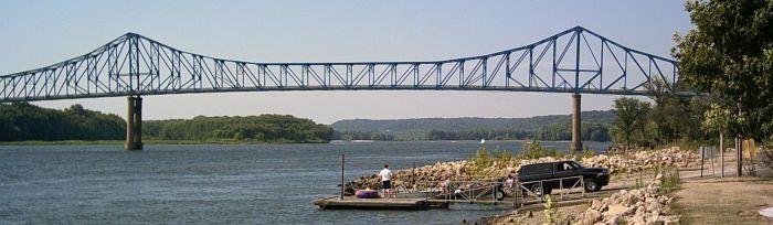
Facing east (June 2002 and 9/27/15)
Left photo by Jason Hancock
The key difference in these pictures is the painted bridge.
Facing east (9/23/18)
Photo by Jason Hancock
The new bridge is just downstream of the old one. To the left is a pullover area with a sign surprise.
Facing west (4/18/06)
These signs are about across from the pictures above from the old bridge. This is the first 67 sighting on 52.
Facing west (11/16/18)
Does this Clearview look off to you? Well, the state of Illinois made it, and also the new first-52 and first-64 signs in Iowa.
Looking north
Photo by Jason Hancock (7/31/05)
It's a really nice bridge, just with a really narrow deck. They don't make 'em like this anymore. This bridge crosses the main channel of the Mississippi, and as such, the state line is in the middle, about three miles away from Sabula. The US 52/IA 64 crossing is, by the slimmest of margins, the farthest east river crossing in Iowa, narrowly beating out the IA/IL 136 bridge at Clinton. The easternmost land in Iowa is about parallel to this bridge, but unless you're riding the Iowa, Chicago and Eastern Railroad, it's hard to get to. (The tracks themselves were originally Milwaukee Road [Chicago, Milwaukee, St. Paul and Pacific] tracks, going through Canadian Pacific and I&M Rail Link before the IC&E took over the IMRL in 2002.)
You look familiar...
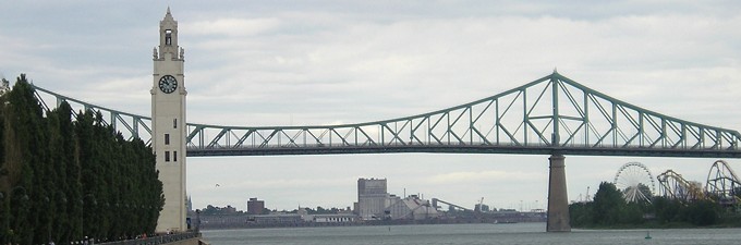
The Jacques Cartier Bridge over the St. Lawrence River in Montreal bears a striking resemblance to the Savanna-Sabula Bridge, possibly because they opened within three years of each other. (6/28/07)
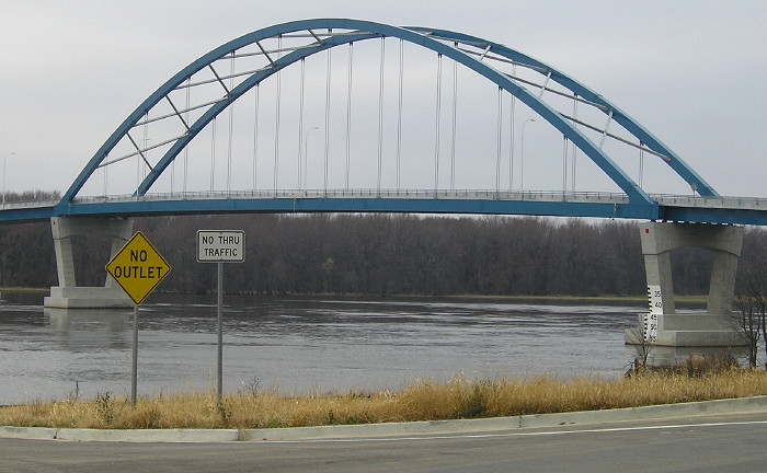
Facing northwest (11/16/18)
This is what we see now across the Mississippi, as seen from the Illinois side.
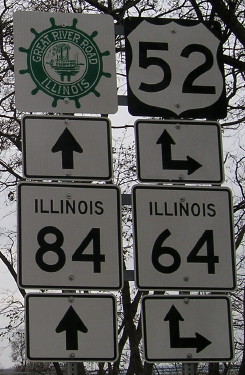
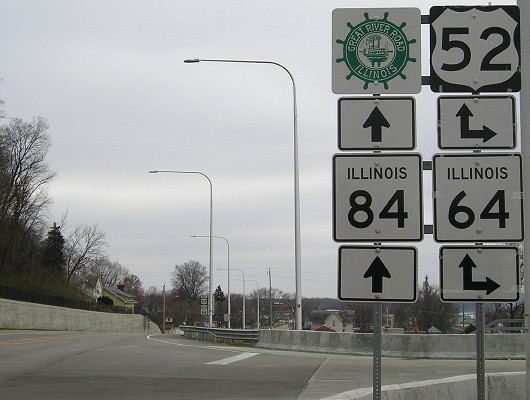
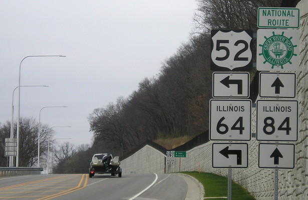
Facing east on 52/64 (4/18/06)
Immediately - and I mean immediately - as cars get off the bridge, drivers see these signs. The intersection's position didn't really change much.
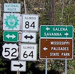
Closeup of signs at left / Southbound sign assembly (4/18/06)
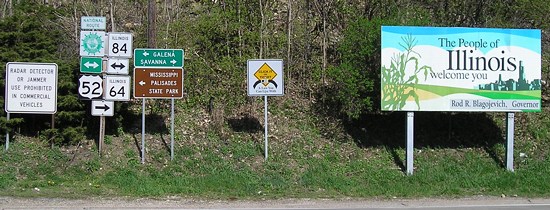
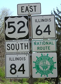
The Illinois Great River Road is the "National Route," while Iowa's side has an "American Byways" designation. Notice that US 52 is signed as east-west in Illinois. The 52/64/84 route becomes Chicago Avenue in Savanna, a street that really does go to Chicago.
Facing south on 84 (4/18/06)
The concrete barriers are the end of the bridge, and there's a plaque for the bridge visible at far right. The plaque is dated Dec. 1, 1932. The bridge was a toll bridge until the mid-'80s.
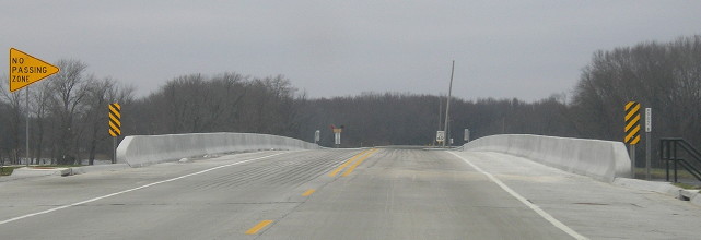
Facing south on 84, new bridge (11/16/18)
Facing south on 84, before and after the LGS (11/16/18)
Facing north on 84, but heading west on 52 and 64 (5/26/02)
Photo by Jason Hancock
Today, IA 64 does not go to Cedar Rapids, but it is the most direct route from Chicago. The route was originally created to do just that. Iowa and Illinois both agreed to use the number 64 to connect the two cities in December 1936. About two and a half years later, IA 64 was extended westward through the rest of Iowa to Council Bluffs, theoretically connecting to NE 64 in Omaha, but I don't know if 64 was actually signed with US 6/75 across the bridge into Nebraska.
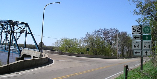
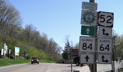
Facing northwest-ish (4/18/06)
This angle really shows how close the bridge is to the intersection. In the middle of this picture, just down and to the left of the sign in the middle, is a plaque about the bridge. There's also one on the superstructure (two below).
Facing north on 84 (11/16/18)
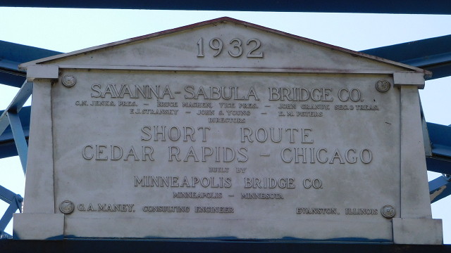
Overhead plaque at bridge (9/27/15)
Facing west (4/18/06)
Right after you turn on the bridge from the Illinois side, you see these two signs. The US 52 shield is in Series D, the default for Illinois but very uncommon for Iowa, and the other is obviously an IA 64 shield - an interesting mix, given that the state line is a bit ahead yet.
Marker near intersection (9/27/15)
Facing west on 52/64 (11/16/18)
Facing west on 52/64 (11/16/18)
Page created 7/15/06; last updated 4/17/19