
WEST Iowa line: Missouri River, Blair NE (10 mi. W of Missouri Valley), Harrison County IA/Washington County NE
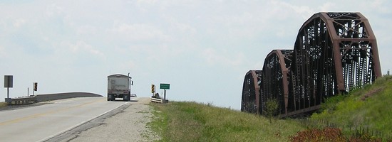
Facing west on 30 (6/4/07)
The old BNSF railroad bridge at right has been around for some time, and may have served as an inspiration for the original US 30 bridge here (see below).
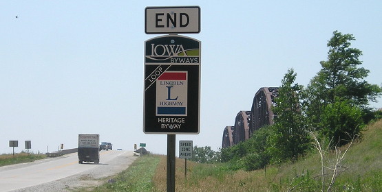
Facing west on 30 (7/12/13)
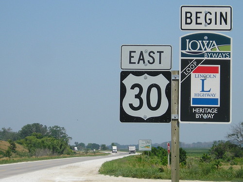
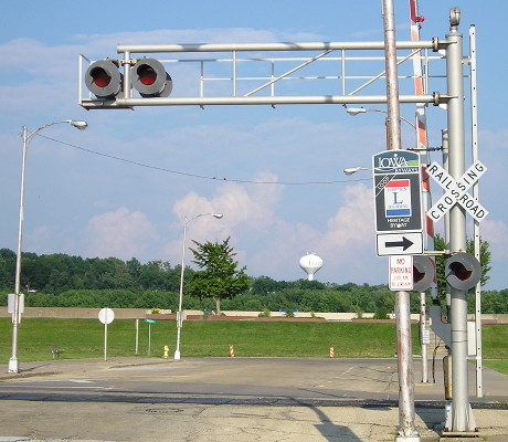
Now that the Lincoln Highway has been signed as a Heritage Byway, 30 between Missouri Valley and the state line is signed as a loop, although really it should be a spur.
Facing west on 30 (6/4/07)
A short distance ahead, 30 meets US 75 (old US 73).
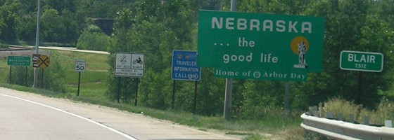
Facing east on 30 (7/29/07)

Facing east on 30 (first sign in Iowa) (6/4/07)
Facing east on 30 (7/12/13)
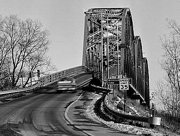
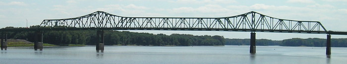
Old WEST Iowa line (December 1931-August 1991): Missouri River (Abraham Lincoln Memorial Bridge), Blair NE (10 mi. W of Missouri Valley), Harrison County IA/Washington County NE
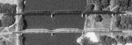
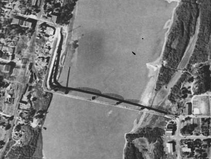
USDA/NRCS/MIT photo (1988)
Notice the parallelism between the railroad bridge at top and the highway bridge at bottom. Today's highway bridge is slightly north of the old bridge, which may explain why there is now a Mile Marker 1A east of the state line (which adds about 1/10 mile).
Facing west on 30 (November 1986)
Library of Congress photo
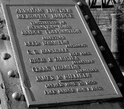
While this plaque states the bridge became free on Nov. 1, 1962, articles in the Missouri Valley newspaper indicate the tolls were actually lifted on Sept. 29. I do not know the reason for the discrepancy. This plaque is now at the Washington County Historical Museum in Fort Calhoun. Despite the name, this segment of US 30 was created after the Lincoln Highway era. However, at the time, "Lincoln Highway" was still in common use, and local legend is that the city of Blair snatched up the Lincoln Highway markers in eastern Nebraska one night and put them on the modern alignment. (Robert Irsay would be proud.)
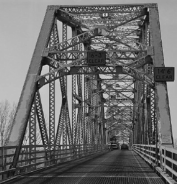
Facing west on 30 (November 1986)
Library of Congress photo
Facing east on 30 (November 1986)
Library of Congress photo
Old WEST Iowa line (October 16, 1926-December 1931): Missouri River (Ak-Sar-Ben Bridge) (with US 75), Council Bluffs IA/Omaha NE, Pottawattamie County IA/Douglas County NE
Highways on the Ak-Sar-Ben (Douglas Street) and I-480 bridges
| 1926-late 1931 |     |
| 1931-34 |     |
| 1934-39 |
 |
| 1939-41 |      |
| 1941-60 | |
| 1960-66 | |
| I-480 bridge opened Oct 21, 1966; Ak-Sar-Ben Bridge torn down 1968 | |
| 1966-69 |    |
| 1969-84 | |
| 1984-present | |
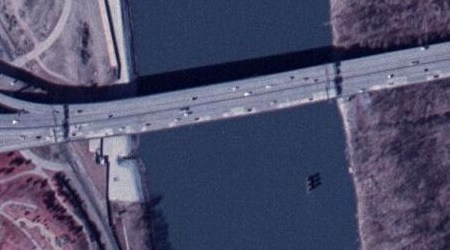
Aerial photo from ortho.gis.iastate.edu
The Ak-Sar-Ben/Douglas Street Bridge, originally built in 1888, was located very near the present I-480 bridge; a pier of the old bridge is still sitting in the river today (lower right).
Rerouting US 30 entirely away from Omaha/Council Bluffs was a big break from the Lincoln Highway era. The area held on with a secondary route designated US 30S (as a "south branch" of the route) that was originally supposed to last only as long as it took to pave the cutoff through Blair, but ended up as an "Alternate 30" that lasted for nearly 40 more years.
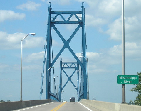
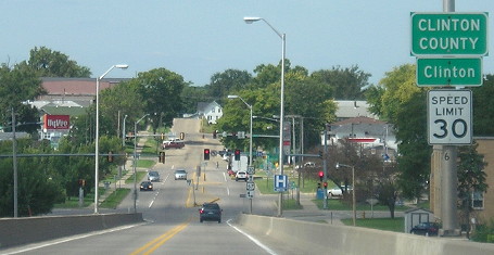
EAST Iowa line: Mississippi River (Gateway Bridge), Clinton County IA/Whiteside County IL
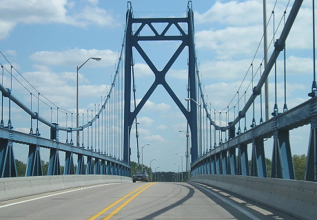
Facing east on 30 (9/1/09)
Facing east on 30 (9/1/09)
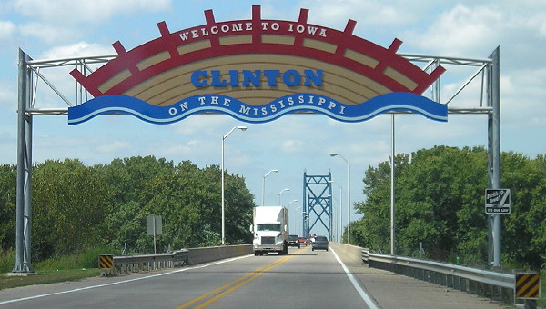
This "Welcome to Iowa" gantry is technically in Illinois. (Next up, Iowa secretly takes Rock Island.)
Facing west on 30 (9/1/09)
For additional photos of this bridge, including before its current paint job, see John Weeks' page.
Facing west on 30 (9/1/09)
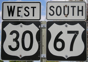
Right at the bottom of the hill is the intersection with US 67.
Facing north on 67, but heading west on 30, on South 3rd Street (9/1/09)

Facing north on 67, but heading east on 30 (9/1/09)
Facing south on 67, on South 4th Street (9/1/09)
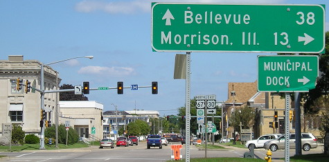
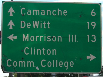
Facing west on 30 (9/1/09)
This pairing in front of the Clinton Public Library, seen at left three pictures up, is the first marker for westbound 30 in Iowa. It is also wrong. A one-way street setup near 30's bridge means that while this block of 8th Avenue IS westbound 30, it is NOT southbound 67. Highway 30 doesn't meet southbound 67 until the next block up, South 4th Street, so this should be "TO South 67." The entire 30/67 duplex through Clinton south of here was converted into a pair of one-ways in the 2010s with a new boulevard between in the Liberty Square project.
Old EAST Iowa line (October 16, 1926-June 30, 1956): Mississippi River (Lyons-Fulton Bridge), Clinton County IA/Whiteside County IL
USDA/NRCS/MIT photo (1930s)
This bridge, built in 1891, was the official connection for the Lincoln Highway from Illinois into Iowa. A second car bridge crossed the Mississippi to the south, near the present 30 bridge, but that was not part of any highway. Notice the hard right turn traffic had to make on the Iowa side. When 30 was rerouted, this bridge was part of a short US 30A from 1956 to 1967, when 30A was dropped and IA 136 was extended into Illinois, and stayed up until the beginning of 1975, when a new Lyons-Fulton bridge opened to the south. (Lyons was originally a separate town that later merged with Clinton.)
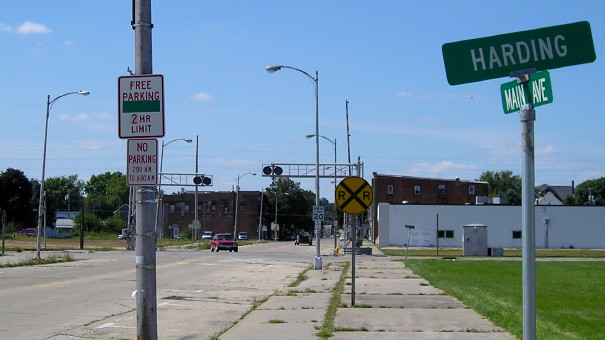
Facing east on Main Avenue (7/6/13)
This is where that north-south jog on the bridge would have started. Today, the street stops and the Lincoln Highway loop returns to US 67.
Facing west (9/1/09)
The berm is behind the camera. This is about where drivers would reach ground level.
Facing south (9/1/09)
This is a view of the current bridge from the area of the original bridge's entry into Iowa.
Page created 8/26/07; last updated 4/2/17