

WEST End: I-80 exit 298, Davenport, Scott County
Facing north, but heading west, on 74 (6/13/06)
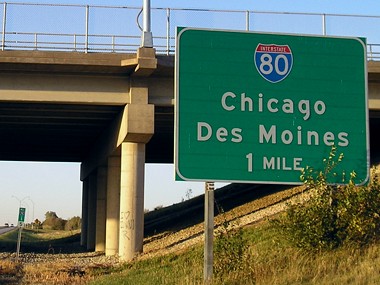
All I-80 interchanges in the Davenport area have Chicago and Des Moines as the control cities. Unlike I-380, there is no exit number marked, though it should be Exits 0B (Chicago) and 0A (Des Moines).
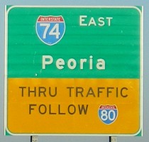
Facing north, but heading west, on 74 (6/13/06)
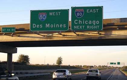
The lanes for I-74 default onto I-80 westbound, hence the lack of directions underneath.
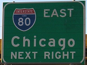
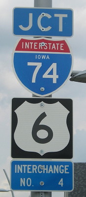
Closeup of sign at right (6/13/06)
This enlarged view shows the state name inside the I-80 shield, which probably means this is an older sign.
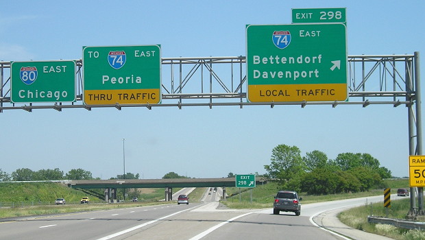
Facing north, but heading west, on 74 (6/13/06)
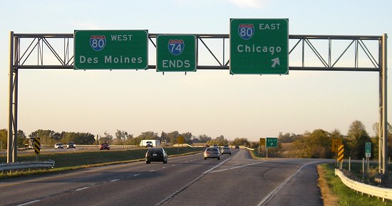
Facing east on 80 (6/13/06)
I-80 and I-74 meet twice in the Quad Cities, once here and once southeast of Moline. Instead of going through Davenport and Rock Island, Peoria traffic is told to follow I-80. This interchange is the only one in Iowa to reference Peoria.
Facing east on 80 (5/22/12)
The "Thru Traffic/Local Traffic" signage is a recent development, but the way to Peoria was a point of contention for decades. There were proposals to reroute I-74 on I-80 and I-80 on I-280, but these were rejected by both Iowa and AASHTO. (For more information, see Jason Hancock's Davenport highway history.) I think that I-74 should be put on I-280 and the north-south interstate through Davenport and Rock Island changed to I-174. It would take more 74 traffic off downtown, and I-280's redundant multiplex with 74 would be gone. (Note: Davenport should be on top of Bettendorf on that sign, since this interchange is inside Davenport's city limits and crosses into Bettendorf later.)
Thing that makes you go "Hmm": In 2006 the ramp speed was signed at 55 mph, which if you think about it is a very high cautionary speed.
EAST Iowa line: Mississippi River (with US 6), Bettendorf IA/Moline IL, Scott County IA/Rock Island County IL
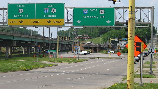
Facing south, but heading east, on 74/6 (5/22/12)
Things are going to start changing here in a big way... eventually. Little by little, steps are being made to replace the twin bridges across the Mississippi River, which might happen at the beginning of the next decade. US 6 runs with I-74 for about half the latter's length in Iowa, joining at Spruce Hills Drive instead of following old Kimberly Road just to the west. Kimberly Road runs into 13th/14th streets, which run parallel to the interstate near the river.
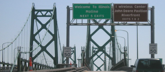
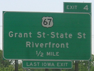
Facing south, but heading east, on 74/6 (5/22/12)
The kerning on these signs can't be helped, but that and the lowercase "i wireless" make me stabby.
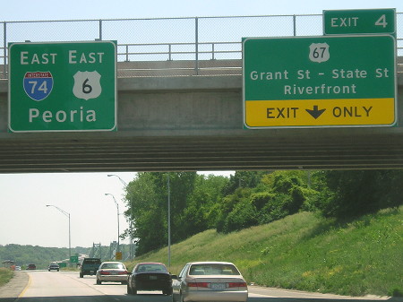
Facing south, but heading east, on 74/6 (5/22/12)
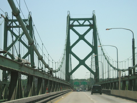
Facing north, but heading west, on 74/6 (4/18/06)
This bridge is the original 1935 bridge first used by US 6. The eastbound (southbound) bridge was built in 1959. As you can see, the bridge is narrow and not up to interstate standards.
Facing north, but heading west, on 74/6 (6/1/13)
Notice how the offramp flows directly into the street, and also that we're still on the bridge approach from the river.
The bridge approaches were rebuilt in 1974. The Iowa DOT compiled a detailed historic study of the bridge in 2012 (PDF).
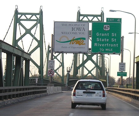
Facing north on the offramp/14th Street (6/8/15)
The southbound (eastbound) mainline of the new I-74 bridge will go right over this position. There will be no access to Kimberly Road from the exit. Kimberly Road will bend around and intersect Grant Street (US 67, changed to two-way for five blocks) on the west side of I-74.
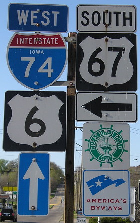
Facing north on the offramp/14th Street (4/18/06)
Iowa signage at its finest, including a somewhat-rare state-name I-74 shield.
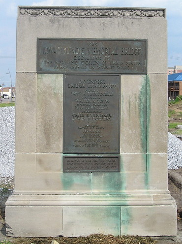
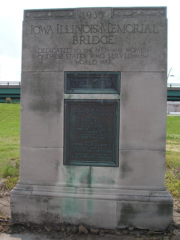
The 1935 marker for the original bridge was the last element standing in this area in summer 2015. It is going to be relocated and preserved.
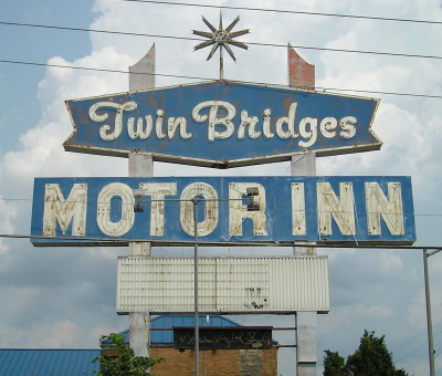
The Twin Bridges Motor Inn is the first/last property remaining on Grant Street east of the construction area for the new bridge. (6/8/15)
Facing east, but heading north, on US 67 (6/8/15)
Page created 12/31/06; last updated 4/12/16