
(July 1, 1920-December 28, 2017)
| IA 98 endpoint history | |||
| FROM | TO | NORTH | SOUTH |
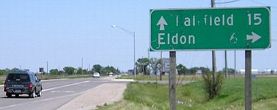
| 7/1/20 | 1935 | IA 8 (I), later US 34 | Eldon (1920 pop. 2091, 2010 pop. 927) |
| 1935 | 1942 | Selma | |
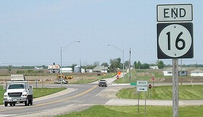
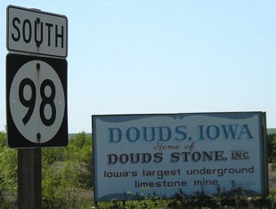
| 1942 | 1950 | IA 16 | Douds (2010 CDP pop. 152) |
| 1950 | 12/28/17 | Leando (2010 CDP pop. 115) | |
- In 1920, they knew it as: A connection between Eldon and the Blue Grass Road
- We know it as: The northwesternmost part of IA 16
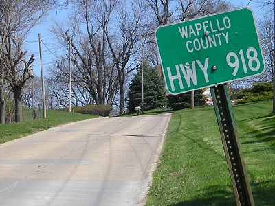
- Let's get granular: The only difference from present IA 16 in that area is the mile coming into Eldon, which used 9th Street and the road past the Eldon Cemetery that never got a real name. It's called "Highway 918" from the secret designation it had in 1984, when it was bypassed.
1920 NORTH End: IA 8, now IA 16 at old US 34, Wapello County
Facing north on 98 (5/10/05)
The north end of IA 98 became the west end of IA 16 after 16 took over most of 98's route in 1942, including all its original route. That means this intersection was the endpoint of one of two routes for 85 years.
Facing east on then-IA 8 (5/10/05)
The road between Agency and Batavia didn't change until the US 34 four-lane in the 21st century.
1920 SOUTH End: Eldon, Wapello County
Here you can see what could be, and likely is, 1929 pavement at the city limits of Eldon and thus the original end of 98. (4/13/16)
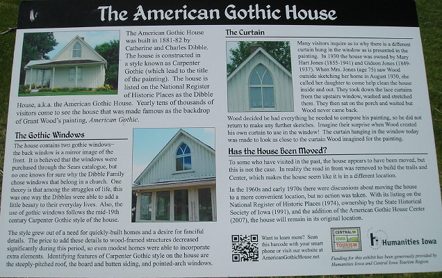
I can't not mention American Gothic with something related to Eldon, right? (4/13/16)

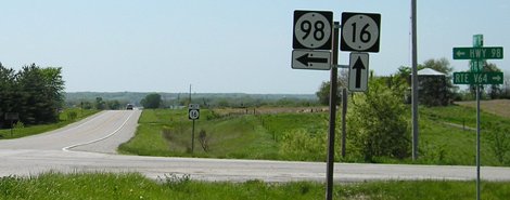
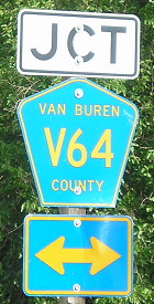
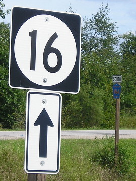
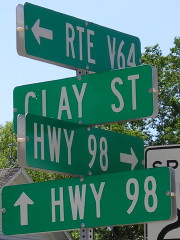
NORTH End: Stop sign, IA 16 and V64, Van Buren County
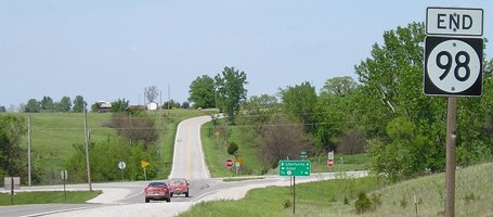
Facing north on 98 (5/10/05)
Facing north on 98 (5/10/05)
Replacement LGS (8/24/19)
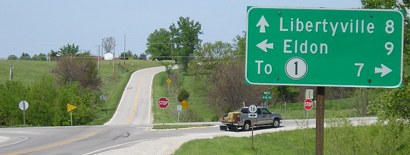
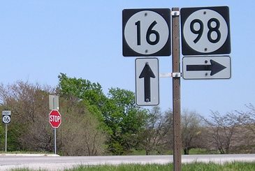
Facing west on 16 (5/10/05)
V64 is not signed in any direction, nor are there any signs for 16 and 98 on V64.
Facing west on 16 (5/10/05)
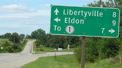
Facing east on 16 (3/16/02)
Photo by Jason Hancock
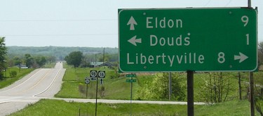
Facing east on 16 (5/10/05 and 8/24/19)
Facing southwest (5/10/05)
Facing southeast, with the same pole as above to right (8/24/19)
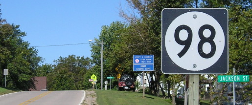
SOUTH End: Clay St., Leando, Van Buren County
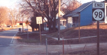
Facing southeast, but heading south, on 98 (3/16/02)
Photo by Jason Hancock
From what I could tell, IA 98 is the only paved road in Leando and Douds. The latter disincorporated sometime in the 1960s while the former has been a non-town for longer than that.
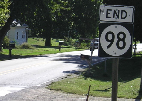
Slightly different angle (9/8/10)
Facing northwest (5/10/05)
Generally, while no Iowan living north of IA 92 would call a county road a "Route" ("root"), Van Buren County uses the term on its rural signs.
Facing northwest, but heading north, on 98 (9/8/10)
Why did IA 98 live?
On July 1, 2003, every state spur died - except for one. Emerging unscathed from the purge was IA 98, a less-than-2-mile road. Correspondence from the DOT informed me that 98, IA 316 south of Runnells, and IA 930 in Boone County were classified as "access routes." Two of those end shortly after crossing the Des Moines River. Because 316 is the only DOT-controlled bridge between US 65 and IA 14, and 98 the only one between US 63 and IA 1, they may have been kept on the books because of their bridges. There may be precedent: IA 411, a short-lived highway, went north from US 6 in Marengo just across the Iowa River, perhaps existing only for construction of a bridge.
Or... you could consider IA 98 to be the state's only highway that existed to serve a school, Douds Elementary (which is in Leando), right at the corner where 98 turns to cross the Des Moines River.
The importance of IA 98 for its bridge was confirmed in the 2010s, when the state went into negotiations with Van Buren County. According to two 2014 articles in the Ottumwa Courier, the replacement bridge cost $6 million and the county was given $2.3 million for the rest of the road. Construction was delayed because of flooding. But now there's a shiny new bridge from 2017 that was built right beside one from 1954 that replaced one from 1898, each a hair more upstream from the previous.
Page created 5/12/02; last updated 11/3/11 3/31/20