
| IA 85 endpoint history | |||
| FROM | TO | NORTH/WEST | SOUTH/EAST |
| 7/1/20 | 1923 | What Cheer | IA 2 (138th St. at IA 21) |
| 1923 | 1926 | IA 2 (138th St. at IA 92) | |
| 1926 | 1/8/31 | IA 2 (IA 21 at IA 92) | |
| 1/8/31 | 1936 | IA 59 (Main at 4th), Montezuma | |
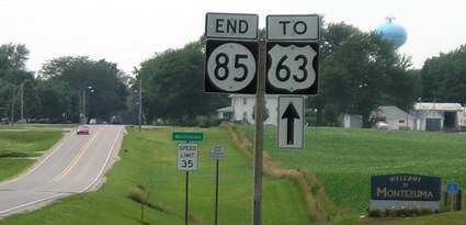
| 1936 | 6/7/39 | US 63 (Main at Front), Montezuma |
|
| 6/7/39 | 1955? | IA 21 (Main at Grover [?], Deep River) | |
| 1955? | 1962 | IA 21 (SE corner Deep River) | |
| 1962 | 8/22/94 | IA 21 east of Deep River | |
| 8/22/94 | Present | ECL Montezuma | |
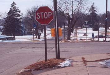
Old WEST End: Stop sign, US 63, Montezuma, Poweshiek County
Facing west on 85 (Winter 2002 and 10/18/20)
Left photo by Jason Hancock
Facing south on 63 (Winter 2002)
Photo by Jason Hancock
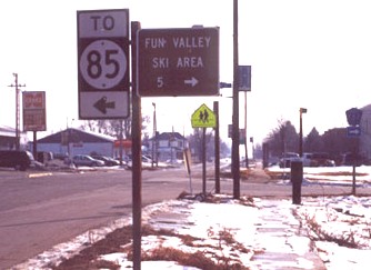
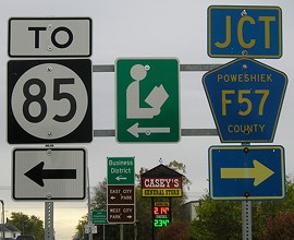
The "To 85" sign is all one piece here, but in the other direction it's a normal assembly. Highway 85 has not ended at 63 since 1994, which kind of makes it a weird case because it's not a spur yet does not have both ends at a non-county highway.
Facing south on 63 (10/18/20)
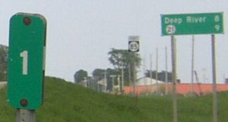
I'll call these mini green signs, because they're not full size. They are in all-caps for legibility reasons given their small size. I have seen these at one other intersection, IA 4 and IA 9 in Estherville. I wonder if we could get these at the west end of IA 8.
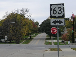
Facing north on 63 (5/13/03)
In the deep background are the F57 shield (lower left), 63 with double arrow seen in the top photo (lower center), and the back of the southbound signage (lower right).
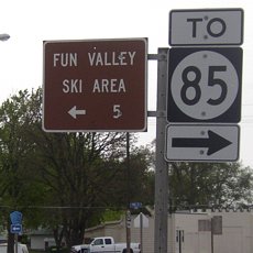
Unfortunately, Fun Valley isn't so fun anymore, because the ski area has been discontinued.
Facing north on 63 (10/18/20)
Facing north on 63 (10/18/20)
WEST End: City limits of Montezuma, Poweshiek County
Facing west on 85 (7/8/05)
Facing east on 85, right across from the above picture (5/13/03)
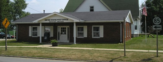
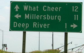
Along the route: Deep River
Facing south, but heading east, on 85 (7/8/05)

Closeup
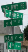
Facing south (7/8/05)
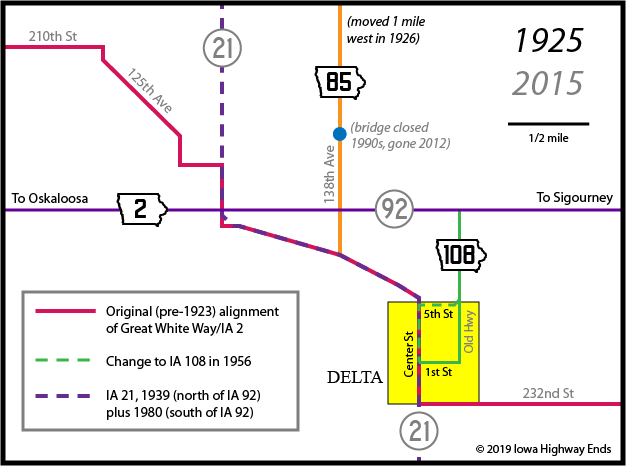
As late as the early 1960s, this location was near IA 21 (below). Now, 85 comes in town from the northwest and leaves to the east, turning at this intersection.
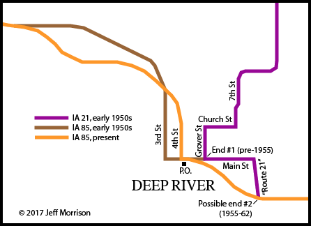
The last major project in Iowa that involved paving a route combined with a substantial realignment was IA 21 between Deep River and present US 6. The above lines in town are based on a 1957 county map with help from the Iowa GIS server. Multiple sources (or at least the one source that everyone is using) tag a road on the east side of Deep River with the name "Route 21". If you think about it, that's a bit odd because A) this route stopped being 21 decades before modern maps and B) "route" is usually not used in this sense this far north in Iowa.
Additional records put online in the mid-2010s show that the entire route of IA 85 was paved in 1955. The project included the segment from Deep River to present-day IA 21 (the intersection below), but at the time, the road running east from "Route 21" to that intersection was part of IA 21. The paving included a change in alignment in Deep River and construction of a curve. In 1954, the official description of 85 was changed to include running "southeasterly on an unnamed street." This meant the end moved from Main Street at Grover Street (the portion running west was changed slightly with construction) to the marked intersection southeast of town. It was there for less than a decade until the IA 21 straightening project moved 85's east end to its current location.
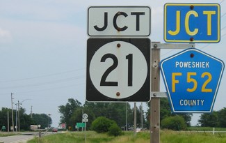
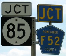
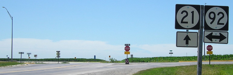
EAST End: Stop sign, IA 21 and F52, Poweshiek County
Facing east on 85 (7/8/05)
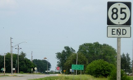
Facing east on 85 (7/8/05)
Okay, so upside-down signage isn't relegated to western Iowa.
Facing east on 85 (7/8/05)
Facing south on 21 (7/8/05)
Facing south on 21 (7/8/05)
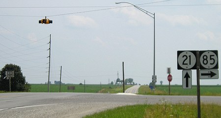
Facing south on 21 (7/8/05)
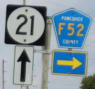
Facing north on 21 (7/8/05)
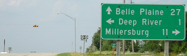
Facing north on 21 (7/8/05)

- In 1920, they knew it as: A connection between What Cheer and the Great White Way/White Pole Road/I.O.A. Short Line, or a fragment of the St. Paul and St. Louis Short Line (Huebinger)
- We know it as: IA 21 between What Cheer and IA 92
- Let's get granular: 138th Avenue, 195th Street, and IA 21
1920 NORTH End: What Cheer, Poweshiek County
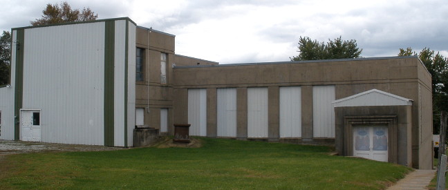
The Art Deco-style gym addition, its windows sealed by siding, is all that remains of the school in What Cheer (1920 pop. 1626, 2010 pop. 646). (10/16/09)
1920s SOUTH End (1): IA 2, now 138th Avenue at IA 21, Keokuk
County
1920s SOUTH End (2): IA 2, now IA 21 at IA 92, Keokuk County
On all the state-level maps, you could think that the original east-west road between Oskaloosa and Harper was substantially identical to IA 92 today. Turns out that is not the case!
Twelve and one-half miles
in distance has been saved, twelve railroad grade crossings and
thirty-nine right angle turns eliminated by primary road relocations on
the Oskaloosa-Columbus Junction road. This is a portion of the White
Pole Road, Route No. 2. The mileage before the changes was 83.31 between
the two towns. Under the new route it will be 70.89, with two crossings
and but ten right angle turns.
Iowa Highway Commission Service
Bulletin, December 1923
The map with the story focused on the segment between Rose Hill and Sigourney, and that's what I used for the map above. Details are sketchy for the rest of the route relocations. Although I am sure the straightening south of Harper/Keota is part of this, the Cotter-Columbus Junction segment has a much later change date on the 1914 county map.
Facing south on 85, now IA 21 (7/15/19)
This was the south end of IA 85 for 10 years until the north-south part was superseded by IA 21.
Page created 4/25/02; last updated 12/31/20