

- In 1920, they knew it as: Winfield's connection to the Red Ball Route
- We know it as: About 6 miles of modern IA 78, and old IA 249 into Winfield
- Related routes:
- IA 249, the stub to Winfield left when 78 was extended east
- IA 304, the stub to Ollie nearly completely superseded by 78 when it was extended west to the intersection below
| IA 78 endpoint history | |||
| FROM | TO | WEST | EAST |
| 7/1/20 | 3/19/30 | IA 40, later US 161 (Old US 218) |
Winfield |
| 3/19/30 | 12/1/30 | US 61 | |
| 12/1/30 | 11/9/48 | Wayland | |
| 11/9/48 | 2026? | IA 149 | US 61, before new four-lane to east |
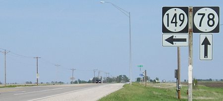
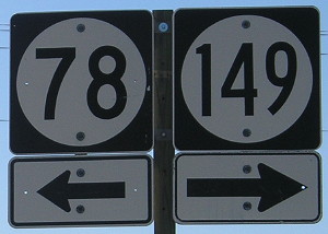
WEST End: T intersection, IA 149, Keokuk County
Facing west on 78 (4/13/16)
Why doesn't 78 continue? Because 149 was here first, that's why. It wasn't until 1948 that 78 made it this far west, but 149 (and IA 13 before that) had been here since 1926. Now, 149 has been extended down to Ottumwa, making it unrealistic 78 will be extended. The layout here is also that of US 63 and IA 96, where the road on the "vertical bar" of the T intersection continues on the "crossbar", only this time the vertical bar heads north.
Facing west on 78 (5/10/05)
Facing west on 78 (4/13/16)
Facing east, but heading north, on 149 (5/10/05)
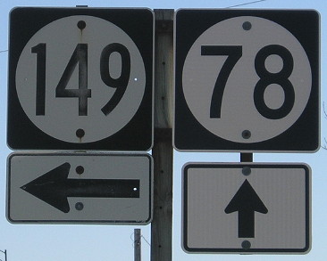
Facing east, but heading north, on 149 (4/13/16)
This is a closeup of the LGS, which hadn't changed, and the sign assembly, which only differs on the up arrow.
Facing south on 149 (5/10/05)
Facing south on 149 (5/10/05)
Facing south on 149 (4/13/16)
1920 WEST End: IA 40, later US 161 and then US 218, near Olds, Henry County
Facing south on 218 (10/18/16)
This photo is NOT at the place where 78 first ended, but its modern equivalent about a quarter-mile east. When the Avenue of the Saints was built in the Olds area, 78 remained on 218's old alignment. This was probably done for traffic flow purposes: Rather than having two places with a high incidence of left turns, there's just one major intersection and 78 goes straight through it. The state did pave the short connector north of Olds for traffic to access 78.
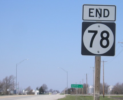
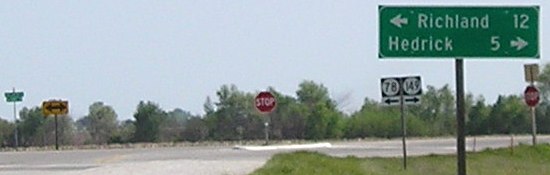
1920 EAST End: Winfield, Henry County
Facing north, but heading west, on 78 (6/1/15)
In 1930, right before 78 was extended eastward, Highway Commission documents appear to have the route end at the railroad tracks on the south side of town. That would mean the endpoint was in this picture, in the area past where the north-south pavement changes.
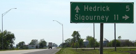
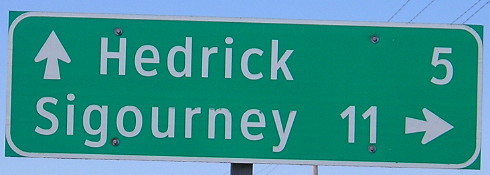
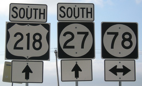
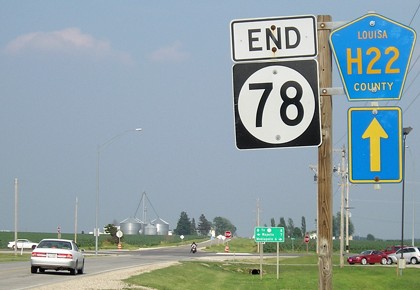
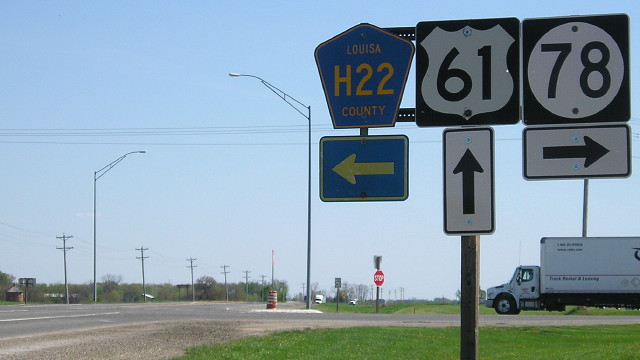
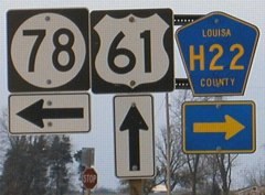
EAST End: Stop sign, US 61 and H22, Louisa County
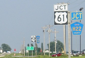
Facing east on 78 (6/16/06)
The location of 78's east end will move eastward when US 61 is upgraded to four lanes.
Facing east on 78 (6/16/06)

Facing east on 78 (10/29/04 and 5/7/18)
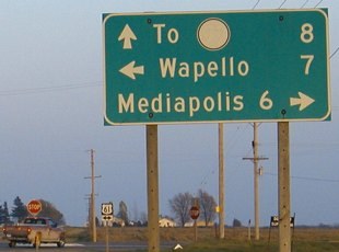
Look very closely (or look below) for the peeled-off pair of nines on the left LGS. When IA 99 was decommissioned, two of the directions' LGSs peeled away the numbers; southbound 61 had the entire line peeled off. This is different from changed LGSs on IA 330 or US 30 in Marshall County; for those, lines were covered up with a strip of wood.
Facing south on 61 (6/22/02)
Photo by Jason Hancock
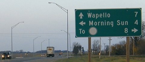
In 2004: This is the LGS that had its entire "To 99" line peeled off. Oakville would be an acceptable substitution for an eastward destination. This intersection is (was) the location of the village of Newport, which only lives today by a small notation on the county map and the "Newport Junction Ampride" there in the background. The store sells Sterzing's potato chips, generally available within a 70-mile radius of Burlington, although they may show up elsewhere if you're lucky.
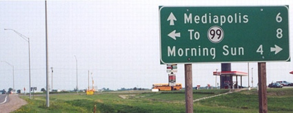
In 2018: This is the only surviving older LGS, but I couldn't get a photo because of heavy traffic. The Ampride became a Casey's sometime after fall 2013. Sterzing's has a much larger distribution radius now. This intersection will be left behind when the four-lane 61 is built, with an interchange just to the east.
Facing south on 61 (5/7/18)
The Des Moines County line is a mile south of here.
Facing north on 61 (10/29/04)
These pictures were taken during my first trip to Louisa and Des Moines counties.

Facing north on 61 (5/7/17)
Page created 3/22/02; last updated 8/5/18