

(July 1, 1920-July 1, 2003)
| IA 77 endpoint history | |||
| FROM | TO | NORTH | SOUTH |
| 7/1/20 | 8/22/22 | Keota (W15 at Broadway) |
IA 8 (IA 1 at Business US 34/Burlington Ave., Fairfield) |
| 8/22/22 | 4/21/24 | IA 2 (now NB W15 at IA 92) | |
| 4/21/24 | 1/6/25 | Keota (Broadway at Hamilton?) | |
| 1/6/25 | 1941 |
110th St at IA 11 (Jefferson Co.) | |
| 1941 | sometime btwn. 11/9/48- 1/23/63 |
IA 78 at IA 1 | |
| 195x or 196x | 7/29/80 | Keota (Broadway at Hamilton) | IA 78 (south side of Richland) |
| 7/29/80 | 7/1/03 | W15 at IA 92 | |
- In 1920, they knew it as: The southern half or so of the Fairfield, Keota, and Cedar Rapids Road (Huebinger), and this part was incorporated into the Pershing Way (registered August 14, 1919) (2 counties)
- We know it as: IA 1, a couple miles of IA 78 (equivalent), and County Road W15, parts of which carried the 77 designation until 1980 and 2003
- Let's get granular: IA 1, 110th Street, Jasmine Avenue, W15, unknown street going east for two blocks to Washington Street in Richland (Main?), 320th Avenue, W15, [vacated bridge SE of current one over Skunk River], old IA 77, first meeting IA 2 where 77 turned east on Broadway.
- At the intersection with G38 is an extinct map dot. "Talleyrand was once a thriving community, but much of it was moved to Keota, giving that town a boost. At one time Talleyrand boasted a drug store, hardware store, two blacksmith shops, a cheese factory, hotel, livery barn, two general stores, a butcher shop, shoe shop, and three churches. In the old days, it is said Talleyrand had at least one murder and numerous woundings as the result of brawls." (Cedar Rapids Gazette, July 7, 1963)
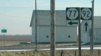
NORTH End: Hamilton St., Keota, Keokuk County
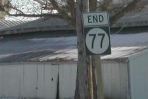
Facing east, but heading north, on 77 (1/20/02)
Photo by Neil Bratney
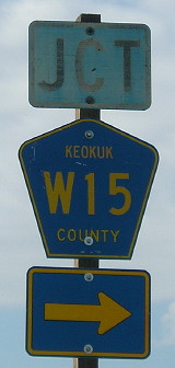
The observant may notice that on the Iowa map, 77 appears to continue east from Keota to the Washington County line. It's really a few blocks off, but close. But when you get to the line, you reach the most flagrant violator of the Iowa county road numbering system. For three miles, between IA 92 and G26, one mile east of W15, the north-south county road is labeled V15! Since V61 is five miles west, and W38 six miles east, this designation is completely odd and out of place. The correct number would be W16.
Facing west, but heading south, on 77 (1/20/02)
Photo by Neil Bratney
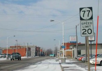
IA 77's east-west portion is probably due to the fact that Keota's main street runs east and west. This is the first sign heading "south".
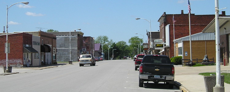
Downtown Keota (about half a block west of above picture) (5/10/12)
A funny thing happened to IA 77 on the way to decommissioning. In the 1980 route log, the last distance is "Davis St to Green St", in the 2001 log it's "Davis St to Hamilton St", yet both are .30 miles with a city distance of .87 miles. The online route log sets the end as Broadway at Hamilton no later than January 13, 1960.
1920 NORTH End (?): IA 2, now W15 at Broadway Ave., Keota, Keokuk County
IA 2, later IA 92, could not have gone straight east from Keota to near West Chester as the oldest maps show; West Fork Crooked Creek is in the way. There's also no way IA 2 would've skipped downtown Keota. I wouldn't be surprised if the official 77 designation went eastward to downtown.
Facing north on 77 (5/10/12)
This sign shows where 77 turned east, before the north-south road intersects G26 to Harper. Originally, 77's independent route would have ended here, with IA 2 ahead and right. In 1922, a straightening project or preparation for one made 2 a straight shot through Keokuk County. Keota lobbied to get its highway back, and 77 became a hybrid regular/stub route.
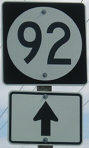
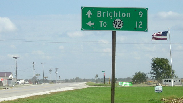
SOUTH End (1980-03)/NORTH End (1922-24): Stop sign, IA 92 and W15, originally IA 2, Keokuk County
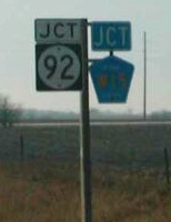
Facing south on 77 (1/20/02)
Photo by Neil Bratney
Neil reports that there is no "End"sign. Until 1980, 77 met the next road up (78) 11 miles south of here, but someone got carried away; the 1981 map mysteriously removed the highway entirely! This is one of the few, if not the only, routes that started out as a regular highway and ended as a simple spur.
Facing east on 92 (10/3/18)
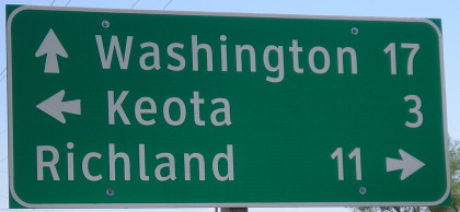
Facing east on 92 (5/10/12 and 10/3/18)
The Clearview sign at left was a straight-up replacement for the old one, but since LGSs at county roads do not include the ahead destination, the newest one doesn't include Washington.
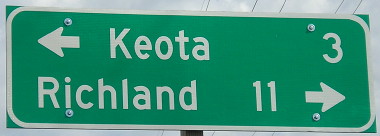
Facing east on 92 (1/20/02 and 10/3/18)
Photo by Neil Bratney
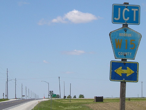
In the same direction in 2002, there weren't any signs for W15.
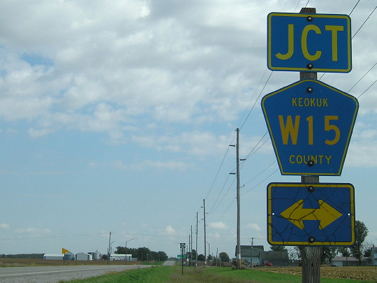
Facing west on 92 (5/10/12)
The double arrow likely predated 77's decommissioning.
Facing west on 92 (5/10/12)
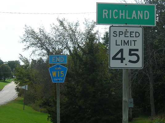
Old SOUTH End: Stop sign, IA 78, Richland, Keokuk County
Facing south on 77 (10/3/18)
Richland took over its portion of 77 about 10 days after the transfer of jurisdiction to Keokuk County, so this wasn't exactly an end, but here is the city limits sign and the last W15 marker southbound.
Facing south on 77 (10/3/18)
Forty years after 77 between 78 and 92 was eliminated from the Iowa highway system, and 15 years after 77 was killed off entirely, it still appears on Google Maps.
Facing west on 78 (10/3/18)
Facing east on 78 (10/3/18)
1920 SOUTH End (2): IA 11, now 110th Street at IA 1, Jefferson County
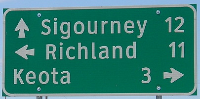
From Richland, 77 passed by the extinct map dot of Woolson, marked only today by a Friends Church (Quakers), and then intersected the road coming north from Fairfield. That road, IA 11, went east from this intersection to Pleasant Plain.
1920 SOUTH End (1): IA 8, now IA 1/2nd St. at US 34/Burlington Ave., Fairfield, Jefferson County
Facing east on 8, now heading east on Business 34 (10/21/05)
IA 77 was redundantly multiplexed with IA 11 to Fairfield until 1925. In the view here, it would have begun to the left.
Last seen: 2003

Page created 3/22/02; last updated 1/28/21