 and
and
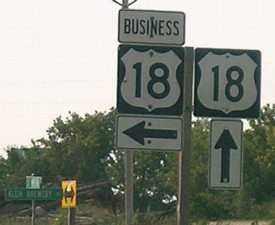
 BUSINESS
(For Business 18, scroll down to 76's old south end)
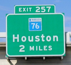
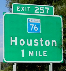
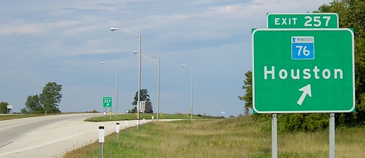
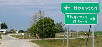
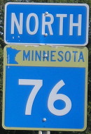
NORTH End of MN 76: I-90 exit 257, Winona County MN
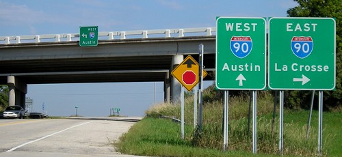
Facing north on 76 (all north end pictures 9/8/06)
Facing west on 90
There was only one 2-mile advance BGS for a non-cloverleaf interchange on I-90 east of Albert Lea, and this was it.
Facing west on 90
Facing west on offramp
A disadvantage of Minnesota's signing style is that you don't know how far it is to towns from intersections or interchanges.
Another sign at offramp
While 76 is generally considered to end at 90, and the sign points as such, the county road is very close:
Facing west on County Road 12
The onramp for 76 to westbound 90 can be seen at left.
Facing south on 76
The sign at right is the same one seen in the offramp picture.
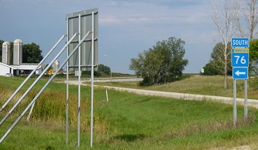
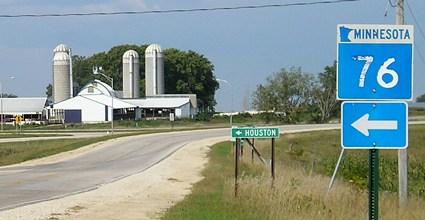
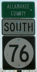
NORTH End of 76: Minnesota state line, Eitzen MN, Allamakee County IA/Houston County MN
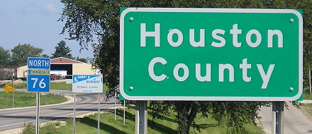
Facing north on 76 (9/2/09)
Facing north on 76 (9/2/09)
This entrance into Minnesota holds special significance for me because this was my first entrance into Minnesota. It was a side trip while dropping my sister off at Camp Tahigwa, less than five miles from the state line.
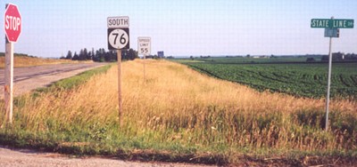
Facing south on 76 (7/14/02 and 9/2/09)
Left photo by Jason Hancock
The gravel road is on the state line (can you tell?). Once you travel two miles south 76 becomes one of the most twisting and scenic roads in Iowa (and, after being re-asphalted in 2009, a genuine joy to drive). Allamakee County is part of the Driftless Area, the part of the state least touched by glaciers.
Along the route: In Waukon
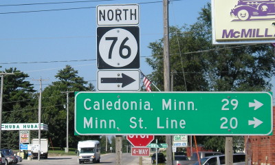
Facing west on 9, but north on 76 (9/2/09)
"Minnesota State Line" is odd enough in itself as a listing, but in a double quirk, it's BELOW a location farther away.

Facing north on 76, but east on 9 (9/2/09)
In downtown Waukon, at the county's only stoplight, is this weird intersection. While IA 76 (even as IA 13 in the 1920s-60s) came north to here and then turned left, a realignment of IA 9 southwest of Waukon means that continuing on 9 means continuing "ahead" onto the offset street.
Waukon is closer to Madison and St. Paul than Des Moines. It's only an hour closer to Keokuk than Duluth. And Ironwood, Michigan, at the western edge of the Upper Peninsula, is just over 300 miles away but Sidney, Iowa, the state's southwesternmost county seat, is 360!
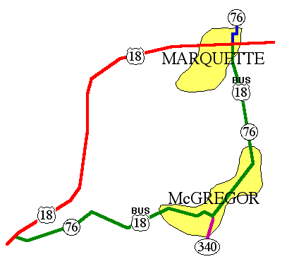
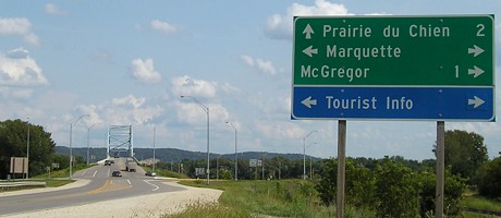
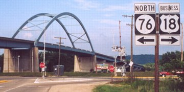
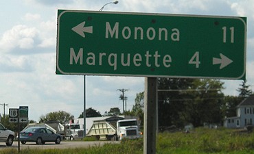
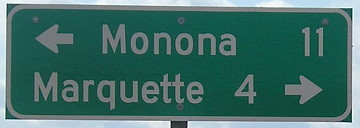
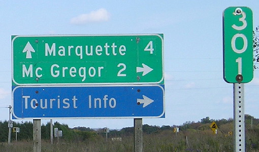
Old SOUTH End of 76/EAST End of Business 18: US 18, Marquette, Clayton County
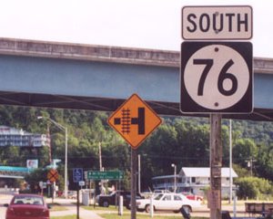
Facing south on 76 (7/28/02)
Photo by Jason Hancock
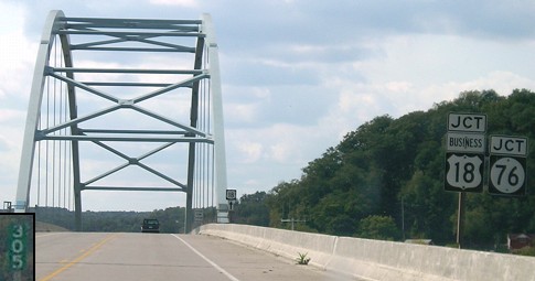
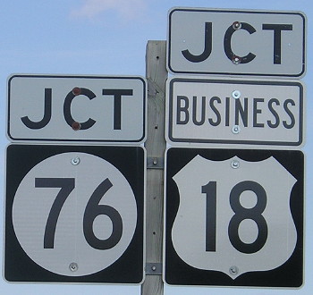
Before 1989, westbound 18 went straight ahead and eastbound 18 took a right in the background to reach the bridge. Today, 18 comes up to the bridge head-on, and Business 18 goes ahead. Instead of giving the business route a 900 designation, it was tacked on to IA 76 mileage-wise, but no signs were put up until 2010. Only mile markers indicated that it's part of 76 (see below).
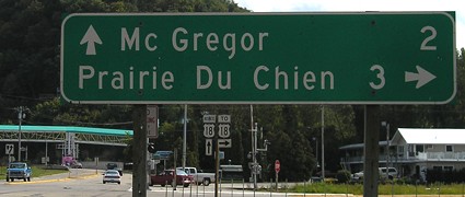
LGS in background of above picture (9/7/06)
This sign says 3 miles to PDC, but the sign on eastbound 18 says it's 2 miles.
Updated LGS (9/28/15)
Facing south on 76 (7/28/02)
Photo by Jason Hancock
As you can see from the map above, 76 no longer intersects 18 directly, but uses an access road. From this point on, only Business 18 shields will be up, as you can see in the background at far left.
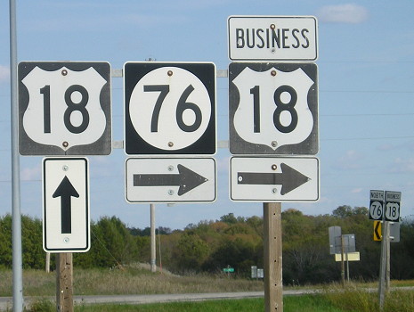
Facing west on 18 (9/7/06)
Technically, this sign is in Wisconsin...or is it? By 2010, a Clayton County sign precedes this.
Facing west on 18 (9/7/06)
The enlarged mile marker is on the bridge itself, right above the top right corner of the inset.
Facing west on 18 (9/7/06)
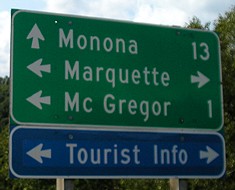
The signs encountered right after crossing into Iowa point in both directions for Marquette, but only one direction for 76.
Facing east on 18 (9/7/06)
The junction with 76 is in the deep background, and you can barely see it to the right of the cut in the hill. Before getting there, 18 curves to the left of the photo and then comes back in. (Look! Scenery! In Iowa!)
Facing east on 18 (9/7/06)
Facing east on 18 (9/7/06)
Note that the font differs on the 18 shields, and only north 76 is indicated.
Facing east on the access road (7/28/02)
Photo by Jason Hancock
Note that US 18 doesn't even enter McGregor anymore, so all the LGSs at intersections east of here that point to McGregor are a little off.
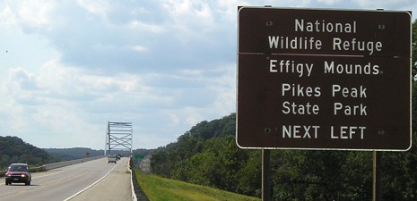
Effigy Mounds is Iowa's only national monument. Iowa really gets the short end of the stick when it comes to the National Park System. We have what literally are big piles of dirt that are best seen from an elevated view (and take a lot of walking to get to), and the birthplace of a man who, despite what he did before being elected, is widely regarded as one of the worst presidents in history - and that's it.
End of the access road (7/28/02)
Photo by Jason Hancock
The Marquette-Jolliet Bridge into Wisconsin is in the background.
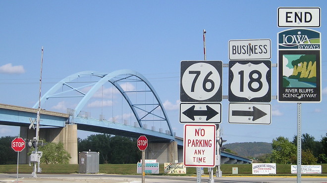
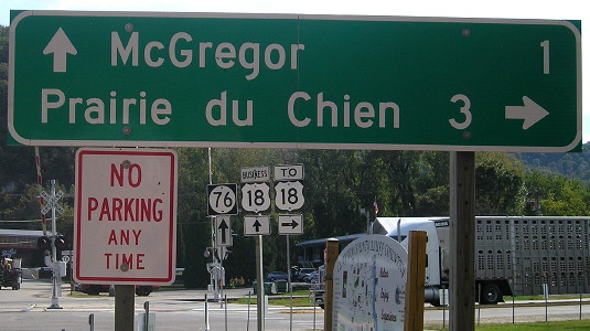
Updated view of intersection (9/28/15)

Facing north, but heading east, on Business 18 (and north on 76) (7/28/02 and 9/28/15)
Left photo by Jason Hancock
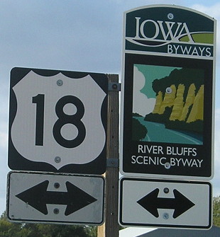
This is also the end of the River Bluffs Scenic Byway.
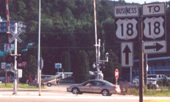
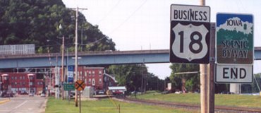
Facing north, but heading east, on Business 18 (and north on 76) (7/28/02)
Photo by Jason Hancock
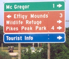
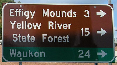
In the mileage signs on the access road and below, Effigy Mounds was in brown as it should be, but is not here. In addition, Prairie Du Chien does not have "Wis." after it, which I think it should. It's right across the river, but the river is wide (oh it's wide) and it's too hard to cross (too hard to cross).
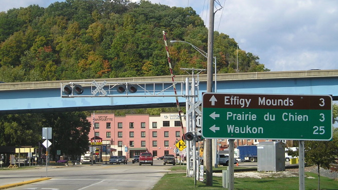
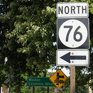
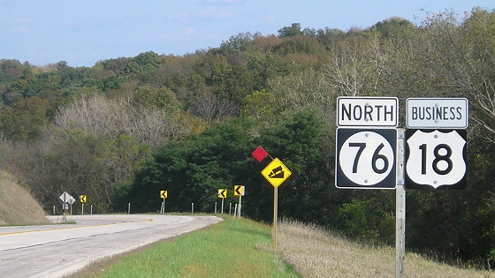
Facing north on 76 (9/28/15)
The signs at this intersection were newly erected within a month of my visit - which, as you can see, was a few weeks before peak leaf season.
Facing north on 76 (9/28/15)
Facing south on 76, but heading west on Business 18 (9/28/15)
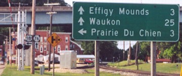
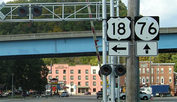
Facing north on 76 (7/28/02 and 9/7/06)
Left photo by Jason Hancock
As you can see in the map at the beginning of the slew of photos at this end, 76 takes a short turn eastward before following the river. Notice Effigy Mounds is back to being listed in brown.
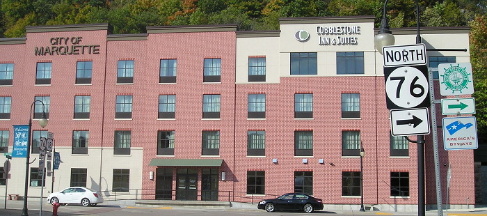
Facing north on 76 (9/28/15)
It looks like the city of Marquette collaborated with a hotel on a new building at the foot of the bluff.
Facing north on 76 (9/28/15)
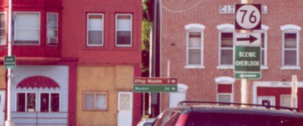
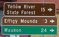
Right after that turn, there are these signs:
Facing east, but heading north, on 76 (9/7/06)
In a poor choice of placing, the LGS is barely visible in the short east-west block of 76, and is parallel to the road heading north (left). The distances are 24 to Waukon, same as the previous signs, and 53 to Caledonia. (The mileage sign was gone in 2010, though.)
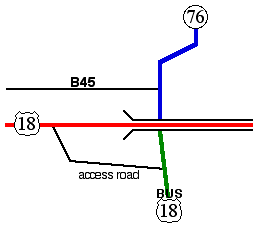
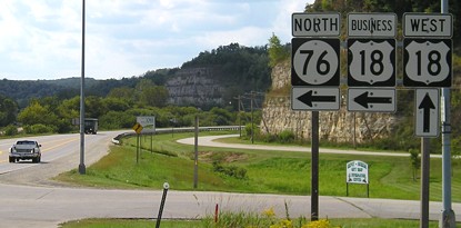
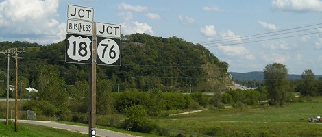
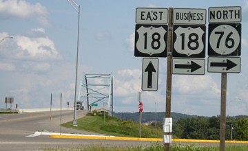
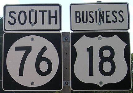
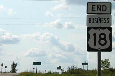
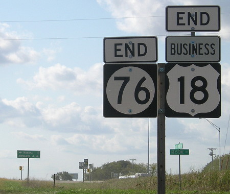
SOUTH End of 76/WEST End of Bus. 18: Stop sign, US 18, Clayton County
Facing west on Business 18, but heading south on 76 (9/7/06 and 9/28/15)
Facing west on Business 18, but heading south on 76 (9/7/06 and 9/28/15)
There was no signage of 76 anywhere at this intersection until 2010.
Facing west on Business 18, but heading south on 76 (9/28/15)
Facing west on 18 (9/7/06)
Facing east on 18 (9/28/15)
Facing east on 18 (9/28/15)
Facing east on 18 (9/28/15)
Facing east on Business 18, but heading north on 76 (9/28/15)
Facing east on Business 18, but heading north on 76 (7/28/02)
Photo by Jason Hancock
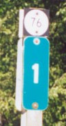
One mile out, we find what until 2010 were the only indicators of IA 76 along this entire route - mini-shields above the mile markers.
Maps created 2/9/03
Page created 2/15/03; last updated 12/13/16