

(July 1, 1920-July 1, 2003)
- In 1920, they knew it as: A road connecting Lehigh to the main north-south road in Webster County
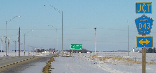
- We know it as: County Road D43
- Let's get granular (1920 route): D43, Quail Avenue, 295th Street, and D43 again (more or less, I think)
- Extended into a double spur from Lehigh to Callender 1935-63.
- Point of interest: As late as February 1920, as the Webster and Boone county supervisors, along with the towns of Dayton and Lehigh, tussled over the north-south route running south of Fort Dodge. That month, in what the Lehigh Valley Argus called "the thoroughly disorganized method of proceeding with the good roads question" (Feb. 26), Webster County overwhelmingly crushed road and bond propositions. Lehigh and Dayton got spurs instead. See also IA 91 (1920 series).
- In the same issue, Argus readers also found out they were getting a new state park, which in 1922 was dubbed Dolliver State Park. The park would later get its own little spur, IA 121.
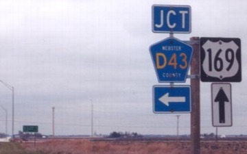
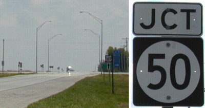
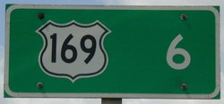
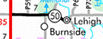
WEST End: Stop sign, US 169 and D43, originally IA 16/IA 90, Webster County
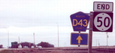
Facing west on 50 (November 2002)
Photo by Jason Hancock
Facing west on 50 (May 2003)
Facing west on 50
Photo by Jason Hancock
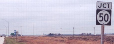
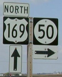
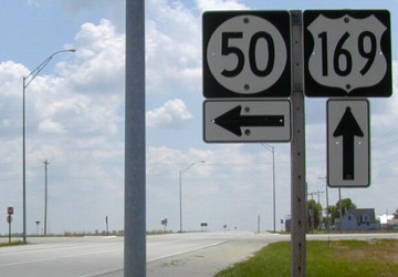
Facing north on 169
Photo by Jason Hancock
Facing north on 169 (November 2002)
Photo by Jason Hancock
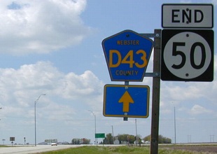
Same pole (December 2005)
Facing north on 169
Left photo by Jason Hancock
Facing south on 169
Facing south on 169
*Original Number, Original End*
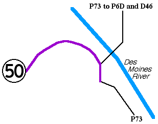
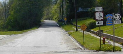
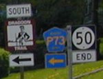
EAST End: P73/Mill St., Lehigh, Webster County
Lehigh (1920 pop. 1090, 2010 pop. 416) is along the Des Moines River. Highway 50 ends just to its west, as P73 continues south and follows the river a ways. The Alternate Dragoon Trail crosses the Des Moines here with P73, rejoining the main route, a block before 50's end.
The picture at right is facing north after one block on 50; its counterpart is below.
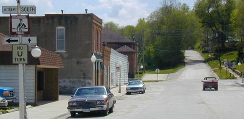
Facing south, but heading east, on 50
To the left is the bridge for P73 and the Alternate Dragoon Trail across the Des Moines River. This is where construction plans in 1926 ended.
Facing south, but heading east on 50
Ahead is a dead end; P73 goes left to leave Lehigh and follow the river. Highway 50 traffic does not have to stop.
Facing west on 50
The west city limits of Lehigh are about a mile away from 50's end. There was one rural "Hwy 50" sign, but past there it was 290th Street. The county roads that intersect 50 had no signs; there were about 5 shields along the route not counting those on US 169.
*Original Number, Original End*
Last seen: 2003
Pictures by Jason Hancock: First, third-fifth, and seventh, 11/10/02
Pictures by me: Second and eighth-fifteenth, 5/7/03; sixth, 12/12/05
Page created 2/23/03; last updated 12/23/05 7/11/20