
| IA 48 endpoint history | |||
| FROM | TO | NORTH | SOUTH |
| 7/1/20 | 1/6/25 | Red Oak (courthouse?) | IA 3 (Center St at Clarinda Ave, Shenandoah) |
| 1/6/25 | 1926 | IA 8, then US 34 (G Ave at Coolbaugh St, just west of Red Oak) | |
| 1926 | Late 1928 | Missouri state line (US 59) | |
| Late 1928 | 3/4/30 | US 34 (Broadway at Oak, Red Oak) | |
| 3/4/30 | 7/8/31 | Griswold | |
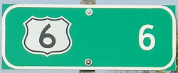
| 7/8/31 | 11/25/31 | US 6 | |
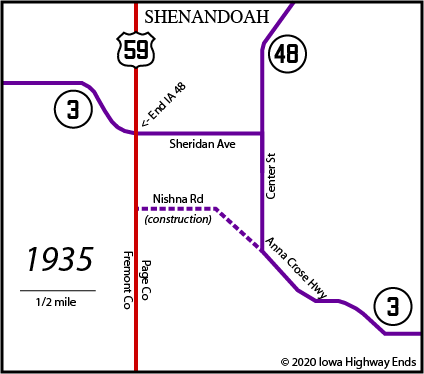
| 11/25/31 | 6/27/80 | US 59 (Sheridan Ave, Shenandoah) | |
| 6/27/80 | Present | US 59 (Ferguson Ave, Shenandoah) | |
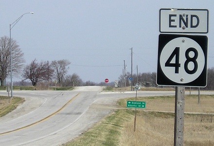
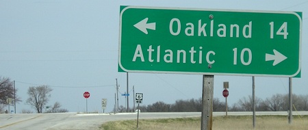
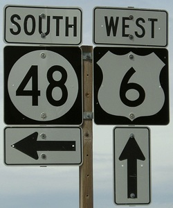
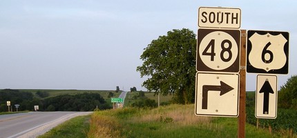
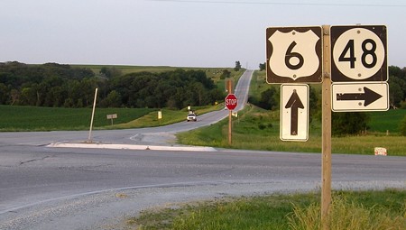
NORTH End: Stop sign, US 6, Cass County
Facing north on 48 (10/22/14)
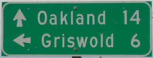
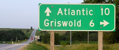
Six miles to 6 from Griswold, in two different fonts.
Facing north on 48 (4/15/09)
Facing north on 48 (4/15/09)
Facing west on 6 (4/15/09)
Facing east on 6 (6/12/06)
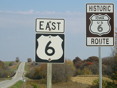
This is possibly the only US 6 shield in Series C font in Iowa, because the one at I-35/80 I saw in 2004 is gone.
Facing east on 6 (6/12/06)
Facing east on 6 (6/12/06)
Facing east on 6 (10/22/14)
David Darby's pursuit of recognizing "Historic Route 6" across Iowa has paid off with signs throughout the state, including along parts of 6 that remain unchanged since it replaced US 32 at the end of 1931.
Rural sign at intersection (4/15/09)
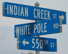
Way, way, way back when, before US 6 was US 32 or even IA 2, the White Pole Road connected Council Bluffs and Des Moines. While 6 is marked as White Pole in Cass County west of Atlantic, the north-south road changed to Indian Creek here because the creek begins to parallel the gravel road north of 48.
"Take Your Choice to Omaha"
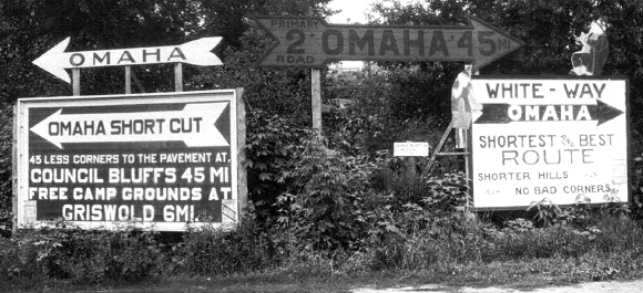
Facing southwest (1921 or early 1922)
© Iowa Department of Transportation. All rights reserved.
Competition for traffic was fierce in the 1920s. Here, the White Way competes with a route using modern IA 48 and most of modern IA 92. At the time, none of the latter route was a state primary. That may have not made a difference, though, since the White Way/IA 2 was dirt; at least one map classifies it as "not built". Paving of US 32 (now 6) in the Lewis area in 1930 changed the route a bit, so this intersection is half a mile south of 48's current north end.

- In 1920, they knew it as: A segment of the Nishna Valley Route, and later on (according to the Registered Highway Routes map) the Harding Highway as it broke off from the Blue Grass Road (2 counties)
- We know it as: The IA 48 corridor from Red Oak to Shenandoah
- Let's get granular: Center Street (Shenandoah), 190th Street, B Avenue, 180th Street, C Avenue, long-abandoned roads that would be C Avenue and 150th Street, an extension of South Avenue that went right through the present-day Essex school building, Forbes St (Essex), IA 48, M41, D Avenue, H54, Evergreen Avenue, 210th Street, G Avenue, Coolbaugh Street (Red Oak)
- Nearly all of this route north of Essex is gravel M41, running to the west of the East Nishnabotna River and missing Coburg by a mile.
- Either Essex renamed Main Street to Iowa Avenue sometime during the 20th century or a 1930 paving blueprint is wrong.
1920s NORTH End (1): Red Oak, Montgomery County
1920s NORTH End (2): IA 8, now G Avenue at Coolbaugh St., Montgomery
County
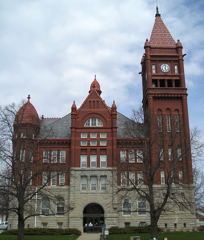
I suspect that designations ending in a county seat ended as close to the courthouse as possible. Thus, here's the Montgomery County Courthouse in Red Oak, one block east of present 48. (4/15/09) Just ahead and to the right of this view is a Napa Auto Parts store with covered side windows and giant front windows that give away its status as a former garage, marked as such in Huebinger's Map and Guide for Blue Grass Road (1912).
IA 48 was one of a number of routes that had their ends cut back to rural intersections. This is one of the smaller trims, just a couple miles. The section of G Avenue between Coolbaugh and H34 was taken out in 2006 for an expansion of Red Oak's airport.
1920 SOUTH End: IA 3, now Center St. at Clarinda Ave., Shenandoah, Page County
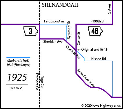
These maps would not be possible without a couple of Highway Commission blueprints regarding the diagonalization of IA 48 and a route for IA 3 that would bypass downtown. Before that, trying to figure things out in the city for the first 20 years of the primary system would have been impossible.
SOUTH End: Stop sign, US 59/Fremont St., Fremont/Page county line
Facing west, but heading south, on 48 (4/20/02)
Photo by Neil Bratney
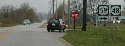
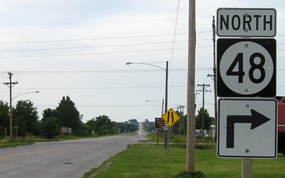
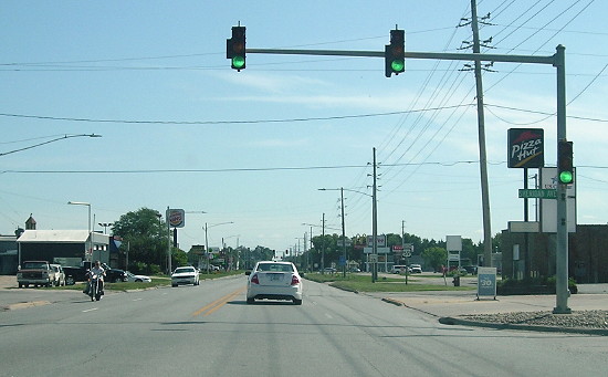
IA 48's end has moved farther north from its original route through Shenandoah, meeting 59 on the north edge of town. In the deep background - not the road the blue car is on - is old IA 2, but it met 59 to the south (left) of this picture, at Sheridan Avenue, which east of 59 was old 48.
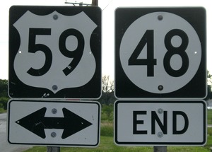
Closeup of signs in above picture (6/12/06)
Facing north on 59 (6/12/06)
Facing north on 59 (6/12/06)
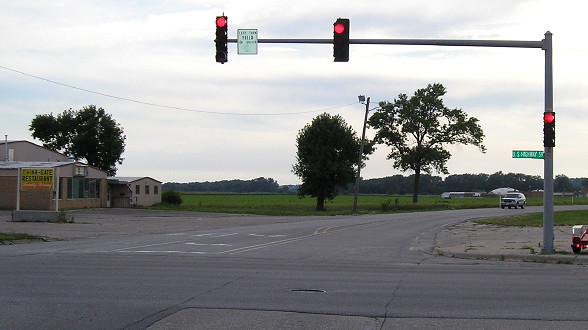
For an intersection with a state highway near a town, this intersection and US 59 at IA 2 are both surprisingly lacking in development.
Facing south on 59 (6/12/06)
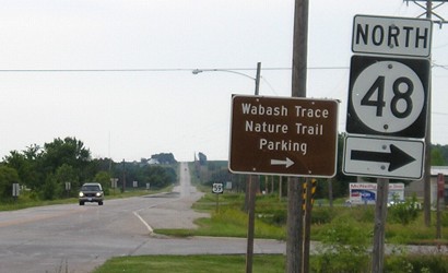
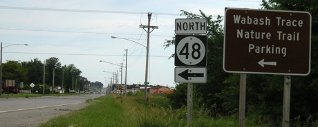
Neil says the Wabasha Trace trail goes sixty miles from Council Bluffs to Blanchard on an old railroad grade.
Old SOUTH End: Stop sign, US 59/Fremont St., Fremont/Page county line
Facing west on 48 (6/12/06)
The pickup is on old 2, which was realigned in the area in two stages (the part east of 59 and a much longer segment in Fremont County).
Facing south on 59 (8/23/19)
Page created 5/12/02; last updated 3/9/21