

(IA 80: July 1, 1920-
October 4, 1957)
(IA 406: October 4, 1957-July 1, 2003)
- In 1920, they knew it as: A way for Blue Grass Road travelers to bypass West Burlington
- We know it as: Agency Road
- See also:
- Burlington Highway Chronology
- This blog post about the 1915 "Seedling Mile" near West Burlington, Des Moines County's first rural concrete road. Perhaps because of this, at least one 1920s paving plan proposed surfacing all of IA 80 but not IA 8 east of their junction. However, both were paved by the end of 1921, making 80 the second completely hard-surfaced route in the primary system.
| IA 80 endpoint history | |||
| FROM | TO | WEST | EAST |
| 7/1/20 | 10/16/26 | IA 8 (same location all the way through) | IA 3/8/20 (either Osborn St at Central Ave or a block south, Central Ave at Washington St), Burlington |
| 10/16/26 | 1956 |
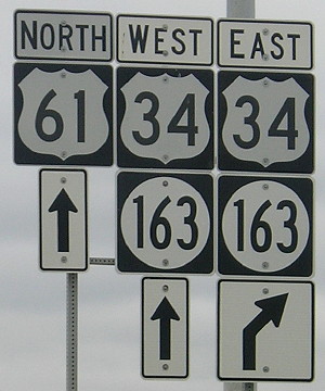
US 34 | US 61 (Osborn St at Central Ave) (& 34 until 1943) |
| 1956 |
10/4/57 |
US 61 (Roosevelt
Ave) |
|
| IA
80 renamed IA 406 |
|||
| 10/4/57 | 12/37/76 | US 34 | US 61 (Roosevelt Ave) |
| 12/37/76 | 2/1/81 | US 34 (Gear Ave at freeway) | |
| 2/1/81 | 7/1/03 | Agency Rd at Gear Ave, West Burlington | |
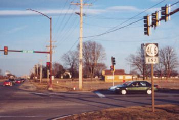
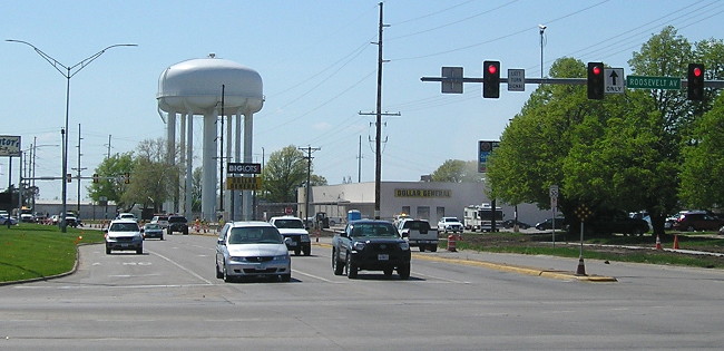
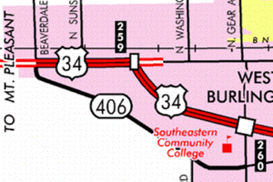
WEST End: Stoplight, US 34 and X40, originally IA 8, West Burlington, Des Moines County
Facing north, but heading west, on 406 (February 2002)
Photo by Jason Hancock
This intersection had highways meeting at it for just over 80 years; then 406 was dropped and 34 moved.
Facing east on 34 (February 2002)
Photo by Jason Hancock
In 1920-26, this was IA 8, aka the Blue Grass Road.
Facing east on 34, post-decommissioning, pre-new 34 (8/14/05)
This is on what most likely is the earliest rural four-lane divided highway in Iowa, in use as part of 34 for 60 years. (And in places shortly before a new freeway opened in 2005, the asphalt looked it.)
Facing south on unmarked X40 (8/14/05)
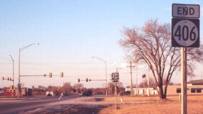
EAST End: Stoplight, Gear Ave., West Burlington, Des Moines County
Facing east on 406 (February 2002)
Photo by Jason Hancock
This is the farthest east "bottom 'End'" in Iowa (being near the Mississippi River will do that).
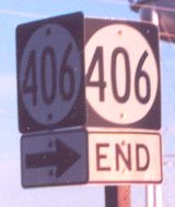
Above "End" sign from a slightly different angle (February 2002)
Photo by Jason Hancock
"Agency Road" is the street name for 406's route. A map titled "Federal Roads in Iowa Territory" in the book Transportation in Iowa shows two roads surveyed in 1839. One went near today's US 151, IA 1, US 218 and then at an angle from Mount Pleasant to Keosauqua, "Military Road". The other went from Burlington through Danville and over to Agency City, "Agency Road". This street keeps that historic road name alive, although today the route to Agency is US 34.
The two roads intersected in a place marked "Washington". Washington was about equidistant from Mt. Pleasant and Keosauqua and directly west of Burlington. I have been told that Washington is an old name for Hillsboro, which one site says was platted in 1840.
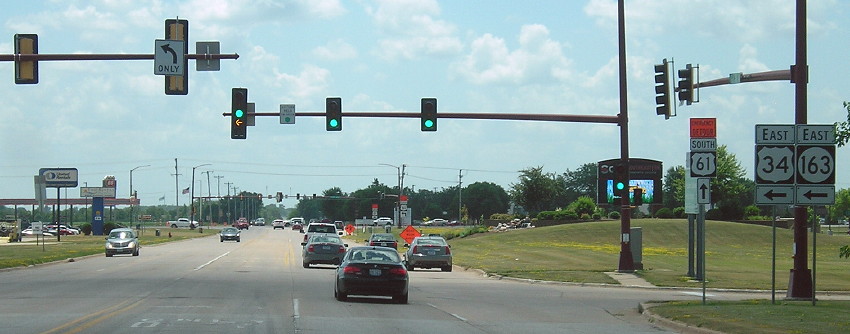
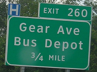
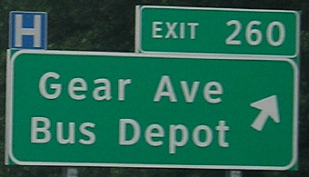
Old EAST End (December 31, 1976-February 1, 1981): Interchange, US 34, West Burlington, Des Moines County
Facing north on Gear Avenue, but heading east on 406 (10/4/15)
Facing south on Gear Avenue, but heading west on 406 (10/4/15)
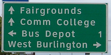
For a short time, IA 406 was routed to run north along Gear Avenue to the new 34 freeway. Before that it continued east on Agency Road to US 61.
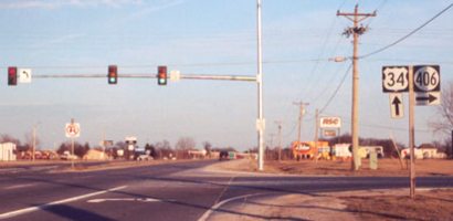
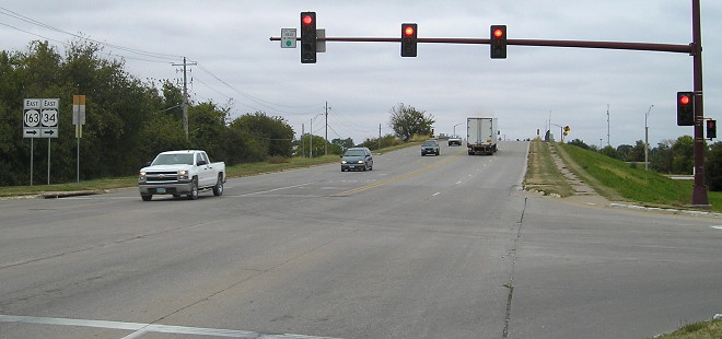
Facing south, but heading west, on 406 (6/18/18)
This is a more encompassing view of the point with the signs above. The stoplight in the distance is Agency Road, 406's final east endpoint.
Facing west on 34 (6/18/18)
Facing west on EB 34 offramp (10/4/15)
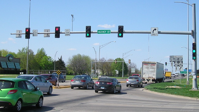
Old EAST End (October 4, 1957-December 31, 1976): US 61/Roosevelt Ave., Burlington, Des Moines County
Facing west on 406 (5/7/18)
All of the numbers that would have to be reassigned for duplicating highways on the new interstate system were in use on relatively short routes; IA 29 was the longest, at 22 miles.
A year before 80 was renumbered 406, it was peeled back out of Burlington to end at Roosevelt Avenue, which was the new "bypass" for US 61. The intersection is eight-tenths of a mile south of old 34, but practically at the doorstep of the eastbound ramps for the 34 freeway that would be built in the 1970s.
Facing north on 61 (5/7/18)
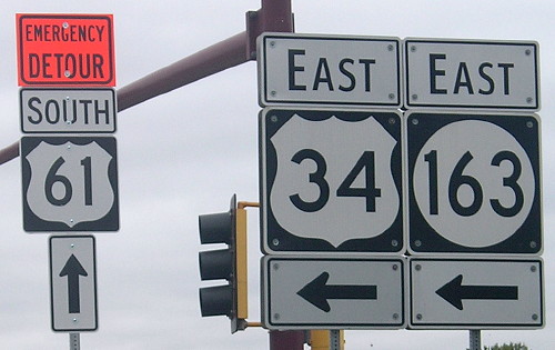
West of 61, it's Agency Road; east of 61, it's Agency Street. A closeup of the signs is below.
Facing north on 61 - NOT at 406's old end, but very close (10/4/15)
1920 EAST End: Burlington, Des Moines County
There are three possible options for IA 80's original east end:
- Osborn Street at Central Avenue. Agency Street runs into Osborn, just northwest of here. Central carried IA 20, which became US 61, and also here had IA 8, later US 34. In 2003, this intersection was dead-ended in favor of a road to the southwest that created a Central/Washington intersection elevated over the railroad tracks.
- Central Avenue at Washington Street, just a block south of the above, with the railroad tracks basically running right through it. That's where travelers from the south would have met IA 8, and an end here would've given them options. (IA 8/US 34 used Washington before a bridge was built across Osborn and the railroad in 1943.)
- Downtown Burlington, perhaps where Washington intersected Main Street, or two blocks north at the county courthouse.
Burlington's 1944 railroad depot, south of downtown on Main Street, remains in use as the Amtrak depot. It's a beautiful building with a shadow of its former bustle — and no one selling tickets. (6/18/18)
Last seen: 2003 (Burlington inset)
Page created 5/13/02; last updated 4/4/20