
(1980-July 1, 2003)
Iowa 403 had more north-south distance than east-west distance, even though it served more as a horizontal connector; it's at a point where the Big Sioux River changes direction (river flow is right to left). Graphic created 5/5/04.
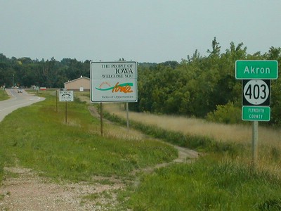
NORTH End: South Dakota state line, Akron, Plymouth County IA/Union County SD
Facing northwest, but heading north, on 403 (6/18/02)
Photo by Neil Bratney
Although the x03 number might make you think it's a spur of IA 3, the two routes do not connect. The 403 number was a spur to Cushing, reasonably close to move the shields to Akron in 1980.
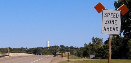
Facing southeast, but heading east, on SD 48 (6/14/04)
This picture on the South Dakota side (the car is coming into South Dakota) shows an Iowa-like "Speed Zone Ahead" sign stuck in the Dakota soil. I didn't see any SD 48 shield in the first mile or so of the route.
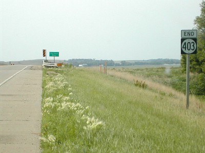
Facing southeast, but heading south, on 403 (6/18/02)
Photo by Neil Bratney
This picture shows all of 403, because it ends at the intersection in the background. It's entirely within the city limits of Akron. This also makes it a unique situation because the entire jurisdiction, including the bridge, was switched to the city. Akron, however, wasn't very receptive to the idea, and attempted to refuse the transfer.

Facing southeast, but heading south, on 403 (7/20/12)
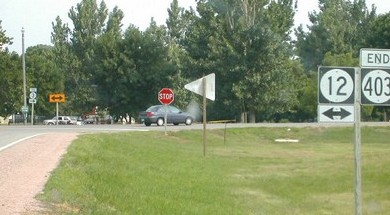
SOUTH End: Stop sign/T intersection, IA 12, Akron, Plymouth County
Facing southeast, but heading south, on 403 (6/18/02)
Photo by Neil Bratney
Facing southeast, but heading south, on 403 (6/14/04)
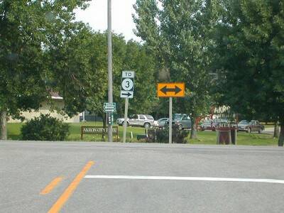
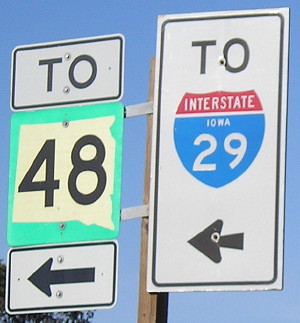
This bracket now holds a "3 ->" to supplement the "To 3" seen below.
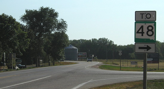
Facing southeast, but heading south, on 403 (6/18/02)
Photo by Neil Bratney
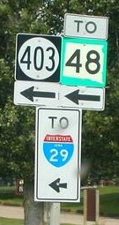
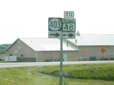
For those using SD 48, which only extends east from I-29, this sign directs travelers to 3. This route is a good cutoff for SB 29 travelers getting to 3; Akron is on the BGS on I-29. (However, 403 appears to have been non-essential enough to be decommissioned.)
Facing north on 12 (6/18/02)
Photo by Neil Bratney
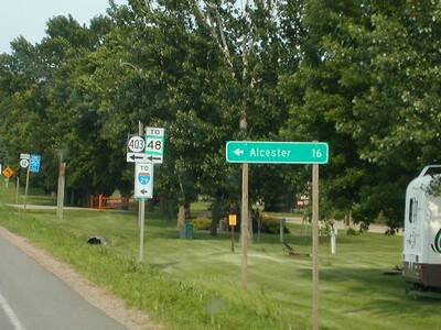
Notice the lack of an "S.D." on the LGS. Alcester is west of Hawarden.
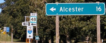
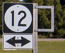
Facing north on 12 (6/14/04)
Facing north on 12 (6/18/02, left two; 7/20/12, right)
Left and center photos by Neil Bratney
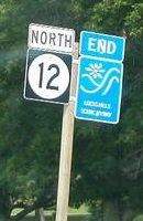
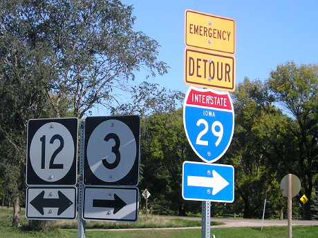
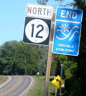
Neil notes the "Iowa" on the I-29 shield, even though at this point the interstate is in South Dakota. This is the north end of the Loess Hills Scenic Byway. Despite a statewide replacement of scenic byway signs, that particular one was still around in 2012 (and 2015, below).
Facing northeast / Facing north (9/30/15)
The "Emergency Detour 29" is turned from traffic. The end of the Loess Hills Scenic Byway has moved to the north intersection of IA 3 and IA 12.
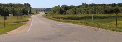
Facing south on 12 (6/18/02 and 6/14/04)
Left photo by Neil Bratney
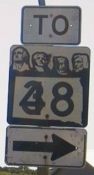
This is an old style SD state highway sign (ca. 1970s), with the Mount Rushmore heads on top. "It also looks like the number has been changed... from 38 to 48, and that the layover "4" is fading away!" Neil says. Not sure why southbound 12 has old signs while northbound 12 has current ones, although that was rectified in the decade after decommissioning.
Facing south on 12 (7/20/12)
Facing northwest (6/14/04)
Looking from 12, it is very easy to see into South Dakota. The river bridge is the brighter white just left of the railroad crossing guard. The shift indicates the original bridge was to the left of the current one.
Same view, eight months later (7/20/12)
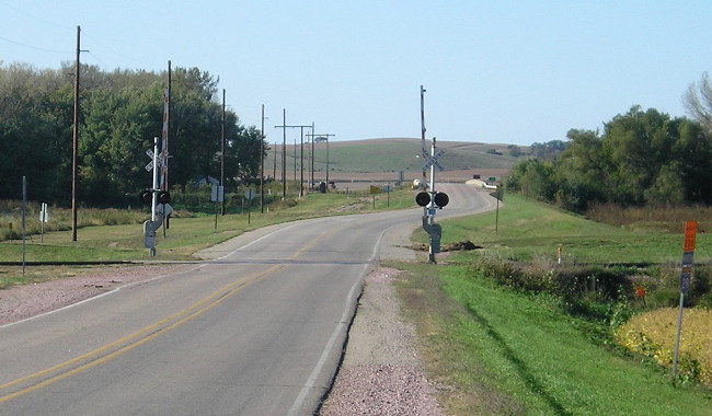
Facing northwest (9/30/15)
Surrounding area information: I-29 exit 31
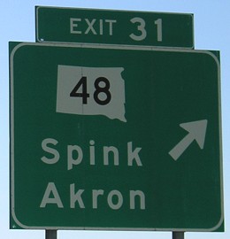
Facing south on 29 (5/13/07)
This sign in South Dakota, 12 miles away from IA 403, makes Akron look like a city in that state. In comparison, a sign for SD 46, which becomes IA 10, says "Hawarden, IA".
Last seen: 2003

Page created 5/5/04; last updated 12/13/16