
(May 11, 1948-December 12, 1983)
NORTH End: Stop sign, IA 330, Marshall County
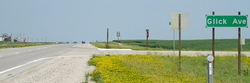
Facing northeast, but heading north, on 330 (7/3/05)
This location is to the south-southwest of where the road for 395 intersected 330. With the construction of the expressway, many side roads were completely reconstructed to end at the four-lane perpendicularly.
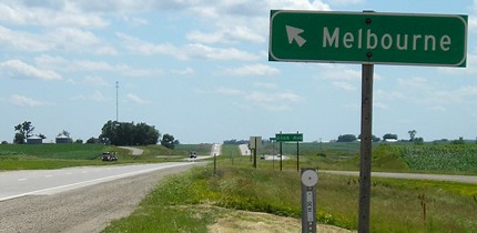
Facing southwest, but heading south, on 330 (7/3/05)
This is closer to the end because at this point, the southbound lanes are the old lanes. Just ahead, the old roadbed shifts to the northbound lanes.
SOUTH End (August 6, 1980-December 12, 1983): City limits of Melbourne, Marshall County
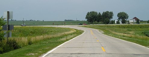
Facing north on the edge of town (7/5/05)
The darker pavement at the bottom is in city limits; there is an "End County Maintenance" sign. (Marshall County is the only Iowa county I am aware of that does this.) Thus, this would be the entire route of a north-south 395 outside of Melbourne, except it wouldn't have turned to intersect 330 perpendicularly. Between here and the intersection used to be a railroad crossing, which probably took up most of the nearly two-tenths of a mile left of the road.
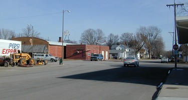
SOUTH End: Second St., Melbourne, Marshall County

Facing south on 395/Main Street (7/3/05)
This, being the south end of the business block, is where 395 ended before the in-town segment was turned over.
Facing east on Second Street (12/14/02)
USGS topo maps are unreliable for marking what alignments of spur routes inside cities. The red-dashed lines get used for what would be perceived to be the arterials, and not the signed route that may use other streets. Street Atlas was on the money with a north-south route, bringing 395 in on First Avenue, turning right on First Street for two blocks, and then south on Main one block to end facing south. From this perspective, 395 began to the left. Turn around, and Second Street is a southern connection from Melbourne to IA 330.
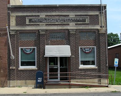
Melbourne, IA 50162 - on the last block of 395 (7/3/05)
Surrounding area information: County J Road
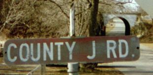
On the east side of Melbourne, this sign marked what is now S62. This had to have been over 30 years old at the time, since the current alphanumeric system started in the early 1970s. The tunnel behind it, for a railroad that no longer exists, is one lane wide. The sign had been removed by mid-2005. (12/14/02)
South of here on the top of a hill, seen heading northeast on 330, used to be a sign with the town's slogan, "Melbourne: Not Down Under But Right On Top." (It's in the Sesquicentennial book, page 158.) It's been replaced, and the slogan is gone.
Last seen: 1983 (1974, 1980, 1981 maps)
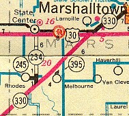
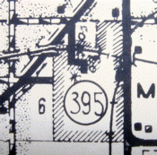
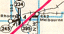
At left, this 1974 map shows Marshall County highways as they appeared, more or less, until 1989, with the exception of 395's decommissioning in 1983. On this map, 395 is marked as going north-south, just west of what is now S62. The 1980 county map shows 395 running north-south, and that agrees with the 1980 route log. BUT... all the maps from 1976 to 1983 show an east-west alignment. All research shows that the route never ran east-west; the horizontal line is due to map scale limitations.
Page created 1/24/03; last updated 1/3/18