
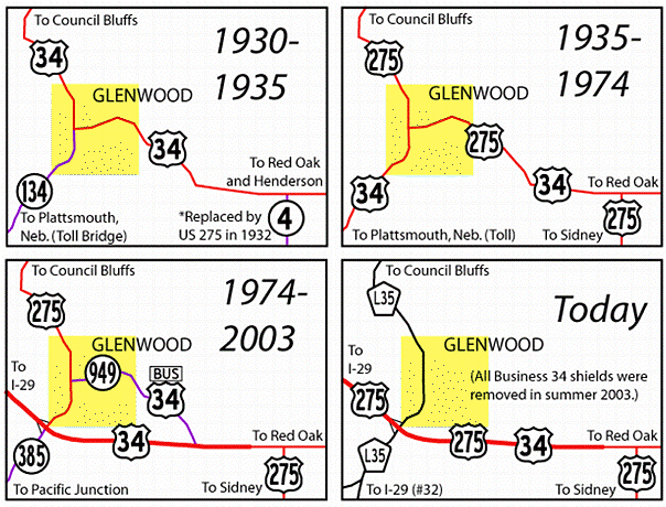
(1945-2003)
Note: ALL Business 34, US 275, and IA 385 signs have been removed since these pictures were taken. I traveled in this area on June 15-16 and July 6, 2003, and in the interim the DOT came through and picked the poles clean as part of the Second Great Decommissioning. While 949 (Business 34 off 275) and 978 (another part of old 34) were accepted by Mills County two days before the end of 2002, US 275 did not transfer until July 1, so all the signs were removed at the same time. Maps of the Glenwood area can be seen here.
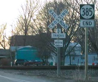
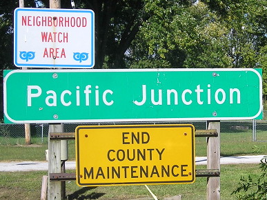
WEST End: BNSF tracks near intersection of Lincoln Ave. and Front St. (L31 west and north), Pacific Junction, Mills County
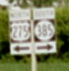
Facing west on 385 (1/20/02)
Photo by Neil Bratney
Of all the changes Street Atlas never got around to making, it did too much on this one, marking 385 along all of 34's old route including what is actually 978. The road into Pacific Junction is completely unmarked. SA does show, however, that L31 comes into town on Front Street and at the railroad tracks turns west on Lincoln Ave. for three blocks, exiting town on Aldens Ave. The maze of railroad tracks here form what you could call a railroad diamond interchange (note the three tracks).
Facing west on 385 (10/2/15)
Facing east on 385 (1/20/02)
Photo by Neil Bratney
Facing west on 385 (10/2/15)
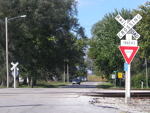
The transfer of jurisdiction shows that Pacific Junction is in charge of the road inside city limits.
Old EAST End (1945-74): Stop sign/T intersection, US 34, Mills County
Facing northeast, but heading east, on old US 34, later IA 978 (1/20/02)
Photo by Neil Bratney
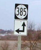
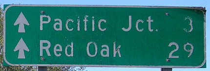
IA 385 bears the distinction of being one of two spur highways created in 1945. It was created when US 34 bypassed the town via a new railroad overpass just south of this intersection. For the first 10 years that 34 went southwest to Plattsmouth (1935-45) it went into Pacific Junction and crossed the railroad as seen at the pictures at the top of this page before going south.
Facing southwest, but heading west, on 385 (1/20/02)
Photo by Neil Bratney
As 385 resumed its old course, 978 began just to the left of this picture.
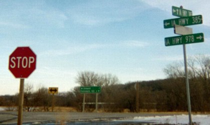
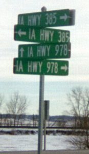
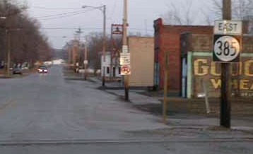
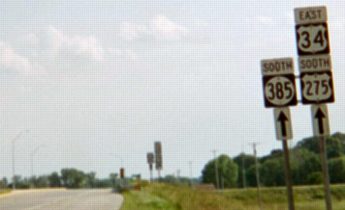
Facing east on 385 (1/19/03)
The 2003 rural sign assembly for IA 978, like 921, was the only proof that it existed.
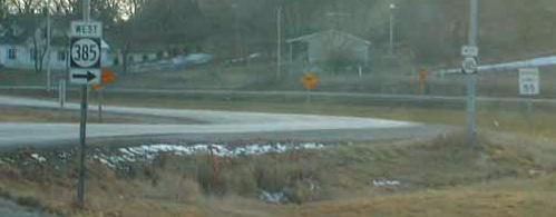
Facing east on 385 (4/6/08)
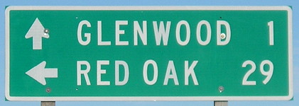
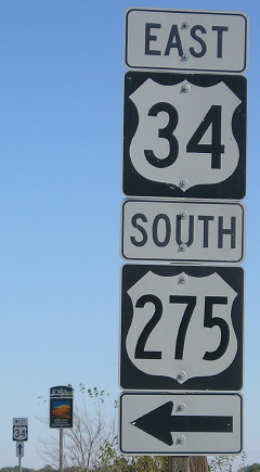
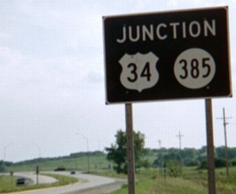
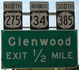
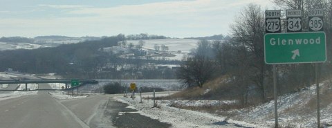
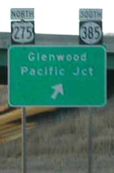
EAST End: Interchange, US 34 and 275, Glenwood, Mills County
Facing north, but heading east, on 385 (6/12/06, but same before 2003)
Facing north, but heading east, on 385, possibly county-mounted signs (10/2/15)
Facing north, but heading east, on 385 (1/27/11)
The all-caps mileage sign is likely a county sign put up after the north-south road became the county's responsibility.
Facing north, but heading east, on 385 (10/2/15)
Facing north, but heading east, on 385 (1/20/02)
Photo by Neil Bratney
Facing north, but heading east, on 385 (6/15/03)
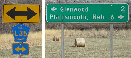
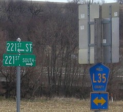
This bridge is now entirely County Road L35, going north on 275's route and south along old US 34 (which had been split between 385 and 978). The longest incarnation of 385 was exactly 3 miles long. This sign is now a "West 34 ^".
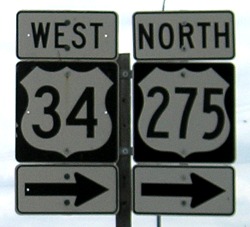
Facing south on 275 (6/16/03)
Neil says the background of this sign is not green, but rather "brown/black". This sign had a 275 shield with a black border added on the right side to replace the 385.
Facing south on 275, now L35 (10/2/15)
Facing south on 275, post-decommissioning (6/12/06)
Old 275, that is, now that it is no longer on this road.
Facing south on 275 (6/16/03)
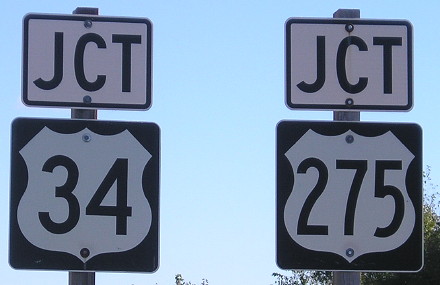
This setup also changed after decommissioning, now with 34 and 275 shields side-by-side with ahead-and-right arrows, replacing the setup in the background.

Facing south on 275, now L35 (10/2/15)
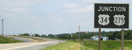
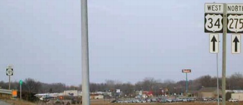
Facing east on 34 (6/15/03)
This is a Miracle Picture, one of those taken before my camera completely quit on me. I call them that because given my troubles it's a miracle they turned out at all. All three shields came down in July 2003, though.
Facing east on 34 (1/19/03)
Photo by Ben Prusia
Neither direction had a full-fledged BGS until the 2010s. Identical situations happen farther east on 34 at US 59 and US 71, neither of which are at-grade intersections and place the shield above a green sign listing two towns.
Facing east on 34, but heading south on 275 (10/22/14)
Facing west on 34 (1/20/02)/ Facing east on the westbound offramp (it's a folded diamond) (6/16/03) / Same view (4/6/08)
Left photo by Neil Bratney
Notice that westbound 34 does not include the business route.
At the junction with IA 978, as 385 left old 34 for its original route, signage changed from north/south to east/west. (You think the DOT would have signed the whole thing east-west when it extended the road.)
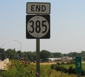
Last seen: 2003

Page created 4/20/04; last updated 4/2/17