

- In 1920, they knew it as: A road between Onawa and Dunlap, if it could be called that. What looks on the early maps to be a decent diagonal from northwest of Soldier to Dunlap was... very extremely not that. (3 counties)
- We know it as: IA 37, except the part west of Turin, which is only IA 175 now although it was co-signed as 37 and 175 for 18 years
- Let's get granular:
- Onawa to Turin: IA 175, L14, and a vacated line east to near the present end of IA 37
- Turin to Dunlap: IA 37 with a whole host of left-behind segments including the following: 242nd Street, 240th Street, 240th Street again, L20, Plum Avenue, 237th Street, a vacated line running into Sequoia Avenue, 270th Street, 280th Street, 290th Street, Teak Avenue, Teak Avenue again, 300th Street, Walnut Avenue, 312th Street and vacated extension southeast, W Avenue, 110th Street, Nelson Hollow Road, and 130th Street
- Point of interest: All the highway numbers between 26 and 39, inclusive, were placed west of present US 71 and north of I-80 except 28 and 38. Only IA 31 and 37 remain.
| IA 37 endpoint history | |||
| FROM | TO | WEST | EAST |
| 7/1/20 | 1924? | IA 12 (6th St at IA 175, Onawa) |
IA 6 (IA 37 at
12th St, Dunlap) |
| 1924? | Late 1926 | IA 12 (Iowa Ave at 10th St) | |
| Late 1926 | 5/27/31 | US 75 (Iowa Ave at 10th St) | US 30 (present north junction) |
| 5/27/31 | 1966 | US 59 (F24 at old US 59) | |
| 1966 | 7/12/71 | IA 175 | |
| 7/12/71 | 8/16/82 | Irwin (Ann St at Ellen St) | |
| 8/16/82 | Present | US 59 | |
1920 west end (2): US 75, now IA 175/Main St. at 10th St., Onawa, Monona County
Facing south on 75 (7/16/14)
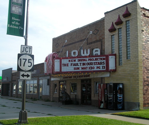
To the left is the start of IA 37 after IA 12 moved to 10th Street. This change put 37 on "the widest Main Street in America". The Iowa Theater is in the northwest corner of the intersection.
The Onawa Democrat dedicated a full page to the opening of the Iowa Theater. Its first movie, "Swing High, Swing Low," starring Carole Lombard and Fred MacMurray, opened April 15-17, 1937, with the help of "The New Western Electric Mirrophonic Sound System." The marquee isn't original but is over 50 years old. It wasn't Onawa's first theater. The first was the Royal, May 6, 1915, but it closed six years later. The second was the Onawa, located in the town's old opera house. It appears to have given itself a curious obituary: The advertisement July 3, 1952, for "Invitation" was followed by "Coming Soon: 'Quo Vadis' (CLOSED)", the latter being the first film shown there November 8, 1915.
1920 WEST End (1): IA 12, now 6th St. at IA 175, Onawa, Monona County
The change in Onawa is based on a very small shift in IA 12 markings, but seemingly corroborated by both the 1912 and 1914 county maps. A second corroboration, of sorts, is that the road running north on Hickory Avenue into 6th Street goes past the Onawa Cemetery and meets the road to Turin at the southeast corner of the Monona County Courthouse square. (5/7/06)
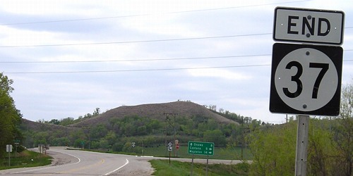
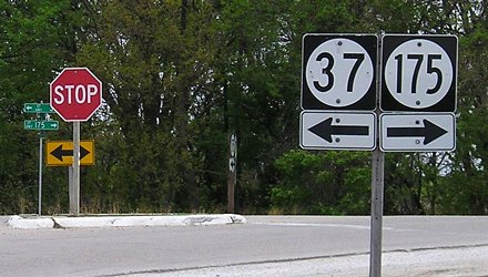
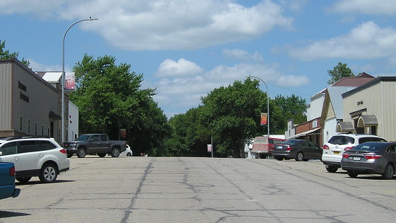
WEST End: T intersection, IA 175, Monona County
Facing northwest, but heading west, on 37 (5/7/06)
Facing northwest, but heading west, on 37 (10/1/15)
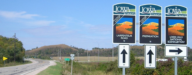
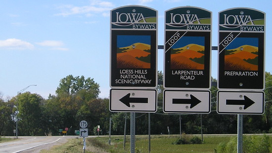
The one quibble I have with the new byway signs is that "Loop" designations can be easy to miss traveling at highway speeds. If the loop ribbon had a different color, maybe the green or bluish-green that's on the "Iowa Byways" header, that would help a lot.
Facing northwest, but heading west, on 37 (5/7/06)
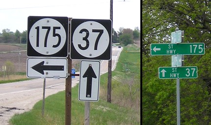
IA 37, which has been around since the creation of the Iowa highway system, started out as a Dunlap-to-Onawa route, and remained co-signed to Onawa until the late 1960s. That through routing is reflected in this intersection.
Facing northwest, but heading west, on 37 (5/7/06)
Facing southeast, but heading east, on 175 (5/7/06)
IA 175 closely follows the Maple River from Ida Grove to this intersection, near where the Maple flows into the Little Sioux.
Facing southeast, but heading east, on 175 (5/7/06)
Facing southwest, but heading west, on 175 (2/23/02)
Photo by Neil Bratney
The Loess Hills Scenic Byway sign should have a right arrow to signify its continuance with 175 - this was fixed when new Scenic Byway signs were erected:
Facing southwest, but heading west, on 175 (10/1/15)
Facing southwest, but heading west, on 175 (5/7/06)
Facing southwest, but heading west, on 175 (5/7/06)
1920 EAST End: IA 6, now IA 37/Iowa Ave. at 12th St., Dunlap, Harrison County
Until late 1926, when the Lincoln Highway was placed on a new route between Dunlap and Arion, that route was the one going through Dunlap's east-west business district and the site of Dunlap's school building, now Boyer Valley High School. A new school was built around the old one in 2004-05.
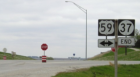
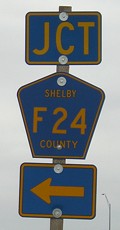
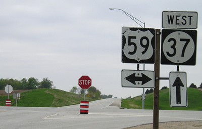
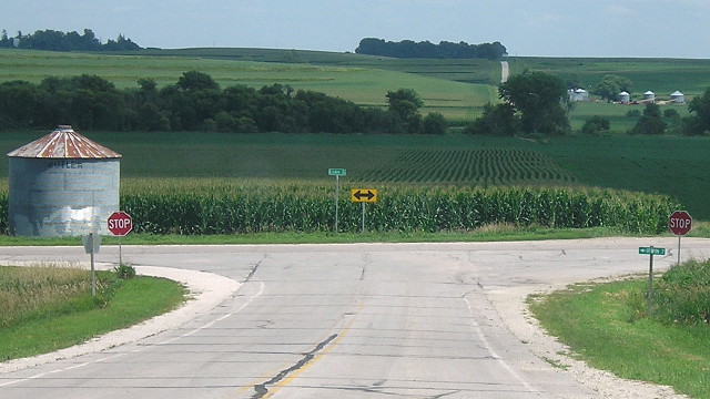
EAST End: Stop sign, US 59 and F24, Shelby County
Facing east on 37 (5/7/06)
Facing east on 37 (5/7/06)
Facing south on 59 (5/7/06)
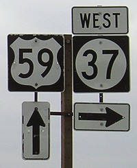
Facing south on 59 (5/7/06)
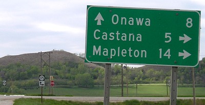
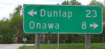
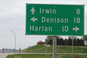
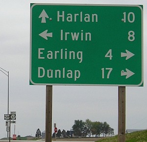
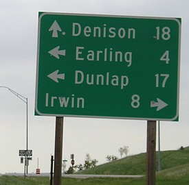
There's no particular reason for there to be four towns on this sign, as convention would omit Dunlap, but this appears to be a relatively new sign. It could be because 37 just skirts Earling.
Facing north on 59 (5/7/06)
Facing north on 59 (5/7/06)
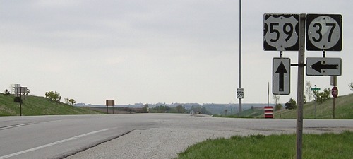
Facing north on 59 (5/7/06)
Not only are the signs in reverse order than usual and spread apart more than usual, they are also old and peeling.
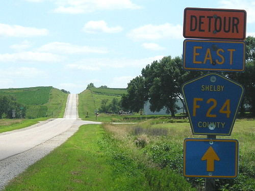
Facing west on F24 (5/7/06)
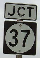
This DOT-standard shield from when this road was part of IA 37 was over a quarter-century old at the time of the picture.
Facing west on F24 (7/24/19)
Facing west on F24 (5/7/06)
Unlike many county road intersections, the state road ahead is signed, although this is probably related to the fact that this used to be 37.
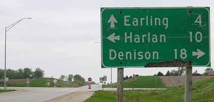
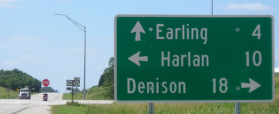
Old EAST End (May 27, 1931-July 12, 1971): Stop sign, Old US 59, Shelby County
Facing east on 37 (7/24/19)
This is a mile east of the above intersection. The old highway was never given a county road designation; it should be M30.
Facing south on 59 (7/24/19)
At the time of my trip, the road to Irwin was closed for a bridge replacement near there. This sign would, I think, typically say "West F24 ->".
Old EAST End (July 12, 1971-1982ish): Ellen St., Irwin
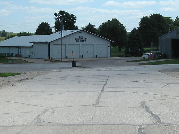
Facing south, but heading east, on 37 (7/24/19)
Facing north, but heading west, on 27 (7/24/19)
On July 12, 1971, US 59 was shifted a mile west to bypass Harlan and Defiance. Almost a month later, the Highway Commission officially extended the IA 37 designation along IA 268 to Irwin. That means that instead of adding IA 268 shields to two miles of road and creating a common end at new 59, eight miles were re-signed as 37 instead. OK, whatever.
Then the extension to Irwin was removed as part of the Great Decommissioning, sort of. It doesn't appear on the 1981 map, which is why I hadn't bothered to get a picture. I didn't even visit Irwin until 2014. But according to the official route description, it wasn't turned over until August 16, 1982, so I made another trip for the above.
Page created 3/22/02; last updated 4/8/20