

(IA 92: July 1, 1920-February 1, 1939)
(IA 363: February 1, 1939-July 1, 2003)
- In 1920, they knew it as: A road to Urbana
- We know it as: The west part of old IA 363/part of the connector between IA 150 and I-380
- Let's get granular: 55th Street, Main Street, and one block of Union Avenue (original route)
- Related route: IA 919, old segment in Urbana after 363 was built to connect with I-380
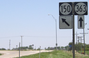
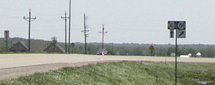
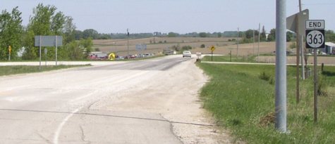
WEST End: Intersection, IA 150, Benton County
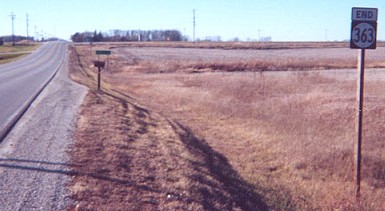
Facing west on 363 (12/9/01)
Photo by Jason Hancock
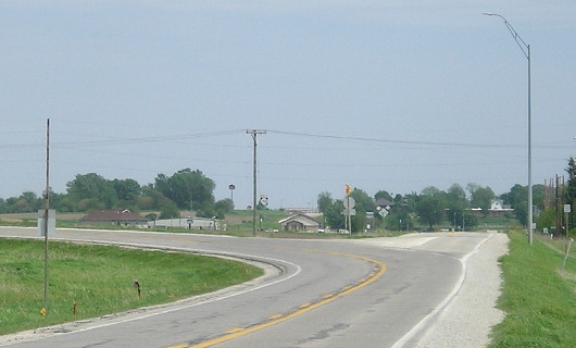
This intersection is not a normal T, because 150 is the prevailing traffic and has a large curve. The intersection structure as a whole is like the west end of IA 383 (see diagrams there). It's remotely possible that this was a last-minute addition to the 1920 system, as the 1914 county map shows the main road hitting an angle using 54th Street Lane.
Facing west on 363 (5/20/03)
The red dot is the stop sign to 150 southbound. The road behind the 150 shield leads to 150 northbound.
Facing west on 363 (5/16/17)
Facing east, but heading north, on 150 / Closeup (12/9/01 and 5/16/17)
Left photo by Jason Hancock
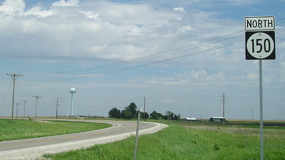
Following 150 into 363 means going against the banked curve. Because there is not a straight road from Vinton to I-380 (the Cedar River takes an easterly jog right where one would be), traffic to/from the north side of Cedar Rapids often uses 150 and 363 instead of following/going to the I-380/IA 150 interchange.
Facing east, but heading north, on 150 (5/16/17)
Facing east, but heading north, on 150 (5/20/03)
A five-fatality crash at this part of the intersection in 2015 prompted calls to remove the curve and turn this into a regular intersection with east-west traffic having the right of way.
Facing northeast (5/16/17)

Facing south on 150 (5/16/17)
Facing south on 150 (5/20/03)
The car is on the short north-south connector for 363 to NB 150. From the point this picture was taken, 150's interchange with I-380 was visible in the other direction.
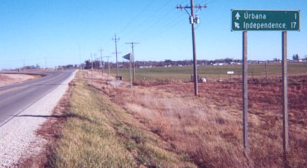
1920 WEST End: The squared-off corner of IA 101, now IA 150, Benton County
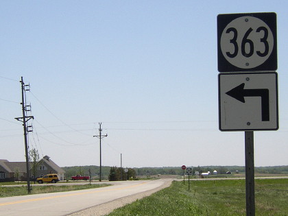
Facing south, but heading east, on 363 (5/20/03); this would have been facing south on 101 in 1920
You can turn right and be on 363, but not for a very long distance.
Before IA 363 was dropped in the Second Great Decommissioning, this was the view on the southbound leg when not following the curve for IA 150. The number of the road to Urbana was changed so #92 could become a cross-state route that retained its number across state lines. In late 2021, this piece will again become IA 150 as the curve is eliminated and traffic will meet at a four-way stop.
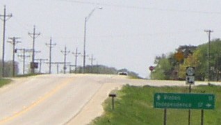
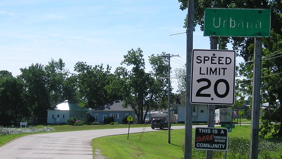
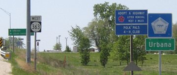
Surrounding area information: City limits of Urbana (I-380 exit 43)
Facing south on 150 (5/20/03)
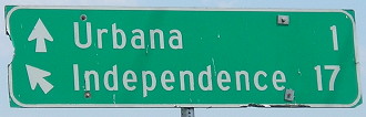
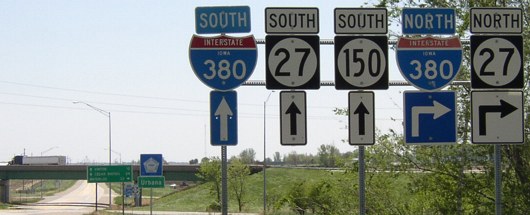
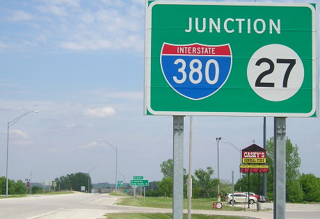
This assembly provides the starkest contrast yet between arrows used before 2001 (under the 380) and 2001 and later (27 and 150). It would probably be more accurate, though, to say that the smaller arrows have a much greater tendency to show up on new signs/assemblies, which this one became with the addition of IA 27.
The city limits are extended to here for a very simple reason: There's a gas station to the left, giving money to the city instead of the county (and probably making Urbana the smallest town in Iowa with two Casey's).
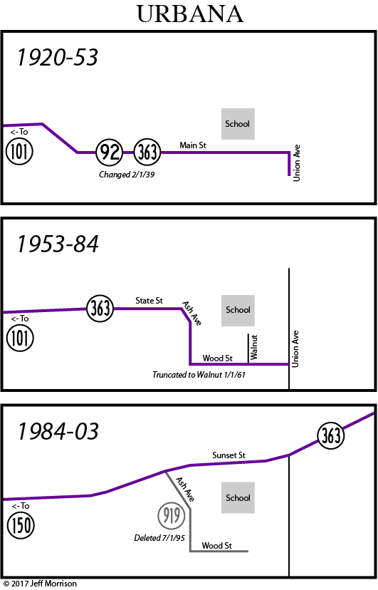
Old EAST End (January 1, 1961-August 19, 1984): Walnut St., Urbana, Benton County
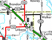
I've made a series of three maps doing the duty of six detailing the state highway in Urbana. In 1953, a new entrance was built from the west and the route was shifted a block south to run through the business district instead of past the school. In 1961, the easternmost two blocks were chopped off. Then, with the construction of I-380, 363 became a connecting route, and the remainder was designated IA 919.
Facing east on 363 (7/25/16)
Here's where old 363 splits off from the new road going to the interstate. IA 919 was decommissioned in 1995.

Facing east on 363 (7/25/16)
The last version of 363 as a spur came in to Urbana on Ash Avenue, turned left on Wood Street, and ended here near the Legion Hall. The roadbed coming into Urbana was reconfigured; there is now a frontage road that was 363 and at the intersection 363 used to turn at there was an "East 363 ^" assembly.
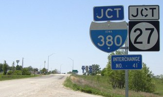
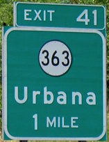
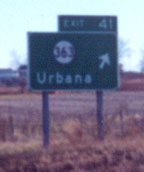
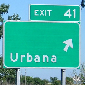
EAST End: I-380 exit 41, Urbana, Benton County
Facing east on 363 (5/20/03)
How's this for abrupt? In front of this picture (not shown) is the offramp from I-380 NB; turn right and hit gravel.
Facing west on 54th Street Trail (say that five times fast!) (5/20/03)
The 380 shield is probably original; the pole is not.
Facing west on 363 (5/20/03)
Somewhat recently, Urbana has extended its city limits to include both the 363 and 150 interchanges (see above).
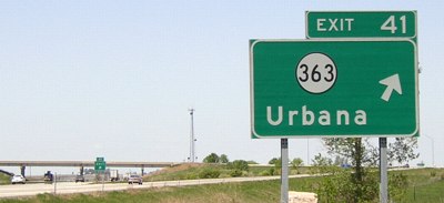
Facing east on 363 (5/16/17)
The standardized interchange signage replaces the type seen above.
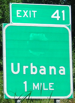
Facing east on 363 / Closeup (5/16/17)
Facing east on 363 (5/16/17)
Facing northwest, but heading north, on 380 (5/20/03)
What's missing from these signs? The same thing missing from the southbound signs:
Facing southeast, but heading south, on 380 (12/9/01)
Photo by Jason Hancock
There are no directional ("West") tags on the BGSs. Since this interchange is in the northermost row of townships in Benton County, the most appropriate county road name would be a Dxx, probably D67; however, since it's almost entirely in the Urbana city limits, it might never get a name.
Facing northwest, but heading north, on 380/27 (7/25/16)
These BGSs have been replaced with ones that say "Urbana / Sunset St", which is the reverse of convention that puts the road designation on top and town(s) on the bottom.
Last seen: 2003
Page created 2/23/02; last updated 7/6/20