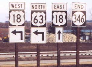
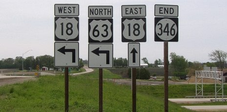
 EAST
EAST
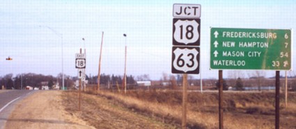
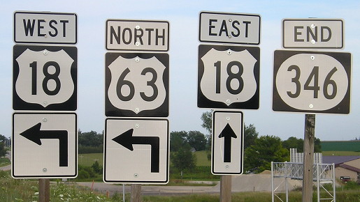
EAST End: Interchange (was 4-way stop), US 63 and US 18, Chickasaw County
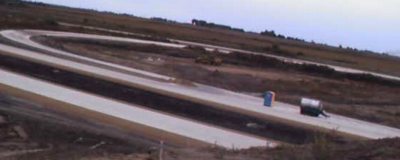
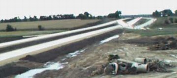
As with 346's west end, the construction has also made a mess of the east end. Pictures by Jason Hancock and Dennis Swanson illustrate the progress made in the fall of 2002. This site started a little late to get pictures of this intersection before construction of the interchange (and, for that matter, we nearly missed IA 24's pre-2002 west end).
All Dennis Swanson pictures were taken 9/21/02; all Jason Hancock pictures were taken 11/17/02.
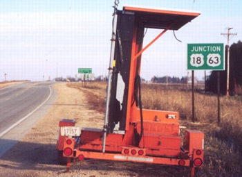
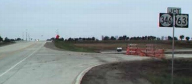
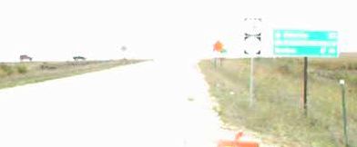
Facing east on 346
Photo by Jason Hancock
This intersection is marked as "Williamstown", another Iowa community that doesn't exist anymore. Its name still shows up on various maps, though, even though the interchange has obliterated any trace of it.

Facing east on 346 (5/18/04)
In the distance below the center light is the road on the other side of the interchange. The bridge is slightly to the north of the original alignment. Comparing this picture with the ones above and below it you can see the old mileage sign has been removed.
Facing east on 346
Photo by Jason Hancock
Construction hit this old LGS a bit. Look to the left and you will see the new LGS.
Facing east on 346 (5/18/04)
In this picture, it may not readily be seen, but it appeared to me when taking these pictures that the 18 shields seemed lighter than the 63 shields - the black backgrounds and numbers for 63 were darker.
Facing east on 346
Photo by Dennis Swanson
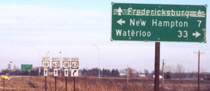
This picture and the two below show progression of signage facing east at the southbound ramps.
Facing east on 346
Photo by Jason Hancock
With the junction signs and LGSs, it's deja vu all over again. Compare this to the earlier photo by Dennis Swanson, without the new freeway LGS. Also note the change in assembly just to the left of the rear "East 18 ^":
Facing east on 346 (5/18/04)
The four-way stop red light and some of the shields have been removed.
Facing east on 346
Photo by Jason Hancock
Compare the two US 18 shields. The one on the left is the unusual one - unusual, that is, except every construction project in 2002 seems to have them. This is after the onramp to SB 63, on the west side of the bridge.
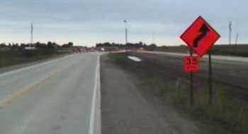
Facing east on 346, after construction (5/18/04)
Facing east on 346 (8/4/15)
In August 2015, nearly all the shields I saw on IA 346 were wide and ugly.
Facing east on 346 (8/4/15)
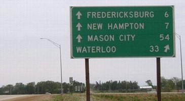
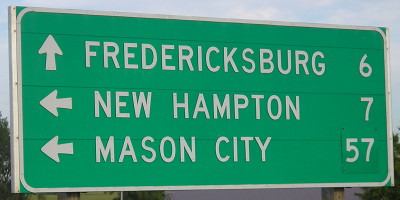
Mason City's mileage has been pasted over as 57 instead of 54, as you can see on other pictures on this page. This has to be because three miles were added to US 18's length when it was rerouted in and around Charles City.
Looking northeast from 346 bridge
Photo by Dennis Swanson
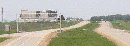
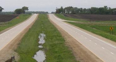
The northbound exit ramp is an inner leaf; the interchange is a modified diamond.
Facing north from the bridge (5/18/04)
Facing south from the bridge
Photo by Dennis Swanson
Dennis reported, "At the time of my trip [9/21/02], traffic was still using the temporary bypass to access the original pavement, which will be replaced by the new southbound lanes. The new temporary cross-over that will direct traffic on to the new northbound lanes was almost ready for use."
As you can kind of see in the picture, 63 used the northbound lanes and then crossed over to meet 18 and 346 at a four-way stop at what will be the southbound ramps.
Facing south from the bridge (5/18/04)

Facing west on 18 (5/18/04)
Facing west on 18 (5/18/04)
Facing west on 18 (5/18/04)
Interesting...usually there are diagonal arrows here, like the Waterloo line facing east.
Facing west on 18
Photo by Dennis Swanson
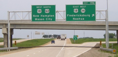
Progressing east to west, this picture is in order. The blocked-off road is the onramp. At the time of construction, though, 18 met 63 on the west side. Now a new "Jct" sign is behind the picture (see above).
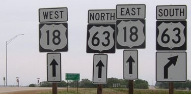
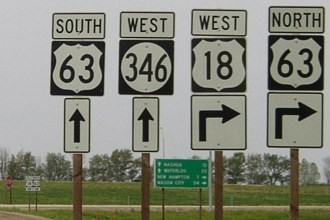
Pay attention to the below signs. The regular BGSs are, in my opinion, great examples of what interchange signing should be.
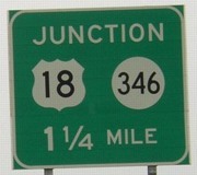
Facing north on 63 (5/18/04 and 11/17/02)
Right photo by Jason Hancock
I'm not quite sure why the extra "Junction" BGS was put up; another one appears approaching IA 24 in New Hampton. The left sign is interstate-sign scale.
Facing north on 63 (5/18/04)
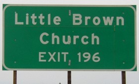
The signs are separate because the church sign was added later, and erected in a temporary fashion. They were later combined:
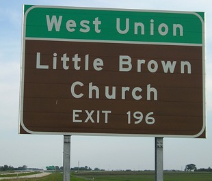
Facing south on 18/63 (5/27/06)
This is the southbound sign, but the northbound one looks like this too.
Facing north on 63 (5/18/04)
Facing north on 63
Photos by Jason Hancock
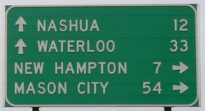
Compare the font in the 196s in the above two pictures. There wasn't a full BGS at the interchange when Jason took this picture. The signs along the 63 bypass are probably the last new ones put up in Iowa not in "Butt-Ugly Kansas-Style Signage," meaning larger initial letters.
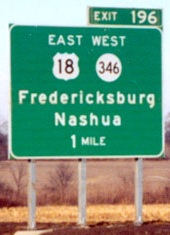
Facing south on 63
Photo by Dennis Swanson
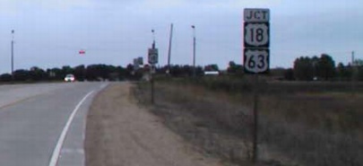
This was on the ramp, as 63 was using it at the time. The "Jct 18" in this southbound view is wrong.
Facing south on 18/63
Photo by Dennis Swanson
Dennis reported, "South of Chickasaw County Road B54/240th Street, new southbound lanes replace the original alignment. At the time of my road trip, all traffic was using the northbound lanes between B54 and IA 346 while the southbound lanes were being reconstructed. This jog to the southbound lanes is just north of IA 346."
Facing south on 18/63 (5/27/06)
Facing south on 18/63 (5/27/06)
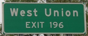
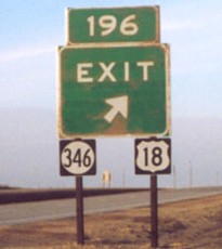
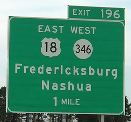
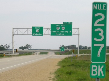
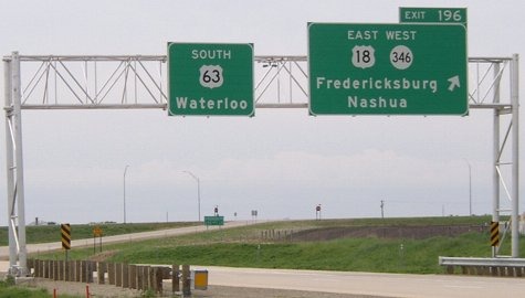
The exit number, 196, is that of US 63's, but the mile marker here is that of US 18's, resulting in a mismatch situation similar to the one on US 20 at IA 14 where 20 suddenly loses 14 miles.
Facing south on 63 (5/18/04)
For additional pictures of the New Hampton bypass, you can go to IA 24 West and Business US 63.
Page created 2/28/03; split 6/9/04; last updated 8/29/16