
(November 9, 1936-June 8, 1988 and September 30, 1993-July 1, 2003)
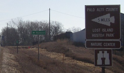
NORTH End: Stop sign, B25, Lost Island Lake State Park, Palo Alto County

Facing north on 341
The north end is pretty self-explanatory, complete with mile marker and faded "Public Area" sign.
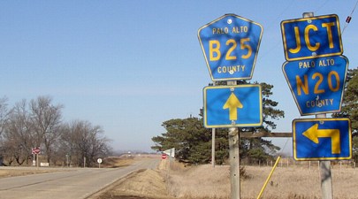
Facing west on B25
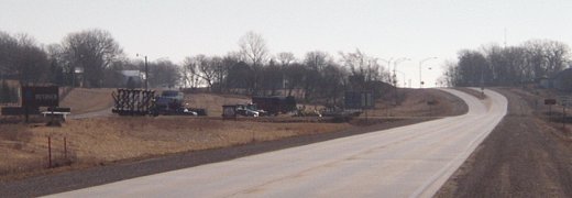
Facing south on 341
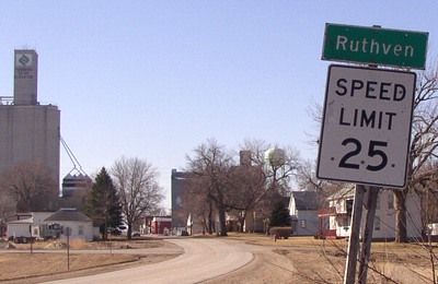
The sign is a leftover of 341's days as a state highway in this part of Ruthven. I say "this part" because it took a while to really die...or it died and was resurrected as a shadow of its former self...
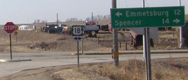
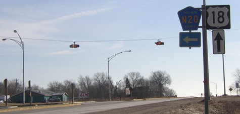
SOUTH End: Stop sign, US 18, Ruthven, Palo Alto County
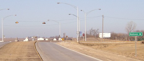
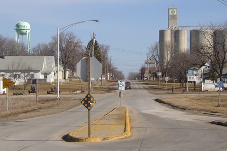
ALL of 341 (1993-2003): Between old and new US 18, Ruthven, Palo Alto County
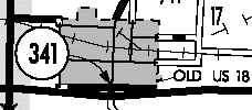
The Ruthven bypass opened November 9, 1966, which rules out any thought that this bit of 341 was connected to it. The spur was decommissioned without anything out of the ordinary in 1988. Then, five years later, the state took the stub back from Palo Alto County...but why?
Facing south on 341
In this picture you can see ALL of the route that was officially 341 from 1993 until 2003. This picture was taken standing in the middle of old 18.
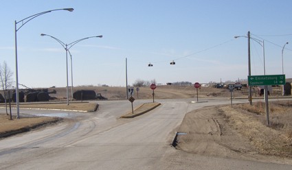
This is the only indication the DOT maintains this piece of road. The .06-mile segment pretty much just entitled the DOT to put up a mileage sign and plow around the little traffic island.
Facing west on 18
Facing east on 18; old 18 is at left
Facing east on 18
As with others, the signage is set up as with state highways.
Facing east on 18
Facing east on 18
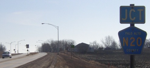
Facing north
Here you can see all of the last 341, and the N20 shield makes it unsigned. Old 18 is the road across the center.
Last seen (full route): 1988 (1986 map)

All pictures by me: 3/22/03
Page created 6/22/03; last updated 2/22/04 3/19/17