
(September 1, 1936-July 1, 2003)
Jason Hancock's pictures are pre-decommissioning; mine are post-decommissioning.
NORTH End: Stop sign, Business US 18 (IA 76)/Main St., McGregor, Clayton County
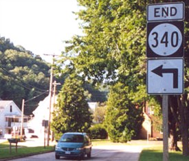
Facing north on 340 (7/28/02)
Photo by Jason Hancock
The end is that-a-way! Highway 340 made a turn northwestward and nearly immediately ran into Business US 18.
Facing northwest, but heading north, on 340 (9/7/06)
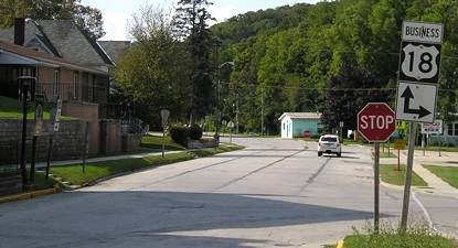
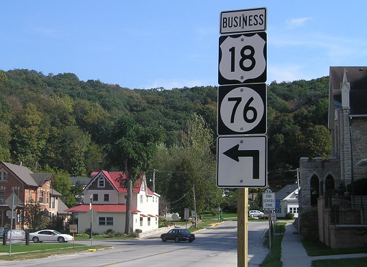
Facing southeast, but heading east, on Business 18 (and north on IA 76) (7/28/02 and 9/7/06)
Left photo by Jason Hancock
The topography of the land limits houses in McGregor to being nestled in the valley the current Business 18 follows. For much of the business district the town is only one property deep on each side, and the same goes for 340 in the few blocks inside city limits. In the background you can see the short block 340 ran on before turning south.
Facing southeast, but heading east, on Business 18 (and north on IA 76) (9/28/15)
Facing southeast, but heading east, on Business 18 (and north on IA 76) (9/28/15)
In about 2010 IA 76 was signed through McGregor. It had been marked only as Business 18.
Facing southeast, but heading south, on 340 (9/7/06)
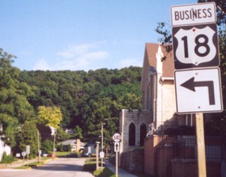
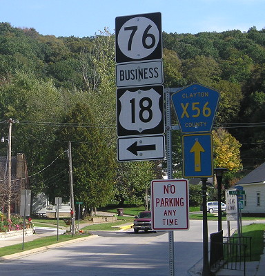
Facing southwest, but heading west, on Business 18 (and south on IA 76) (9/7/06)
Facing southwest, but heading west, on Business 18 (7/28/02 and 9/7/06)
Left photo by Jason Hancock
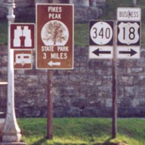
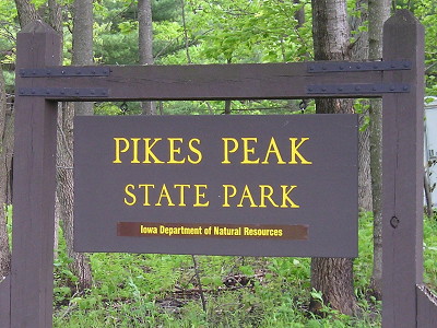
SOUTH End: Pikes Peak State Park, Clayton County
Facing south on 340 (7/28/02)
Photo by Jason Hancock
Before ending, 340 turned to head into the park. It skirted the west edge of the park ever since it left McGregor.
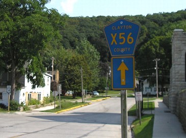
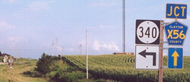
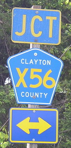
Facing north on X56, directly opposite the above sign (9/28/15)
Whoever says Iowa is flat hasn't heard of the Driftless Area.
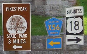
Facing west on 340 / Sign at intersection (5/14/10 and 9/28/15)
This sign shows that the stub into the park did not become part of X56.
Facing east, but heading south, on 340 (7/28/02)
Left photo by Jason Hancock
The Mississippi River is straight ahead, about 2/10 of a mile or so.
Zebulon Pike came to this peak before he went to that other one in Colorado. (5/14/10)
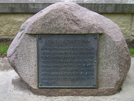
Point of Discovery in the park, across from the mouth of the Wisconsin River (5/14/10)
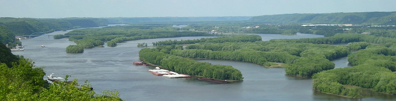
Here is a small panorama (larger version here) of the Mississippi River from Pikes Peak State Park with US 18's crossing from Iowa into Wisconsin visible at left and center. Although a substantial channel of the Mississippi cuts across north of those barges, the state line remains on the west side, with the basket-handle bridge. (5/14/10)
Last seen: 2003

Page created 1/17/03; last updated 12/13/14