
(July 10, 1935-December 19, 1980)
NORTH End: Four-way stop, 1st St., Galva, Ida County
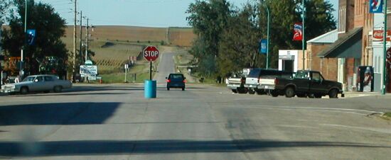
Facing north on 328 (9/20/02)
Photo by Neil Bratney
Facing mostly north (7/15/14)
By all rights, this should have been IA 329. But the Highway Commission, fresh off a numbering spree, accidentally assigned the number 328 twice - first to a spur to Pilot Mound, and then this road. Instead of giving the later route the higher number, the Pilot Mound spur got 329 instead.
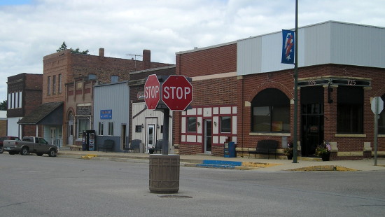
Downtown (7/15/14)
SOUTH End of IA 943: City limits of Galva, Ida County
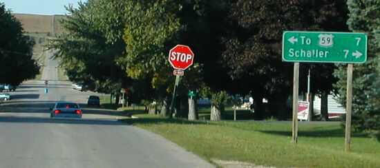
Facing north on 328 at 5th Street (9/20/02)
Photo by Neil Bratney
Neil writes, "Ida Co. D15 (historic US 20, c. 1932) crossed IA 328 on the south side of Galva at the stop sign in the foreground." This intersection, which was not 328's north end, still had a DOT sign at the time of Neil's picture. That could be because while Ida County accepted its portion of 328 from the state, Galva did not, leaving a discontinuous segment about half a mile long. It was given a secret number, 943, and remained under state control until January 20, 1987.
Facing north, same intersection, replaced sign (7/15/14)
The city limits of Galva are about a quarter-mile south of this point, but this is the closest intersection.
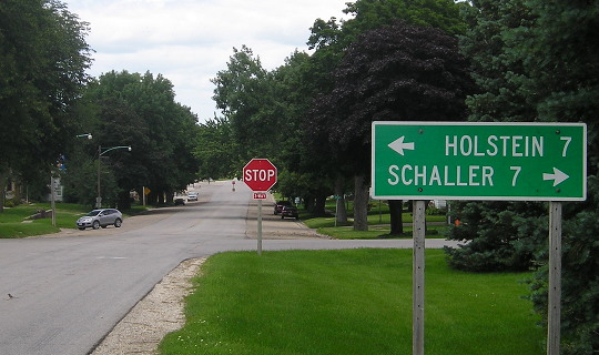
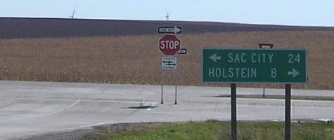
SOUTH End: Stop sign/T intersection, US 20, Ida County
Facing south on 328 (9/20/02)
Photo by Neil Bratney
Neil's observation: "With medians constructed on both highways, this appears to be quite a heavy-duty highway, however I'm sure the pavement's seen better days." The pavement has since been redone, below.
Facing south on 328 (10/19/18)
Facing south on 328 (7/15/14)
Facing south on 328, with new 20 (10/19/18)
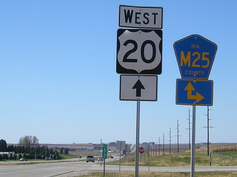
Facing west on 20 (7/15/14)
Facing west on 20 (10/19/18)
Facing west on 20 (10/19/18)
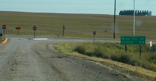
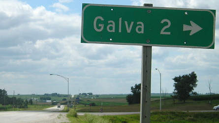
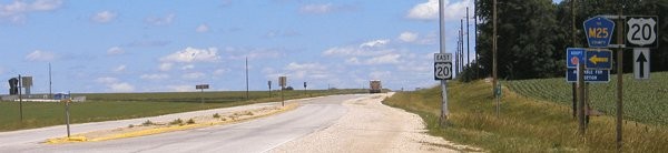
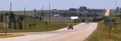
Facing east on 20 (7/15/14)
Facing east on 20 (6/10/04)
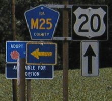
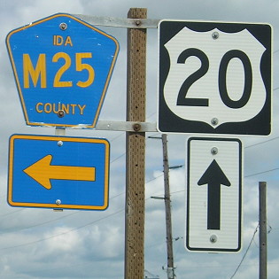
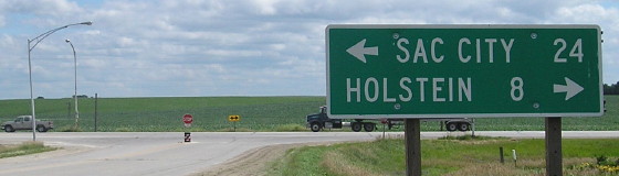
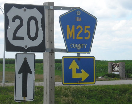
Closeup of signs at right of above picture (6/10/04 and 7/14/15)
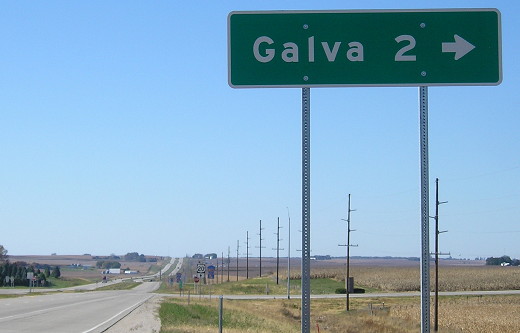
Facing west on 20 just west of the intersection (6/10/04)
Between Correctionville and US 71, 20 follows a statewide correction line. Along this line, the surveyed miles do not line up north and south of it; they and the townships they make up are offset. This is why counties in Iowa are not all perfect squares or rectangles. This correction line is responsible for the offset nature of the entire tier of counties 20 follows. In the background of this picture is the only place 20 deviates from a straight line in Ida County. In the past, 20 followed this line across the state at one time or another a lot more, including from Duncombe to south of Williams (old IA 928), from IA 14 to D18 (previously IA 57, now D19), and between Raymond and Manchester (D22/old IA 939). Nearly all of the present day's four-lane generally runs at or few miles south of this line. West of US 71 to Sioux City, the four-lane 20 completed in the late 2010s is almost-but-not-quite on the roadbed of original 20, except for here, where the deviation was ironed out.
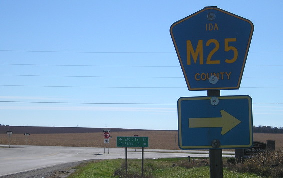
The two junctions with M25, going south here and north to Galva, are closer to each other than usual because the road to Galva runs through the middle of a section and the southbound route follows the line. (In a county road street numbering system, southbound M25 would be an xx0 street while northbound would be an xx5.) The concrete island at left ends in the unseen foreground of the shot two pictures up. LGS is "To 175 10"; east of Ida Grove, 20 and 175 stay about that far apart.
Last seen: 1980 (1981 map)

Page created 5/4/04; last updated 3/19/19