

- In 1920, they knew it as: A significant portion of the Onawa and Okoboji Diagonal (2 counties)
- We know it as: IA 31 and L56
- Let's get granular: Except for the part east of Quimby, IA 31 is in the same corridor it's always been, but nearly none of it is in the same place.
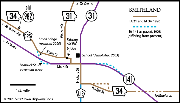
- Main, Washington, State, and Walnut streets in Smithland
- A very crumbling culvert at the corner of State and Walnut (as of 2020) bears hallmarks of early IHC construction.
- However, even the two-block segment from there to Main and Hickory isn't what I thought it was. Blueprints dated 1917, but not put into effect until later, explicitly put IA 34's path on one block of Washington and one block of Main, rather than using State past the school to Hickory. In all likelihood, 31 and 34 overlapped for a tiny bit in Smithland so 31 could be signed to the business district.
- Lee Avenue, then 7th Avenue and State Street in Oto
- This segment hugs the edge of the Loess Hills, which is a hint to both its early existence and prominence.
- Two more clues: The Oto school, whose cupola indicates pre-WWI construction, is on State Street, which itself is on the high ground. The Oto Cemetery is southwest of town on Lee.
- Present 31 here, just off the hills in the Little Sioux River floodplain, was built in 1934 to follow an Illinois Central line that was pulled up by WWII. The railroad was labeled the Dubuque and Sioux City in the IHC files, a name it hadn't carried for nearly 50 years by that point.
- Vacated road north of D54, then Lenox Avenue, 252nd Street, Lucas Avenue, 230th Street, Lenox Avenue
- Division Street and either Miller Avenue/Main Street or 2nd Avenue in Anthon, then north on a mostly-vacated stretch including Wolf Creek Trail
- 180th Street, O'Brien Avenue, and another vacated stretch to near the Little Sioux River, but then up Briese Lane
- D22 and Driftwood Street through Correctionville; this segment, left behind in 2015 in conjunction with the four-laning of US 20, was one of the last 1920 pieces left. Also Sioux Avenue in Correctionville.
- L36 and C66 to Washta, plus Ritts Road and vacated extension
- About ¾ of a mile of present IA 31, Willow Road, and another half-mile of present 31
- Clark Avenue and Main Street/L51 in Quimby
- 1920-23: 4th Avenue, IA 31, Silver Sioux Road, vacated Little Sioux River crossing, Little Sioux Road, 590th Street, O Avenue, C44, vacated road in the middle of Section 21, L56
- After 1923: L51, L56, C44
1920s NORTH End (1): IA 5, Cherokee, Cherokee County
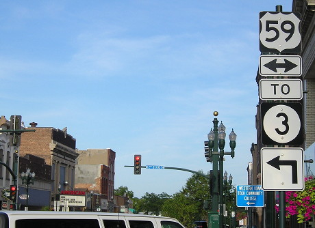
Facing east on Main Street (8/22/19)
IA 31 would have run into IA 5 at 5th and Main streets, or L66 and C38 today, a quarter-mile behind the camera, close to the courthouse. So this would have been on 5 and possibly 31, looking at the core intersection of Main and 2nd. Now, 2nd carries US 59, but in the 1920s, the north-south road through Cherokee was running east and west.
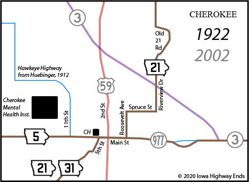
1920s NORTH End (2): IA 21, now C44 at US 59, Cherokee County
IA 21 was straightened in Cherokee County in 1924. At the end of the year, as the new route opened, the Great Truncation pulled 31's south end to three miles north of the present one.
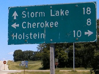
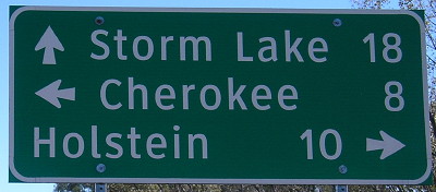
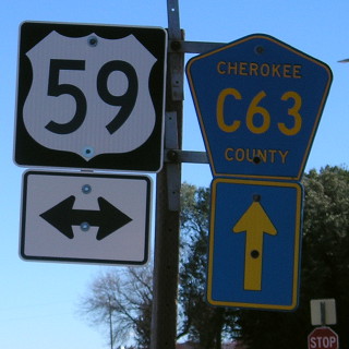
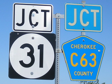
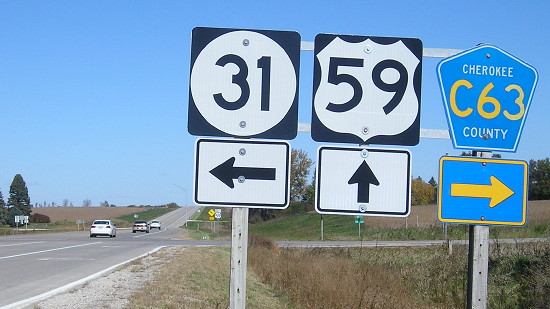
NORTH End: Stop sign, US 59 and C63, Cherokee County
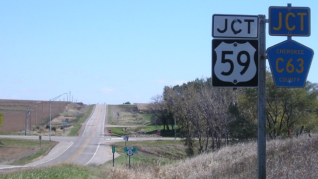
Facing east, but heading north, on 31 (10/20/18)
Going down the page, these will be past/present shots. The "past" will be identifiable by the slightly reddish grass, as I had a malfunctioning camera the first time I took a big trip in far northwest Iowa. The "present" will be identifiable by a slight bluish tinge, perhaps because of the time of day, although I'd have to say it was a perfect day for a trip aside from the wind.
Facing east, but heading north, on 31 (6/14/04)
Facing east, but heading north, on 31 (10/20/18)
I think I did better with depth-of-field positioning the first time around.
Facing east, but heading north, on 31 (6/14/04)
Facing east, but heading north, on 31 (10/20/18)
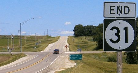
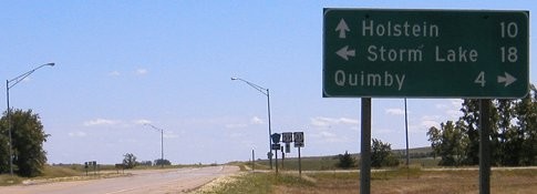
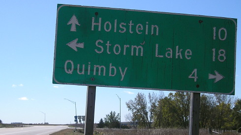
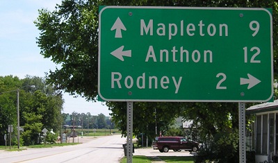
An earlier end of IA 31 was closer to Cherokee than this one is; it used to follow L51, L56, and C44 from Quimby to US 59. The Cherokee Chronicle-Times in 1940 referred to paving 59 from the Ida County line to the "Flanigan corner", and whaddya know, construction documents show Thomas Flanigan and/or his children owned land in Sections 27 and 22. At that location, gravel 59 went a mile and a half east and then south; paving in 1937 moved it onto Main Street in Holstein, and the Cherokee County project finished the shift. Interestingly, those construction documents prepare a Y intersection for 31's current end, which wouldn't be moved for a decade.
Facing east, but heading north, on 31 (10/20/18)
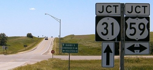
Facing north on 59 (10/20/18)
Facing north on 59 (6/14/04)
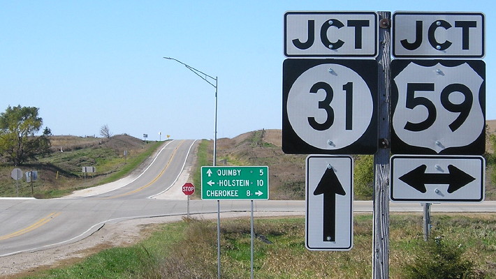
Facing north on 59 (10/20/18)
Facing north on 59, minus an ahead arrow (6/14/04)
Facing north on 59 (10/20/18)
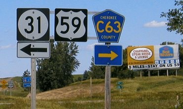
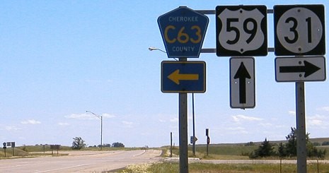
Facing west on C63 (6/14/04)
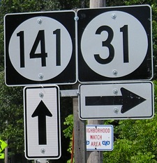
Unlike many ends that also intersect a county road, both the cross road and the road ahead are mentioned here on C63. Note that on this county LGS, Quimby is 5 miles away, compared to the 4 on the DOT signs above and below.
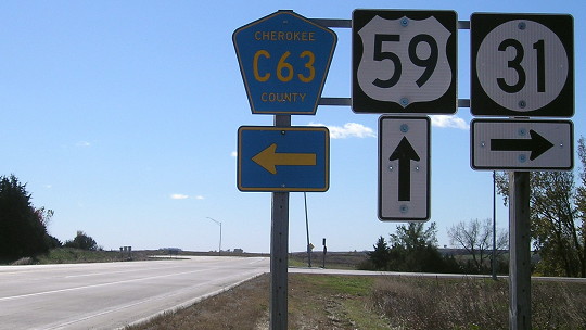
Facing west on C63 (10/20/18)
Not the same LGS in 2004, as the left-turn destination has been moved up for conventional order.
Facing west on C63 (10/20/18)
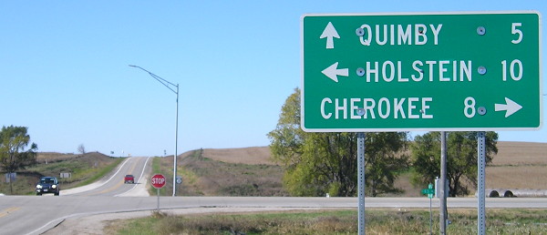
Facing south on 59 (6/14/04)
Facing north on 59 (10/20/18)
Facing south on 59 (6/14/04)
Facing south on 59 (10/20/18)
Along the route
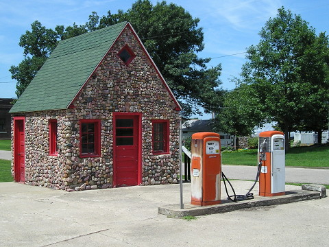
This small 1934 gas station, once Heath Mobil Service, is at the corner of Driftwood and 6th streets in Correctionville. Driftwood from 7th Street south to D22, including the jog in the road in downtown that divides the statewide correction lines that gave Correctionville its name, was part of IA 31 from 1920 until 2015. The informational marker references the popularity of US 20, but this was off that route. (7/23/09)
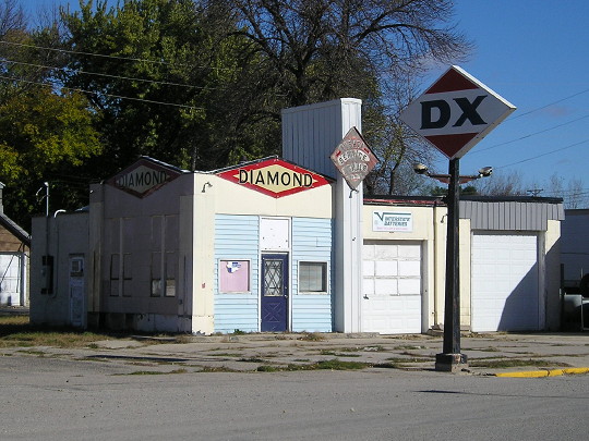
This old service station is on Main Street in Washta at 3rd Avenue. Originally, 31 headed north here, and on Ritts Road, until a direct route southwest opened in 1927 (see below). (10/20/18)
Hookup process for
good roads
It is understood that the State Highway engineers are surveying for the
relocation of No. 31 from Washta to Correctionville, on the east side of
the Little Sioux. This is the better and more feasible route but Ida has
not viewed it with favor because it would call for the expenditure of
several thousands of dollars without compensating advantage to Ida or
any part thereof. ... The highway, as it is being surveyed, according to
report, would avoid two bridges over the Little Sioux, the hill west of
Washta and the hill north of Correctionville.
— Cherokee Evening Times,
October 21, 1925
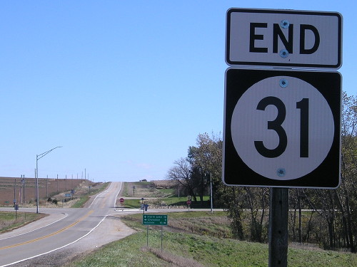
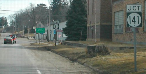
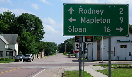
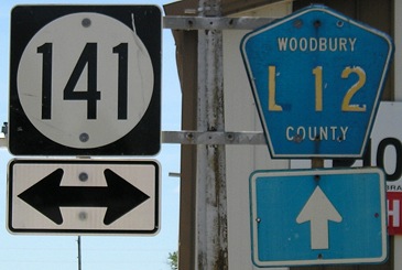
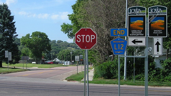
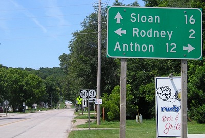
SOUTH End: Stop sign, IA 141 and L12, Smithland, Woodbury County
Facing southeast (7/17/20)
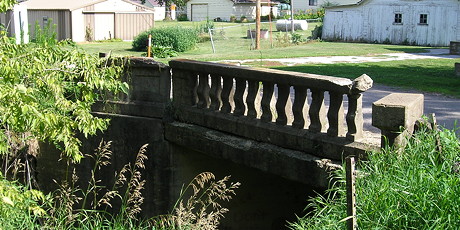
Here's an example of how "field checks" can improve my research. I found out a few months before this trip that present 31 between Smithland and Oto is not original. The first route was on the edge of the Loess Hills, as mentioned up at top. I wasn't quite sure how the shift to the present route and intersection with 141 happened, though. But, when I drove the gravel south from Oto, I found this bridge at the intersection of Walnut and State streets in Smithland that shares characteristics with early Highway Commission work. That dovetailed with a 1927 grading document for IA 141, enabling me to recreate the original routes through town. (Then discovery of a 1917 document made me reset the segment between here and downtown.) The small bridge referenced on the map below can be seen on the IA 982 page.
This styling from 1917 Iowa Highway Commission blueprints just screams "late 1910s".
Facing south on 31 (2/23/02)
Photo by Neil Bratney
This picture shows the old Smithland school, which was torn down sometime between May 2002 and September 2004. When I made my first visit to Smithland in 2009, only a grassy area remained.
Facing south on 31 (7/23/09)
Hickory Street, which runs north-south, is Smithland's business district, and the original alignment of IA 34/141 went through it.
Replaced southbound LGS (7/17/20)
Facing south on 31, on the other side of the street (7/23/09)
Facing north on L12 (7/23/09)
There are no shields for either 31 or 141 heading north.
Facing north on L12 (7/17/20)
These are the new Iowa Byways signs. In this angle you can see the open space that was the Smithland school a block north.
Facing west on 141 (7/23/09)
Facing east on 141 (7/23/09)
The most likely 1920 endpoints for 31 are the present end but facing east (this view) or Walnut at State, two blocks west of the school site. I suppose there's a slim chance that in 1928-34 it was Washington at Main, where old 31 intersected new 141, and also a slim chance that "31" was painted on utility poles into downtown in the 1920s.
*Original Number, Original End (but not the original direction)*
Page created 3/22/02; last updated 3/10/10 5/8/22